
AppsRunner
-
Posts
2,420 -
Joined
-
Last visited
Content Type
Profiles
Blogs
Forums
American Weather
Media Demo
Store
Gallery
Posts posted by AppsRunner
-
-
Seems as if Tama county has had the worst winds so far, EM reporting up to 100mph gusts there.
Just now, Hoosier said:I remember the old school high end severe thunderstorm warnings where they would mention "siren activation is suggested" in times like this. Don't know if any offices still do that, but this is the perfect type of situation for it.
At least for DMX's CWA most of the larger cities (DSM/Ames) have siren activation for any warning with 70+
-
Hey guys, just dropping in here now to say hello! I'll be moving out to DEN/BOU near the end of June to start at the WFO. Looking forward to some future discussions with you all, and I'm excited to live in a slightly more exciting state! Hopefully you'll be seeing me in more threads around here over the next few months. Any advice on the best places to live would always be appreciated (and maybe the best places to get out to storm chase from too
") )
)
-
We got down to -7 in Ames this morning, and -1F at DSM. The -7 is a degree off the all time Ames record but shatters a record from 1911 (2F). DSM's is also a record, five degrees colder than the previous one.
I'm personally very thankful that this type of anomalous cold didn't come in the dead of January.
-
 2
2
-
-
Ended up with around 4" here, depending on which CoCoRaHS station you like in Ames. Not too shabby for a fairly short duration event. Now for the cold!
-
2
-
-
Around 1-1.5" in Ames. The 1.2" which fell yesterday night at DMX is a daily snowfall record, breaking the previous record of 0.2" in 1913.
Thankfully we didn't have any accumulations on roads, it sounds like traffic got pretty rough in the eastern half of the state.
-
3
-
-
Coincidentally in Norman this week for the HWT. The mood is pretty ominous.
Really don’t like the look of the flash flooding threat either
-
Looks like this is the real deal for Chicago. (Un)fortunately looks like I'm a little too far south to experience the fun, but this will be fascinating to watch tomorrow. Looking forward to seeing some good pictures!
-
Changed over to snow for an hour or so at the end. Didnt lose the snowpack which doesn’t bode well for getting too warm this next system
-
May briefly manage to change to snow this afternoon but I'm not counting on it. 34F and rain right now.
-
3 hours ago, TugHillMatt said:
I would love to see the band hit during the day. Seriously, every one of our heavier events has hit at night. They started usually with Sw flow during the afternoons, then shift West in the evenings, then NW overnight.
I actually meant to ask if this is a common set up with different variables, or just coincidence.
1 hour ago, Phillifan22 said:What you’ve noted is not a coincidence. Studies have shown lake effect tends to weaken during the day (especially in late fall and early spring when daylight is longer and the sun angle is higher). This weakening is caused by a decrease in the temperature contrast as the air above and around the lake (as well as the land) warm. It goes back to the fundamental of lake effect, cold air over a warm lake.
While Phillifan is right... I think what Matt is referring too has just been luck or a lack-thereof. One thing that may also contribute is the land-breeze fronts (e.g. Steenburgh and Campbell) that could be contributing, especially overnight where lake vs. land temperature differences are maximized. But I think for Matt's question, the answer is pretty much down to luck. I remember a few years back when phillifan and I did forecasts for the DOT there seemed to always be heavy lake-effect during the day due east of the lake, so it's probably just random chance.
-
2
-
-
We got to -8 briefly this morning. It was unpleasant.
Not sure how to feel about the Thursday storm here. On one hand, the GFS/FV3 are both pretty good hits and the GEM isn't awful but the Euro/UKMET have basically no precip.
-
2
-
-
Got down to -5 an hour or so ago, and we'll probably struggle to get above 0 today. A few more storm threats on the horizon here. That first wave Thursday looks like it'd be a good event somewhere, thought the weekend one has more potential to be big.
Either way, I just hope it warms up a bit. The roads are finally clear in town after being almost completely ice packed for the week after the blizzard, but the sun can only do so much when it's this cold out.
-
1
-
-
1 hour ago, cyclone77 said:
Just an FYI, I have yet to receive my severance package.

Much better look on the Euro the past few runs compared to the previous cycles. Hopefully this one delivers for those snow starved areas from central IL to OH. Could be in for some accums here as well if trends continue.
Yeah, I've noticed the trend back west here too. I hope that whatever happens back here helps out the I-70 folks, they could use a storm.
-
8 hours ago, hawkeye_wx said:
The latest couple euro runs show not a single flake of snow for most of Iowa over the next ten days. We've been the snow epicenter for the last several weeks, but now the script gets inverted.
4 hours ago, cyclone77 said:Yeah I was starting to think MLI had the all-time record snow season in the bag, but things have definitely quieted down. If we're not going to make a run at the record I'd just assume move on to spring.
Of course the 18z GFS has a stripe of 30” in 4 days so, ya never know
-
2 hours ago, CNY_WX said:
That’s close to 20:1 stuff. BTW, how do you melt the snow in your tube quickly? I bring it in the house and let it melt slowly but that can take hours.
As someone else had mentioned, the standard is usually to use warm/hot water on the outside of the tube.
-
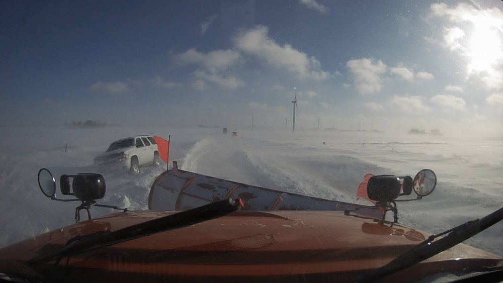
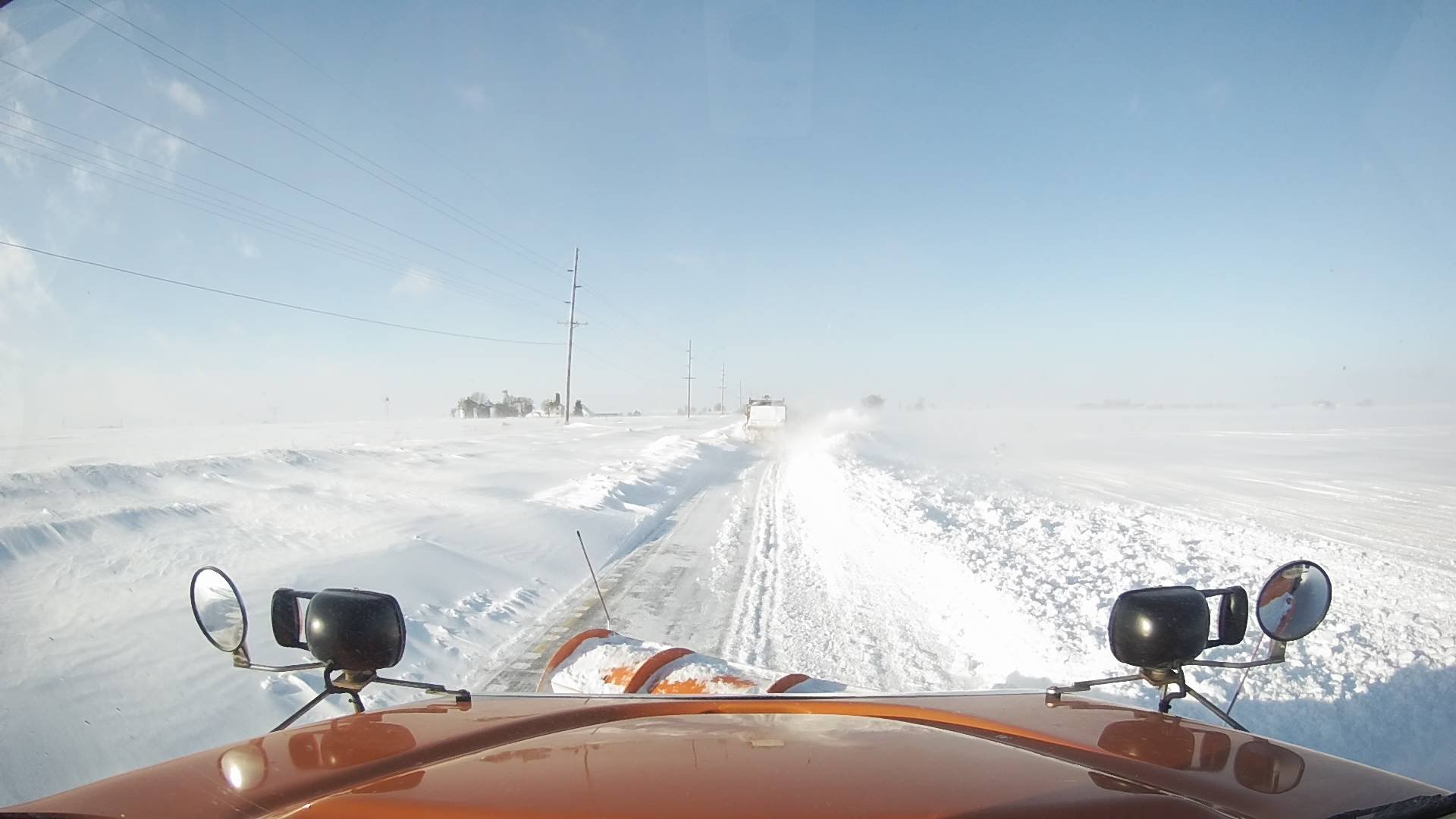
May not be as bad as some of the others... but across central Iowa it's still bad. I-35 still shut down between Ames and the border. Route 69 between here and Des Moines almost worse.
I-35 north of Story City:
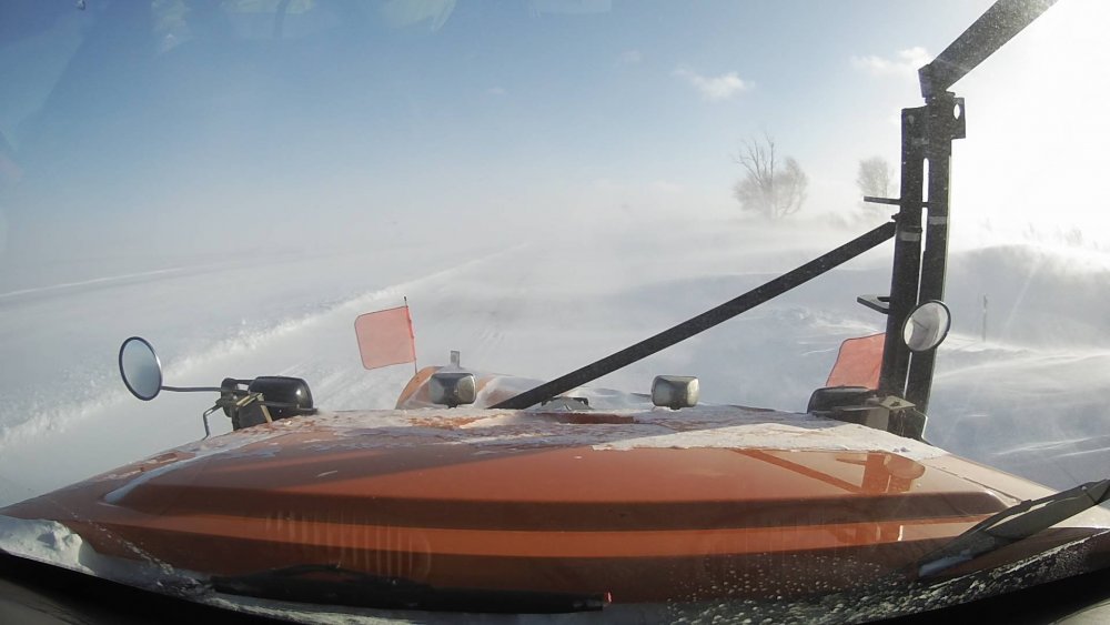
Route 69 between Ames and Ankeny:

Route 69 north of Story City:
-
3
-
 2
2
-
-
Ground blizzard conditions have closed I-35 from Ames to the MN border today. Basically every road outside town is closed.
-
1
-
-
DVN gusted to 54kt. A lot of places just in NW/NC IA are blow 1/4 SM.
-
Looks like Ames really lucked out compared to surrounding areas. Several reports of 6-7" in town, with 4" east/west of us where subsidence from the one good band decreased their totals a bit. Essentially any road outside of the city is considered impassable right now.
-
1
-
-
2 hours ago, hawkeye_wx said:
I just checked the radar and noticed the yellow band parked over Ames. The ISU webcam looks pretty good. There's a brand new report from a NWS employee in Ames of 3.6".
Yeah, a 4.1" report came in at 10 and it's been heavy snow since then. Winds have picked up here in the last couple hours, and we're now consistently gusting to about 40mph. Some stations to the NW were up near 50-55mph. Ames really got lucky with this storm as that band pivoted over. It was definitely some of the heaviest snow I've seen living in Iowa/Ohio. Hopefully we'll make it to 6-8" from this.
On another note, this storm should get DSM to a new all-time record snowiest February. It's been a remarkable run here since mid January.
-
Very heavy snow in this band with excellent dendrites .
-
2
-
-
Barely missed the dry slot, slowly but steadily picking up in intensity. Probably have an inch or two so far, hard to tell.
Winds will start kicking in in a few hours. Looking forward to that.
-
All snow now and cement parking lot covered.
-
1
-
-
I’ve been added to the blizzard warning, though still only looking at a few inches. Starting to mix.


August 10 Severe Weather
in Lakes/Ohio Valley
Posted
Taken back in Luther, but this in that area of 110kt velocity northwest of DMX.