RodneyS
-
Posts
1,429 -
Joined
-
Last visited
Content Type
Profiles
Blogs
Forums
American Weather
Media Demo
Store
Gallery
Everything posted by RodneyS
-
Today reached 84 at DCA, the warmest temperature ever in DC from November 5th to February 24th. February 25, 1930 also reached 84, and the first day in a calendar year to exceed that was March 8, 2000, which reached 85.
-
You omitted RIC.
-
Your point is well-taken. I just did an analysis that shows that the DCA October 2024 average maximum of 73.0 (3.6 degrees above the 1991-2020 normal) tied for the 8th warmest in DC history. On the other hand, the DCA October 2024 average minimum of 53.0 (0.8 degrees above the 1991-2020 normal) tied for the 27th warmest in DC history. So, in contrast to many recent months over many recent years, the average maximum was much further above the recent normal than the average minimum was. As a personal observation, when you couple the DCA October 2024 maximum range of 60 to 83 degrees and the minimum range of 44 to 67 degrees with only 1.48 inches of precipitation (all of which fell on the first two days of the month), a case can be made that October 2024 was the best month in DC history for sunny and pleasant weather.
-
Your tiebreaker could be the key to victory . . . but not necessarily your victory.
-
I have rounded up your forecasts for DCA, IAD, and RIC to 2.4, 2.8, and 2.3, respectively. If you want them rounded down, let me know. Note to everyone: Forecasting snow to the nearest 1/100th of an inch does not make any sense because official statistics are kept only to the nearest 1/10th of an inch.
-
It's time for the 11th annual Mid-Atlantic snowfall contest! First, thanks to @Roger Smith for pointing out that last year's contest, which was billed as the 9th one, was actually the 10th, as Roger unearthed records of the first one, which occurred during the 2014-15 snow season, and was won by @nw baltimore wx. So he has been added below to the list of previous winners, including last year's winner @Kmlwx Second, those who participated last year will recollect the consensus that a Strong El Nino was going to end the Mid-Atlantic snow drought, but that did not happen. So, it appears that snow lovers in our region will have to put their faith in a Weak La Nina this snow season. That may not sound too promising, but perhaps the consensus will be wrong again. Also, I note that we are nearing a solar maximum, which just maybe will somehow, some way upset the apple cart and bring ample snowfall to the Mid-Atlantic. In any event, the focus of this contest is forecasting the total snow that will fall during the 2024-25 snow season at BWI International (BWI), Reagan National (DCA), Dulles International (IAD), and Richmond International Airport (RIC). In the event a tiebreaker is required (that happened 6 years ago), please choose one of the following two airports: Salisbury, MD (SBY) or Lynchburg, VA (LYH). Choose only one. Please note that you are forecasting the total snowfall for the entire snow season (NOT just Dec/Jan/Feb) to the nearest one-tenth of an inch. Generally, snow does not fall after early April at any of these airports, and so the contest is usually finalized by early to mid-April. The winner will be the entrant who has the lowest combined absolute value departure for all four airports. For example, if you forecast: BWI: 0.0" DCA: 0.0" IAD: 0.0" RIC: 10.0" And the actual seasonal totals turn out to be: BWI: 2.5" DCA: 2.5" IAD: 2.5" RIC: 2.5" Your absolute value departures would be: BWI: 2.5 DCA: 2.5 IAD: 2.5 RIC: 7.5 Thus, your total departure would be 15.0. Please use the following format when posting your forecast, in this order: BWI: DCA: IAD: RIC: Tiebreaker (SBY or LYH): The deadline for entries is Sunday, December 1, at 11:59pm. You are welcome to update your forecast at any time up to the deadline. However, please do not edit your original post -- either submit a new post or send me a private message. If there's any accumulating snow before the deadline, please include that in your forecast as well. I think the best approach is to submit your forecast in advance of the deadline and update if necessary, just in case you get tied up on December 1st, when the contest will lock -- no late entries will be accepted. The winner gets an E-trophy made of snow and an induction into the Hall of Fame with the previous winners: 2014-15: @nw baltimore wx@S@S@Shadowzone 2015-16: @Shadowzone@Stormpchadowzone 2016-17: @StormpcStormpchadowzone 2017-18: @olafminesaw@Storm @olafminesaw 2018-19: @olafminesaw (tiebreaker win against @Stormpc) @Stormpc 2019-20: @Prestige Worldwide 2020-21: @NorthArlington101 2021-22: @IUsedToHateCold 2022-23: @LittleVillageWx 2023-24: @Kmlwx Everyone is encouraged to play, including lurkers, new members, and people outside the region. Good luck everyone!
-
November 2024 temperature forecast contest
RodneyS replied to Roger Smith's topic in Weather Forecasting and Discussion
DCA _ NYC _ BOS __ ORD _ ATL _ IAH __ DEN _ PHX _ SEA 1.1 1.4 1.3 2.9 2.0 2.5 -0.3 -1.5 0.6 -
October 2024 averaged 63.0 degrees at DCA -- 2.2 degrees above the 1991-2020 normal and tied for the 15th warmest October in DC history. January-October 2024 averaged 64.5 at DCA, 2nd warmest in DC history, behind 2012 (64.7).
-
Correction: September 2024 averaged 72.5 degrees at DCA -- 0.1 above the 1991-2020 normal and the 36th warmest September in DC history. (January-September 2024 still averaged 64.7 at DCA, 2nd warmest in DC history, behind 2012 (65.1).)
-
September 2024 averaged 72.6 degrees at DCA -- 0.2 above the 1991-2020 normal and tied with 1965, 1983, and 2017 for the 32nd warmest September in DC history. January-September 2024 averaged 64.7 at DCA, 2nd warmest in DC history, behind 2012 (65.1).
-
October 2024 temperature forecast contest
RodneyS replied to Roger Smith's topic in Weather Forecasting and Discussion
DCA _ NYC _ BOS __ ORD _ ATL _ IAH __ DEN _ PHX _ SEA 0.3 1.5 1.5 2.5 -0.1 2.8 4.2 2.8 -0.3 -
September 2024 temperature forecast contest
RodneyS replied to Roger Smith's topic in Weather Forecasting and Discussion
DCA _ NYC _ BOS __ ORD _ ATL _ IAH __ DEN _ PHX _ SEA -1.6 -0.7 -0.4 0.3 -2.0 - 0.3 2.0 0.9 0.6 -
August 2024 averaged 79.3 degrees at DCA -- 0.1 below the 1991-2020 normal and tied with 2015 for the 28th warmest August in DC history. The meteorological summer (June-August) 2024 averaged 80.9 at DCA, third warmest in DC history, behind 2010 (81.2) and 2011 (81.1). January-August 2024 averaged 63.7 at DCA, 2nd warmest in DC history, behind 2012 (64.2).
-
This morning we set a daily low temperature record at Dulles for the first time since the above one, which was more than six and a half years ago. Today's morning low of 49 beat the previous August 22nd record of 51, which was set in 1969 and equaled in 1976. FYI, on June 20, 2022 Dulles tied the June 20th low temperature record of 48 set in 2000, but failed to break that record.
-
July 2024 averaged 83.7 degrees at DCA, 4th warmest in DC history behind 2011 (84.5), 2012 (84.0), and 2020 (83.9). June-July 2024 averaged 81.7 at DCA, 2nd warmest in DC history, behind 2010 (81.8). January-July 2024 averaged 61.4 at DCA, 2nd warmest in DC history, behind 2012 (61.8).
-
August 2024 temperature forecast contest
RodneyS replied to Roger Smith's topic in Weather Forecasting and Discussion
DCA _ NYC _ BOS __ ORD _ ATL _ IAH __ DEN _ PHX _ SEA -0.1 0.2 0.1 -0.8 -0.1 -0.5 1.3 0.7 1.5 -
The 2024 first half of the 92-day Northern Hemisphere meteorological summer (June 1-July 16, which encompasses 46 days) broke the all-time DC record for the warmest average, with a temperature of 81.7 at DCA, beating the previous record average of 81.0, set in 2010.
-
June 2024 averaged 79.7 degrees at DCA, 2nd warmest in DC history behind 2010, which averaged 80.6 (1907 is coolest at 65.9). January-June 2024 at DCA averaged 57.6, the 2nd warmest first half in DC history, behind 2012 at 58.0. The first half of 2017 is third warmest at 57.3 and last year is 4th warmest at 57.1.
-
July 2024 temperature forecast contest
RodneyS replied to Roger Smith's topic in Weather Forecasting and Discussion
DCA _ NYC _ BOS __ ORD _ ATL _ IAH __ DEN _ PHX _ SEA 0.5 1.0 0.9 -0.1 0.6 1.0 1.1 1.0 1.1 -
May 2024 averaged 69.3 degrees at DCA, tied for 16th warmest in DC history (2015 is warmest at 73.2 and 1882 is coolest at 59.2). January-May 2024 at DCA averaged 53.2, 4th warmest in DC history, behind 2012 (54.4), 2023 (53.7), and 2017 (53.3).
-
DCA _ NYC _ BOS __ ORD _ ATL _ IAH __ DEN _ PHX _ SEA 0.0 1.1 0.3 -1.8 -0.5 0.9 1.6 0.6 0.6 99 99 97 96 97 102 99 118 97
-
April 2024 averaged 60.5 degrees at DCA, 10th warmest in DC history, but behind last year's 62.1 (3rd warmest). January-April 2024 at DCA averaged 49.1 degrees, 4th warmest in DC history, but again behind last year's 50.8 (warmest in DC history).
-
May 2024 temperature forecast contest
RodneyS replied to Roger Smith's topic in Weather Forecasting and Discussion
DCA _ NYC _ BOS __ ORD _ ATL _ IAH __ DEN _ PHX _ SEA0.8 _ 0.3 _ -0.5 __ -0.7 _ 1.1 _ 1.6 __ -0.1 _ -0.3 _ -0.9 -
DCA _ NYC _ BOS __ ORD _ ATL _ IAH __ DEN _ PHX _ SEA -0.3 1.1 0.9 -0.1 -0.2 1.1 0.6 -1.9 -0.2
-
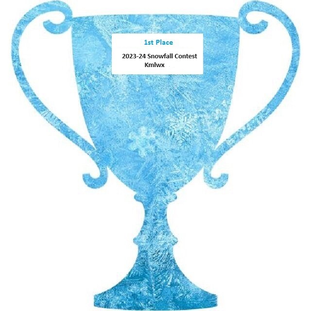
April showers have arrived in the Mid-Atlantic, but it is rather obvious that they will not produce any measurable snow. So, it is time to award the 2023-24 Championship Trophy to Kmlwx. He was the second entrant on the day that the contest opened on 11-1-2023, but his "shot in the dark" hit the bullseye, as he accurately forecast not only another quiet snow season in the Mid-Atlantic, but also nailed the wide disparity between the snow total at Richmond and BWI/Dulles. RickinBaltimore would have walked away with the trophy if RIC were excluded, but he labored under the illusion that the airport is still located in Virginia, having missed the news that it was recently relocated to Richmond County, Georgia . . . Okay, that's an April Fool's joke, but it does seem that way regarding snow. So, congratulations to Kmlwx, and the rest of us will try again this November.