

CNY_WX
-
Posts
2,717 -
Joined
-
Last visited
Content Type
Profiles
Blogs
Forums
American Weather
Media Demo
Store
Gallery
Everything posted by CNY_WX
-
Latest report from KBGM has visibility at 1/4 mile in moderate snow.
-
Looks like rain on I95.
-
The angle they just showed has the ball in Gallmans’ hands on the ground. Review gave it to the Giants.
-
How the hell does Gallman drop that ball?
-
Giant’s D comes up big when they needed to!
-
Giants are giving me more gray hair. I don’t think it matters since Washington will probably win tonight.
-
Snow is blossoming overhead on radar. Nice flake size right now, let’s squeeze out what we can.
-
That’s kind of the attitude I’ve developed as I’ve gotten older. I still get disappointed when we miss out on a big event or the models during January look meh. But I try to put things into perspective. There are many other things going on right now that have longer term implications on my life.
-
Same here, nary a flake. What a winter!
-
Hey Matt, looks like you’ve got about a 15 minute burst of snow headed towards you. Better take some pictures to prove it happened.
-
Where did you get that information? GFS? I still don’t see the lake enhanced rain.
-
It was 30 when I went to bed around 1. Got up just after 7 and it had risen to 32. In the last half hour it jumped to 35. What’s left of my snowpack is starting to resemble a glacier.
-
Probably about the same here. My temperature has dropped to 30. Edit: Actually I think it’s 55/45 here, haha.
-
Your optimism always makes me feel good.
-
If it’s from Environment Canada it would be in Celsius. -30 C = -22 F. At -40 both scales are the same.
-
That’s his fantasy map, lol.
-
That’s one chunk of cold air completely cut off from it’s source.
-
It probably cost you $5.
-
Stations: NY-OG-28 Brewerton 1.5 ESE Lat: 43.228345 Lon: -76.113248 * indicates Multi-Day Accumulation Report Station NY-OG-28 Date Precip in. Snowfall in. Snowfall SWE in. Total Snow Depth in. Total SWE in. 12/01/2020 0.38 0.0 NA NA NA 12/02/2020 0.11 0.7 NA NA NA 12/03/2020 0.08 1.4 NA NA NA 12/04/2020 0.00 0.0 NA NA NA 12/05/2020 0.12 0.0 NA NA NA 12/06/2020 0.02 0.1 NA NA NA 12/07/2020 -- -- -- -- -- 12/08/2020 T T NA NA NA 12/09/2020 0.08 0.8 NA NA NA 12/10/2020 0.20 0.7 NA NA NA 12/11/2020 0.02 0.0 NA NA NA 12/12/2020 0.00 0.0 NA NA NA 12/13/2020 T 0.0 NA NA NA 12/14/2020 0.00 0.0 NA NA NA 12/15/2020 0.03 0.3 NA NA NA 12/16/2020 -- -- -- -- -- 12/17/2020 0.36 3.4 NA NA NA 12/18/2020 0.01 0.1 NA NA NA 12/19/2020 0.00 0.0 NA NA NA 12/20/2020 0.02 0.3 NA NA NA 12/21/2020 0.10 0.2 NA NA NA 12/22/2020 0.04 0.0 NA NA NA 12/23/2020 T T NA NA NA 12/24/2020 0.00 0.0 NA NA NA 12/25/2020 1.17 0.0 NA NA NA 12/26/2020 0.10 0.3 NA NA NA 12/27/2020 T T NA NA NA 12/28/2020 0.01 T NA NA NA 12/29/2020 NA 13.2 NA NA NA 12/30/2020 T T NA NA NA 12/31/2020 0.08 0.0 NA NA NA Totals : 2.93 in. 21.5 in. 0.00 in. -- -- The lake effect the other night somewhat saved the month. 21.5 inches is still well below normal.
-
Actually there are spots down south that are getting more snow than us. West Texas is getting hammered.
-
And they call lake effect fake snow!
-
I remember that. Back when we used to have real winters up here. Now we have the mid Atlantic winters.
-
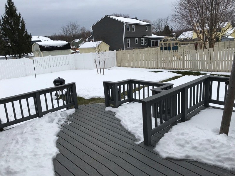
Here’s my backyard this morning. Edit: The dew point is down to the upper 20s. Even though the temperature is 34 the sub freezing dew point slows down melting by depressing temperatures near the surface through evaporational cooling.
-
I still have a snow cover here but it’s probably half of what it was the other day. Of course I always expect lake effect snow to compact to about half of what is measured even when it’s cold.
-
I only measured 0.08 here.


