

Birds~69
-
Posts
34,336 -
Joined
-
Last visited
Content Type
Profiles
Blogs
Forums
American Weather
Media Demo
Store
Gallery
Posts posted by Birds~69
-
-
6
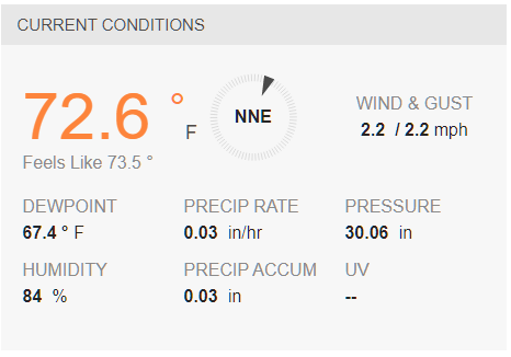
22 minutes ago, Hurricane Agnes said:I did hear one low rumble of thunder from a distance and there is a lighter return band incoming here (hopefully it will provide some more). Am up to 0.17" of rain and temp at 68 w/66dp.
I heard Glenn on the radio earlier this afternoon talking about upper 50s for the weekend for highs.

Yep, Sat (57F) and Sun (59F)
Still a decent batch moving in...
66F

-
Light rain, distant rolling thunder. Down to 66F....still really dark.
-
Rain and wind have lightened up but I had a solid downpour. Didn't think the temps would drop so fast...down to 68F.

-
Downpour, thunder (no lightning), wind...temp down to 70F
-
4 minutes ago, Birds~69 said:
No question it is. I've been dark and windy for 1/2hr and the precip is still to the W. Temp went from upper 80s to around 90 down to my current temp of 77F...
72F, rain on my doorsteps. Nice winds...

-
Just now, The Iceman said:
Getting darker already by me and that usually means the storms gust front is outpacing the precip. I expect the line to weaken considerably the next hour as it approaches the Delaware. Will be surprised if it stays severe. I just hope it rains.. my grass is bone dry and I'm tired of watering the garden twice a day...
No question it is. I've been dark and windy for 1/2hr and the precip is still to the W. Temp went from upper 80s to around 90 down to my current temp of 77F...
-
Just now, Hurricane Agnes said:
Am seeing the line of dark clouds to the west of me. Sky now mostly cloudy and temp is down to 87, dp 68.
It gets pretty dark....looks like 8pm here. Gusty winds as well...
79F / DP 64F (no rain yet)
-
Just now, JTA66 said:
Gust front coming through now.
Yep, things have picked up within the past 10min...
-
Just now, CoolHandMike said:
Wow, yeah it did:
Seems like it's losing a degree every time I refresh. 74F on Wunderground now from 76F...
-
1 minute ago, CoolHandMike said:
Pretty decent gust front went through and now it's raining big, fat drops. Not pouring, though. Hearing constant rolling thunder to the north.
Your temp really dropped...down to 76F

-
15 minutes ago, CoolHandMike said:
Sky went dark. Waiting for the gust front.
Looks like it's losing some intensity as it moves E (Reading)...."reds" are dwindling.
90F / DP 64F

-
 1
1
-
-
15 hours ago, Hurricane Agnes said:
I remember ripping that onto 8-track tape. I think it fit on one 8-track (all of 3 channels and most of the 4th). I may still have it in a crate in the basement. Don't have anything to play it on.

Although vintage, 8-tracks were a horrible breakthrough in technology back in the day. The idea of breaking a song in half (and stop) so it could click to the next track (then resume) was idiotic and ruined the vibe. I had Doors, Zeppelin, Floyd 8 tracks and the player would eventually eat them, it was just a matter of time. Complete fail...
Most humid/DP day so far (Hum 97% / DP 66F) and uncomfortable. Temp only 67F so if we hit 90F w/this DP it's going to feel super muggy. Hopefully we're rewarded w/some T-Boomers....

-
1
-
-
5 hours ago, RedSky said:
Better yell really loud...
I have a big shovel....I'll get his attention.
Today will be the first day in quite a while where I'll be checking the radar...
63F / DP 61F
-
27 minutes ago, RedSky said:
They only exist in hotspots. They are in two locations only at Towhee, none in the woods or near the water. They like open areas with just a few scattered trees. Another observation today is they are popping up in random hotspots driving back, a couple days ago there were none on the way home. Mysterious critters this brood x.
Millions if not billions were predicted in SE PA....we were the hot spot. They may have a more specific hotspot(s) around the area but damn the majority of us should have seen at least one with such a large volume? Just 1. I'm calling Herb....
-
1
-
-
Probably a A/C day tomorrow but after that, no 90s really in site. Friday/Sat 60s with rain then 70s and 80s for some time.
I'll give the critters one more chance with rain Friday into Sat (maybe a storm tomorrow). After that, if they don't show up, it's not happening...
67F / DP 59F
-
1 hour ago, JTA66 said:
I think I was 12 when that movie hit Prism one summer. I was convinced the clock was ticking for those of us in PA and we'd be running from swarms of killer bees by the 1990's.
This made me feel.
 Early 80's when cable just became available in my area...
Had the big ass Jerrold 3 level click button box w/a annoying long cord to the TV console which always got tangled up with something or I tripped over it.
73F / DP 56F...no sign of cicadas.


-
14 minutes ago, RedSky said:
I put one of those traps out to keep them from eating the silks on my corn in 2004 and it pulled in all the beetles in the county then I REALLY had a problem lol
I really haven't seen them in years...decades? Maybe a few? But in the lates 70's my area was drilled...Dad was pissed because they ate his garden to hell.
Glenn's 5pm Burbs forecast...rain percentage by day. Looks like Sat will be mostly in the 50s...


-
1 hour ago, JTA66 said:
lol...not here. Brood X is the biggest bust since 3/5/2001.
Seriously, this confirms my memory of 2004, these guys aren't imby. Need to wait until July for the annual cicadas to show up (along with cicada bees).
Yeah, nothing here either...I was just being a smartass. However, I'd rather bust on critters than a big ass snowstorm.
No memory of 1994 either. Times are different now, media (social media) like to super overhype trivial things now. And local news...ratings, ratings...Glenn hasn't really mentioned cicadas in recent days.
Do you, Redsky or anyone w/age remember the Japanese Beetle infestation in the late 70s or so? Those F'ers were everywhere! People had those Bag a Bug things hanging all over the place, front/back lawn and they would be full...


-
4 hours ago, JTA66 said:
The grass has that crunchy, August feel to it as you walk on it, some lawns starting to brown up already. I'm not mowing again until we get some rain.
Besides that...beautiful morning out there compared to the last few, 62F/DP 52F.
Maybe the crunch is from the massive amount of cicada shells?
Hanging at 65F...
-
1
-
-
65F / DP 45F at 1:30pm. Rather dark clouds around and temps have not moved much.
Memorial day weekend (Fri-Sun) looks like temps around 70F (Sat 60s) clouds/sun and a chance of a shower(s)...Memorial day itself temps in the 70s w/more sun. Probably see some overnight temps in the 40s...
-
61F / DP 45F /Cloudy w/a breeze at 6:45am. Feels great...
-
9 minutes ago, RedSky said:
At lake Towhee specifically it's biblical I was impressed even at my old age. Never got em like that in Horsham it's worth a trip.
Ok, camped there one time, I know where that is...damn close to Knockamixon. I went to shooting range up there as well which I think closed...
79F...A/C going off soon.
-
1
-
-
25 minutes ago, RedSky said:
Millions/billions of Cicada's in Haycock township out by Nockamixon lake, opposite of dry slot heavy at times and low visibility lol
Here to the west absolutely nada
I really may make a trip up that way, haven't been up around Nockamixon in years. I'm 90% convinced I'll get screwed around this area with very limited critters.
Looking forward to clouds and 60s tomorrow...
86F
-
1
-
-
6 minutes ago, Hurricane Agnes said:
Hit 91 today (so far) a couple times - just after 2 pm and then just after ~3:30 pm. Amazing that the low this morning here was 72 and this is May. Will see how robust the cold front is when it drops down into the area.
Currently bopping between 89 & 90 and mostly sunny, with some cumulus starting to roll in from the north and west.
It was 73F here at 2am early this morning and I doubt I dropped into the 60s. I see Philly hanging around 70/low70s tomorrow w/burbs in the upper 60s....great stuff.
A/C goes off once it gets dark around here tonight...expected low upper 50s to 60F.
87F
-
1
-


E PA/NJ/DE Spring 2021 OBS Thread
in Philadelphia Region
Posted
Winds drilled some people. Glad it wasn't me, Phils and Sixers tonight...