Rjay
-
Posts
28,400 -
Joined
-
Last visited
Content Type
Profiles
Blogs
Forums
American Weather
Media Demo
Store
Gallery
Everything posted by Rjay
-
We use evidence. There's variables in play and nuance to this discussion.
-
@FPizz can you please ask then their rationale behind saying that? I just want to understand where they are coming from.
-
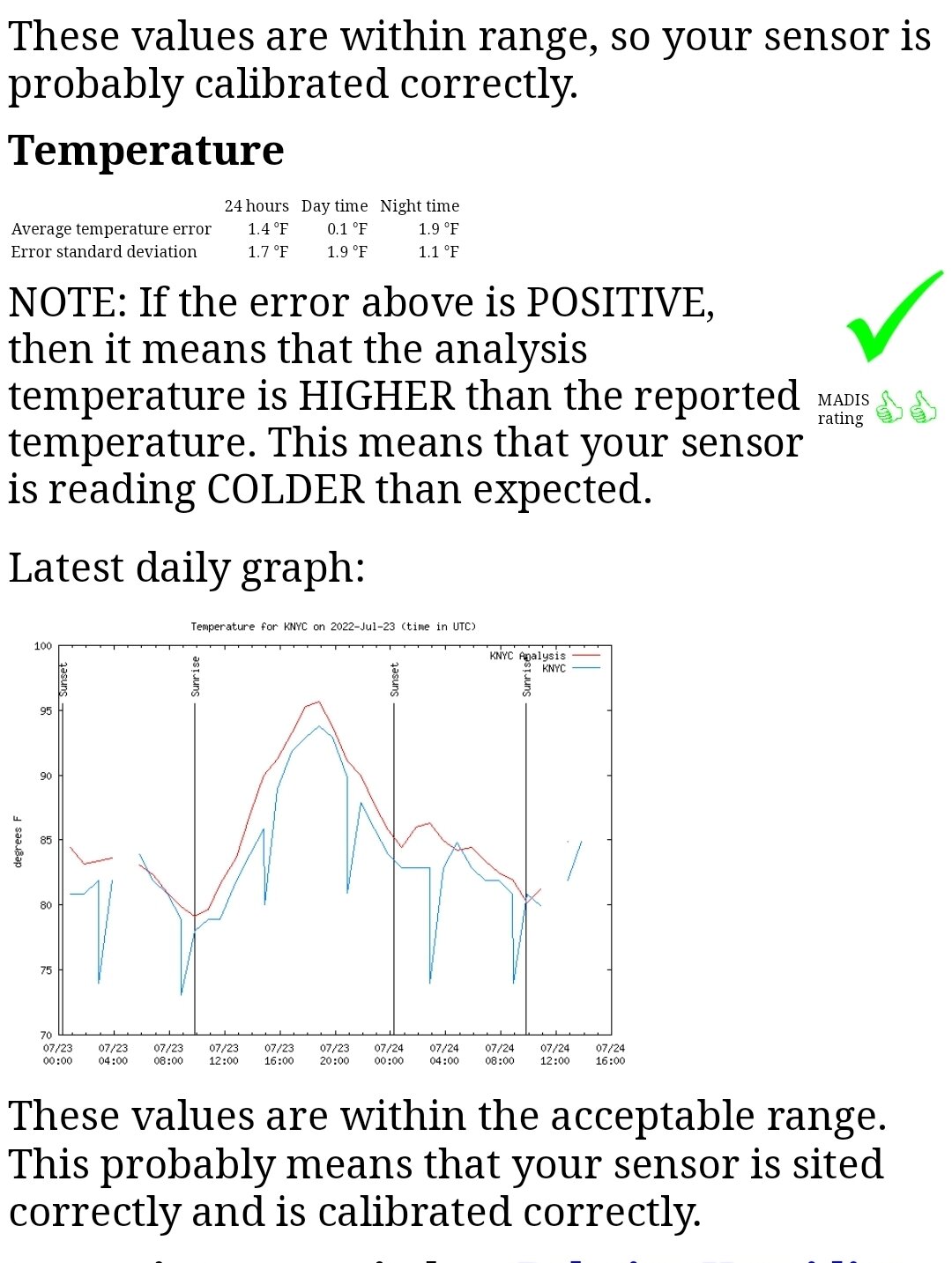
They are likely using MADIS and MADIS is wrong.
-
That's the key imo.
-
No one says a word when FOX is 15-20 colder than ISP on radiational cooling nights. But when EWR is 1-3 degrees warmer than other stations in the area people have a big issue with it. You have to wonder why that is.
-
Lol

-
-
Somerville 100 Harrison 99
-
August
-
Prob smells pretty bad. This heatwave is bootleg without the high dews.
-
No one said there wasn't a ton of concrete/blacktop near the airport but it's representative of the area.
-
No it hasn't. Only TEB but TEB was running way too warm for years until they fixed it in 2020.
-
So you'll ignore all the evidence. Ok then.
-
It's hot. But thank god @binbissohelped keep those dews away today or it would feel miserable. This heatwave, while historic in parts of NJ, doesn't feel all that bad compared to what it could feel like.
-
That's why the debate. *And half my subforum.
-
Boston 100
-
Bos just hit 100 lol
-
*108 lol. Newark tends to line up very well with concrete jungle areas like interior Queens (on days the seabreeze can stay away from Long Island).
-
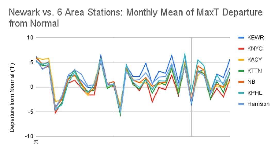
Yup. The check mark means it's within range. Same site people use against EWR.
-
As of 2pm EWR 99 Hillsborough 99 Somerville 98 Harrison 98 New Brunswick 98 I just dont understand where the EWR nonsense comes from.
-
MADIS also says NYC temps are fine. It's garbage. At least 6 sites in NJ hit 100 yesterday.
-
99/58 at ewr. The heat is def more tolerable without the humidity.
-
Lol sorry
-
Doncat was 99 yesterday. I expect at least that today.
-
Nyc will need something extraordinary to hit 100 and LGA has gotten a seabreeze at some point each day. You have several posters who've hit 100 too, including Forky.