-
Posts
6,476 -
Joined
-
Last visited
Content Type
Profiles
Blogs
Forums
American Weather
Media Demo
Store
Gallery
Posts posted by strongwxnc
-
-
Area Forecast Discussion National Weather Service Greenville-Spartanburg SC 116 AM EST Sat Jan 31 2026 .WHAT HAS CHANGED... Snow amounts have been bumped up slightly across the region, mainly over the NC Foothills, but most places very similar to the previous fcst.
LETS GO. Flakes.
I just woke up!
-
4
-
-
They’ve got me in the 3 to 7 range Saturday day. Possibility of an inch before sunrise.
. -
-
Solid. Solid!
-
3
-
-
This will
Also be colder correct?
. -
Our little guy coming down out of the Dakota's .
-
1
-
-
Just now, wncsnow said:
It's a bit concerning they give the NAM that much weight
My brain is mush after the last two weeks. Ready for go time.
-
2
-
1
-
-
6 minutes ago, wncsnow said:Quote
The 06Z ECMWF and GFS depict a mesolow developing over northeast Georgia and tracking southeastward across the South Carolina Upstate on Saturday, but the 06z NAM shows the mesolow developing farther north and east, just on the edge the GSP forecast area. Depending on where exactly this mesolow develops and tracks on Saturday is one of the main forecast challenges.From the updated AFD at 1:53. Working off the 06 runs as stated.
-
2
-
-
9 minutes ago, wncsnow said:
lovely Euro run. Someone near @strongwxncis getting 10+ out of this
Got that strip through the SSE side of my county. Im like 5 miles to the N of it.
-
1 minute ago, wncsnow said:
Another short range gets juicier!
RAP has a later start time also for MBY. 4am
-
3 minutes ago, BooneWX said:
I know it’s the Graf but in my past observations it’s pretty good with picking up unique meso features and banding. I’m glad every run seems to be looking better on it.
Got a link?
-
UNCA will be sending Balloons up starting at 6 Pm today
-
4
-
-
4 minutes ago, Maggie Valley Steve said:
Haywood County schools will let out at noon.
Thats a good call for them. I hope others do.
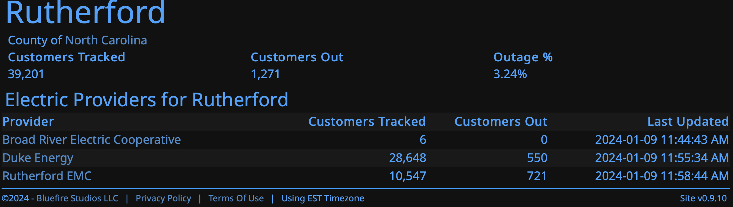
I work in Rutherford County school (AP at East Middle) and over buses. We had a 1 hr delay today (for some reason). Lots of issues even this morning. I hit lots of ICE still around on many roads.
-
3
-
-
1 minute ago, wncsnow said:
Pretty solid NAM runs. Upstate gets hammered. We need just a little push north.
I think this will be the battle zone (at least until a new zone is created LOL).
-
-
5
-
-
Ugh. Those short range models have me nervous. The 6Z Euro still looks good, though.
ULL stays neutral longer . Also go time. The model whiplash should be crazy today.
. -
Feeling good under a warning this morning. I hate the word lock in winter weather but the 9 in 10 chance is 2-3" . Of course the high end 1 in 10 is 9-11".
Getting close to nowcast time
-
1
-
-
“Hey siri… add baby oil to my shopping list.”
.
Yeah, that’s the best line so far
.-
1
-
-
Myself and I assume others also have been dug into models runs since the sunday before last. This has been an epic time frame for tracking.
-
2
-
1
-
-
Quote
ARea Forecast Discussion National Weather Service Greenville-Spartanburg SC 153 PM EST Thu Jan 29 2026 .WHAT HAS CHANGED... The winter storm watch has been upgraded to a winter storm warning across the North Carolina mountains. The remainder of the watch will likely be upgraded to a warning tonight. Snowfall totals have increased with the highest totals still expected along and east of I-77, but confidence in heavy snow is increasing for portions of the Upstate and mountains.QuoteKey message 2: A significant winter weather event will impact the region from Friday night through Saturday night, with snow expected to be the primary precipitation type. Due to cold temperatures leading up to the event, impacts to travel will be significant. While some variations in model guidance persist, the overall forecast trend is coming into better agreement with high confidence in a significant winter storm for the western Carolinas and northeast Georgia. A potent Tropospheric Polar Vortex (TPV) is currently analyzed just north of the Great Lakes within a broader gyre over southeast Canada. Farther south, a subtropical jet extends from the eastern Pacific to the Gulf Coast with a lead shortwave trough diving through the Southern Plains. And to the west, a tall western ridge resides from the Great Basin through the Cascades and into the Canadian Rockies. Heading through tonight and into tomorrow, the TPV will drop across the Midwest and dig into the Mississippi Valley. The trough will initially have a very positive tilt to it, but will quickly take on a neutral tilt over middle Tennessee before becoming negatively tilted as it swings across the Southern Appalachians through the day on Saturday. The latest trend in guidance has been for a slower evolution of the TPV, which would allow for the lead southern stream wave to get out ahead of the bowling ball upper low and initiate surface cyclogenesis along a coastal baroclinic zone along the Carolina coast. Furthermore, guidance has latched onto the development of a mesolow in the lee of the Southern Appalachians with the mesolow moving southeast through the Savannah River Valley and into the South Carolina coastal plain. This would place much of the forecast area in a very favorable location north of the mesolow and north of the bowling ball closed upper low. Here, strong forcing for ascent will be present in conjunction with convergent low-level flow, some component of which will have a moisture connection to the Atlantic. This will also foster the development of a notable band of 850mb frontogenesis across the Upstate and into the North Carolina Piedmont and portions of the foothills. The result of which has been a notable southwest trend in QPF with an uptick along the I-85 corridor. Snow will start as early as tomorrow afternoon across the mountains as upper divergence increases as the TPV encroaches on the Tennessee Valley. A strong upslope component of the flow will also help force precipitation across the mountains. Snow will then overspread areas east of the mountains late Friday night into early Saturday morning. The event will peak through Saturday morning into the early afternoon before gradually tapering off from west to east late afternoon through the overnight hours with all snow coming to an end by daybreak Sunday morning. This will be a very unusual and highly anomalous event in many ways with near record low 500mb heights, very cold temperatures and rare Snow-to-Liquid Ratios (SLRs) of 15:1 - 20:1. The dendritic growth zone will be very deep with plentiful forcing for efficient snow growth. Thus, it won't take much QPF to reach warning criteria snow across practically the entire forecast area. The winter storm watch across the mountains has been upgraded to a winter storm warning owing to earlier onset time tomorrow afternoon and evening. Snow will take longer to break out east of the mountains and the winter storm watch here will likely be upgraded to a winter storm warning with the overnight forecast package. Forecast confidence in where the highest snowfall totals occur is moderate and some variability still exists. Right now, the highest totals are still generally along and east of I-77, but this is subject to change pending the evolution of the mesolow. A band of heavy snow could setup along a corridor extending from Greenville/Spartanburg to Charlotte. Snowfall totals along and north of I-40 are a little more uncertain now with the heaviest snow potentially shifting south towards I-85. Nevertheless, warning criteria snow of at least 3" is still highly likely. There has also been a signal for a "dry slot" between snow bands in the general vicinity of northeast Georgia, although where this occurs is still uncertain - but even there warning criteria snow should still be realized. The ceiling is high with this event and a swath of 8-12"+ totals cannot be ruled out where the greatest banding is able to set up shop.
-
1
-
-
https://products.climate.ncsu.edu/weather/winter/latest-snow-events/
Cool map about snow history in NC based og amount since last.
-
2 minutes ago, scottk said:
As someone who is not a regular on the forum, I have a question.
Where are the majority of you all located?
I’ve gathered that it is somewhere in NC. But when I see posts saying things like “this model run was really bad” or “this one looks like a great trend for us!”, I don’t immediately know what/where/who you’re referring to.
Most have locations logged under the user name.
-
2
-
-
NWS GSP chat says they will upgraded to a warning this afternoon.
-
2
-
1
-
-
7 minutes ago, BooneWX said:
We’re looking good. Only critique would be that I’d like to see the digging calm down a bit. You want to be just northwest of the ULL, not way northwest.
Hopefully we will have a good agreement on this today into tonight.


.gif.4b28339dad4d3455a823708f58d1faf0.gif)
2026 Foothills thread
in Southeastern States
Posted
Uppped totals. Good to see as I get up I thought a decrese.