
wxmanmitch
-
Posts
2,090 -
Joined
-
Last visited
Content Type
Profiles
Blogs
Forums
American Weather
Media Demo
Store
Gallery
Posts posted by wxmanmitch
-
-
I literally have goosebumps right now after seeing the RDPS (RGEM) and the radar. Death band incoming and I may very well be very close to or under the pivot point. It's already pounding snow, although flakes are small to medium. 9.4° F.
-
 5
5
-
-
4.0" final here. Wind is absolutely howling just above the surface with the occasional gust mixing down. Snow is blowing around all over the place making measuring difficult. 25.5° F.
-
2
-
-
3.2" of snow with 0.28" LE here. Light snow ongoing with dropping temps now at 29.7° F. Grateful to at least get something even though I missed out on the QPF bomb...
-
I'm likely watching this one from afar or from the edges anyway barring a TB12 Super Bowl LI type comeback. RGEM offers a bit of hope that I at least get something.
It can happen. I remember the 3/7-8/18 nor'easter that was modeled to go slightly east and I wound up getting 3'+ from a sick deform band that sat up over me for several hours and dumped...
-
4.0" overnight for a 4.6" two day total. Road was plowed and I have just enough to snow blow the driveway even though it'll melt soon.
-
1
-
-
7 minutes ago, backedgeapproaching said:
Same exact total here. I think tonight was always going to be the one to get the totals up in SVT, so we will see how it plays out. I have noticed that most of my uplsope events that produce anything substantial are almost always nocturnal. Substantial for here I consider 3-6", unless its an anomalous event like NOV '16 or Jan 2010 or something like that which were day and night events. It just seems like during the day time its always more cellular in nature while night its get more consolidated. Again, just speaking for my backyard specifically.
While not always the case, I've noticed the same thing. Stability tends to increase at night so that would favor a more stratiform type of upslope as opposed to a cellular (unstable) or streamer (neutral stability) upslope so there is definitely merit to this observation. The streamers can nail a particular location if you manage to get one over you for a while.
-
1
-
-
Only 0.6" on my snow board from rounds 1 and 2, so it's safe to say the upslope has been a disappointment down here so far. This stuff is hard to measure with some "drifts" to 2-3" around the house. Awaiting to see what the clipper brings us for round 3 overnight...
I haven't been able to get the deeper moisture profiles needed to get a more robust upslope snowstorm this far south. It's one of those deals where you can clearly see the silhouette of the sun or moon through the clouds. The bigger events tend to produce a thicker cloud cover where the sun or moon aren't visible.
-
Classic stratiform type upslope snowfall ongoing with fat, fluffy flakes. Still rather wet since it's 32.6° F, but the ground is white once again. Under a WWA for 4-8" through Tuesday.
-
2
-
-
25 minutes ago, jculligan said:
Hi everyone! It's been several years since I've been active on this page - in fact so many years that I couldn't recover my old password due to a retired email account, and therefore had to create a new profile lol. I'm formerly kulaginman and I'm actually a "red tagger" (graduated from the Plymouth State meteorology program about 15 years ago).
In any event, I'd like to contribute to this page once again and I recently moved to a tiny place at an elevation of 1500' on the shoulder of North Doublehead Mountain in Jackson, NH...so this could be a very interesting meteorological location. I'm about a mile away from Black Mountain Ski Resort.
Hoping for the first weenie flakes in my location tonight (we missed the big event on October 17th which blanketed the other side of the notches). Cheers to a snowy northern New England winter ahead.
Hi...Justin, I remember that original screen name. Glad to see you back on the forums. We overlapped a bit at Plymouth...I graduated with a BS in '07, MS in '10.
You're in a good spot for snow up there in the heart of CAD country. Any idea what the annual averages are like at your location?
I've since relocated to a decent snow spot high up in the Green Mountains of far southern Vermont. I get a nice mix of snow from coastal storms, southwesterly flow overrunners, and upslope on NW flow.
Look forward to your observations this winter.
-
33 minutes ago, powderfreak said:
I feel like that's much more normal than the other way around... the electronic tippers seem more prone to being on the high side though Dryslot in the last post proved not always.
It makes sense though in big rain events if you consider it as a percentage of error, right? In lighter events you may only notice a very slight difference, but as you magnify the rainfall the difference between the two will grow. @dendrite is the expert on these things but if that's say an 8-9% error, in a lighter rain event that's only the difference of 0.50" vs. 0.54", which may not be as noticeable?
The percentage of error is definitely more significant the heavier the rain gets, not necessarily the more rain that falls for the event in question. The worst errors seem to occur during thunderstorms. Prior to calibrating my Davis tipper, it was over reporting by an average of 25-30%. It's pretty much spot on for the light rain events, so for instance if my Stratus gets 0.14" my Davis is usually 0.14", unless it all fell in < 5 minutes or something.
-
1
-
-
3.66" in my Stratus rain gauge, 3.95" in my Davis VP2. I've noticed my Davis tends to over report rain during heavy events, but is very close to the Stratus for the lighter events. Is this normal?
Anyway, drought cancel here. Rivers and streams are flowing vigorously again. Not that there was much of a drought to begin with here...
-
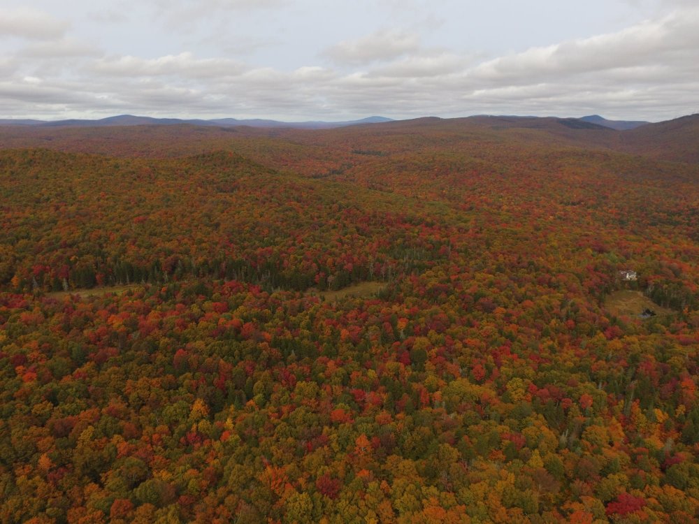
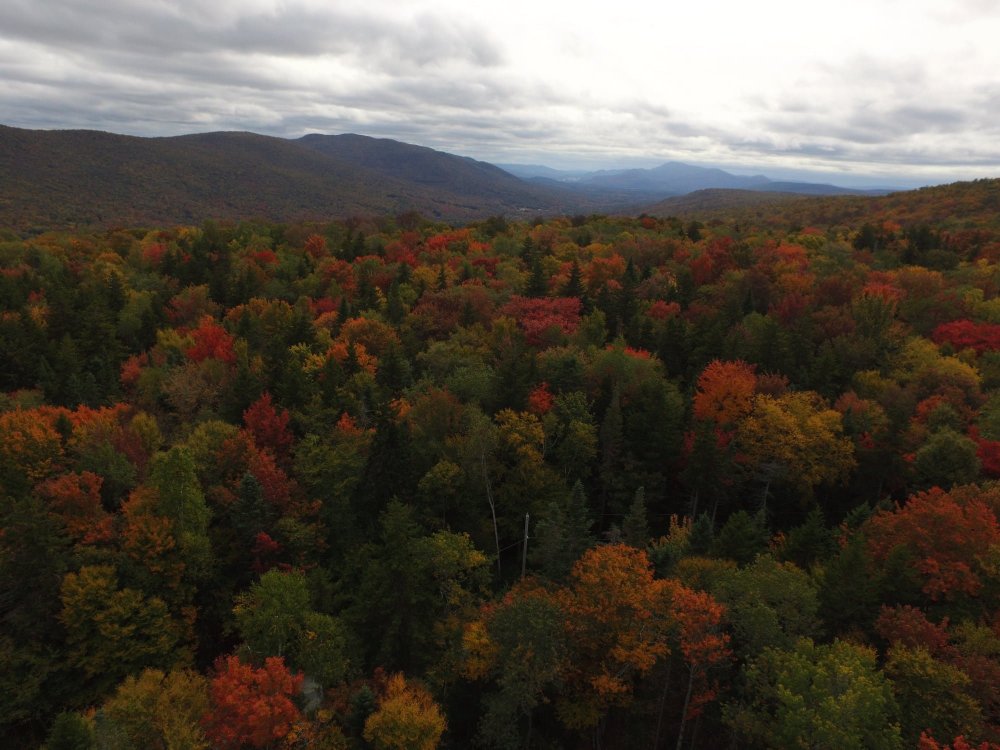
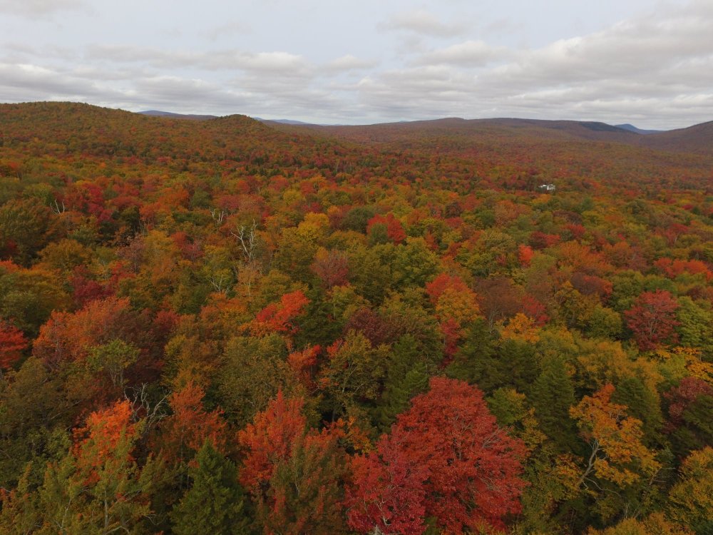
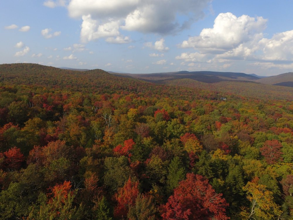
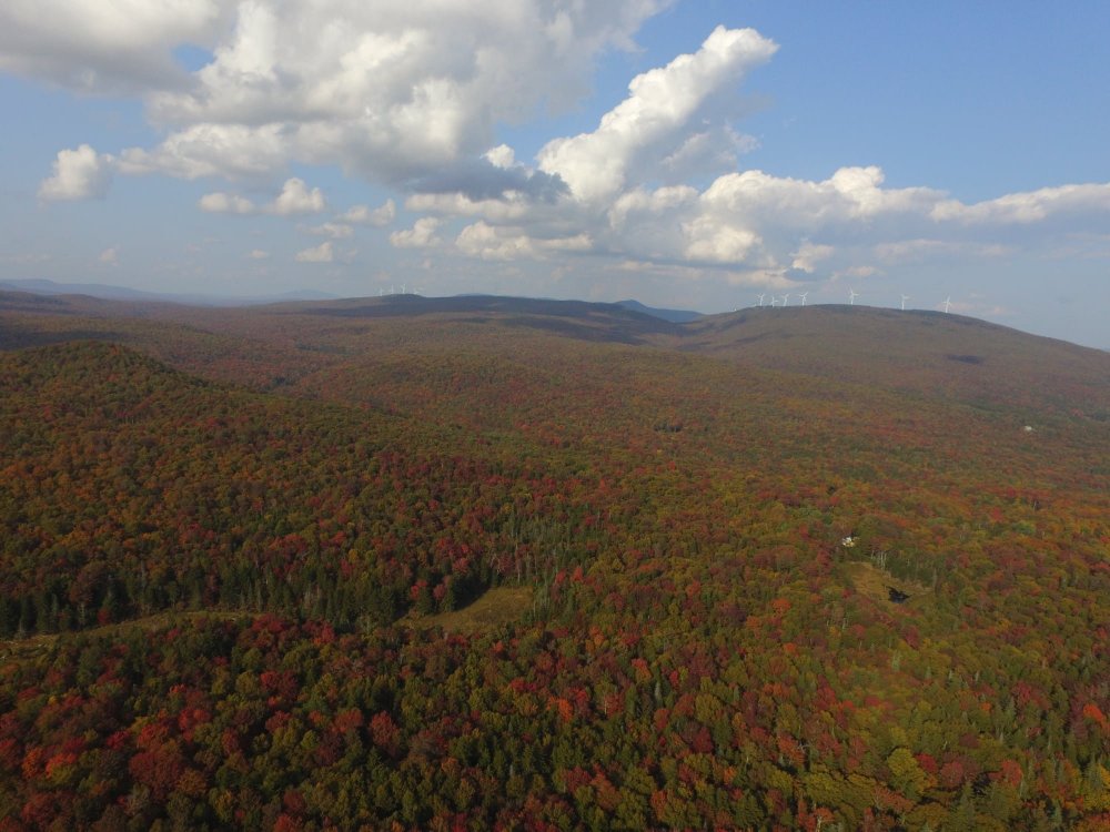
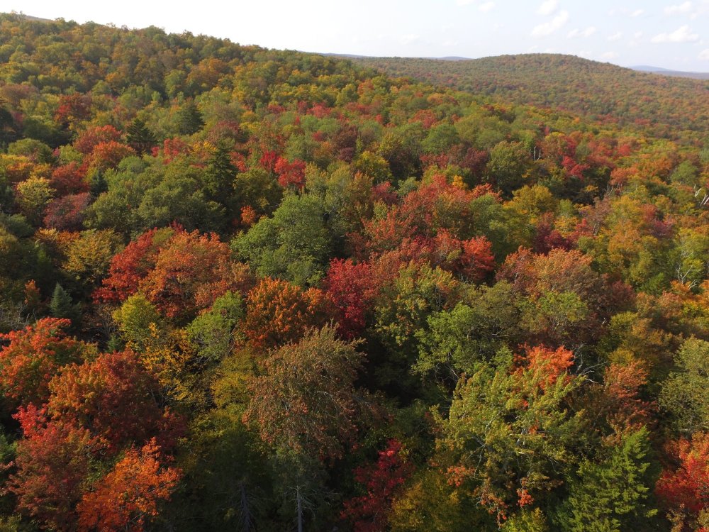
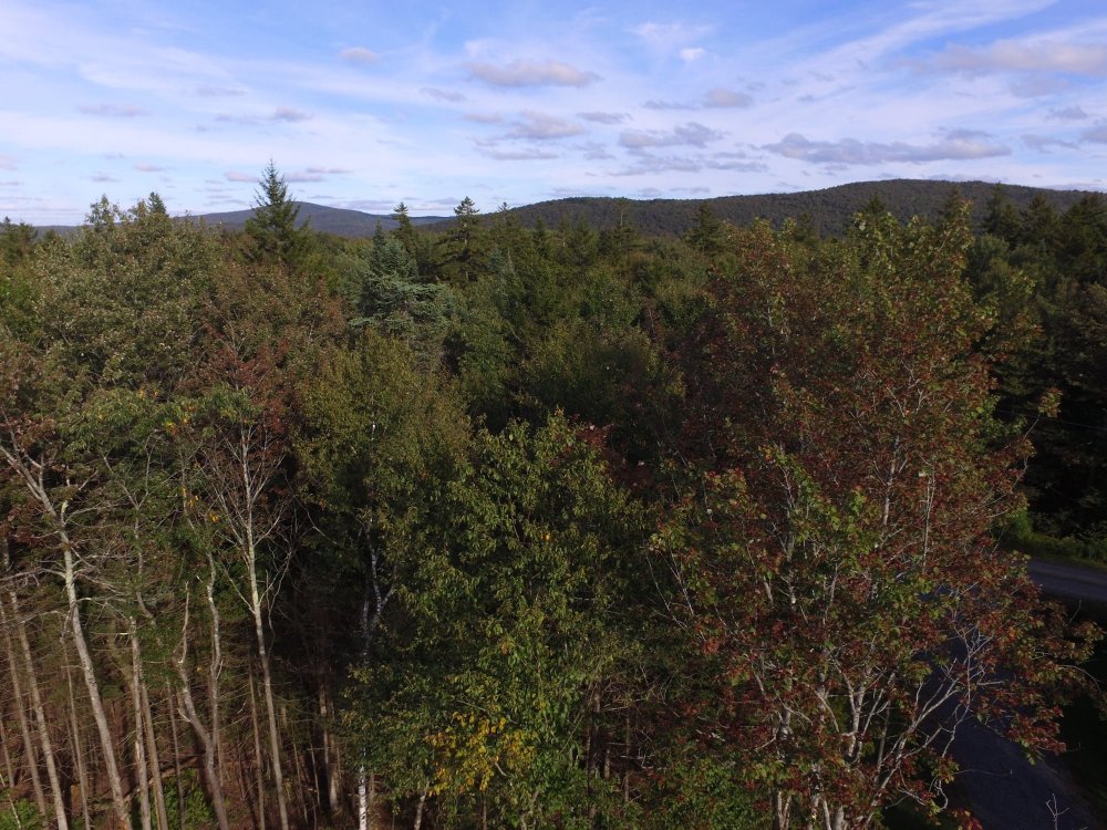
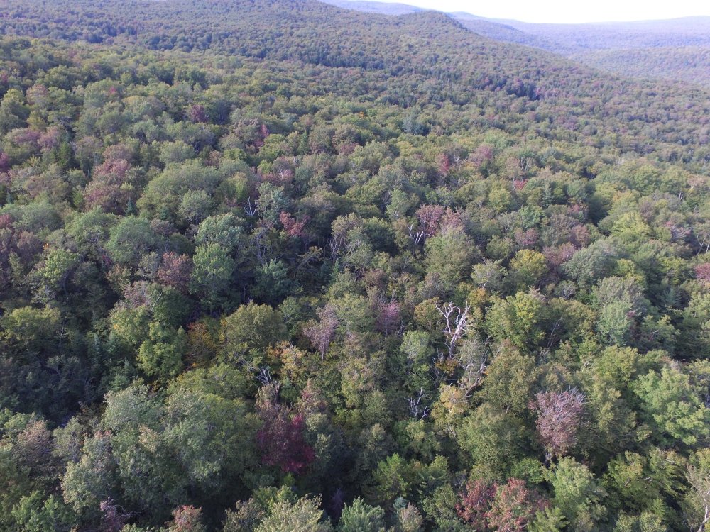
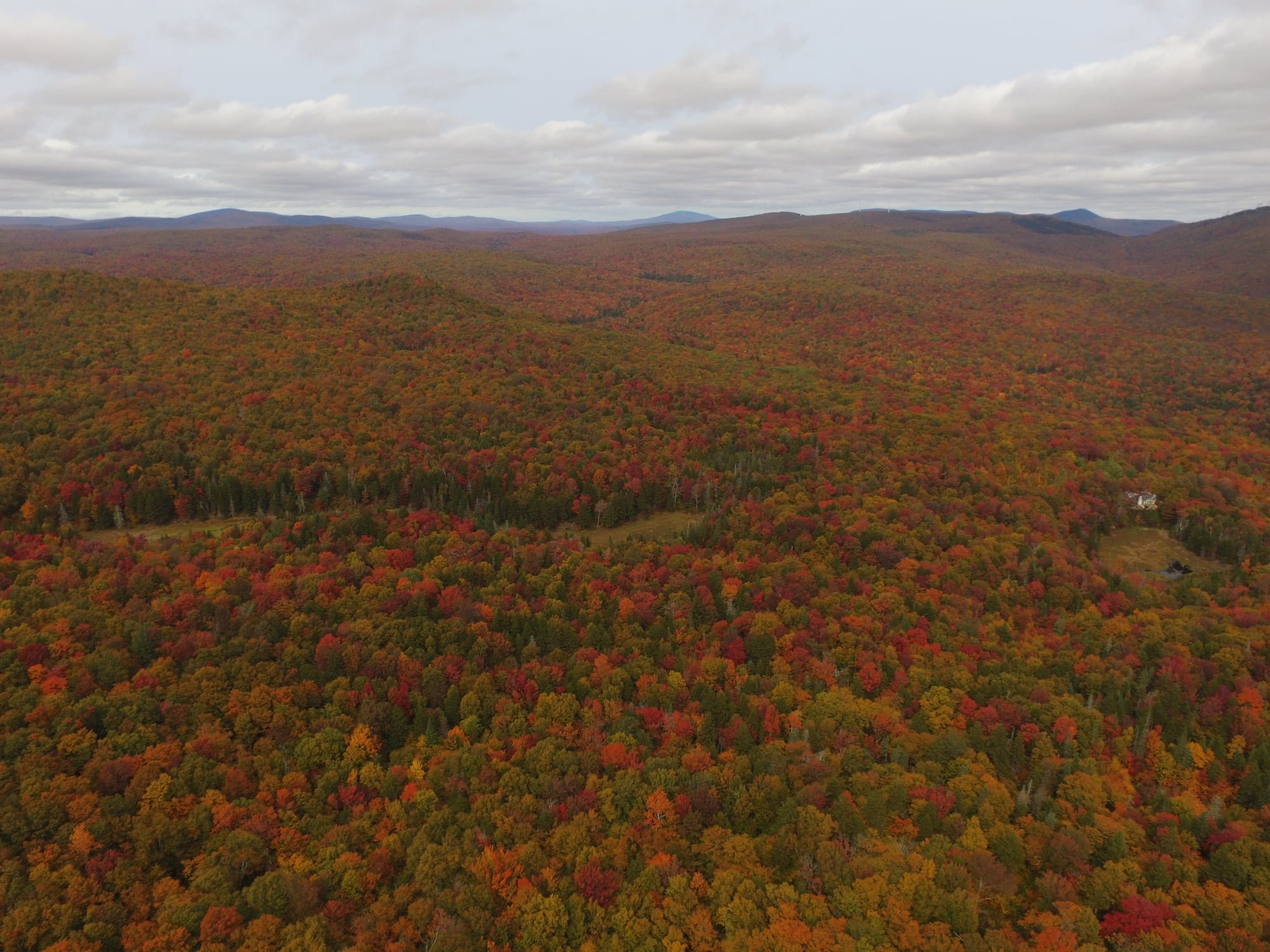
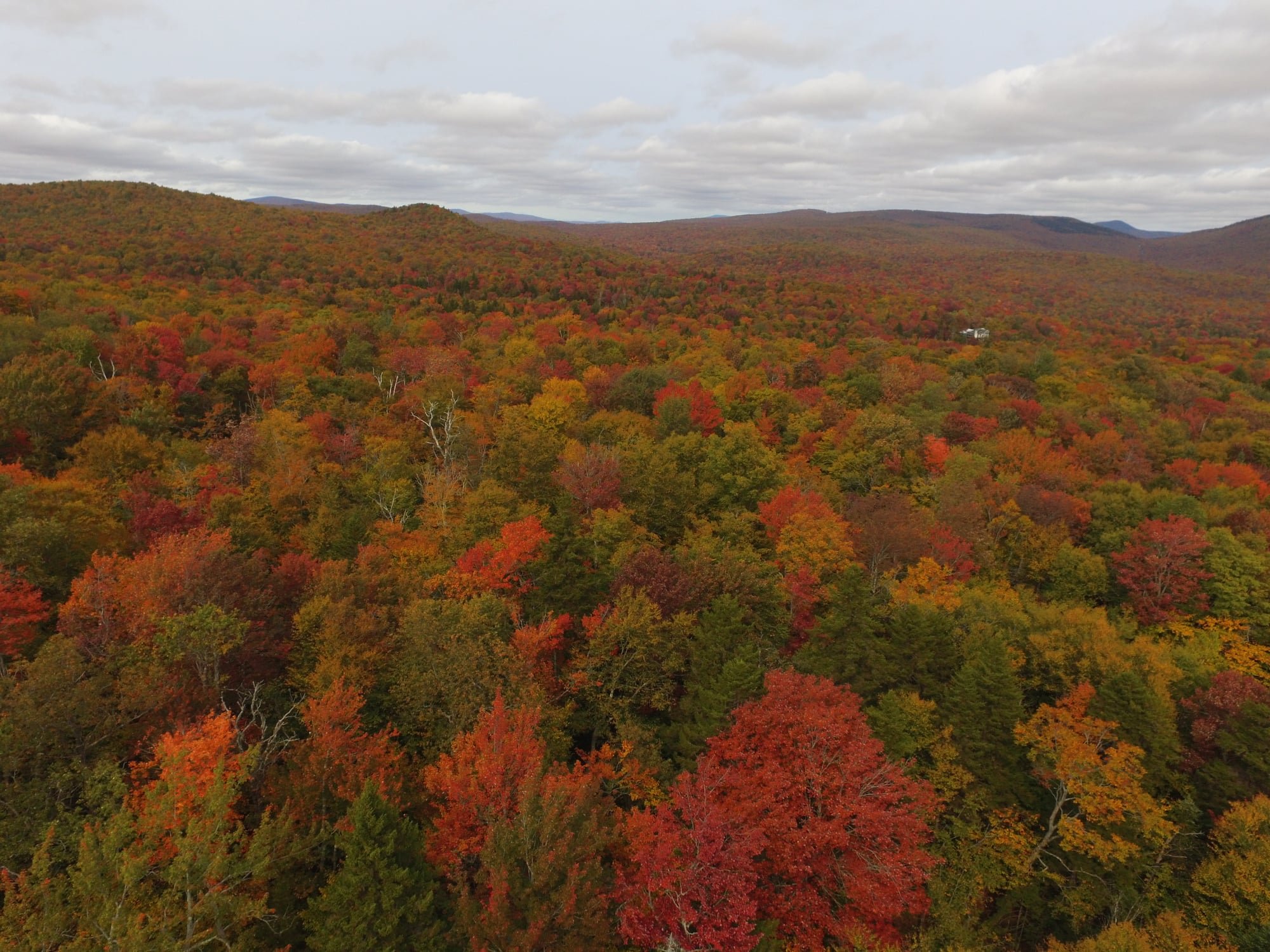
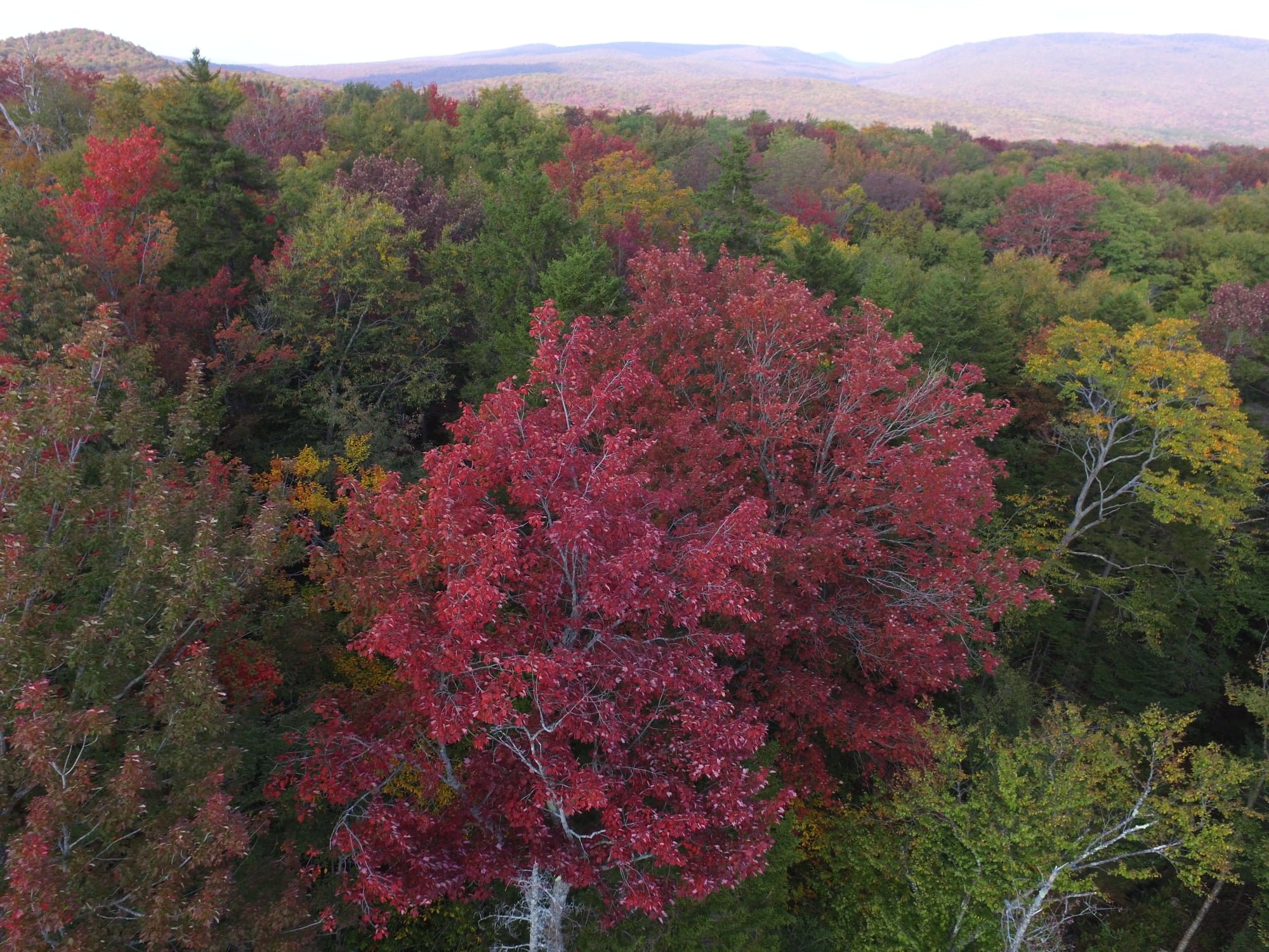
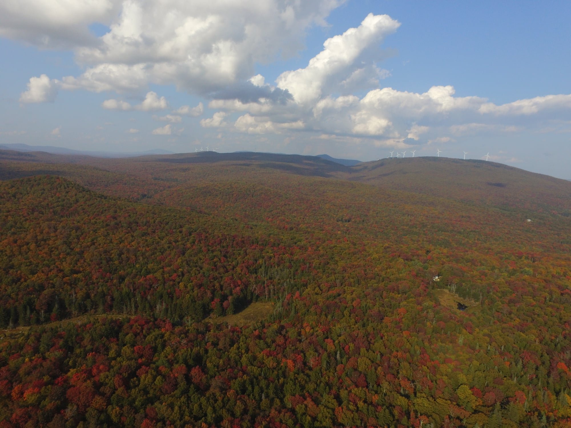
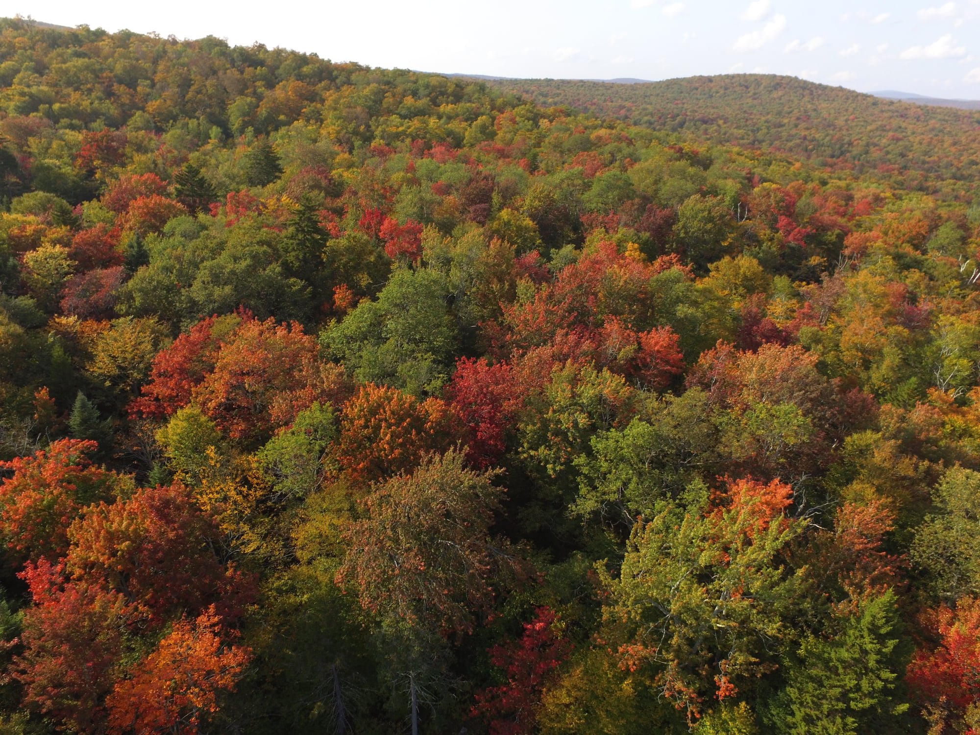
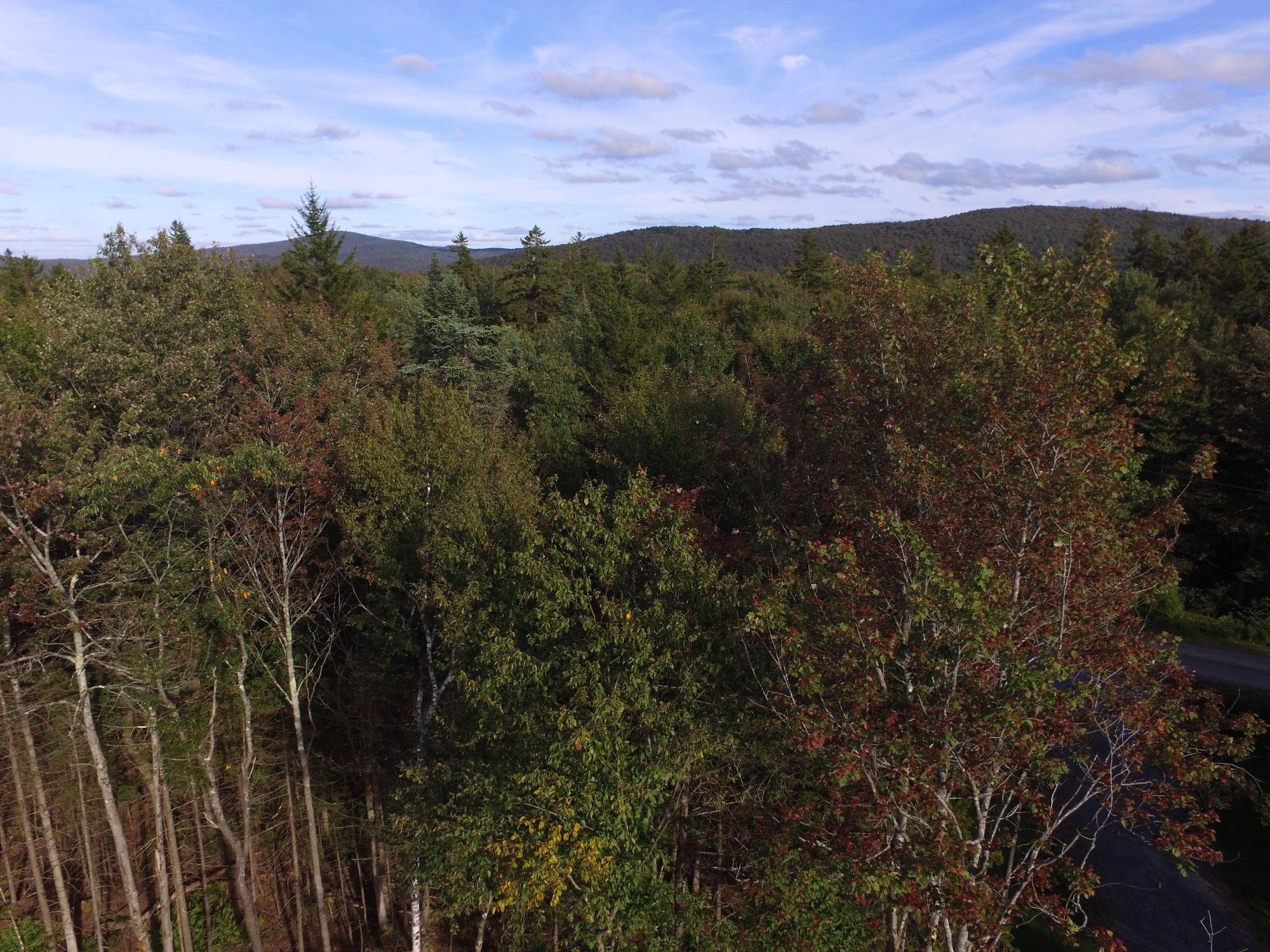
There's a reason why Vermont is world renowned for fall foliage and this is it! Just a few of the drone shots I got yesterday above my house.
-
5
-
-
I'd say I'm just about there. The sudden explosion in colors over the past few days has been nothing short of incredible to witness. The red maples are putting on quite a show again this year. There's such a great abundance of them around these parts, especially in the 2,000-2,500' zone.

-
3
-
-
I didn't see a 2020 Fall Foliage thread, so I figured I'd get one started since the leaves are beginning to turn here in the highlands of southern Vermont. The red maples are beginning to turn a bit read and the sugar maples have a hint of orange, so it's coming. I've been largely spared from the drought here, but I did have a bruce spanworm (a close relative to the invasive winter moth that's invaded coastal New England) infestation that did a number on the ash trees and did some minor damage to other species. Fortunately, I don't think the damage to the maples was significant enough to detrimentally effect the fall color and ash trees only make up a small component of the forests around here so I think the foliage should at least be decent in S VT.
-
3
-
-
15.12" of rain for meteorological summer. That drought was a bunch of fake news, lol.
Average temperature was 64.1° F, low was 30.8° F on 6/1, high was 84.8° F on 7/19. Now onto fall and winter...
-
79.9° high today counts as the 10th 80°+ F day this summer. It's been just awful this year. Nonstop heat and humidity. Last year I had only 4 days that reached or exceeded 80° F, all in July.
I'm so done with this crap. Summer can F*** off already!
-
2
-
 2
2
-
-
2 hours ago, tamarack said:
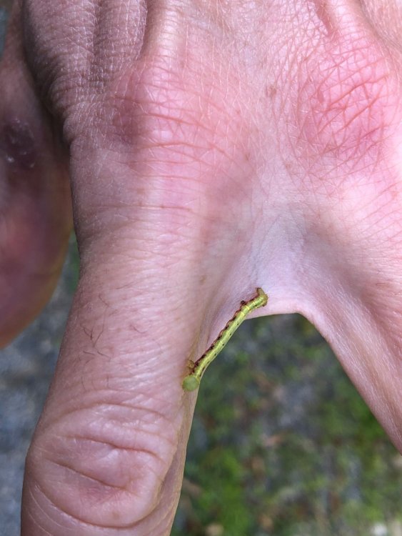
Winter moth or Bruce spanworm (they're somewhat similar in appearance and phenology, moths flying in late fall) would be my guesses.
Thanks. According to some research, it could be either and the two are known to hybridize. The Bruce spanworm is native, but the winter moth isn't. Without DNA analysis it's nearly impossible to tell them apart.
https://en.wikipedia.org/wiki/Operophtera_bruceata
https://www.maine.gov/dacf/mfs/forest_health/insects/bruce_spanworm.htm
-
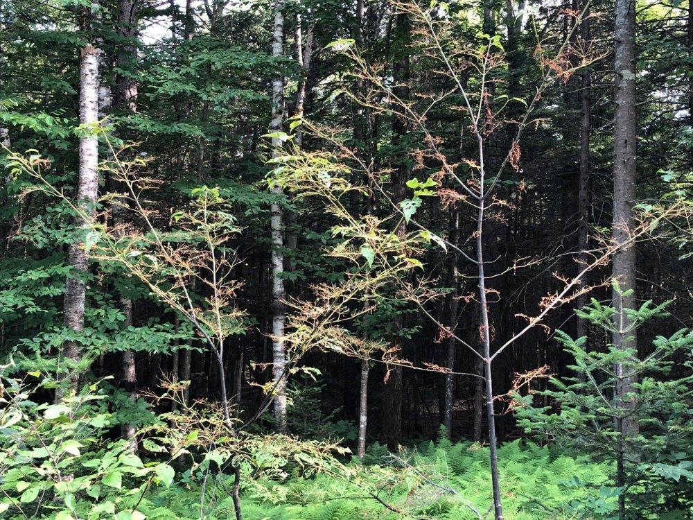
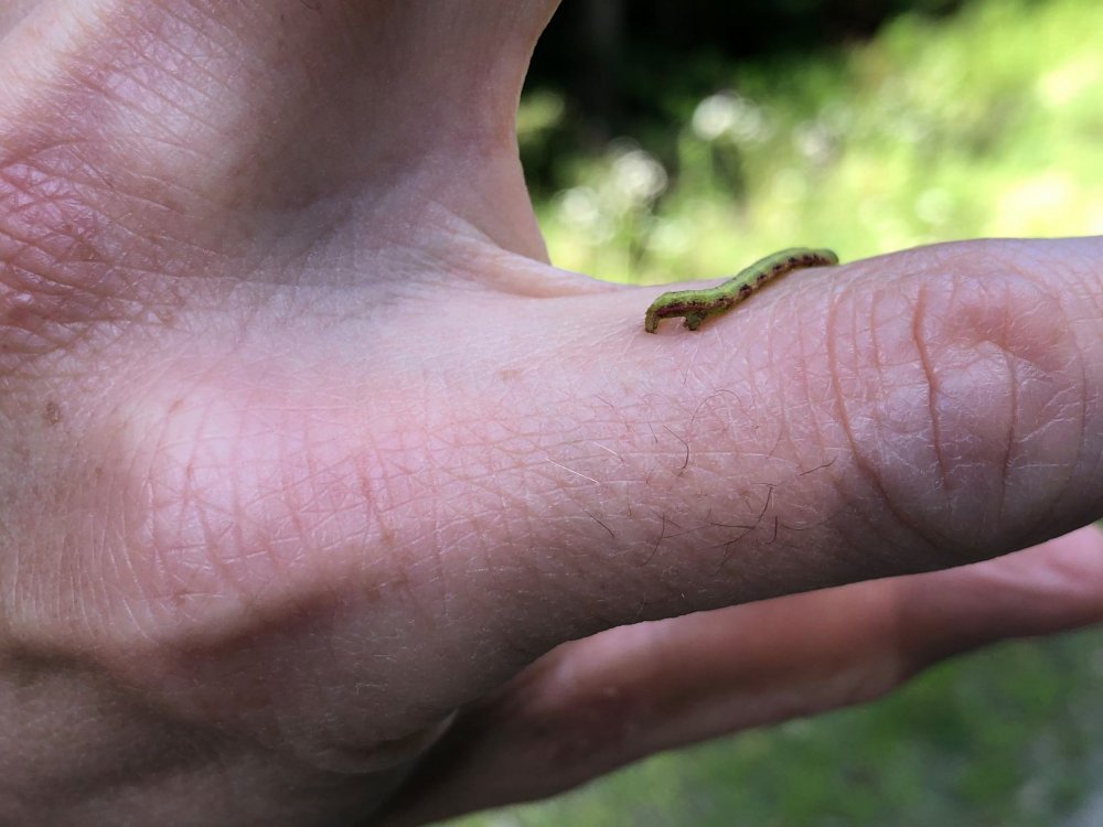
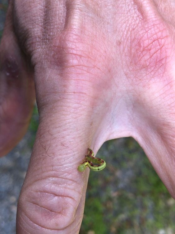
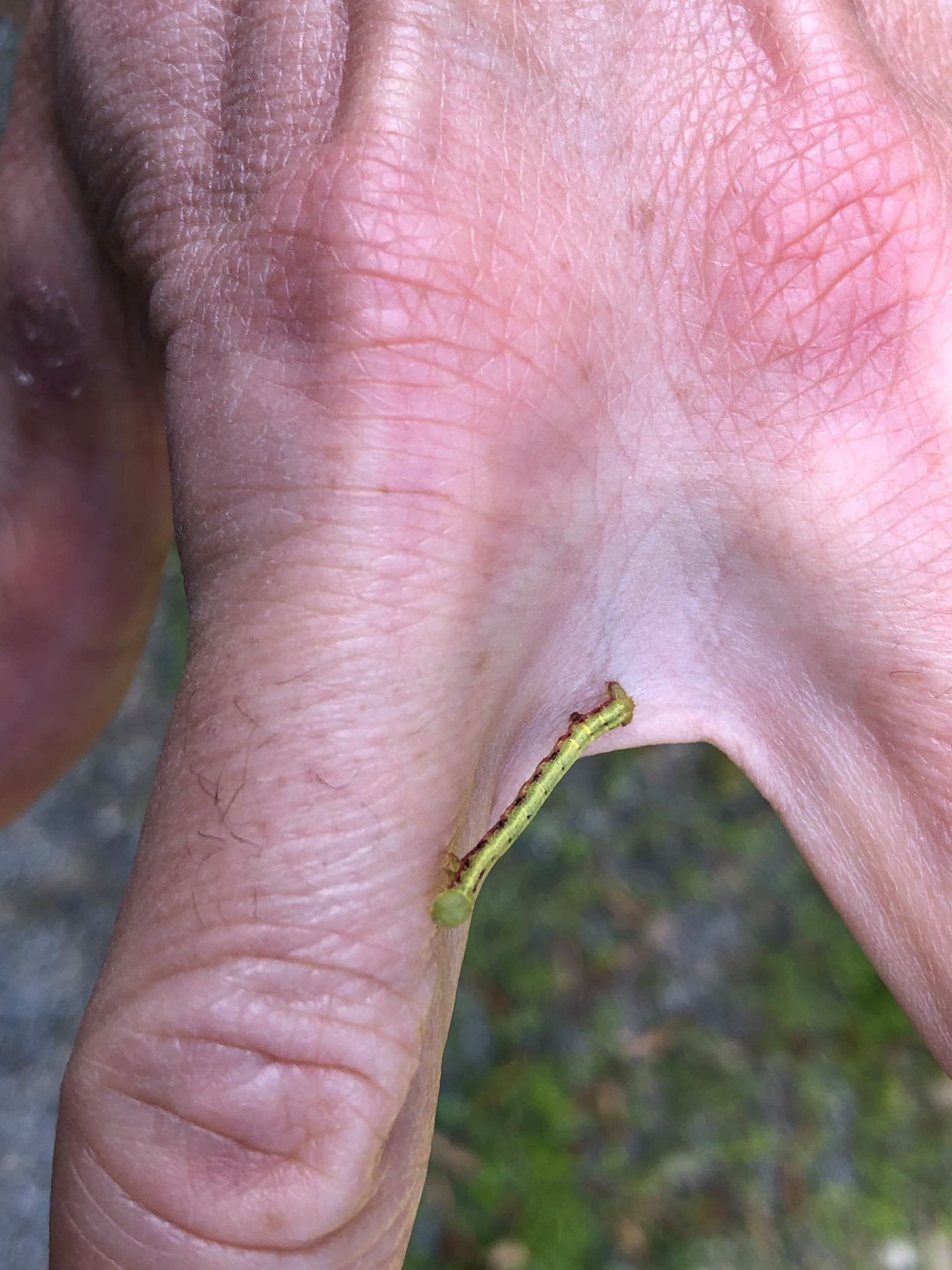
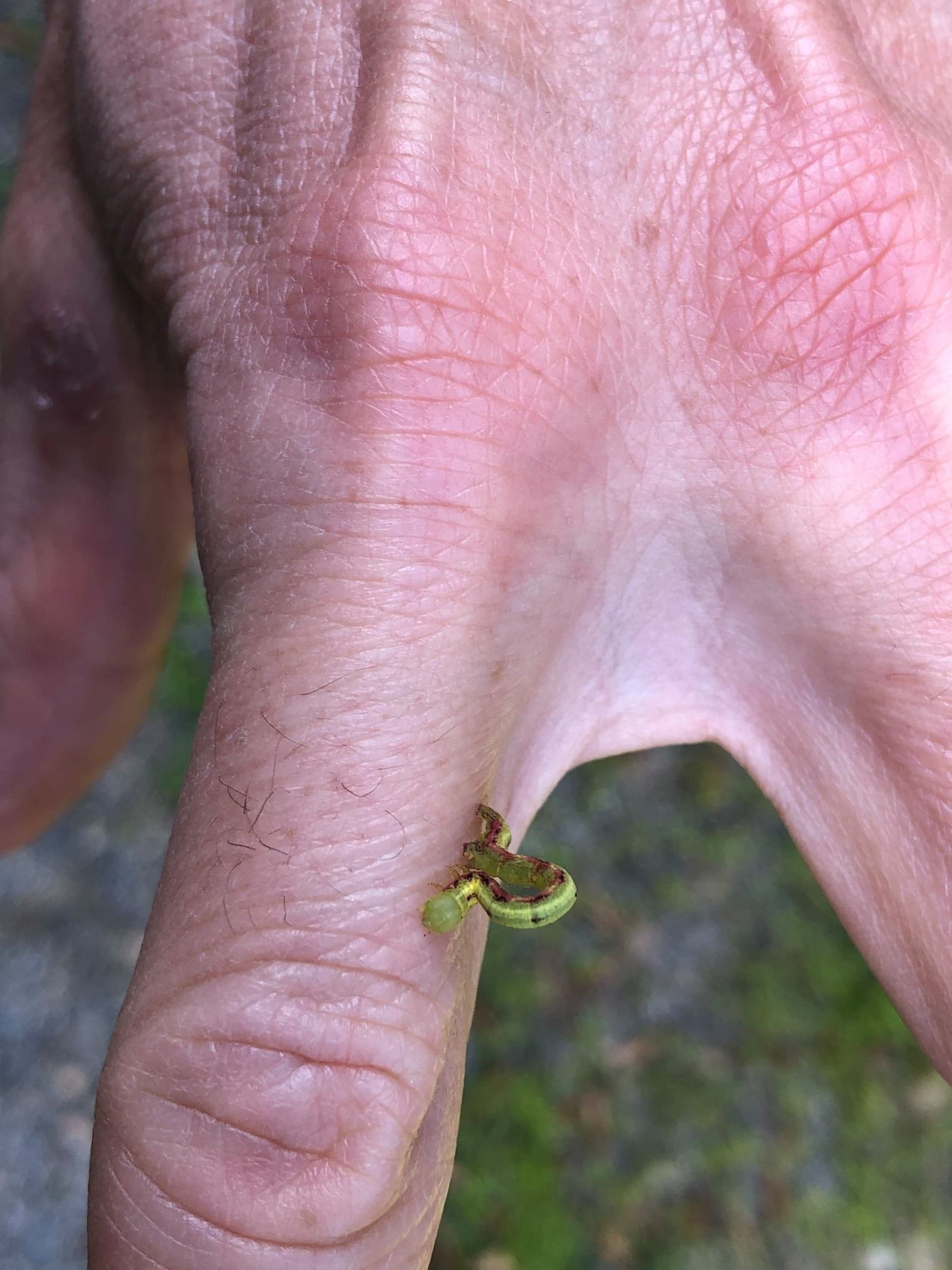
Anyone here good at identifying caterpillars? I've got a ton of these little green inchworms devouring things around here.
 They have stripped many of the white ash trees bare and are now eating birches (especially the yellow birches) and maples (especially the striped maples). DIT would approve. Fortunately, the latter species are not being stripped like the ashes so it shouldn't have a huge impact on the fall foliage, but with emerald ash borer now making an inroads into the area, the inchworms will only put more stress on the ashes, making them more susceptible to EAB infestation.
They hang from the trees on a long thin strand of hair and appear to float in midair. I must've found half a dozen of them on me after mowing the lawn. My inclination is that they're the dreaded winter moth, but I'm not sure. I didn't think we had them up here and thought they were more of a spring caterpillar.
-
A torchy 84.3° F max today (Monday), but 1.30" of convective rain saved the day! It couldn't have come at a better time as the lawn was just beginning to show signs of water stress, especially in the sunny areas.
The cells started initiating to my east by noon, but the boundary slowly moved west and basically stalled over me for several hours producing waves of showers and even some thunder and lightning before eventually dissipating from the loss of solar heating and subsequent reduction in instability.
It's so nice to win the rain lottery!
-
 1
1
-
-
1 hour ago, J.Spin said:
Naturally that “A” threshold is going to vary based on a location’s snowfall average and S.D., but at our site, somewhere in that 200” range for snowfall is typically what I use for “A-grade” territory as well.
If I set the average at C and use the typical 1/3 σ steps for the grade subdivisions, the snowfall thresholds for reaching the various B and A grade levels are as follows:
B-: 179.2”
B: 191.1”
B+: 203.0”
A-: 215.3”
A: 227.2”
A+: 239.2”
Although 2007-2008 had only 203.2” of snowfall, I’m pretty sure I gave it some level of an “A” grade because it was just so solid in many snow-related categories. We don’t have the wild swings in annual snowfall up here that some places do, so it feels like it’s hard to get solid “A” and “F” seasons, although using the S.D. in grading should actually take care of that issue. The grading scheme I’m using is pretty stringent on the high end though, in that only the top few % (+2 σ) of seasons are going to get a straight A or better based on snowfall. One thing to note is that the current 36.2” S.D. is probably artificially large due to the highly anomalous 2015-2016 season’s effects on the relatively small data set. Removing that season from the data set results in a huge drop of the S.D. down to 28.3”, so the snowfall totals required to get up into that A range will come down a bit as that S.D. potentially relaxes.
I like the statistical analysis! Since I've only been at my present location for two full winters, I don't have a big enough dataset to compute letter grades to the nearest tenth of an inch yet.
I too will factor in other things like overall temperatures and snow retention into the final grade. Average or below average temperatures with the amount of snow I had would've put into the high C, low B range, but with the mild pattern and frequent rain/ice events it was a tough winter for the snow mobilers and skiers. January was pretty much a total loss and although things did recover in February, it wasn't great for either activity. Then come March and COVID-19 started shutting things down.
My sigma values here are probably larger than up your way as I am more dependent on synoptic snows than the northern Greens or Whites that get more upslope and consistent cold. I will get upslope on occasion as well, but not like up north.
-
D+/C- season here with a 143.5" season total. Yes, I have very high expectations...an a A range winter needs to drop at least 200".
I would've given the winter a full letter grade higher if it weren't for the lack of consistent cold and the frequent rain and mixer events. Snow pack retention was below normal as well, especially with January's brutal mega torch that pretty much wiped out all of the November and December snow.
Oh well, on to next season.
-
1
-
1
-
-
79°/64° F off a high of 82° F. Awful, I hate it, especially since there's so little breeze. I didn't reach or exceed 80° F until July 4th last year.
Black flies have been brutal lately, but don't seem quite as bad today due to the heat. No deer flies yet, but they won't be far behind with this type of weather.
-
6 hours ago, CoastalWx said:
How high up does the slight inversion or wind shift need to occur for blocked flow? I didn’t see anything much below 700mb that screamed block flow.
Typically 850 to 900 mb, but I've seen blocked or slightly blocked flow occur if there's more of a northerly component to the wind in the low levels or weaker westerly flow without much evidence of an inversion. The stronger the cross barrier component of the wind and, of course, the lower the stability, the higher the Froude number will be.
Looking back on it in more detail, there was likely some synoptic forcing mechanism that was enhanced by upslope behind those totals as opposed to just pure upslope. Many of these backside events are wrap around comma heads with NW flow, but the maxes with this one seemed a bit further west than usual. Shaftsbury, VT (10.5") and Cambridge, NY (12") are not typically spots that jackpot in these setups. Usually it's a bit to the east near the crest of the spine. How much of this was the result of synoptics vs. upslope is difficult to pin down and would make for a good case study subject.
I measured 7.5-8" in Woodford at 10 AM, so the 8.5" report from 7:30 AM is legit. Even the east side of Bennington at 900' had 6-7". I finished with 5.0", but the Deerfield Valley towns just to my east had less than an inch. Very sharp gradients that were not as dependent on elevation as I would've anticipated.
-
2 hours ago, powderfreak said:
I saw 8.0" inches in Granville, NY on 0.68" water.
Was there some weird stuff going on last night?
This stands out like a sore thumb but it's got 8.0" snow depth. At first I thought they meant 0.8" but the precip is nuts.
 2 hours ago, backedgeapproaching said:
Yep, check out weathernet, 2 more reports of 8+ in Washington county NY
1 hour ago, Ginx snewx said:Woodford has 8.5 oh damn
1 hour ago, powderfreak said:Yeah must be some weird convergence. You are right, it is legit, there’s enough 8-9” reports right in that area.
Crazy as it’s literally 3-4 times the amount of melted precipitation as everywhere around there. It’s not even close but there it is in several different reports.
I'll head up to Woodford in a little to see if that 8.5" is legit, but I think it is. Likely some blocked upslope going on the west side of the Taconics and Greens that led to those 8-9" totals.


Dec 16-17 obs/nowcast thread
in New England
Posted
Wow! Looks like 18" or so here. Haven't gone out to measure yet. That death band wound up about 20-30 miles further north than modeled. Amazing storm.