

nzucker
-
Posts
10,771 -
Joined
-
Last visited
Content Type
Profiles
Blogs
Forums
American Weather
Media Demo
Store
Gallery
Posts posted by nzucker
-
-
On 3/4/2019 at 4:32 PM, dmillz25 said:
Those northern Brooklyn/southwestern queens neighborhoods tend to do well with these marginal events. We tend to receive 1-3” more snow than say Coney Island or JFK. Especially last night. As @purduewx80 atested to, we mixed here for literally 30 min tops which probably didn’t cut into snow totals too much. There is a 15 mile difference between here and Coney Island which can prove huge sometimes
There's also some elevation in the Cyprus Hills area.
-
14 hours ago, mikem81 said:
Take a look at last night's 0Z EURO (during the storm). It had JFK getting 9 inches. It got 2.2. There was a warm layer above 850 that almost all the models did a bad job on.
Yeah the Euro had like 9-12" while reality was more 4-8" with lower amounts right near the coast. Mid-level warming was an issue as even the Bronx mixed with sleet a bit.
-
9 minutes ago, LibertyBell said:
So maybe it was more like 08-09? That season started out with SWFE but ended up with a coastal in March. 07-08 is a good match for how snowy Caribou has been though. 08-09 was cold but had more days of snowcover. January that year was actually pretty good, numerous small snowfalls that actually stuck around lol.
I did like the 3/1-3/2 storm more, plus with that storm it was snowing well into the morning!
Think we have another shot at snow at the end of the week?
We could have a very rare single digit March low this week- when was the last time that happened?
Speaking of 1994, didn't we have a dry arctic airmass come down in the first week of April that year? I remember bright sunny skies with temps staying in the 30s and lows in the low 20s lol. Might have been April 8, 1994 or somewhere around there. If we had had a storm that day it would have been a big snow.
edit- I think that might have been April 1995 not 1994!
08-09 was a pretty good winter in Dobbs Ferry....8" on 12/19, 6.5" on 1/26, and 10" on 3/1 were the major events. Last accumulation was 1" on 3/20. February was largely a dud like this winter, except for one 3" event on 2/3 I believe. I left for Chile so I missed the 3/1 event. Very cold January that year....most stations were -3F to -4F.
Possible some light snow on Friday before the transition begins to a milder pattern. If that goes for like 2 weeks, it'll be around 3/25 that the next trough approaches. Pretty late, but not totally impossible to see another light to moderate snowfall, considering we had 6" on 4/2 last year.
Not sure about single digits...NWS seems to be backing off on lows and has us mostly around 20F.
April 2013 also had a cold, dry stretch with radiational cooling nights that brought us into the 20s. As did April 2016 and, of course, last year w/ the 4/2 snow and a missed threat on 4/9. Warmth didn't arrive until the mini heat wave in May as I recall running the heat quite deep into April.
-
 1
1
-
-
5 hours ago, LibertyBell said:
Maybe it's just my bias because I grew up in the 80s, but I feel like there are more years in the 25-30 range than there are in the 30-35 range. We can figure this out easily enough if we can find out what the two most frequent 5 inch ranges are for NYC snowfall, Would it be 20-25 inches and 25-30 inches or 25-30 inches and 30-25 inches?
For where I live in the southern part of the region (and I suspect where the majority of people live who live in NYC, live in southern Brooklyn and southern Queens), I suspect it's 20-25 inches and 25-30 inches. JFK averages about 22 inches of snow a year.
Speaking of the 80s and 90s, RIP Luke Perry. I used to watch him in 90210 (which is being rebooted with many of the same people) and now was watching him in Riverdale.
I love Riverdale and have seen every simple episode. Lots of good intrigue and some very skilled young actors. Loved the reveal of the Black Hood as well as the ongoing uncertainty between Hermione and Hiram Lodge as to who is truly evil. We also don't know how closely the town's events parallel the game of Griffons&Gargoyles which the town is set on playing. Very sad to see Luke Perry gone. He was only 52 as well, and a main character in Riverdale. Don't know how his gruff, tough love manner will be replaced.
-
1
-
-
4 hours ago, LibertyBell said:
Why cant we get a storm like this in the middle of an arctic airmass like we're going to get in the middle of the week? What a waste of record breaking single digit air.....
I compare it to Yankees hitting HR with no one on base in a blow out game while in close games with RISP they strike out, sounds familiar haha.
Even the 3/1-3/2 storm seemed to have a slightly better airmass. That was a very powdery snow.
This week looks cold with multiple days not reaching 32F...my forecast show 31/18, 28/18, 30/22. NWS did back off on some of the morning cold. But should be the coldest stretch by far until next winter, and particularly impressive for March. I'm still not sold on a March 1960/1967/1994/2015 due to the models showing a strong warming trend as the -EPO breaks down.
4 hours ago, LibertyBell said:thats why it was a lot like 07-08
07-08 was more of a SWFE. Yesterday was a coastal. We also had much colder weather this winter than in 07-08, aside from the brutal March 08, which approached record lows where I lived in Poughkeepsie. But I agree that the storm track to the west was very similar to what we saw in 07-08; yesterday was the exception, not the rule.
-
1
-
-
50 minutes ago, Rtd208 said:
I am just happy we finally got some snow but I am ready to close the book on this winter.
I have about 18" this season off an average just around 30." We need one major storm to approach average. Doubt it's in the cards, but with this cold -EPO pattern, a few smaller storms are possible before the breakdown post 3/15. Doubt we saw our last flakes.
-
1 minute ago, ag3 said:
I think NYC, Bronx and Northern Queens escapes the sleet line.
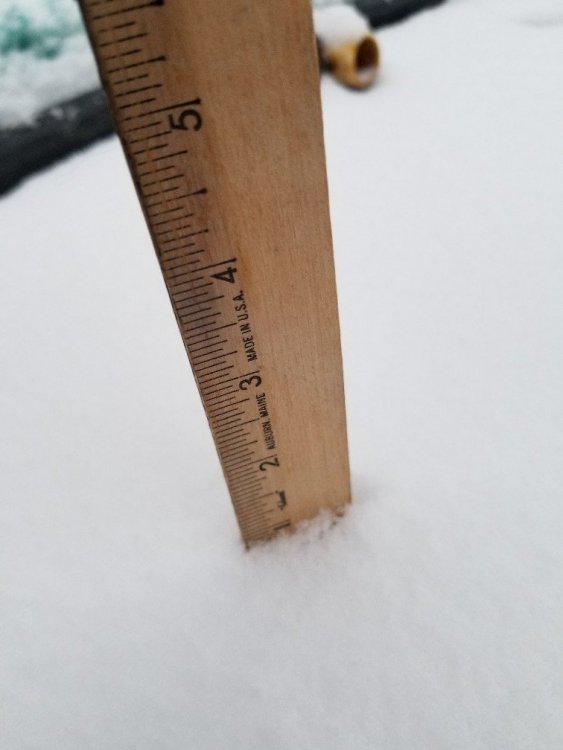
I doubt it will get here, just shy of 3" so far.
-
21 minutes ago, Meteoropoulos said:
Ripping HEAVY snow here in northeastern Queens! Easily a solid inch so far. Looks like we will get 3-5" minimum here. Didn't expect such intensity with this system.
And now Sunday night looks like 6"+ possible with the southern trend.
Maybe the March 10th weekend storm produces enough to put NYC over the average seasonal snowfall? Yes, it is asking for a lot, but quite possible!
Yeah I have 1.5"+ in Bronx. Looks nice out there. Expecting 4-6". Three nights in a row of snow in a snowless winter, who would have thought.
-
Radar looks good for the area.
-
2 hours ago, bluewave said:
Only the 10th time that March is starting with measurable snowfall in NYC since 1950. All the previous years finished March with negative temperature departure or a small positive one. So this fits with the delayed start to spring theme which has been common during the 2010’s.
Years since 1950 with measurable snow on March 1st in NYC and monthly temperature departure.
2015....-4.4
2009...-0.1
2005...-3.0
1968...+0.8
1963...+1.2
1957...-0.6
1953...+0.9
1952...-2.3
1951..-1.0
We've had a lot of cold Marches recently....March 2013 had two significant snowfalls, 2014 started with a week of highs in the 20s/low 30s with a storm missing South, March 2015 began with 20" snowpack at Central Park that lingered through much of the month, March 2017 had a 10" snow/sleet storm, and March 2018 had 4 Nor'easters.
I don't expect us to come close to those max temps Mar 1-10...next week looks extremely cold with 850s of -18C. I think we start torching with a GoA low as the -EPO breaks down after 3/15. But until then it's deep winter with several major snow threats.
-
Just now, gravitylover said:
I'm at 14" now

Wow, I have 13" in the Bronx. I guess you missed the meat of the November storm. That's a really low total for 700' elevation near the Putnam border...you probably average like 45" around there...
-
11 minutes ago, jfklganyc said:
when all is said and done this looks like a 2 inch job for Westchester
Schools are closed… Again!
I never saw so many snow days in a winter that was pretty snowless
They closed in Hastings for this? I'm from Dobbs, and I know it's a very hilly area as I grew up at 350' elevation near the Juhring Estate...but a 2 hour delay would have sufficed here. 2" snowfall that's ending before schools open, and it's March so it will melt faster than a couple months ago.
-
2 minutes ago, gravitylover said:
20*, looks to be right at 1" and the last of the light snow is moving out now. I didn't believe it was going to happen so I guess it's a good thing the dogs woke me up to let them out or I wouldn't have seen the snow falling.
How much on the season there?
-
2 minutes ago, WEATHERMINATOR said:
Nice powdery 1.5 inches here in the bronx.
A little over an inch now in Pelham Bay.
-
18 minutes ago, ILoveWinter said:
Def more than a dusting in the UWS, been coming down nicely for a few hours now.
Yeah, solid inch here. Measurement taken at 6:30 and it's been snowing steadily since.
-
33 minutes ago, SnowGoose69 said:
It’s easily a half inch already. ASOS in NYC at 0.04 liquid confirms that
Yup, everything's covered here in the Bronx. About a half inch, maybe slightly more than the other night. Will be a picturesque sunrise.
-
Looks like we picked up another half inch here. Have had a couple light snowfalls here recently. Beautiful out there.
-
8 hours ago, bluewave said:
Yeah, we had much more snow during several milder and similar temperature winters during this decade. While 2012 was a milder DJF, we had a similar amount of snowfall for this DJF. Very little you can do with an unfavorable Pacific pressure and jet pattern. Even if it was a colder winter than 2012.
NYC DJF snowfall
2018-2019 3.6 8 2017-2018 23.8 0 2016-2017 20.5 0 2015-2016 31.9 0 2014-2015 31.5 0 2013-2014 57.3 0 2012-2013 14.1 0 2011-2012 4.5 0 2010-2011 60.9 0 2009-2010 51.4 0 NYC DJF average temperature
2018-2019 36.4 7 2017-2018 36.2 0 2016-2017 39.3 0 2015-2016 41.0 0 2014-2015 31.4 0 2013-2014 32.9 0 2012-2013 36.8 0 2011-2012 40.5 0 2010-2011 32.8 0 2009-2010 33.8 0 Amazing to see how much more snow some of the significantly warmer winters had: 16-17 had 20.5" at 39.3F (3F warmer than this year) and 15-16 had 31.9F at 41.0F (nearly 5F warmer than this year). Not that it's been a cold winter....we'll probably finish DJF around +1.5F, but it shows that temperatures weren't the driver of the low snowfall.
-
1
-
 1
1
-
-
Wasn't a total bust here, had about 2". It's not compacted down to 1.5" with the sleet and Freezing rain, but it was a decent storm. Made it too icy for me to go to work and tutor this afternoon, had to move the session to Friday.
-
1
-
-
31F here with freezing rain after 2" of snow. (Pelham Pkwy)
-
1
-
-
On 2/17/2019 at 8:27 AM, HoarfrostHubb said:
Still not in skiable shape since my crash. I’m thinking I sprained my ankle and MCL. Returning to the doc on Tuesday.
Kinda sucks. The conditions at WaWa have not been great, but having to sit on the sidelines is depressing.
What crash? You OK?
-
1 minute ago, ForestHillWx said:
That sounds like the plot of "Day After Tomorrow"; a guilty pleasure, as I am a "climate denier" by in large. I even read posts above yours, where our neighborhood professor alleges "complexity" in these "denials", in a rather dismissive post; I shudder to think what else he may know about me, that I do not know.
As this post will be deleted, and I may in fact be shunned from the main thread, in my own humble opinion, there is nothing worse in life than stifling debate by casting out the heretics. Science is a continual study of nature. Always evolving, much like our weather/climate.
Personally, I drive a 12 year old car that still gets 35mpg; my home is lit via led lights. Much to the dismay of my wife, the winter time indoor temperature stays below 67 degrees. I do all of this, not because of my contribution to the carbon foot print, but the impact on my wallet. (Which if the greenies get there way, will cause everyone of us to reconsider our power demand, but I digress).
Anyway, it seemed the AGW debate was permitted latitude here; I just wanted to speak up in case there are any other "deniers" looking for snowstorms on the horizon.
Well we're all looking for snowstorms on the horizon, denier or not, lol. It's been that kind of winter.
-
41 minutes ago, psv88 said:
One thing is that climate models are fickle and complex. Sure climate warms, but when Greenland melts and the North Atlantic is much less salty, what happens to the Gulf Stream? Does the lack of salinity disrupt its flow and lead to colder waters off the east coast? Does a cooler Gulf Stream means less intense nor’easters? Frankly, nobody really knows.
A slowing Gulf Stream/thermohaline circulation could actually leave eastern Northern America (and parts of western Europe) colder than average while the tropics bake. Some studies have shown slow-downs in this circulation pattern induced by the large influx of cold, fresh water into the NATL from the melting of the Greenland ice sheet. I don't know the impact on Nor'easters (except we can't buy one this year), but the temperature effect is more obvious.
-
1
-
-
1 minute ago, JustinRP37 said:
That isn't blaming this year on climate change. Many models though do show increasing snowfall here as the climate warms for some time. This is because we will also likely see an increase in precipitation. You cannot blame one year or one season on climate change. That is weather. Weather varies from year to year, day to day. Climate is long term averages. So if we note rapid changes over time those may be attributed to climate change.
Right, the increase in precipitation may have a greater impact on snowfall than the increase in temperatures, especially in colder areas. We've seen this with some very high QPF storms in recent years like the March 2017 mixed event and the January 2016 Nor'easter. However, eventually the warming temperatures will become too much, and snowfall will start to decrease; most models show this happening in the second half of the 21st century. If NYC's climate does warm to the current climate of the AR/MO border, as shown in the NYT article, or even to the climate of DC, there will be a substantial decrease in snowfall.
-
1
-

Meteorological Winter 2018 Banter
in New York City Metro
Posted
I think I've seen this before although I only went to one conference. Was that 2/78? How old was she?
So sorry for your loss....