snywx
-
Posts
10,482 -
Joined
-
Last visited
Content Type
Profiles
Blogs
Forums
American Weather
Media Demo
Store
Gallery
Everything posted by snywx
-
Pretty decent rates out there right now might be able to get 4-5” today after all
-
1-2” additional up this way. Should shut off by 9
-
28 w/ moderate snow 2.5” new today
-
31 w/ lgt snow 2” new otg
-
Its gonna be close but I won't be complaining. Its been a great weekend for winter weather!
-
30° w/ snow intensity increasing a bit 1.5" new
-
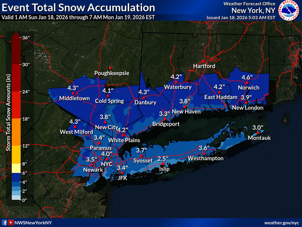
Total for todays event
-
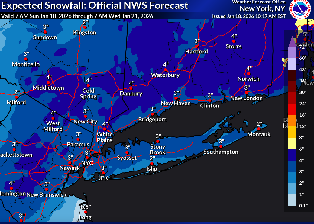
This might be a bit of a reach by Upton. Gonna need 3" up here from the 2nd round to reach this.

-
28 w/ lgt snow 1.3” new otg
-
-
Lgt snow here coating on all surfaces
-
Mesos are throwing more precip back this way. NAM, RGEM, RRFS all have an advisory event here
-
Just some very lgt snow falling here 4.7" final 28.3" ytd
-
just some very lgt snow falling now. I doubt anything else accumulates today 4.7" final
-
28 w/ lgt snow 4.6” otg
-
Back edge is still out toward Scranton. I’m thinking another 1-3”
-
A general 4-5” looks likely up here.
-
25 w/ moderate snow 3.8” otg
-
25 w/ Moderate snow falling accumulating on all surfaces. Approaching 1” otg
-
25 w/ flurries 0.8” otg
-
Nice moderate event on tap for the interior tomorrow. 0z NAM is a nice 3-4” for 84 corridor in OC
-
Caught me completely off guard when I got the notification. Haven't been paying attention to anything weather related the past 10 days. Looking like a general 3-4" possibly iso 5-6" in & around Orange County. Sunday/Monday looks like a non event, maybe some lgt accumulation along the immediate coast/ E LI
-
0.3" last night.. 23.6" ytd
-
9/1 right now 4” of snow cover 23.3” ytd. awesome start to this winter season
-
Roads are a mess up here