

snywx
-
Posts
10,049 -
Joined
-
Last visited
Content Type
Profiles
Blogs
Forums
American Weather
Media Demo
Store
Gallery
Posts posted by snywx
-
-
-
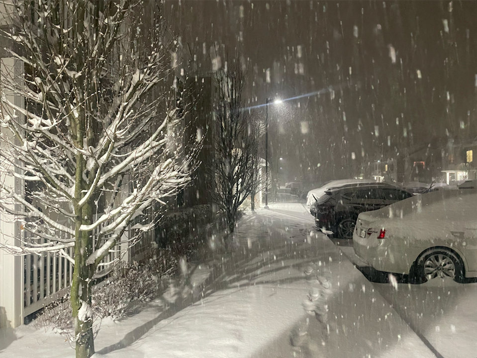
For once we have a big bust incoming for us.. on the good side
11” otg
heavy snow continues
-
 5
5
-
-
1 minute ago, Stormlover74 said:
4 9" reports
...Sussex County...
1 SSW High Point 9.0 in 1000 PM 01/06 Emergency Mngr
3 W Vernon Valley 9.0 in 0950 PM 01/06 Broadcast Media
1 ESE Kittatinny Lake 9.0 in 0938 PM 01/06 Public
Hampton Twp 9.0 in 0920 PM 01/06 Public
Some of the hardest rates I've experienced in a long time. Im hearing reports of 12"+ in NEPA right now.
-
1
-
 1
1
-
-
7 minutes ago, IrishRob17 said:
I think a key is what happens tomorrow, if the snow backfills or not. The big damage is tonight but tomorrow could be a nice icing on the cake.
Even if its 1-3" tomorrow should feel quite wintry.
-
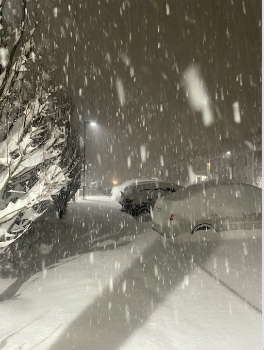
This band means business.. I know some of guidance picked up on sig accumulation on this side but i was skeptical. If these rates continue for another 2 hrs then 12" is not out of the question
-
3
-
-
1 minute ago, Rjay said:
Allsnow and I have a buddy in Vernon who says he has a lot of snow. I believe him.
Pat from 33 ? I trust his measurement then
-
1
-
-
Just now, Rjay said:
Allsnow and I have a buddy in Vernon who says he has a lot of snow. I believe him.
At this pace ill have 9" by 11pm
-
2
-
-
27 w/ heavy snow
6.0" otg
3" in the last hour
-
1
-
-
1 minute ago, hudsonvalley21 said:
The 00z HRRR shows an additional 8”. Maybe another 2”-4” or 3”-5”?
Yeah im thinking maybe 5" more.. If these rates continue tho we can be in for a nice surprise. I think the catskills cash in
-
1
-
-
0z NAM shows 9-11" additional for this area. Interesting. I doubt it but nice to see
-
1
-
-
Heavy snow here
3.2" otg
-
6
-
-
15 minutes ago, rgwp96 said:
No way that’s bogus
No way he has 9" right now. Maybe half that
-
2
-
-
26 w/ heavy snow
2.8” otg
-
2
-
-
3 minutes ago, CPcantmeasuresnow said:
Was expecting 8-10 here by every short and medium d range model and I think right now 5 might be difficult.
Same here.. Its a steady light snow but I was expecting some heavier rates by 0z
-
4 minutes ago, wdrag said:
I find it hard to believe we'll exceed 10". my guess is we be satisfied with 5-8" and get out of here. Its least it was slippery for a few hours. icing overnight then back to another inch or two of snow tomorrow, I hope.
Agreed.. Unless these rates pick up in intensity we will struggle to achieve 6"
-
-
2 minutes ago, Allsnow said:
Mixing line getting close…
mod snow
Looks like its midway through middlesex approaching SI
-
 1
1
-
-
28/22 w/ lgt snow
coating on all surfaces
-
-
24 minutes ago, CPcantmeasuresnow said:
That explains why snywx who I believe is only a couple of miles from you seems to do bette snow wise. I believe he's at 850 feet. It can make a noticeable difference as we all know.
He’s not as close as you think. Im a few miles west of the city of Middletown.
-
1
-
-
If I had to draw a line on where the 6" line will be its prob from Mahwah to Suffern to Stony point across the river to Yorktown.
-
2 minutes ago, IrishRob17 said:
I’ve seen them pick up on the Wallkill River as well at times which is impressive IMO
I believe areas along the Walkill & Hudson are the lowest points of the county. Two areas in Orange county that should clean up is the Schnemunk area ( Highland Mills, Monroe ) & Shawangunk ridge area ( Otisville, Greenville ). I can def see some 12" reports coming from those areas.
-
1
-
-
27/20 here
Expecting 8-12"
-
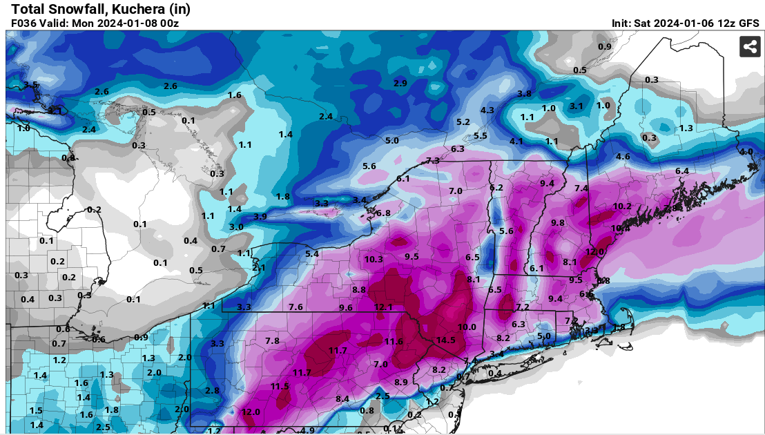
12z GFS
I know its strictly for entertainment purposes but the GFS along with other guidance continues to increase amounts in the immediate area

-
1
-
Interior NW & NE Burbs 2024
in New York City Metro
Posted
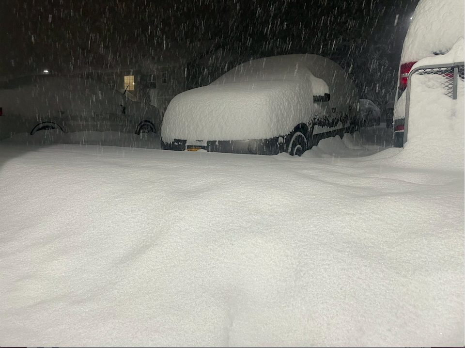
Approaching 12" on this side