
weathertree4u
-
Posts
974 -
Joined
-
Last visited
Content Type
Profiles
Blogs
Forums
American Weather
Media Demo
Store
Gallery
Posts posted by weathertree4u
-
-
I am liking our chances over the next few weeks; hopefully you guys in the Eastern Valley can score with the system this week, I think it will be primarily south of my area this time around but the latest GFS spits out a decent chance next week for the Middle TN area
-
2 minutes ago, John1122 said:
The NAM is a state length slammer.
Not much north I40
-
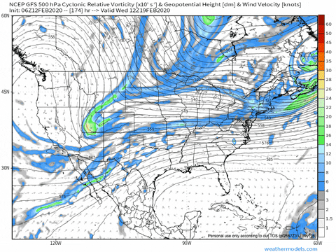
The latest GFS run shows an almost perfect storm near the end of the run - just great to see it at least modeled - just need it to come a little further north and it be just a touch colder - with that being in early March, that says something - hopefully it says we get snow lol
-
 1
1
-
-
30 minutes ago, Holston_River_Rambler said:
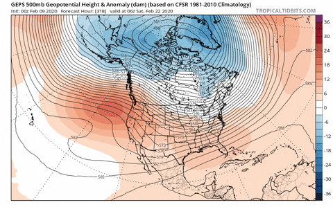
Further out in time, the Euro Control and EPS, suggest what looks to me like an odd/ blocky pattern, :
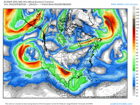
GEFS and GEPS have something similar:
I can't tell if that is a good look, or if it would just give us a bunch of cold/ rainy cutoffs?
I would put my money on a bunch of cold/rainy cutoffs. As I said previously, persistence has won the modeling battle this year, we have been here before, always looks good in the long range but when we get to the long range it turns out to be the same as the current time frame and I think others have eluded to this, even though most of us want at least one good system, we recognize the struggle that modeling has gone through this year. I mean, again, as previously mentioned by others, the current cold shot for mid month, the one we have now, originally started out as a pattern flip, then down to a week or so, then in reality, it is about 48 hours of cold. So, while I like the look and though this post does not necessarily indicate it, I am hopeful we can pull out one good system but I recognize we are now working against climatology every day we move closer to meteorological Spring.
-
1 hour ago, snowmaker said:
From a personal perspective I hope it gets north enough for the tn-ky border areas to be involved. Sitting in Montgomery Co, I hope it at least makes it close to Nashville anyway, I could snow chase pretty easy at that point. I also have friends in Henry Co and Christian Co Ky that love snow and hope they can get them one before the end of the year as well. But it's weather and we have no option but to take what it delivers.
Mid Sumner County here, I agree, north please
-
1
-
-
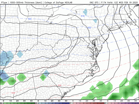
38 minutes ago, Holston_River_Rambler said:
WPC rather optimistic about precip. getting back north, days 5 - 6, not so much on it being wintery though:
This may be a Birmingham to Atlanta system
-
2
-
-
3 minutes ago, Mr Bob said:
The weeklies have gone mad the next couple of weeks, also.....
Meaning...
-
2 minutes ago, Holston_River_Rambler said:
Euro kinda has the same system the 6z GFS has (and has had off an on), but is holding energy back in the SW.
0z Euro
6z GFS
0z Euro
6z GFS
I would suspect that once we get past the system today modeling will come into better agreement, hopefully.
-
2
-
-
Still like the time period around the 20th; I think we have some chances going forward and it may be like last week where the system really only comes into focus 48 - 72 hours before the event.
-
1
-
-
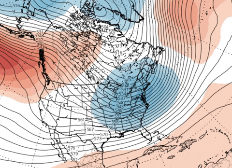
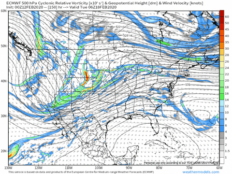
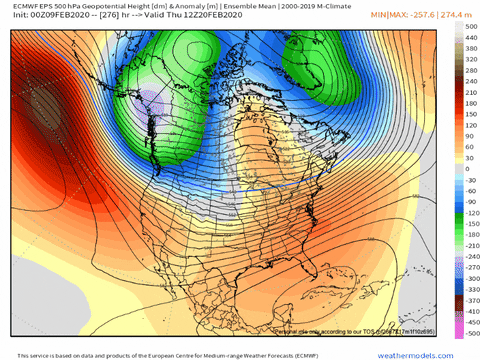
1 hour ago, Holston_River_Rambler said:
Here's what that above 500 mb pattern on the Euro Control translates to on the surface, just showing for an option for the Euro past day 10:
Not particularly dry, but storms move in and out and the firehose is cut off as upper winds realign a bit.
Persistence has won so far this season, hopefully will get few dry days but I would be willing bet the larger pattern will return as has so far
-
1
-
-
1 hour ago, mempho said:
That's incredible. It has to break down eventually...
Sent from my SM-G950U using Tapatalk
Nope; at least not for another few weeks, has to wait until end of the month so that it can cause the maximum inconvenience by making March colder than normal, not cold enough for snow but just cold enough to really be a pain in A--
-
1
-
-
Wonder how many forum members remember the winter of 1994? Stands out in my mind as the ice storm of record in my memory. Grandparents were without power well over two weeks in the Portland TN area - in some instances, not only did trees come down on lines but CEMC also had to reset poles and restring new line.
-
 1
1
-
-
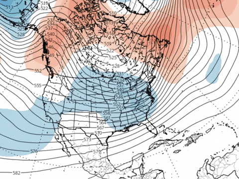
8 minutes ago, Holston_River_Rambler said:
C'mon trough, swing east and dry us out:
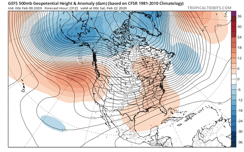
All ensembles have been doing this for a couple of days. Euro most insistent that the EPO is still bad, but even it is relenting on the PNA enough to hopefully dry us out.
The base pattern has to change eventually anyway, right? If we flipped to this mess in early December, maybe we flip at the first of March?
At this point and I think allot of forum members would agree, having a good snow would be great but man do we need a break from this rain!
-
2
-
-
7 hours ago, Carvers Gap said:
Been up on the Plateau for a couple of days and am home now finally. Rolled through right after the snow finished up - beautiful sight. Haven't been able really dig into modeling much. With two advisory level events for the window of Feb 5-10, bout all we could have asked for in a base warm pattern. Very happy for our folks who have received snow this week. Still a lot of uncertainty moving forward with Feb 14th having a cool or cold front. Will continue to monitor the 14th timeframe for an outside chance. Again, still not convinced modeling has the upcoming pattern nailed down. Will try to post tomorrow. But what a fun day following all of those posts by many who have waited patiently for snow for several years.
Yea, got a little Thursday late night and Friday early morning. Been looking through some old pix and the last really good Winter I had north of Nashville were the two back-to-back Winters of 2009/2010 and 2010/2011 where we had several good snows; not saying that havent really had anything since then but those two years there was something almost every week. Keeping with that same theme, seems like about every ten years we have a really good Winter, previous to the two years mentioned, the Winter of 2002/2003 was really good. All of those instances were coming out of a solar min. Wonder if going forward for a couple of years we can at least expect a break in this pattern since we are slowing climbing out of a solar min....
-
1 hour ago, jaxjagman said:
Seems possible and very well could be but the downfall to me is if there is going to be a transition into a LaNina and what and how strong it does end up to be.Last season we we started to see the surgence of a Nino,this year could be reversed,
@jaxjagmanat least next winter may be different
-
1
-
-
2 minutes ago, jaxjagman said:
Looks more active east of the IDL.The Euro even shows it getting more into the WP and even hints at it going into the WH after it goes back into the COD

Is going into the WH and COD conducive to winter weather here?
-
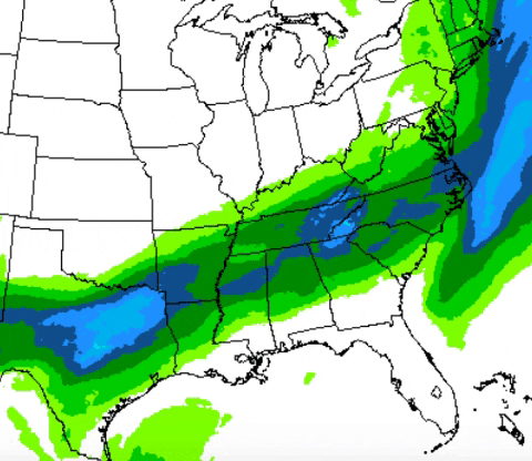
28 minutes ago, jaxjagman said:
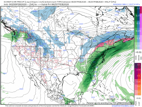
Excessive Rainfall Discussion
NWS Weather Prediction Center College Park MD
308 AM EST Sat Feb 08 2020

Day 3
Valid 12Z Mon Feb 10 2020 - 12Z Tue Feb 11 2020

...THERE IS A MODERATE RISK OF EXCESSIVE RAINFALL EXTENDING FROM
LOWER MISSISSIPPI VALLEY ACROSS THE LOWER TENNESSEE VALLEY INTO
THE SOUTHERN APPALACHIANS...

...Lower Mississippi Valley across the Lower Tennessee Valley into
the Southern Appalachians...
Strong short wave energy closes off as it drops across Southern CA
to a position off the northern Baja Peninsula by the end of Day 3.
Short wave energy ejected from the closed low rides along a slow
moving front extending from the Southern Appalachians into the
Lower MS Valley, providing synoptic scale ascent for heavy
rainfall over areas that received flooding in the recent past.
There is a good model agreement with the overall setup, increasing
confidence in an enhanced flash flood threat in this area.

As the closed mid level low settles just off the Southern CA coast
during the second half of Day 3, the west southwest mid level flow
becomes increasingly parallel to a slow moving front extending
from the Mid Atlantic Coast to the western Gulf of Mexico. Ahead
of the boundary, a 45/55 knot low level west southwest flow sends
1.50 inch precipitable water air (which is between two and three
standard deviations above the mean) along the front, peaking after
11/00z. Within the moisture plume, model soundings showed 500/1000
J/KG of MUCAPE extending from eastern LA into west central GA. The
combination of moisture and instability should be sufficient to
support low topped convection along the front.

Convection is possible at the beginning of the period across MS
ahead of the initial short wave energy, extending into northern AL
into the Southern Appalachians during the afternoon. The low
topped storms are expected to produce heavy rainfall over areas
that saw flooding with the last round of heavy rain earlier in the
week. After a possible lull during the evening hours, the next
area of convection develops along the front across AR into central
MS. During this time, difluence increases over the front in the
presence of a dual jet structure extending the Lower MS into New
England, which should allow an areal coverage in heavy rain.

As the front drops slowly southeast during the late evening and
overnight, cells are expected to track from southwest northeast
along the front, producing training along the front from central
MS into northern GA and upstate SC. Hourly rainfall rates during
this time could exceed an inch, especially where training occurs.
There is a strong model signal for 2.00/4.00+ inches of rainfall
extending along the front, with the highest amounts extending from
central AL into far northern LA, closest to the best instability
axis.

Over the Southern Appalachians into northern AL, three hour flash
flood guidance values are as low as 1.00/1.50 inches, as these
areas received more than 300 percent of normal rainfall in the
past week. There are still rivers in flood here, with soils still
nearly saturated. Though rainfall amounts here are lower than
further southwest, the impact here could be greater. After
collaborating with the WFOs MRX/FFC/GSP, a Moderate Risk was
placed here for Day 3.

Further southwest, extending from northern Al into central MS, the
antecedent conditions are not quite as wet, with the bulk of the
heaviest rain with the last event occurring further northeast.
However, the model signal here is stronger for 3.00/4.00+ inches
of rainfall with the convection, lying closer to the best
instability. Based on this, and after collaborating with WFOs
BMX/JAN/MEG, the Moderate Risk was extended across northern AL
into central MS for Day 3.


Hayes
Just amazing. I think you @jaxjagmanhad posted last week sometime about the extremes in the weather and to think that possibly at some point in the Summer this tap will shut off in a big way and we could go from extremely wet to extremely dry, which, could bode badly for the fire season fall 2020
-
1 minute ago, Carvers Gap said:
It has another threat around 240. Not sure I believe that run, but that is a lot of cold(well inside of 240).
Lol, you are being punked
-
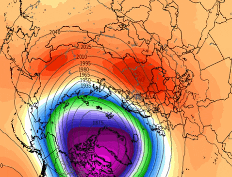
Just now, Holston_River_Rambler said:
Judah Cohen, despite all his hype and attempts to use twitter for a variety of ends, shared some research yesterday that is helpful:

The projected displacement puts us in cluster 2 and at least gets us close to cluster 4 which would be ideal. I'd like to see all this within like 3 days at this point, but all models are at least consistent showing that it will get displaced our way. That seems more reasonable than a split with how strong this SPV has been and probably the best we can hope for.
No clue how quick it would respond for us, even if we get the best case scenario, but at least the cold air is on our side of the globe for once at high latitudes, so we could be getting a lot worse looks at long range right now. Even the cluster 2 and EPS over night look zonal and would get us out of this flood pattern.
So, what you are saying is the cluster continues
-
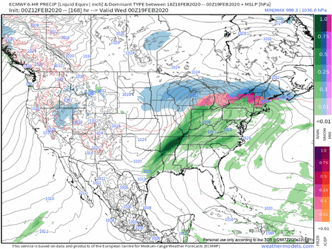
9 minutes ago, Holston_River_Rambler said:
Secondary disruption of the SPV finally starting to get into Euro range:

GFS still has it too and now looks similar to the Euro with a displacement to the south:
Possible impact end February?
-
2 minutes ago, Holston_River_Rambler said:
NAM still NAMifying this AM with the Thursday wave:
Really interested to se if the radar actually looks like what the NAM has been showing for a few days for the Thursday wave when all that precip just materializes to the west of us.
NAM kind of looks like the UKMET with the Saturday thing now:
Like John said the Euro did flop on the Saturday storm, but the energy is still there, just favoring the more suppressed solutions the EPS had been offering. TBH I'd rather have it looking a little weak and suppressed. sheared at this range, so at least we have some wiggle room for it not to go north as it verifies a little NW as stronger than modeled. Absolutely no guarantees too doesn't verify as a washed out, weak wave, but at least it has room to improve now.
EPS, according to Bob Chill when Ji in the MA forum was panicking about the 18z EPS last night, usually follows the OP at this shorter range, so not unexpected to see it back off some, but it still looks as good as it did yesterday at 0z, but not quite as good as it did yesterday at 12z:
Knoxville snow hole in effect again, and don't even ask about Chattanooga or Memphis.
Join the club! The Nashville snowdome has been in place for years now
-
 1
1
-
-
The latest run of the GFS does not disappoint in providing yet a different solution in the long range. I need to move to Minneapolis so that I can be assured of getting my snow fix every year.
-
2 hours ago, John1122 said:
As I figured, the Euro goes from major winter storm to nothing burger. Snow modeling doesn't work in this area. Don't know why, it just doesn't.
Meanwhile the massive winter storm it forecast in Texas and Oklahoma a week ago is unfolding as expected.
Like your post not because I like it but because you are spot on! Everywhere else modeling seems to know well in advance at least the generalities of what is going to fall from the sky and will depict the same thing in multiple consecutive runs. In the TN Valley, forget it.
-
1
-
-
So looks like the latest run of the GFS is not nearly as torchy, especially in the long range
-
1
-
February/March 2020 Winter's Last Chance Thread
in Tennessee Valley
Posted
I guess if this pattern continues will be harder and harder to bad mouth the Winter this year.