MGorse
-
Posts
2,276 -
Joined
Content Type
Profiles
Blogs
Forums
American Weather
Media Demo
Store
Gallery
Everything posted by MGorse
-
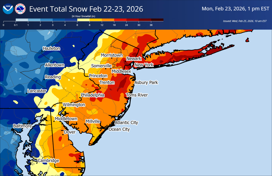
February 22-23, 2026 blizzard. This was based on reports NWS Mount Holly received.

-
The east to northeast low-level flow is starting to increase in conjuction with increasing lift aloft from the south as the surface low is developing off the NC coast.
-
The 12z NBM does not include the 12z models. There is a lag.
-
We are seeing that lowering of snow amounts in the guidance on the western edge. Banding may end up being east of Berks and the Lehigh Valley, or there could be dual banding with one extending into this area at least for a time tonight.
-
We are ready for this blizzard.

-
Well, the NAM is one hell of a start to the 00z suite. Unreal!!
-
The NBM ratios are likely too high as it usually runs on the higher side.
-
I think that data will be for the 00z models.
-
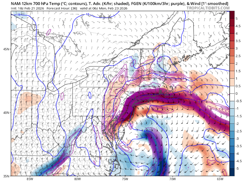
NAM FGEN Sunday night. Damn!
-
The 18z HRRR, NAM and NAM 3km have all gone nuclear!!
-
Well hello there 18z NAM. Insane!
-
Well, I am now included in a Blizzard Warning. This should be very interesting!
-
The main forecast update is now finalized usually between 1-2 AM/PM.
-
Well, I have been called into work tomorrow. Good times to be had!
-
Good morning. Winter storm still there I see.
-
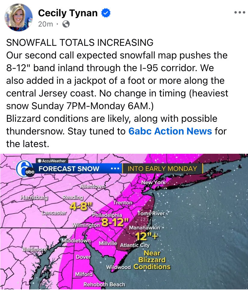
6ABC increased amounts for some.

-
Add the 00z GFS to the meteorological porn. Insane!!
-
Yup, wind, coastal flooding and beach erosion at the coast could be bad with this.
-
If it is snowing at 1-3 inches per hour and especially also at night, it will stick to the roads.
-
That could be 4 inches per hour with thunder. Crazy!
-
This is absolutely nuts!!
-
It is like trying to develop an eyewall like feature at the end of the loop. Damn!
-
Given these model solutions, the 700-850 mb frontogenesis is going to be insane. If correct, easily a period of 2-3 inches per hour.
-
The 00z NAM is like meteorological porn!
-
No comment.