-
Posts
3,289 -
Joined
-
Last visited
Content Type
Profiles
Blogs
Forums
American Weather
Media Demo
Store
Gallery
Everything posted by RCNYILWX
-
Textbook for the Chicago metro. Sent from my SM-G965U using Tapatalk
-
Oh my at the UKMET. Plus LES on the back side. Gotta try to not get too excited lol, will be doing the grids and AFD for LOT. Sent from my SM-G965U using Tapatalk
-
Yep, the NAM performed very well with that event, probably the overall best with UKMET. Sent from my SM-G965U using Tapatalk
-
Definitely a bump north vs 06z. If the ECMWF and EPS don't change drastically, I'd give more forecast weighting to the ECMWF suite than the GFS/GEFS. Would like to see the UKMET jump more fully on board today. Sent from my SM-G965U using Tapatalk
-
It's good to use some caution, there's no guarantees the ECMWF locks in and we'll have to see the rest of the 12z suite. Model adjustments don't necessarily follow a linear caving trend. It's just interesting to see a linear-like trend on the GFS and having similar experiences in the past. For the December 17th storm I've referenced, the GFS did not really budge from its incorrect solution, it only stepped that way in the near term, and honorary New England sub thread guest@weathafella can comment more on that. I've brought it up because it's fairly analogous in that the GFS for that setup struggled mightily with the effect of confluence from the north. Sent from my SM-G965U using Tapatalk
-
For the lulz, go on Tidbits and do a run to run of the GFS going back to 12z yesterday. Sent from my SM-G965U using Tapatalk
-
The classic GFS baby stepping we know and love. Sent from my SM-G965U using Tapatalk
-
Winter 2020/2021 Short Range Discussion
RCNYILWX replied to Chicago Storm's topic in Lakes/Ohio Valley
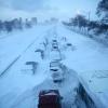
Our event page for the snow squall: https://www.weather.gov/lot/2021jan19 Includes a short presentation put together by one of our forecasters that I tweaked for public consumption. Really fascinating event. Looking back, it's clear that at a busier time of day we would've needed to issue our first SQW, and there was some consideration put toward it as the event unfolded. The last snow squall event of this magnitude I can recall, brief whiteouts and roads going to trash, was late January 2014 with an Arctic front. And multiple instances of thundersnow associated with a Clipper type system is rare, if I'm not missing any events, I think have to go back to December 2010 for that in the LOT CWA. Disappointed I missed out on personally experiencing impacts where I live, but glad others got to experience this unique event, and was cool to look back on again while putting together the event page. Sent from my SM-G965U using Tapatalk -
00z EPS mean and individual members. The mean is pretty much a carbon copy of the 18z run. Looking at member low locations, if anything a slight north lean. Still some clunker members but a majority favoring heaviest snow swath from I-80 and north to WI. Didn't see a jump toward the suppressed solutions. Good to see multi-run consistency from the EPS in favoring a significant event. Sent from my SM-G965U using Tapatalk
-
UKMET was still a slight improvement. Cold sector precip gets squashed by the confluence but a 995 mb low riding the Ohio River on Monday-Monday night. If all you had was the surface map for your forecast, that surface low track would usually portend solid snow at least up to I-80. As is, UKMET indicates a moderate event from central IN northeast across northern half of OH. Sent from my SM-G965U using Tapatalk
-
Baby step at 500 mb on the 18z GFS, northern stream slower/not as potent/farther north. Sent from my SM-G965U using Tapatalk
-
That's one of our newer meteorologists, on a training shift. I'm working tomorrow and Friday on the day shifts. Not sure who will be doing what. Sent from my SM-G965U using Tapatalk
-
I think it was supposed to be addressed and the size of the GEFS was increased which theoretically helps. However anecdotally it still appears to be too non-dispersive. Since we don't have many big events to go by this winter, the December 17th event I mentioned earlier, GEFS did suffer from being too close to the op.
-

Winter 2020-21 Medium/Long Range Discussion
RCNYILWX replied to Hoosier's topic in Lakes/Ohio Valley
I think you might have the wrong take here. Anyway, new thread for the potential event Saturday PM into Tuesday. There's additional potential later next week. Sent from my SM-G965U using Tapatalk -
This is a key point here, related to the potential for a swath of significant precip amounts: If the primary wave remains coherent/amped and juiced (with Pacific and Gulf moisture), there is plenty of latent heat release involved. Height rises out ahead of the wave aided by the latent heat release are part of the question of whether we can strike right balance between it and the confluence created by the strong west based -NAO. Can see it frequently on the east coast when there's blocking in play, and for the EC, there's the addition of Atlantic moisture and heating to add into the equation. Have seen it go both ways, but if the wave remains strong and juiced, it's unlikely to be total suppression city , just the location of the max precip swath modulated. If we do get a strong system out of this l, I do unfortunately expect a sharp gradient on the north and south side, inherent to this type of setup plus the likelihood of mesoscale banding due to a strong thermal gradient. For the reasons above, it's not at all surprising to see duds among the 51 member EPS at this range. What's nice is that it's a dispersive ensemble and we can see the various outcomes and glean confidence in or lose confidence in the preferred outcome. The 12z GEFS is mostly duds because it's too non-dispersive of an ensemble system. Edit: And I agree with @A-L-E-K that it is noteworthy for the EPS mean to show that large 6"+ swath at 10:1.
-
12z EPS individual members Sent from my SM-G965U using Tapatalk
-
Just a note on the model discussion. This is not apples to apples but the GFS was hot garbage for the eastern big dog on December 17th. There was a fairly strong block that developed out ahead of it and the GFS was suppression city within the short range. The NAM, UKMET, GEMs, and ECMWF all far outperformed the operational GFS, and GFS v16 did much better than the op. Sent from my SM-G965U using Tapatalk
-

Winter 2020-21 Medium/Long Range Discussion
RCNYILWX replied to Hoosier's topic in Lakes/Ohio Valley
New thread for this potential event, let's take the discussion over there. Sent from my SM-G965U using Tapatalk -

Winter 2020-21 Medium/Long Range Discussion
RCNYILWX replied to Hoosier's topic in Lakes/Ohio Valley
I'd prefer that shifted south too, riding the edge a bit here on the DuPage-Will border. Sent from my SM-G965U using Tapatalk -

Winter 2020-21 Medium/Long Range Discussion
RCNYILWX replied to Hoosier's topic in Lakes/Ohio Valley
Ha, you know what I mean, showing that magnitude of system and next step is getting run to run consistency on the 18z ensemble, and 00z runs to really feel better about it. I think we can work with that south end because the -NAO may help in that respect. -

Winter 2020-21 Medium/Long Range Discussion
RCNYILWX replied to Hoosier's topic in Lakes/Ohio Valley
The sweet spot between a strong system and the blocking preventing a warm cutter. Expecting some monster hits on the 12z EPS. Would like to see some southward spread as well. Quite a south end gradient on that run of the Euro for the I-80 and south crowd. Sent from my SM-G965U using Tapatalk -

Winter 2020-21 Medium/Long Range Discussion
RCNYILWX replied to Hoosier's topic in Lakes/Ohio Valley
WE TAKE Sent from my SM-G965U using Tapatalk -
If anyone has links to some of the threads for the past greats (GHD I & II, etc) in the Great Lakes Ohio Valley area since the inception of American Weather forums, would be appreciated to post them here. Sent from my SM-G965U using Tapatalk
-

Winter 2020-21 Medium/Long Range Discussion
RCNYILWX replied to Hoosier's topic in Lakes/Ohio Valley
I wasn't going to post the pivotal Midwest snow map for the GEM but here it is. Sent from my SM-G965U using Tapatalk -

Winter 2020-21 Medium/Long Range Discussion
RCNYILWX replied to Hoosier's topic in Lakes/Ohio Valley
There's the warm advection phase Saturday into Sunday and then main wave comes out Sunday night-Monday night. Problem is the GFS is suppression city for the main wave. 12z GEM solution is a good hit for many north of US-24. Edit: 12z UKMET is suppressed with the main wave but not to the extent of the GFS.


