

yoda
-
Posts
63,556 -
Joined
About yoda

- Birthday 09/30/1986
Recent Profile Visitors
21,700 profile views


-
Mostly Code Red AQ for us tomorrow... but C and W MD are code purple https://forecast.weather.gov/product.php?site=lwx&issuedby=LWX&product=AQI
-
Updated afternoon Day 3 SPC disco Day 3 Convective Outlook NWS Storm Prediction Center Norman OK 0227 PM CDT Thu Jul 16 2026 Valid 181200Z - 191200Z ...THERE IS A SLIGHT RISK OF SEVERE THUNDERSTORMS FOR PARTS OF THE OHIO VALLEY AND LOWER GREAT LAKES INTO THE MID-ATLANTIC... ...SUMMARY... Strong to severe thunderstorms are expected across portions of the Ohio Valley and lower Great Lakes into the Mid-Atlantic, mainly Saturday afternoon into the evening. Some threat may linger into late Saturday night. ...Ohio Valley into the Mid Atlantic and vicinity... Some amplification of a mid/upper-level trough is expected over the northeastern CONUS on Saturday, as multiple shortwaves move through the base of the trough. The primary surface low is expected to deepen as it moves across southern Quebec toward northern Maine. A trailing cold front will move through parts of the Ohio Valley and Northeast. A remnant surface front initially draped from western PA toward the Delmarva region is forecast to lift northeastward as a warm front through the period. As deep-layer flow strengthens atop a richly moist and destabilizing warm sector, organized severe potential is expected to develop across a relatively broad region from the Ohio Valley into the Mid Atlantic, with at least an isolated threat potentially reaching parts of New England. Uncertainties include the influence of early-day convection and potential persistent smoke on the northeastward extent of substantial surface-based destabilization. Along the cold front, the greatest relative threat is currently expected from the lower Great Lakes into eastern parts of the Ohio Valley, where stronger 850-700 mb flow (around 25-40 kt) is forecast. Organized cells/clusters capable of damaging wind and isolated hail may evolve along/ahead of the front and spread eastward. Rich boundary-layer moisture and modest enhancement to low-level SRH may also result in some tornado threat, depending on storm-mode evolution. Favorable moisture/buoyancy will also extend westward along/ahead of the front into parts of the Midwest and lower Ohio Valley, but there may be more of a tendency for convection to be undercut by the front with westward extent. Farther south/east, organized convection may evolve or reintensify near the effective warm front by afternoon into parts of PA/NJ, and also develop into parts of MD/VA along/east of a surface trough. Very warm temperatures and steepening low-level lapse rates will become supportive of damaging-wind potential, and isolated hail may also occur. Some tornado threat could also evolve in closer proximity to the warm frontal zone. An extensive frontal QLCS may develop by evening, and continue to pose some wind-damage threat for as long as it persists into Saturday night.
- 1,020 replies
-
- 2
-

-
- severe
- thunderstorms
- (and 7 more)
-
Hmmmm... sounds like Saturday could be quite interesting... afternoon AFD from LWX on the threat @wxmeddler @Eskimo Joe @Kmlwx @high risk KEY MESSAGE 2...A strong cold front brings the threat of severe weather Saturday, possibly lingering into Sunday to the south. An unseasonably strong upper trough and embedded shortwave/jet streak will pivot near and north of the area Saturday. Strong height falls associated with this trough, coupled with high low-level moisture content and modest mid-level lapse rates will likely result in strong instability, perhaps even if cloud breaks are muted by early day precip. The strong deep layer flow will lead to effective shear magnitudes of 30-40 kts, helping to organize storms that develop in the vicinity of a pre-frontal surface trough in the wake of any morning activity. Low-level flow will be a bit weaker during the day, so although transient supercell structures are possible, the main risk should be damaging wind gusts and perhaps large hail as opposed to tornadoes. This could change if the effective warm front lingers overhead. Depending on storm coverage, temps could reach well into the 90s Saturday. With high humidity, heat indices may approach 100. Heading into Saturday evening, low-level flow increases again ahead of the approaching synoptic cold front associated with the aforementioned upper trough. This sends PWATs hurdling to over 2.2" and keeps CAPE elevated well into the evening. The expectation is for a strongly forced line of storms to develop in the unstable airmass from the eastern Great Lakes into the upper Ohio Valley (i.e. western NY/PA into OH/WV). This line of storms may be slow to weaken as it treks into the area from the northwest through the evening, especially if there is moderate to strong instability left (depends on earlier activity). The main threat at this point would appear to be gusty to damaging winds and heavy rain due to multiple rounds of storms. High instantaneous/sub-hourly rain rates would be plausible in this setup. If any discrete activity develops in the evening ahead of the line as the LLJ increases, there may be a risk for large hail as well as a couple tornadoes, particularly in areas for surface flow is backed (i.e. near/east of I-95 near any bay breeze boundaries, increasing SRH). Some guidance such as the NAM12/RRFS-A has the SigTor parameter in the 1-3 range Saturday evening in this environment. Activity should wane during the overnight hours Saturday as the front and associated convection drop south and the atmosphere gradually stabilizes. The front will probably end up near or south of I-64, with any remaining severe threat later on Sunday ending up near and south of the effective frontal boundary.
- 1,020 replies
-
- 3
-

-
-
- severe
- thunderstorms
- (and 7 more)
-
URGENT - WEATHER MESSAGE National Weather Service Baltimore MD/Washington DC 955 AM EDT Thu Jul 16 2026 DCZ001-MDZ008-011-013-014-016-504-506-508-VAZ053-054-527-170000- /O.NEW.KLWX.HT.Y.0010.260716T1500Z-260717T0000Z/ District of Columbia-Cecil-Southern Baltimore-Prince Georges-Anne Arundel-Charles-Central and Southeast Montgomery-Central and Southeast Howard-Southeast Harford-Fairfax-Arlington/Falls Church/Alexandria-Central and Southeast Prince William/Manassas/Manassas Park- 955 AM EDT Thu Jul 16 2026 ...HEAT ADVISORY IN EFFECT UNTIL 8 PM EDT THIS EVENING... * WHAT...Heat index values around 105. * WHERE...Washington DC, and portions of central, northeast, northern, and southern Maryland, and northern Virginia. * WHEN...Until 8 PM EDT this evening. * IMPACTS...Hot temperatures and high humidity may cause heat illnesses.
-
 Its July 15th
 -
Day 1 Convective Outlook NWS Storm Prediction Center Norman OK 0249 PM CDT Tue Jul 14 2026 Valid 142000Z - 151200Z ...THERE IS AN ENHANCED RISK OF SEVERE THUNDERSTORMS ACROSS PORTIONS OF THE NORTHEAST... ...THERE IS A SLIGHT RISK OF SEVERE THUNDERSTORMS ACROSS CENTRAL MONTANA... ...SUMMARY... Severe thunderstorms capable of producing damaging winds, large hail, and a few tornadoes are expected today across parts of northern New York and New England. Thunderstorms with scattered severe winds and isolated hail will also be possible across portions of Montana. ...20z Update... The previous forecast largely remains on track with only minor adjustments required. Convection across southeast Quebec has struggled to maintained intensity as it approaches the U.S. border through mid-afternoon with abundant cirrus, smoke, and cloud debris overspreading central to northern ME. Recent surface observations show temperatures remaining in the mid/upper 70s, which is supporting very limited MLCAPE per the 18 UTC CAR RAOB. This casts considerable uncertainty on the degree of destabilization that will occur through the early evening hours. Latest CAM guidance appears to be capturing this trend and depicts low probabilities for intense UH and/or strong wind swaths across northern ME. 30%/Enhanced contours were trimmed southward to account for this decreased confidence. Further southwest, warmer temperatures in the 80s are supporting a more volatile atmosphere with MLCAPE values estimated to be around 2000 J/kg. Strong shear remains across the region per VWP observations, and CAM guidance continues to depict some potential for intense convection traversing northern NY, VT, NH and western ME later this evening as the primary surface trough migrates east. Risk probabilities have been shifted southwest to better align with the better thermodynamic environment and convective signal. However, the recent convective trends upstream and modulating influence of wildfire smoke on boundary-layer mixing/CIN reduction casts uncertainty on how widespread the severe threat may be.
-
Sounds like the 2000 SPC OTLK is saying the smoke is an issue
-
Yay Zone Forecast Product National Weather Service Baltimore MD/Washington DC 456 AM EDT Tue Jul 14 2026 DCZ001-141200- District of Columbia- Including the cities of Adams Morgan and Washington 456 AM EDT Tue Jul 14 2026 .REST OF THE OVERNIGHT...Clear. Lows in the mid 60s. Light and variable winds. .TODAY...Sunny. Highs in the lower 90s. Southwest winds around 5 mph. .TONIGHT...Clear. Lows in the mid 70s. Southwest winds around 5 mph. .WEDNESDAY...Sunny, hot with highs around 101. West winds 5 to 10 mph. .WEDNESDAY NIGHT...Partly cloudy in the evening, then clearing. Lows in the upper 70s. Northwest winds 5 to 10 mph. .THURSDAY...Mostly sunny. Hot with highs around 100.
-
Yup, this is what I'm thinking Wiz is doing right now re chasing
-
Good disco from Marsh at SPC in the day 4-8 range Day 4-8 Convective Outlook NWS Storm Prediction Center Norman OK 0405 AM CDT Mon Jul 13 2026 Valid 161200Z - 211200Z ...DISCUSSION... All ensemble guidance suites are in broad agreement that the central US ridge will once again build westward in response to the development of a eastern North America long-wave trough during the forecast period. However, significant differences exist within and between ensembles regarding the timing and exact nature of this transition. At the start of the forecast period, a frontal boundary will be pushing south and west in the wake of a strong short-wave trough that moved across New England in the prior days. The trend over the past 48 hours is for this front to push farther south and west, bringing a continental dry airmass into New England and portions of the Mid-Atlantic. For example, several days ago ensemble guidance was in good agreement that the front would be draped across the Mid-Atlantic on Friday. Many, but not all, of the recent runs now push the front south into southern Virginia and northern North Carolina. This results in significant uncertainty regarding the potential severe weather environment on Friday (Day 5) across the Mid-Atlantic. For example, the GEFS mean temperature for Washington D.C. is 93F on Friday afternoon, while the EPS mean temperature is 102F. However, both ensembles have dewpoint temperatures in the 50Fs. Given the increasing uncertainty as to the location of the surface boundary on Friday and the overall quality of the severe weather environment, unconditional 15% severe probabilities for Friday are removed with this forecast. It is possible that severe probabilities may be reintroduced in later outlooks should it become apparent that the surface boundary washes out earlier than expected and quality low-level moisture is able to return sooner. That said, the front should begin to dissipate by Saturday in response to a mid-level trough digging southeast across the Great Lakes. This will allow rich boundary-layer moisture to advect northeastward into the Mid-Atlantic and southern New England. This increase in boundary-layer moisture and strong diurnal heating will allow for afternoon MUCAPE values between 1000-2000 J/kg, perhaps locally higher on Saturday and into Sunday. This unstable and vertically sheared environment will be ripe for thunderstorm/severe thunderstorm development ahead of any digging mid-level trough. However, as alluded to previously, the timing, magnitude, and number of these troughs is highly variable within the ensemble guidance, leading to too little confidence to pinpoint where and when unconditional severe probabilities should be added. As confidence in the timing, track, and strength of these embedded troughs becomes clear, severe probabilities will likely be needed somewhere across the region stretching from the Upper Midwest southeast into the Mid-Atlantic for one or more days. ..Marsh.. 07/13/2026
- 1,020 replies
-
- 1
-
-
- severe
- thunderstorms
- (and 7 more)
-
No, I do not want the bolded from this mornings LWX AFD - the 100s that is KEY MESSAGE 2...Forecast confidence decreases substantially late this week into the upcoming weekend, but the potential is there for both extreme heat and severe thunderstorms. Model guidance is in reasonably good agreement that the longwave pattern across the CONUS late this week into the upcoming weekend will feature troughing across the Pacific NW, ridging over the center of the country, and then troughing downstream across New England. Such a pattern will place us in NW`ly flow aloft. However, there`s considerable disagreement regarding the placement of individual shortwaves and their associated sfc fronts throughout that period. As a result, there`s a highly atypical amount of forecast spread for this time of year during that time window. Ensemble guidance has members showing highs anywhere from the upper 70s to the mid 100s each day Fri through Sun, with above average spread on Thu as well (mid 80s to mid 100s). So depending on which solution verifies, we could have anywhere from well below normal temps to record highs each day. Dry conditions are expected on Thu, but chances for storms start to increase for Fri, Sat, and Sun. Depending on how the pattern evolves, and which side of the frontal boundary we end up on, there could be a potential threat for severe thunderstorms. The forecast temp spread illustrates the unseasonable amount of baroclinicity that will be present, which should translate into unseasonably strong wind fields aloft as well. If we end up on the warm, unstable side of the boundary, the threat would likely be there for severe thunderstorms, with MCSs possible in NW`ly flow aloft. SPC currently has much of the forecast area highlighted in a 15 percent contour for severe thunderstorms on Fri, and WxNext2 AI guidance highlights additional threats for severe thunderstorms on both Sat and Sun. We`ll need to monitor trends over the course of the week, since this is a very conditional threat at the moment, given the atypically high amount of forecast uncertainty.
-
Looks like it threw out an OFB
-
I figured... just looks weird lol
-
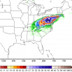
Weird looking radar... Radarscope has light showers flying east/southeast but heavy showers moving NE that just popped up in DC metro
