

wncsnow
-
Posts
5,723 -
Joined
-
Last visited
Content Type
Profiles
Blogs
Forums
American Weather
Media Demo
Store
Gallery
Posts posted by wncsnow
-
-
Just now, Queencitywx said:
I'd agree with that.
Yea it shows more of a Saturday morning/day threat instead of Fri or Fri night... I would think some areas of NC would get some accumulating snow after hour 84
-
Looks like its getting going later, timing is very different
-
 1
1
-
-
Precip is still very light and temps marginal so maybe a car topper if lucky
-
2 hours ago, Cold Rain said:
Dude, you are massive! Completely dwarfing that bridge in the background!
Yea, Paul Bunyan's distant cousin
-
1
-
-
Here's me playing with my pet osprey

-
1
-
-
48 minutes ago, WeatherNC said:
Thinking maybe Henderson now, don't have a warm and fuzzy about Roanoke Rapids
Roxboro might be even better, heck im really liking where I am in Danville too..
-
Great trends yesterday for my area, went from 1-2 to 2-4 now 4-6 or even 6-8 possible. Be interesting to see what type of ratios we get here
-
Decent run but not as robust as 12Z for most places West of Raleigh and parts of the upstate
-
Usually the UK is a foreteller of what the EURO will say.. lets see if it trends NW too..
-
Loving the NW trend here but still think best totals will be Triangle to Norfolk
-
9 minutes ago, benjammin said:
We moved six months ago from Chesterfield to Altavista, just up 29 from you. I'm expecting little to nothing here.
Sent from my XT1650 using Tapatalk
I think we can squeeze a couple inches of snow out of this yet. problbly nothing major though
-
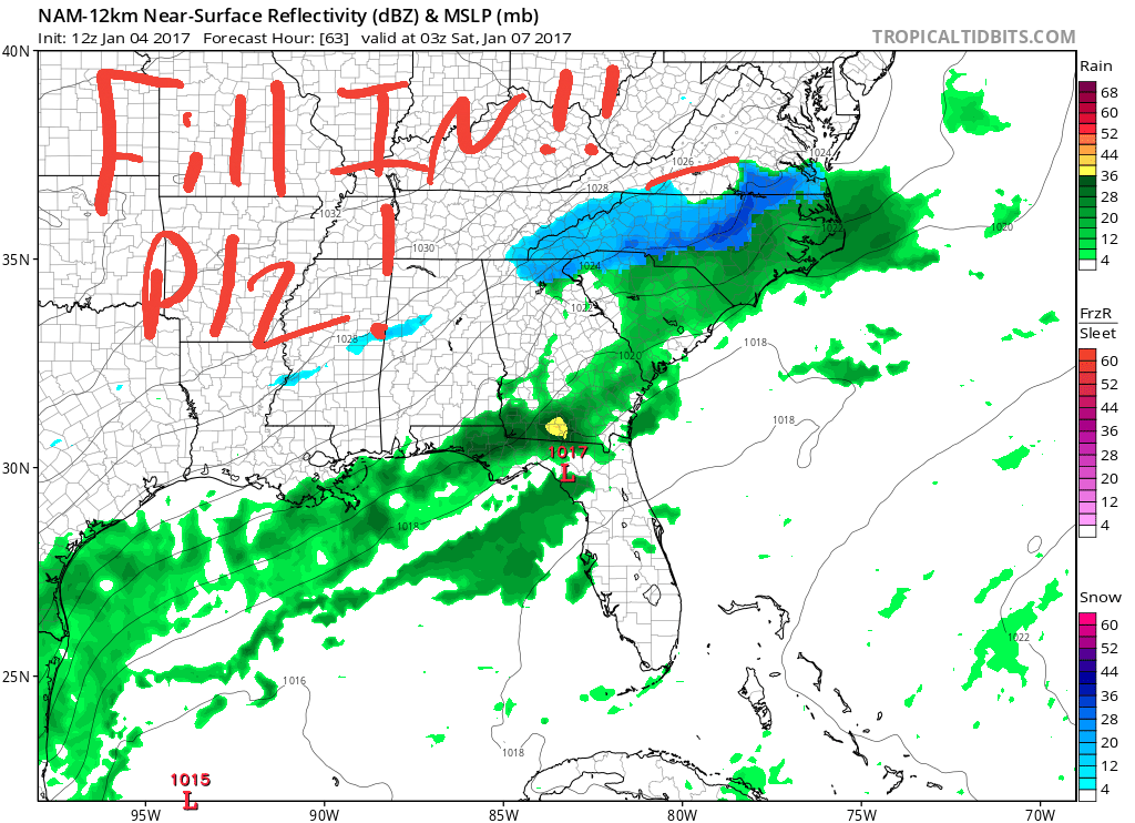
2 minutes ago, Jonathan said:
What's with this precip gap in the NAM?
This is just cruel. Supernatural powers at hand here.
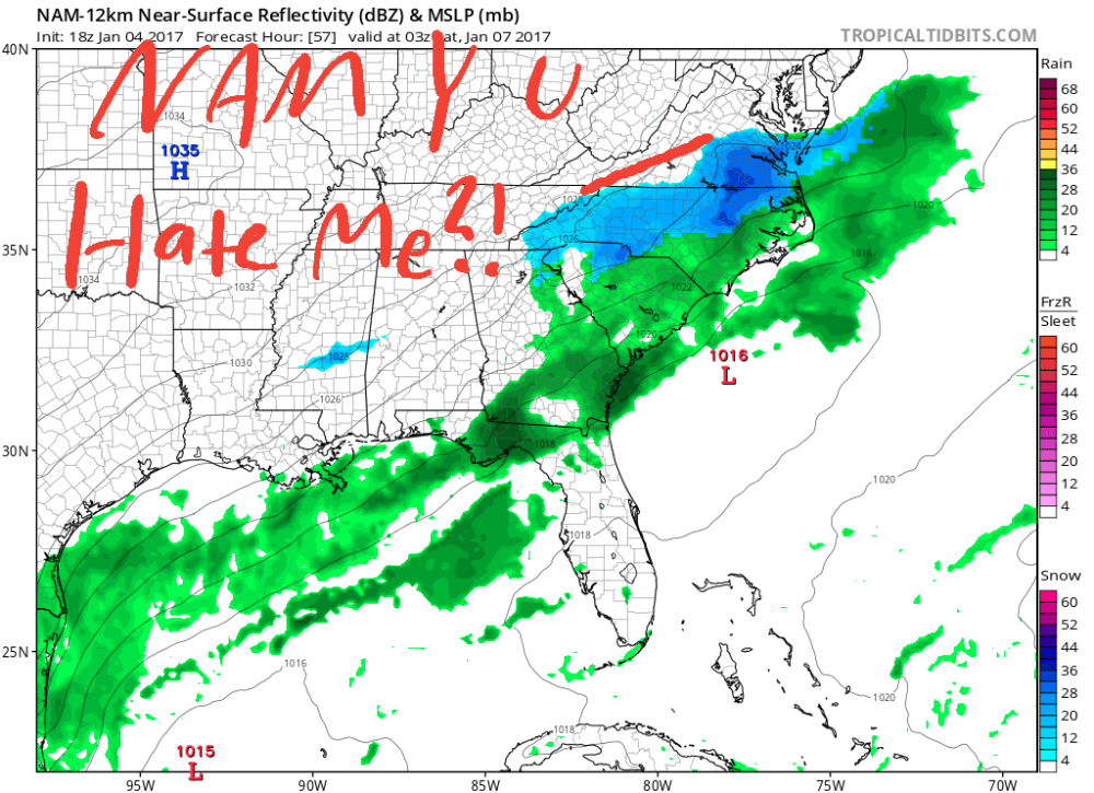

LOL I was thinking the exact same thing...
-
After this storm and cold shot there is no winter weather or even cold temps in the foreseeable future..
-
Snow map looks somewhat similar to this storm back in 02.. Setup is a little different but there are some similarities
-
When I moved to Danville a few years ago I was the only poster I know of from the city, now there are at least 3 if not more!
-
1 minute ago, Trevor1621 said:
 VB native here and that statement just made me a very happy guy haha. What do you think (I know it's early) the total here will
Be?
Sent from my iPhone using TapatalkThe GFS is really the only model that isnt showing half a foot there so my guess would be 6-8 inches and possibly a lot more
-
Wish I was back in VA Beach for this storm.. think they may jackpot
-
We all know that areas from ATL to Columbia to I 95 corridor are going to mix and the EURO solution is closer to being correct..The verification scores are pretty sweet inside 72 hours..
-
Looks like I'm moving to New Zealand.
Bahahahaha
-
Some recent photos, at a couple heels football games, including ACC championship game in Charlotte and at my buddies wedding


-
 Just a couple of weeks left and then the flip flops will be in season
Great picture!


Thanks! Im still a novice salsa dancer but its loads of fun!
-
The girlfriend and I before salsa dancing in Asheville

-
Lived here all my life (20 years) so ive seen some good snow storms but no ice storms stick out in my mind. The 2000s really sucked here. Asheville west would get snow, South Carolina would get snow and I remember the big Charlotte storm and we got 2 inches I think. So 2009-2011 really spoiled me and I would love to have that on a more consistent basis.
Yea the 2000s were pretty bad in general but 2003 was a good winter, and there was a couple moderate ice storm in the early to mid 2000s
-
Nice poll! Ice storms are aesthetically pleasing, just incredibly beautiful but dangerous.. But I like extreme weather so..


The December to Remember 7th-8th blue turd winter threat thread.
in Southeastern States
Posted
The EURO took a step back from yesterdays run, showing snow in areas that will be borderline or rain and not much precip to the west...