

OSUmetstud
-
Posts
16,433 -
Joined
-
Last visited
Content Type
Profiles
Blogs
Forums
American Weather
Media Demo
Store
Gallery
Posts posted by OSUmetstud
-
-
4 minutes ago, BuffaloWeather said:


Where do you find the map?
-
1 minute ago, rochesterdave said:
It looks almost identical to 12z. Hoped for that tick. No tick for you.

Thats because it is the 12z
-
 1
1
-
 3
3
-
-
Euro ensemble mean.

-
1
-
 3
3
-
-
4 minutes ago, vortmax said:
According to the EC, there will be 25-30kt winds over the lake hitting the shore for 12hrs+. Does this get taken into consideration for blizzard conditions for the South Shore ctys?
There probably will be a blizzard right at the lakeshore. I've seen that in Oswego when I lived there too but from what I've seen BUF wouldn't issue a blizzard warning unless the conditions were more widespread than that. This storm doesn't have really cold air and high pressure on its nw flank to get really strong winds during the heaviest snowfall.
-
1
-
1
-
-
1 minute ago, BuffaloWeather said:
What a crazy 6 hour QPF forecast from KBUF
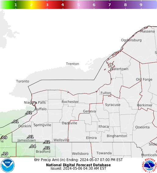
It's probably underdone lol
-
3
-
-
23 minutes ago, rochesterdave said:
When does the drinking start? I’m jealous. Of the drinking mostly.
The drinking never stops in BUF.
-
2
-
1
-
-
1 minute ago, KPITSnow said:
WOuld it be safe to say that on a baseline, us in WPA want the same sort of "trends" as those up in WNY?
Yeah I'd think so...obviously it can go too far if it really moves se.
-
Just now, BuffaloWeather said:
If the Bills lose at least I have a storm to look forward to on the cold long walk back to the car.
Don't speak that into existence.
-
1
-
3
-
-
1 minute ago, BuffaloWeather said:
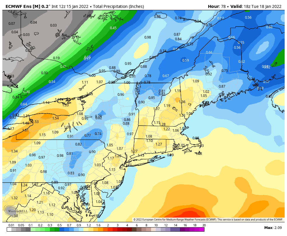
Wow nice. I saw the Erie QPF total increased and thought it went further west. Must be some lake enhancement there? The entire run got more juiced.
Erie PA went from 1.9" to 2.8" since last nights run.


Yeah there's more of a squeeze as the ov shortwave is coming in from the northwest. You can see the se movement from the Toronto decrease and Rochester increase.
-
1
-
1
-
-
2 minutes ago, tim123 said:
Yup more lake enhanced
That's not where the increase occurred. It's because you dryslotted less in the initial heavier qpf part. The se upper level low and surface low was bodily a bit further southeast.
-
2
-
-
6 minutes ago, BuffaloWeather said:
Euro went further NW, hits Erie PA with massive storm.

Nah. It went se from the 00z and 06z runs.
-
3
-
-
4 minutes ago, vortmax said:
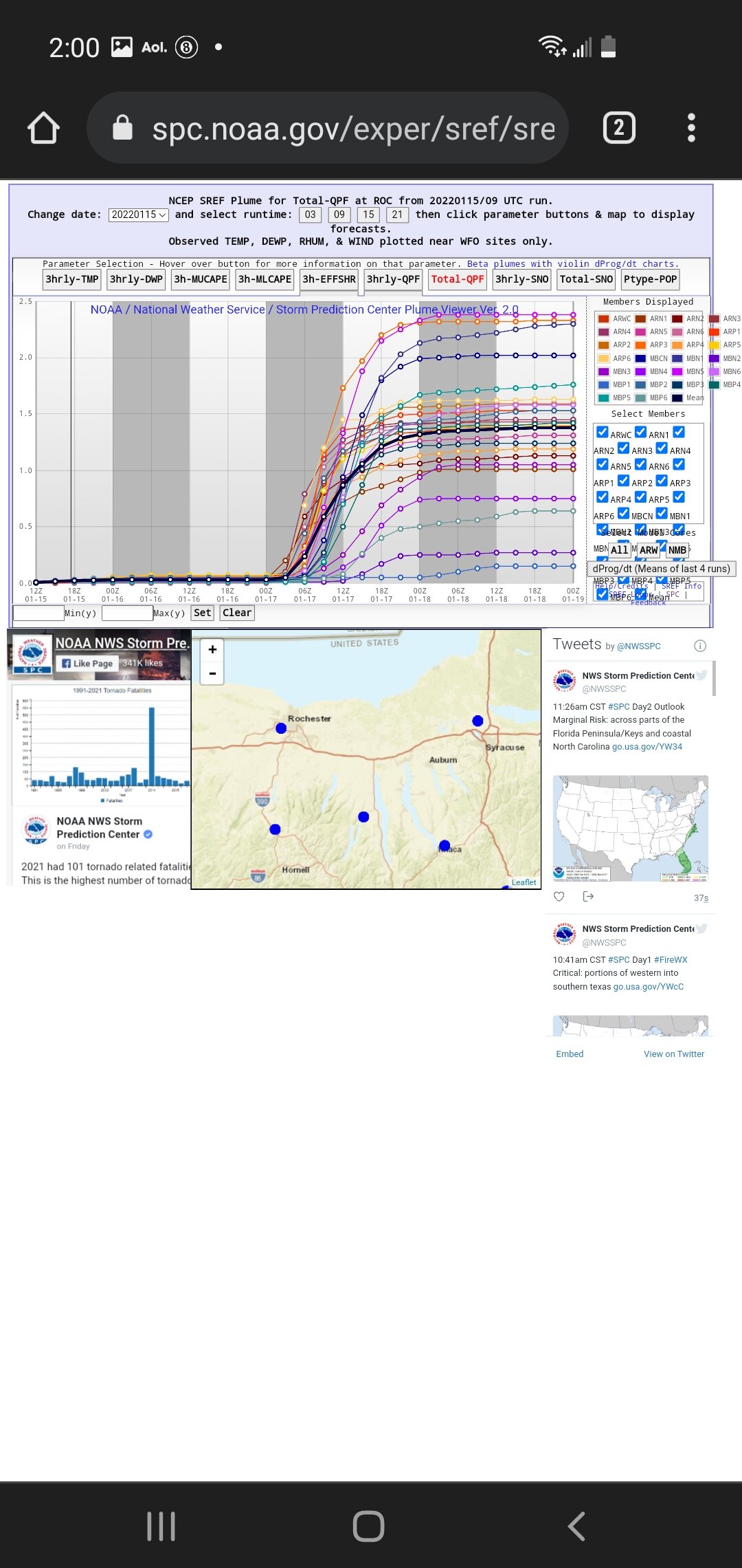
Who's got the SREF plumes for this bad boy? Are we in range?
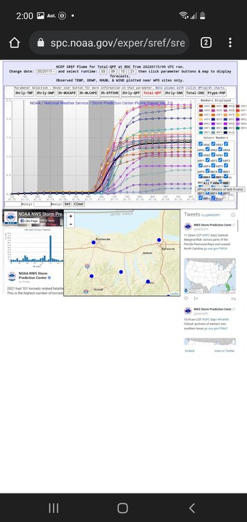
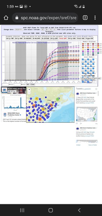
-
3
-
-
-
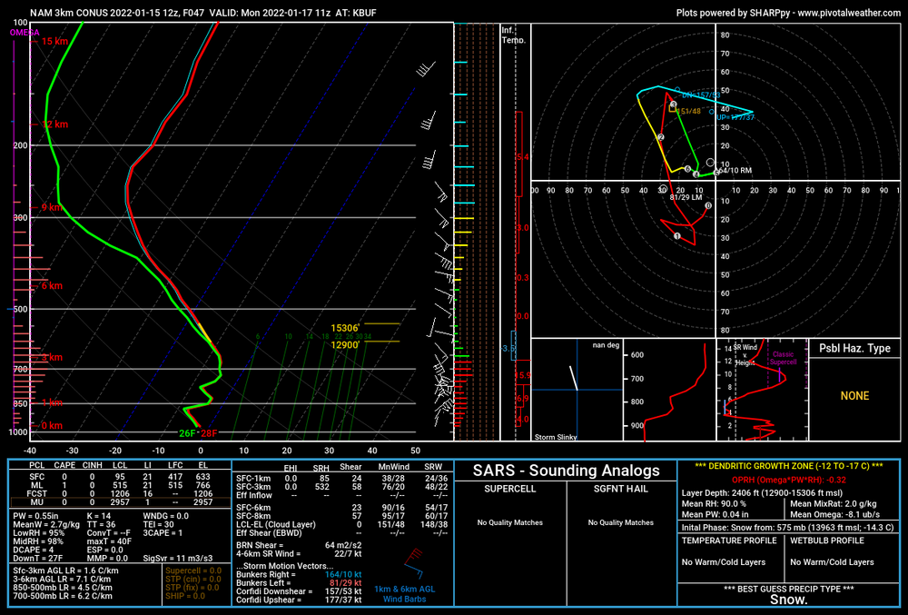
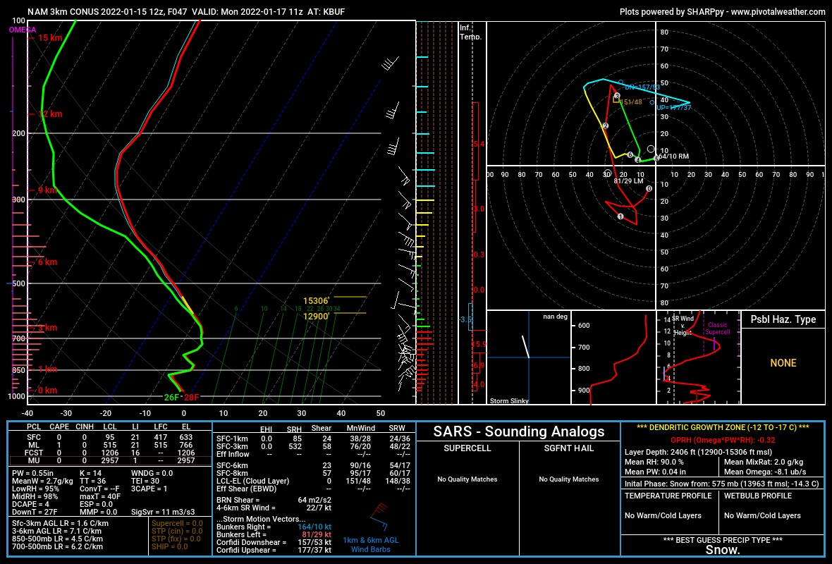
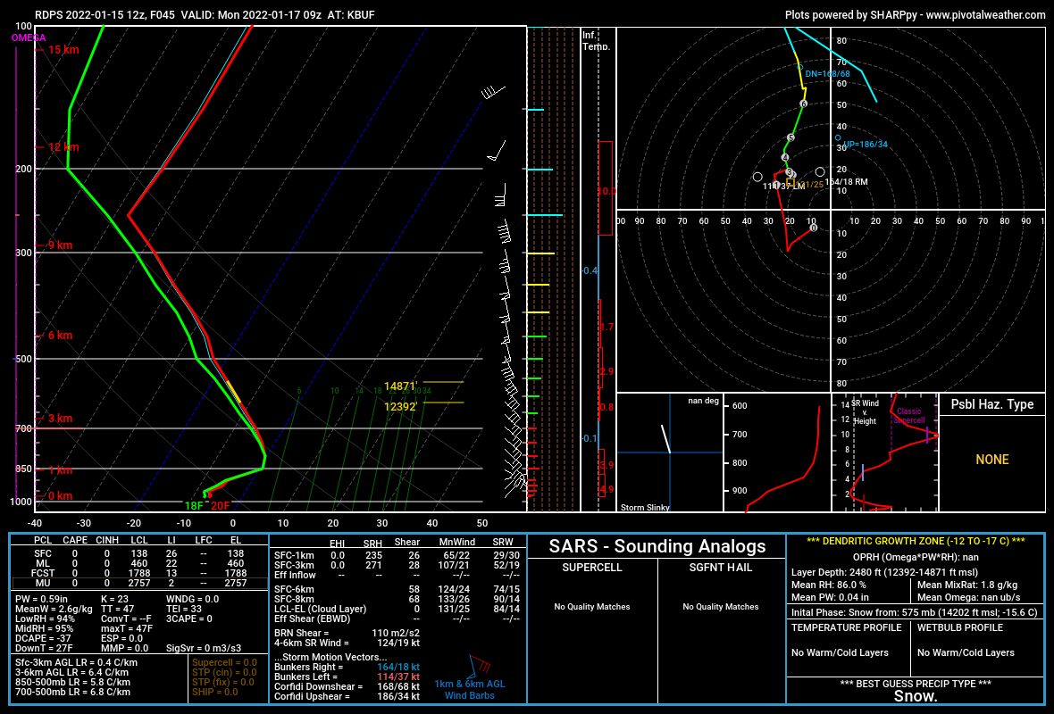
6 minutes ago, tim123 said:
Anyone know what you wanna look for to forecast thundersnow? I think the potential is there?
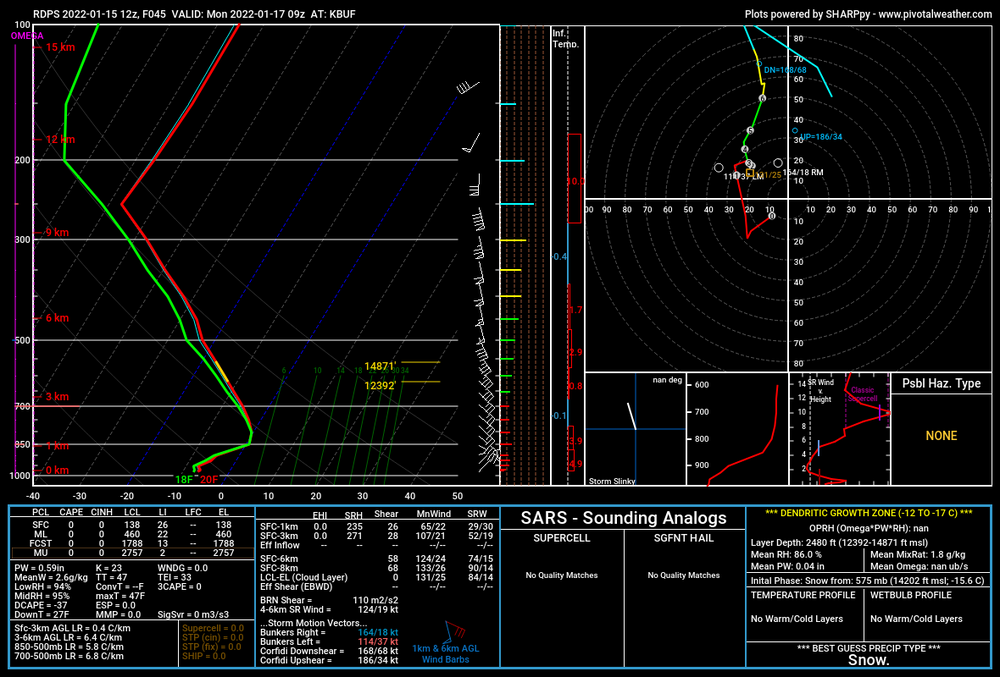
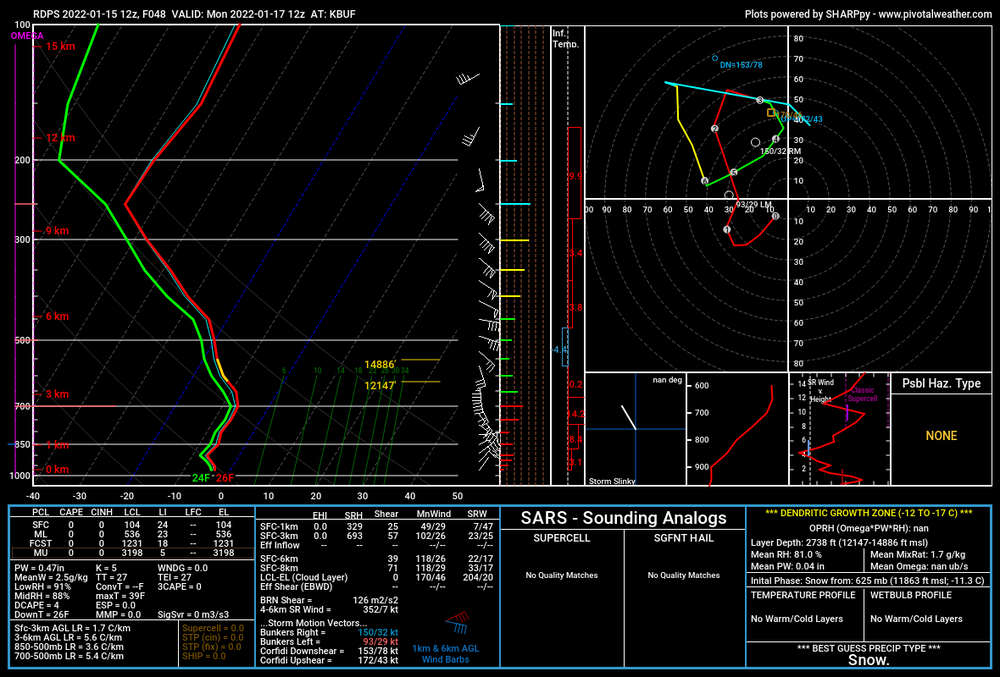
Possibly. Here is the nam3km at buf with steep 3 to 6km lapse rates of 7.1 c/km.
-
2
-
-
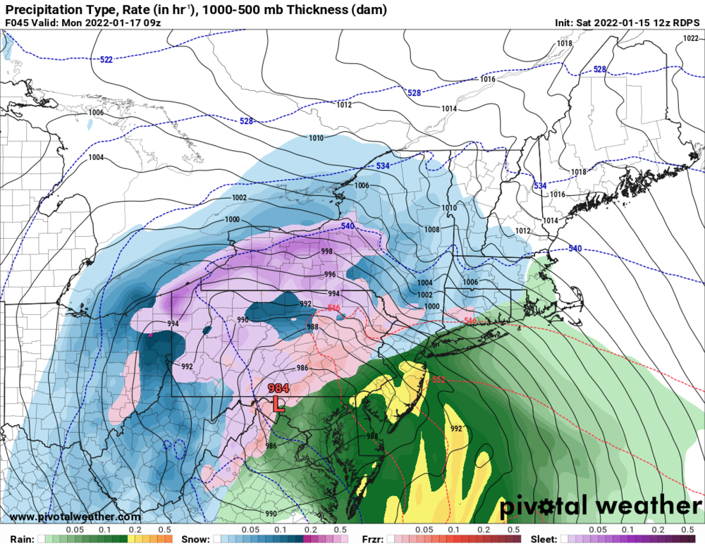
These algorithms seem a little too keen on mixing on the rdps to me. These soundings look like snow to me.
-
2
-
2
-
-
1 minute ago, Buffalo Bumble said:
Off topic, but are you getting slammed with snow/wind today? Looks like a monster storm ongoing in Newfoundland...
Wind and rain. It's been a shitty winter in Eastern NL so far. PEI and SE NB got the snow goods with this one. Well probably gust close to hurricane force tonight.
-
1
-
 2
2
-
-
3 minutes ago, rochesterdave said:
 .
.
Lol. I mean the that trough isn't pushing the storm off the coast. It's partially phasing with the southern low.
-
12 minutes ago, vortmax said:
The weaker kicker is key to keeping a cap on this thing. Glad to see this. My guess is we'll see that SE shift we've be talking about.
It's a good discussion but I dont like calling that trough a kicker..its actually the reason this thing is getting tugged west and not slamming nyc and new england with snow.
-
1
-
-
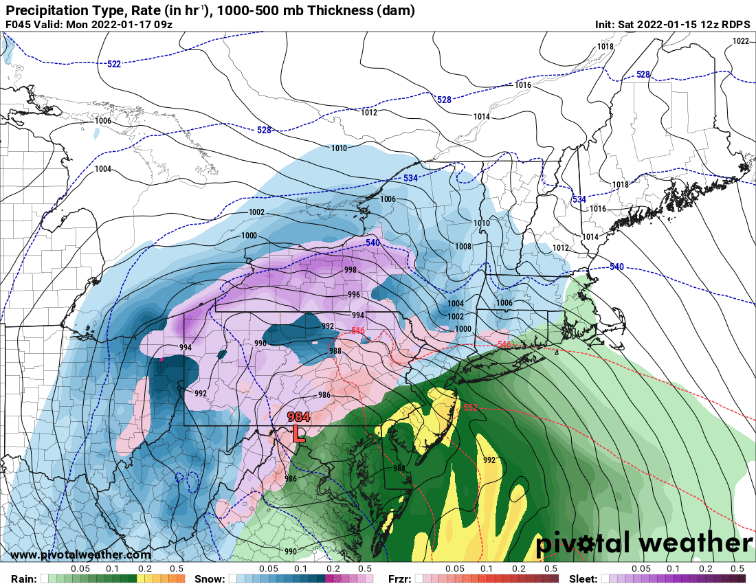
2 minutes ago, sferic said:
Will that snow hole courtesy of a dry slot still encompass Syracuse ?
What needs to happen for the dry slot to shift ?
Prayers
-
6
-
-
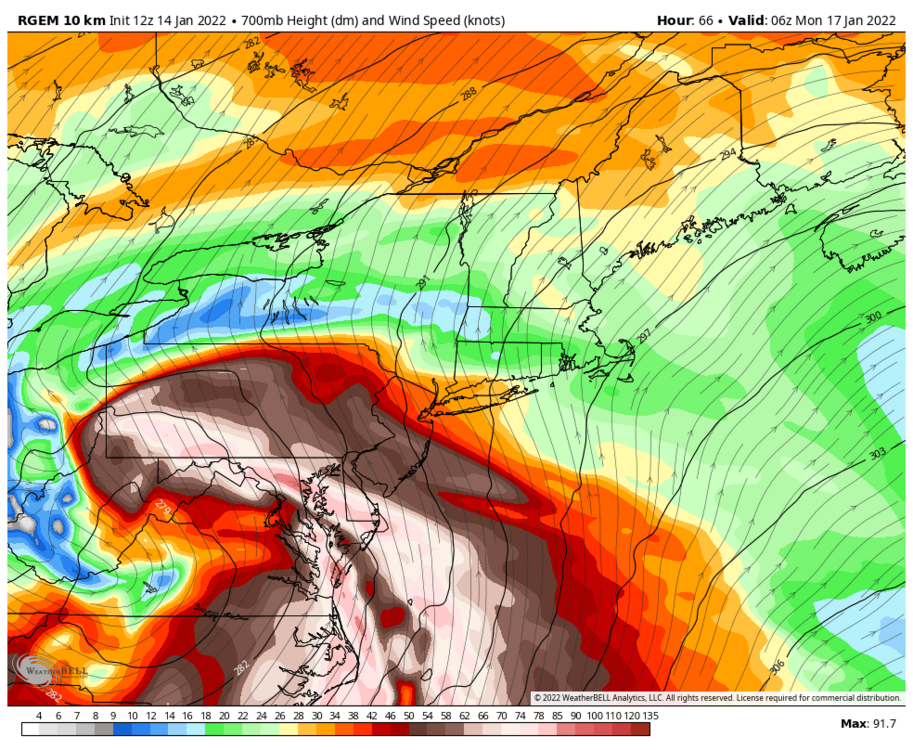
The Hudson Valley shadow for this event is really something. Very strong ese 850-900mb flow will do that.
-
1
-
-
3 minutes ago, KPITSnow said:
In which sense? I'm assuming that the 12 is way too over amped?
Also...the sref package is less amplified than the op 12.
-
Just now, KPITSnow said:
In which sense? I'm assuming that the 12 is way too over amped?
Yeah.
-
1
-
-
Just now, tim123 said:
3 km nam look way better
It's a red flag to me that the 12 is too crazy when the nam3km is less amplified.
-
3
-
-
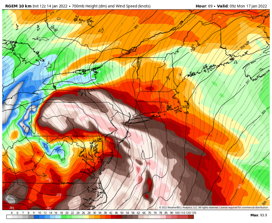
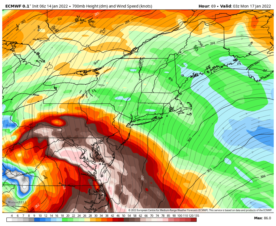
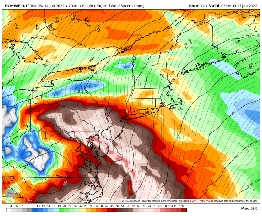
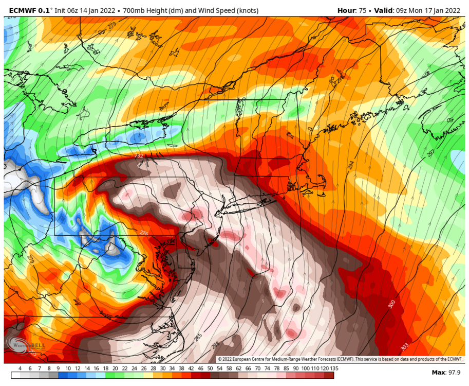
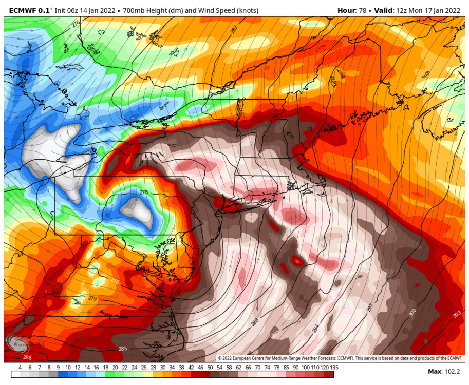
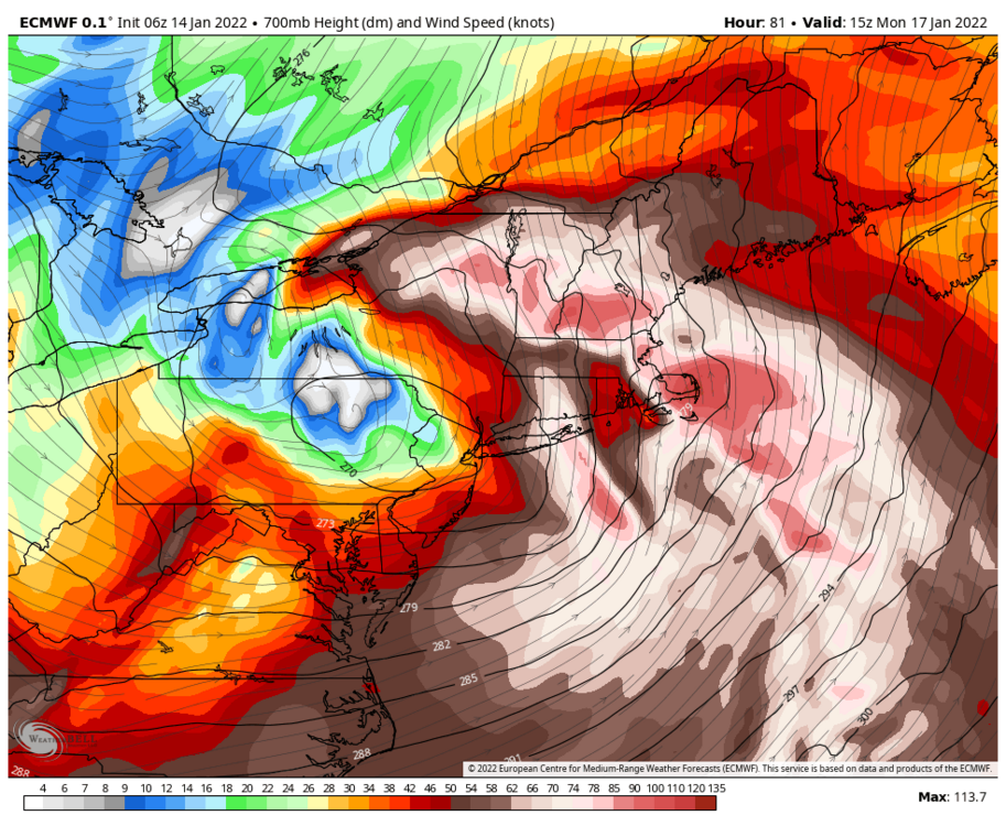
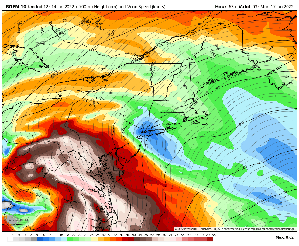
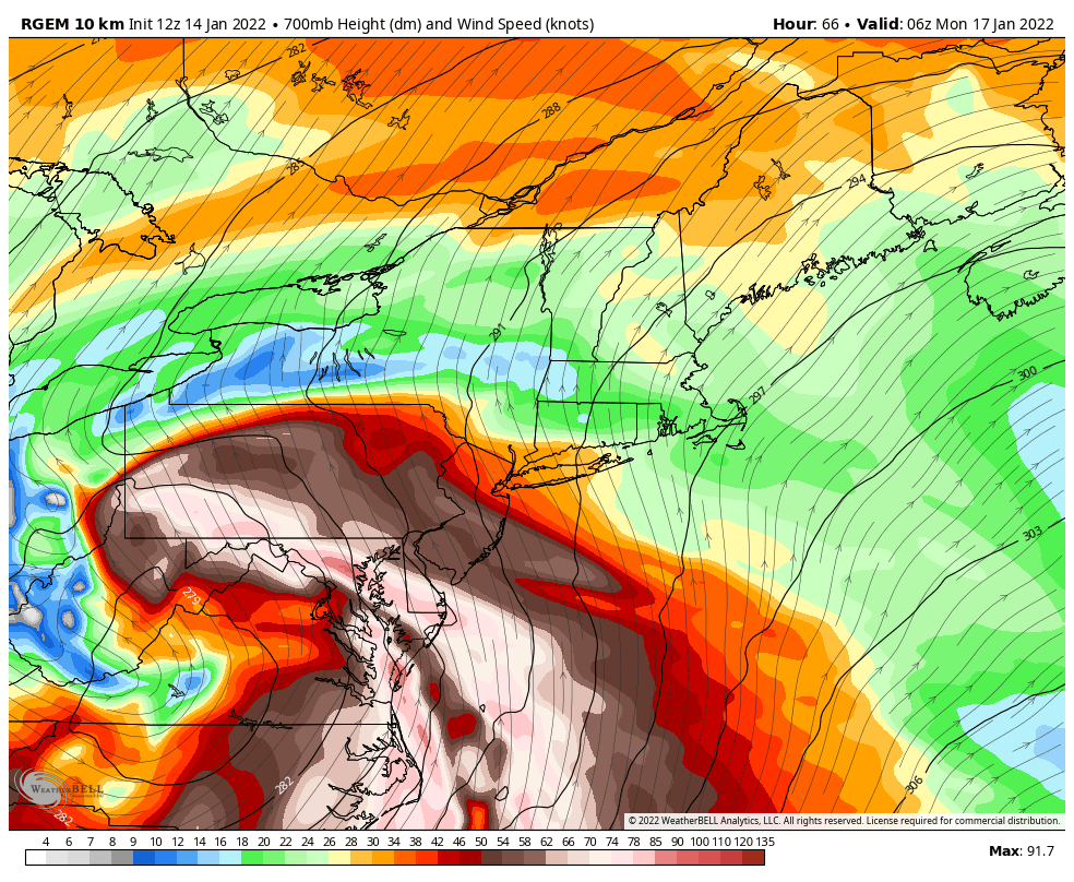
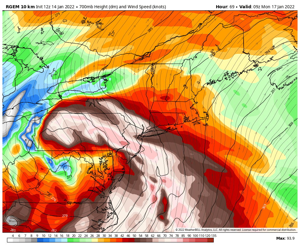
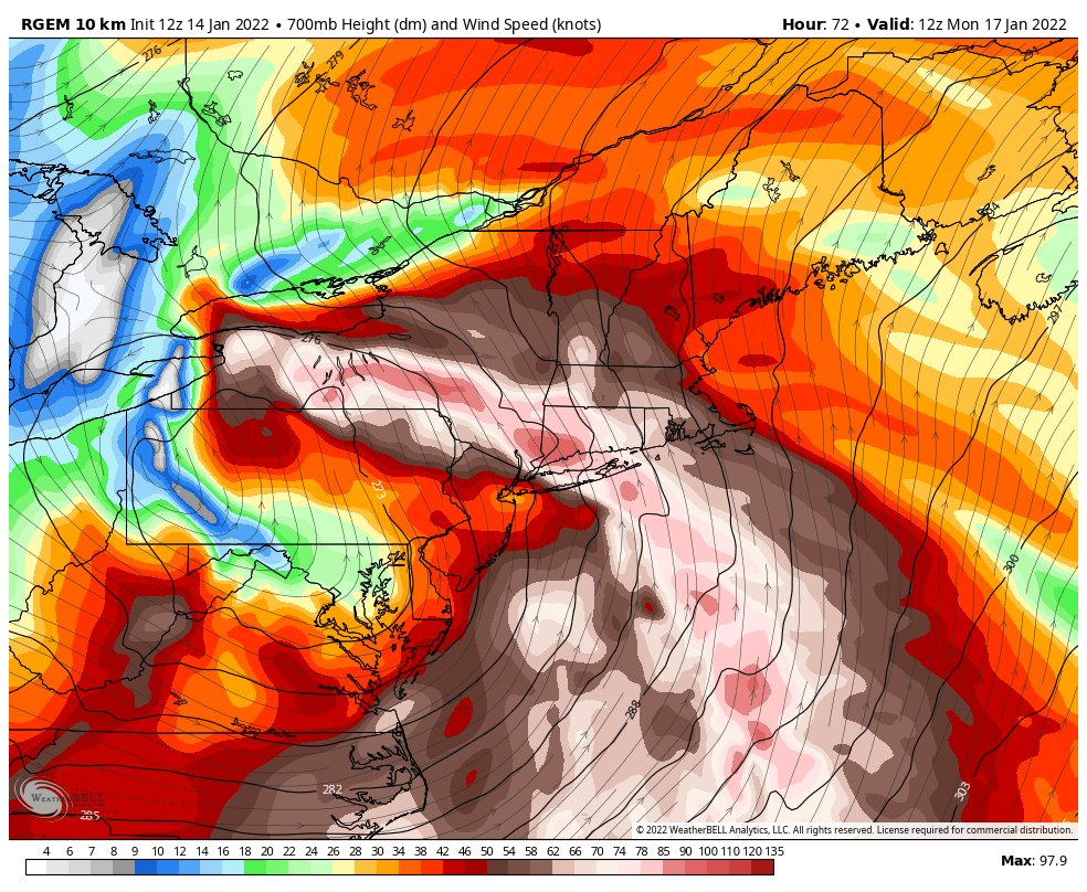
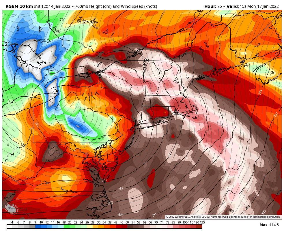
I think this is a good dynamic way to look at things. You want to be near the northwest edge of the 700mb jet where the mid level lift is maximized. Anywhere within the strong speed zone is going to at considerable risk of mixing and the dryslot.


-
1
-
1
-


.png.443275128854de0f5687cdaf53f85058.png)
.png.611ad2a0a07a4799ed96522e91d56e7e.png)


Widespread Snow Potential January 16th to January 18th
in Upstate New York/Pennsylvania
Posted
Theres sleet in Charleston WV right now.