

nj2va
-
Posts
13,580 -
Joined
-
Last visited
Content Type
Profiles
Blogs
Forums
American Weather
Media Demo
Store
Gallery
Posts posted by nj2va
-
-
-
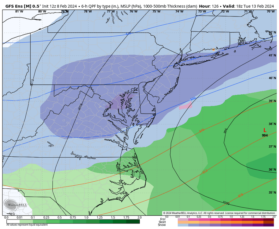
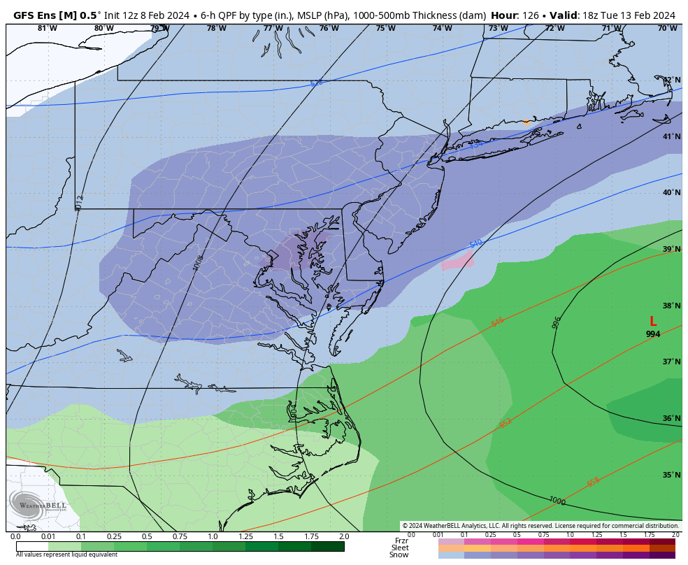
ICON still sucks (both as a model and for this threat) but it did shift south from 18z.
-
 1
1
-
-
7 minutes ago, wxmeddler said:
I'm overall dubious about the cold air coming in hard from the E/NE late in the game as shown by the GFS. That might work if there was a modified arctic high sitting over Quebec, but there isn't here.
We don’t want science based analysis at this point. Just weenie based.

-
 6
6
-
 1
1
-
-
Maybe that's the compromise between Euro/GFS. I'd take it in a heartbeat.
-
2
-
-
ICON continues to cut to basically Pittsburgh before transferring.
-
45 minutes ago, North Balti Zen said:
I mean...it is pretty clear that all the other guidance made a major move to the GFS. Obviously them meeting in the middle even now wouldn't be great, but I don't see any reason to think this thing has no chance based on the 12z suite, looks to me like a good argument to be made that the GFS is leading the way.
I realize we're a glass half empty forum for snow, but agree with this. The maps above show the clear shift towards a GFS solution - too early to say which 'camp' is going to be right. At least its nice to track something beyond -NAO signals.
-
1
-
-
1 minute ago, NorthArlington101 said:
Idk man… toggling it back from 00z it was a pretty big jump. Kinda looks like it’s behind the GFS by 2 cycles.
Maybe they meet in the middle and we get screwed. But maybe the GFS isn’t done moving yet and the middle is OKAgreed, I think that was a decent enough shift. There’s even been shifts within 100 hours that have been meaningful this winter with our last two events so I don’t think anyone can confidently say they know the final outcome.
-
2
-
-
4 minutes ago, jaydreb said:
GEFS coming in hot.
Triple blue'd.
-
That was close to a big dog. Just missed the phase.
-
4 minutes ago, North Balti Zen said:
On balance, it is a TON more fun to have one of the majors doing this five days from an event even if it is on an island - just fun to dream a bit - especially given that this is still the period before THE PERIOD OF INTEREST.
Yeah, we don't need the constant reminders its on its own...lets just weenie out and dream.

-
4 minutes ago, NorthArlington101 said:


DCA is the new snow capital of the east. Whodathunkit
-
1
-
2
-
-
I like seeing that H north of us over Canada, sinking south as the LP deepens. Get that a bit stronger and more south in Canada and it'd be even better.
-
2
-
-
Sunrise alert. Gorgeous oranges, pinks and purples.
-
6
-
-
3 minutes ago, snowfan said:
CMC solution makes it tempting to road-trip to downeast Maine for this one. Holy shit.
Nubble Lighthouse in a blizzard would be pretty.
-
1
-
-
CMC cuts to Buffalo then transfers off the jersey coast. Bombs into a snowicane for coastal NE.
-
The classic transfer from Pittsburgh to the coast. Those always work for us…
-
3
-
-
8 minutes ago, BristowWx said:
it showed up again at 6z. Almost the same evolution. huh
The big ones lock in early.
")
-
1
-
2
-
-
1 minute ago, Scraff said:
That one deserves a FOLKS!
PD3
-
2
-
1
-
-
Wow, upper pattern showing the potential

-
4
-
1
-
-
ICON is basically if the NAM went past 84H as a global model. Just not worth discussing.
-
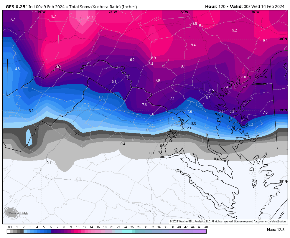
12-18”
-
We need a 'Winchester pummeled' post at 00z.
-
1
-
-
OMG, I would have screamed.
-
1
-
-
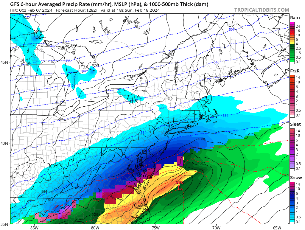
Canadian went from a cutter at 12z to a low that tracks over Norfolk at 00z (still rain for the area though).
2024 Valentines Day Rain/Snow/Who The Hell Knows Thread
in Mid Atlantic
Posted
Looks great!