

ChescoWx
-
Posts
7,516 -
Joined
-
Last visited
Content Type
Profiles
Blogs
Forums
American Weather
Media Demo
Store
Gallery
Posts posted by ChescoWx
-
-
2.5" here in East Nantmeal Twp. as of 4am
-
Only heavy snow I can find on obs is at Hagerstown and Camp David Maryland....the returns to the north look more impressive than obs
-
No real surprises so far....snow blossoming along mason dixon line across N MD and SC PA

-
 1
1
-
-
10 minutes ago, MGorse said:
I don’t think it is subsidence, but rather weaker lift outside of the strong lift that is producing the band.
In the professionals we should trust!
-
1
-
-
Here in East Nantmeal snow picked up pretty quickly after first couple flakes temp also falling quickly down a degree since snow started and now at 32.3 degrees
-
5 minutes ago, penndotguy said:
33F DP23 Cloudy skies, just about show time
32.8 DP 23 heavy virga here in East Nantmeal
-
1
-
-
-
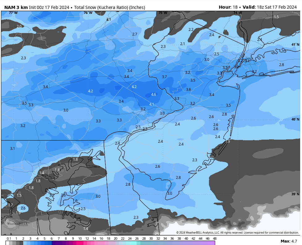
NAM looks not that far from the NWS forecast 3" to 5" I am not stunned!

-
-
If you follow these short term models....
-
10 minutes ago, Ralph Wiggum said:
As soon as the WSWs get hoisted the SE zones go to complete shit. An inch or 2 now if we r lucky on latest mesos. Lets hope the NAM at 0z corrects this and NAMS us.
Steve models are not real useful at this point....they will waver back and forth - time for radar and station obs
-
2
-
-
29 minutes ago, Birds~69 said:
Who?
16 minutes ago, RedSky said:The RAP looks like the hrrrr and anybody have the 18z euro? Not liking the dry frame I saw.
Never a big fan of the short term rapid refresh type models....need to watch obs and radars for reality at this point
-
3 minutes ago, Birds~69 said:
Who?
Never saw him before.....then again I never watch TV weather folks - just happened to pass by as my wife was watching
-
Just saw a forecaster on Fox29 say it will be a heavy wet snow to shovel in the morning.....
-
 2
2
-
 1
1
-
-
-
2 minutes ago, snowwors2 said:
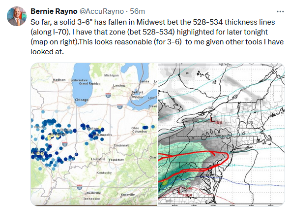
Rayon’s train had a REAL BAD derailment during our most recent storm‼️
ya think? he had no zip zero snow for SE PA.....that said he is usually pretty solid in his views
-
1
-
-
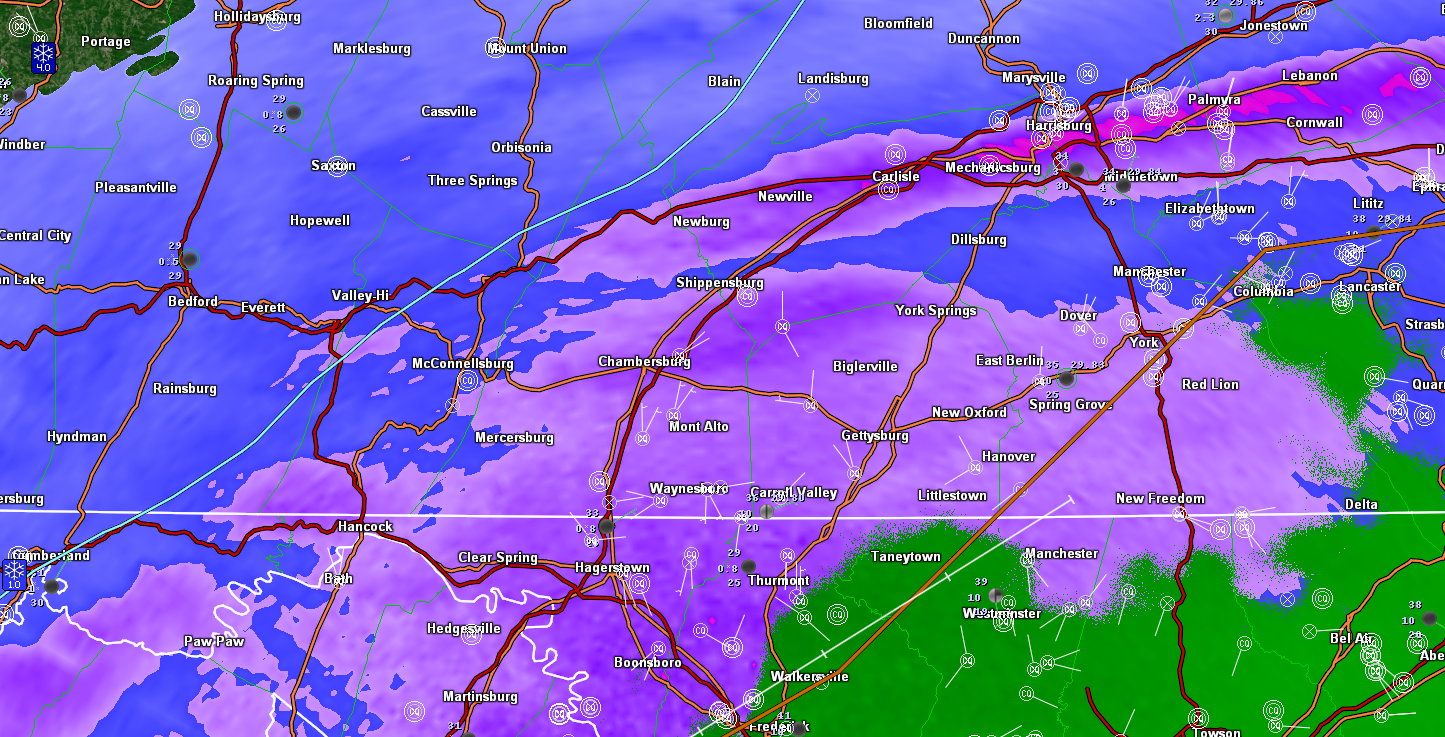
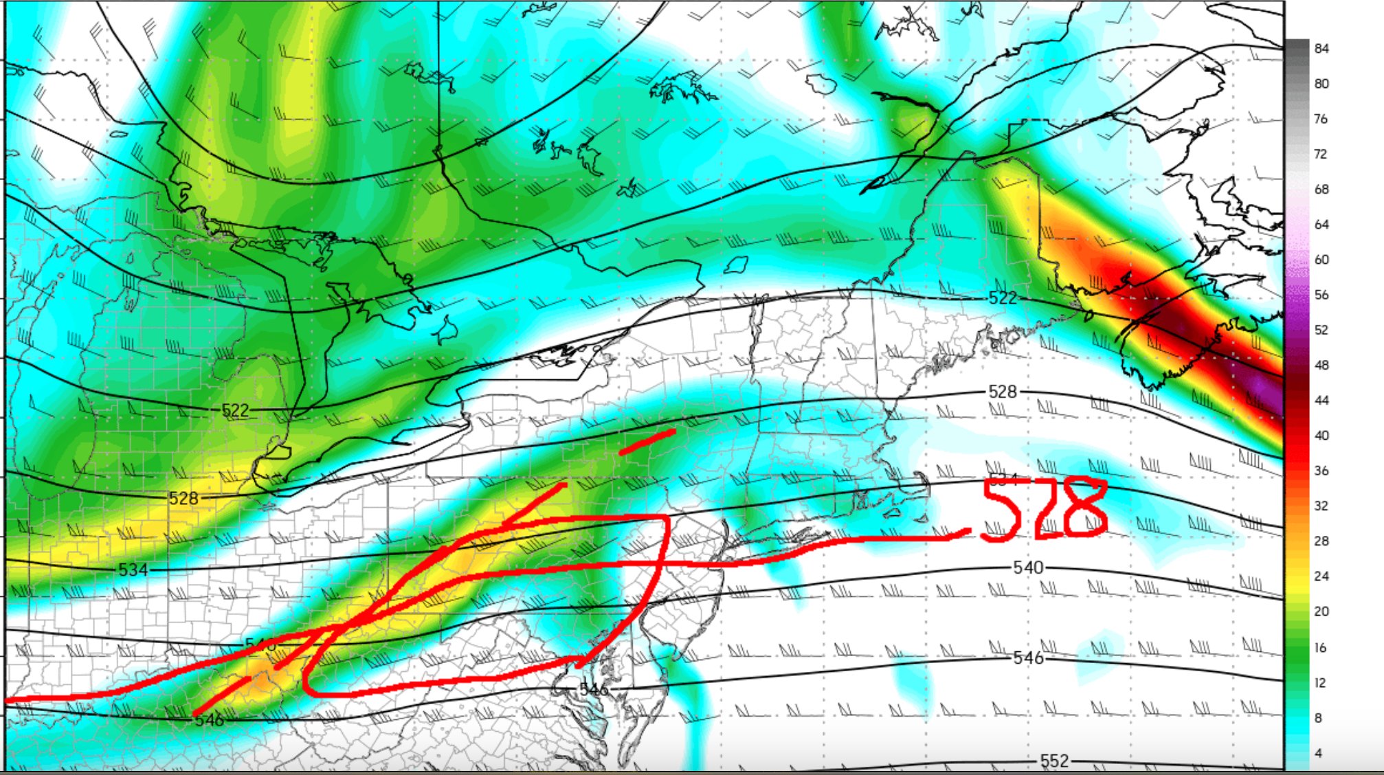
Bernie Rayno's circled view of where area of "heaviest" snow could be...
-
Interesting you can see the difference where State College has updated and increased their snow totals...
-
1
-
-
-
Just now, Blue Dream said:
anybody else setting their alarm for 4AM tomorrow lol?
I will be up early need to clear drive and get down to SIC in time for 5k run at noon
-
1
-
-
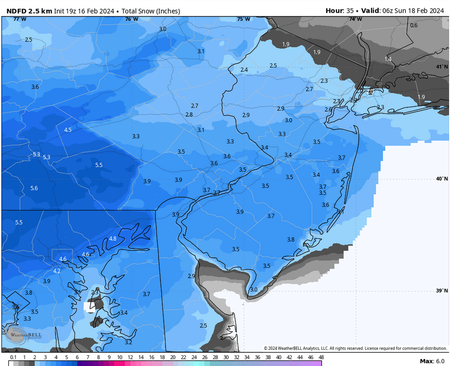
Winter Storm Warning just issues for Western Counties for 3" to 7" of snow for State College zones

-
1
-
-
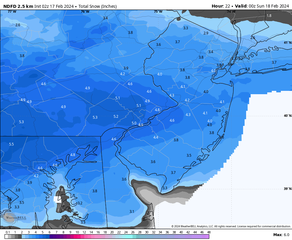
Nice to see such consistency across the models...kind of thought the Euro would have a strange run like it did before the last storm....I still kind of think everyone stays with a WWA as meeting the 5"+ criteria seems to be marginal at best. But clearly best shot for any warnings would be Chester, Delaware, Lower Montco and Bucks...

-
Just now, RedSky said:
I smell winter storm warnings hoisted this afternoon
Maybe for spots with lower criteria (5") thresholds

-
1
-
-

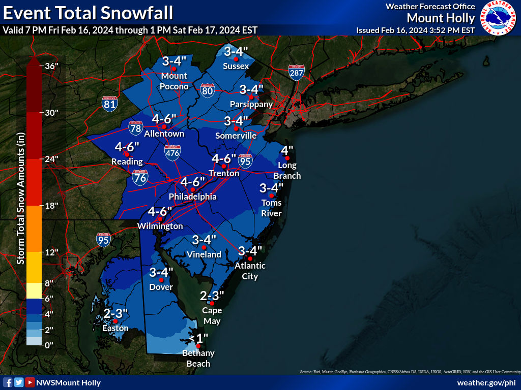

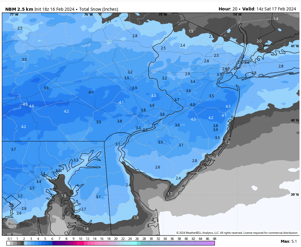


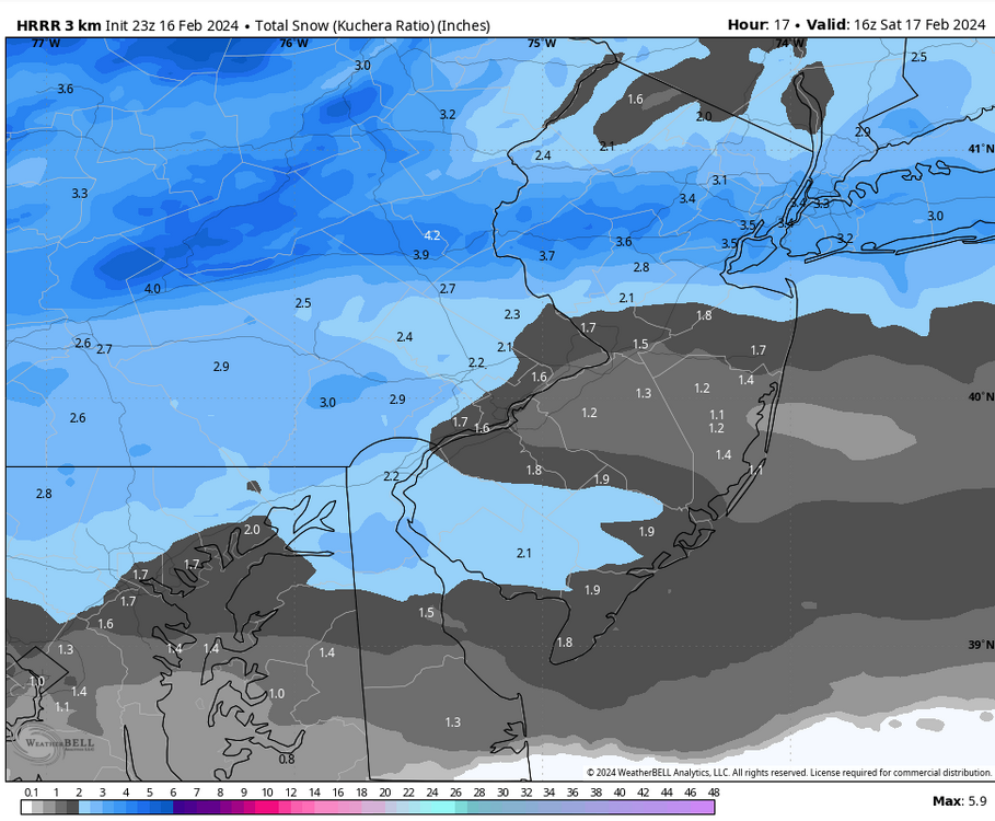
The Official Unofficial Overnight February 16/17th Snow/OBS Thread
in Philadelphia Region
Posted
We ended up with 2.8" of snow here in East Nantmeal which makes 13.3" of snow this week! That is more than our normal February snow of 11.9". Season to date we are at 24.5" which is only 0.8" below our normal seasonal snow to date. The storm delivered an unexpected dump of snow as a narrow band of heavy snow formed just 18 to 30 miles north of Chester County. For example in Fleetwood 9.0" of snow fell just 19 miles north of EN. Another example is just south of Allentown a spotter reported 12.1" while only 2 miles north of there another spotter recorded almost 4.5" - impossible to forecast those kind of snow bands!