

CoastalWx
-
Posts
176,023 -
Joined
-
Last visited
Content Type
Profiles
Blogs
Forums
American Weather
Media Demo
Store
Gallery
Everything posted by CoastalWx
-
-
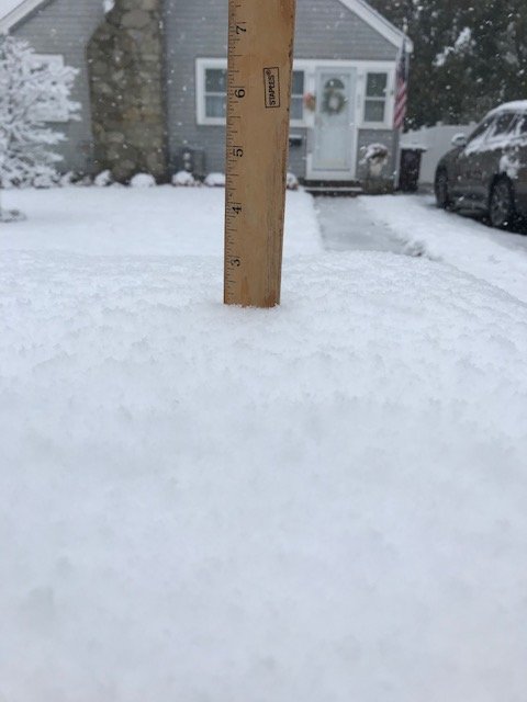
2” ripping.
-
1.8”!
-
Blowing off roof now.
-
It may end quicker than HRRR says..or at least be very light and non accumulating for an hour or two.
-
We going to pound town here. 32.3, white and sagging. No that does not describe me.
-
Hopefully a plow hits it.
-
It's going to crush from RI to Bob.
-
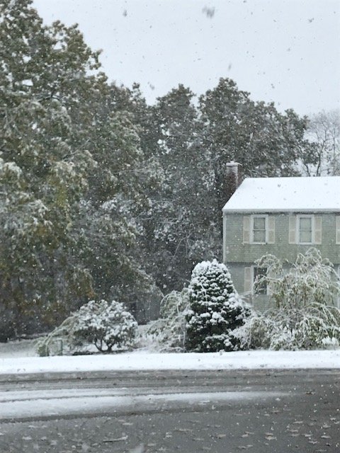
Oaks leaves white is so strange to see.
-
0.6" here.
-
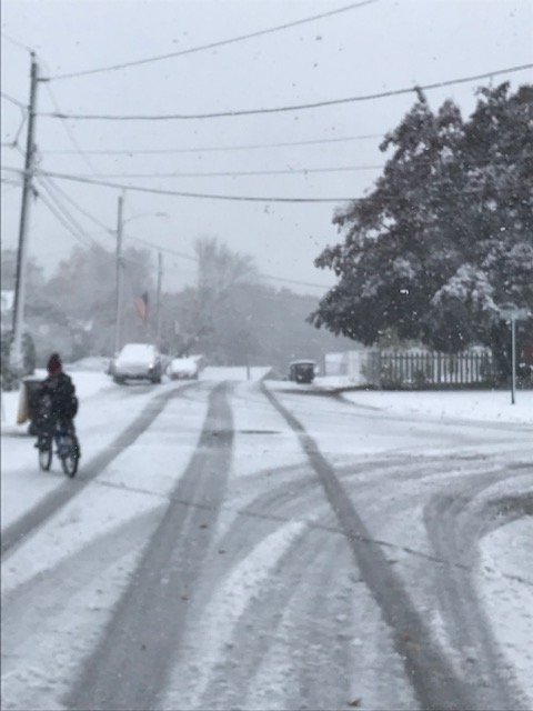
Sticking to pavement now.
-
My son is weenieing out and remote learning. Not a good combo.
-
Slush on cars. On the coast. Dam.
-
Really coming down now. 33.8.
-
Logan 1/2SM moderate. Awesome. Steady snow here and 34.
-
Kids happy.
-
Yeah, well F 11-12. Hope we do not see it.
-
Effing A baby. Love to see it.
-
Pretty cool on the cstl plain. 11-12 here we come.
-
35.9 and becoming mostly all snow. CSTL front looks to have just passed.
-
It won't be 4-6.
-
CF from Braintree Split SW to Randolph-Easton down to E Prov.
-
Looks like it's going to town in Boston.
-
Rates great ern CT into RI and MA.
-
37 now. Been a steady drop. Impressive with 55F SST.


