CoastalWx
-
Posts
176,023 -
Joined
-
Last visited
Content Type
Profiles
Blogs
Forums
American Weather
Media Demo
Store
Gallery
Everything posted by CoastalWx
-
Ideally we get it once a week to keep the lawns and gardens green. But I do like my sunny no clouds kind of days too. I could go for some stein.
-
4.6” and change this month even with just a few hundredths today. That’s been like my avg precip last few summers lol.
-
Brockton baby. King of storms in the 90s and 00s.
-
Shear good to the north tomorrow. WF nearby. Maybe night time sizzle tomorrow night.
-
Meh
-
Meh
-
Hrrr was better
-
That’s a nice line now. Ginxy and RI incoming.
-
Splitsville for Jay and myself I think.
-
Why are you placing that away from your house?
-
Carpet bomb warnings. Is that really necessary?
-
Wagons SW.
-
Yeah the caterpillars. Saw that small section.
-
53.8 now. Ugh
-
Gypsy Phil taking out trees near exit 17 I see.
-
We comma head. Meanwhile 54.1 here at Winni.
-
Yeah this is unusual. Look at all the warm summers we have had. Near record warm June in many spots too. Back to 90s Tuesday.
-
Each major holiday including thanksgiving has been non-COC.
-
I rented last week and it was great. This is highly anomalous. Will be back on the cape in august when it will feel like Havana.
-
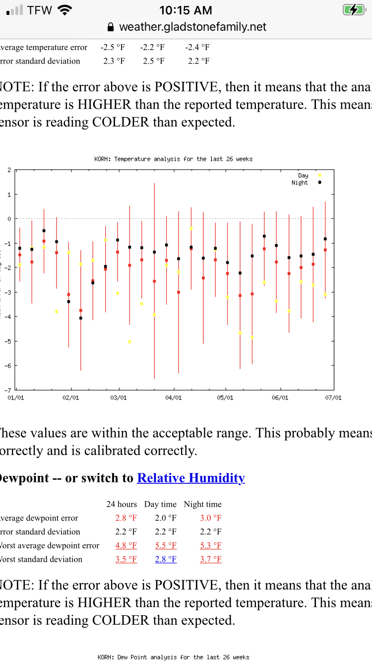
This is for ORH and I noticed they seemed a little mild too.
-
They caught my eye too.
-
Headed to Maine from RI for “training.” Sounds about right.
-
Meh. Probably north.
-
Comma head pivoting this evening. Where was that all winter?
-
They came from Tolland CT since they have no police Dept there.