

mob1
-
Posts
2,222 -
Joined
-
Last visited
Content Type
Profiles
Blogs
Forums
American Weather
Media Demo
Store
Gallery
Posts posted by mob1
-
-
Just now, SnowenOutThere said:
maybe he meant Euro?
I think he meant with winds early next week, models have a rather significant wind event for coastal areas.
-
 1
1
-
-
Just now, CoastalWx said:
They can fail in potent setups like this. I've found that to be true more often than not.
Probably because of their lower resolution, so they tend of be more broad and smooth out things.
-
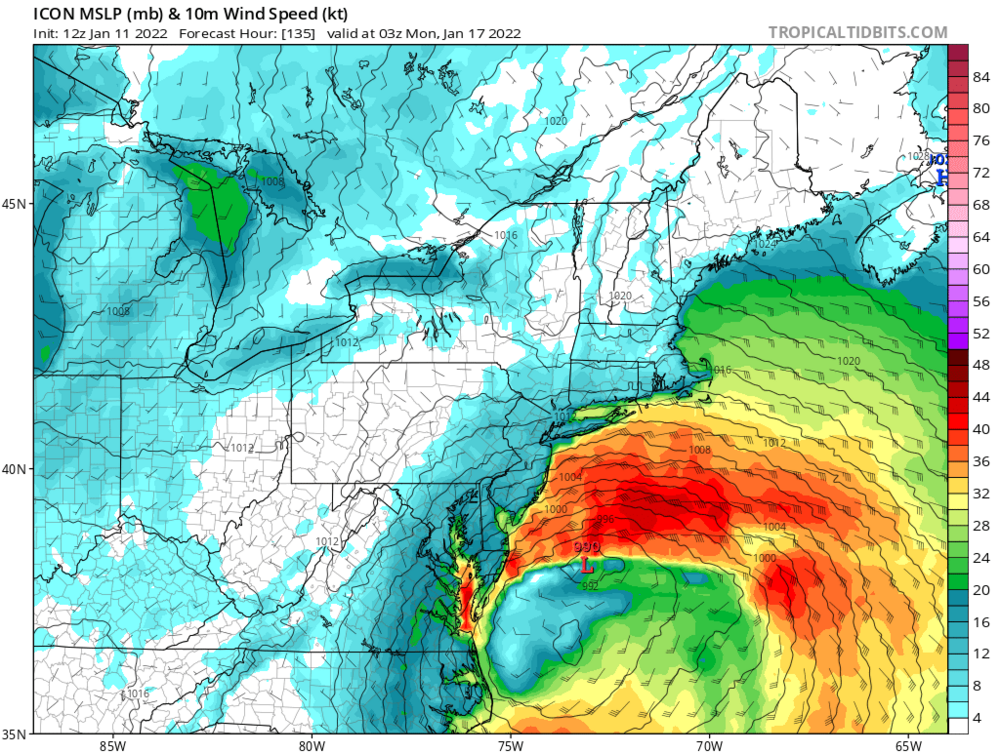
ICON doesn't look too dhabby for early next week.
-
1
-
-
-
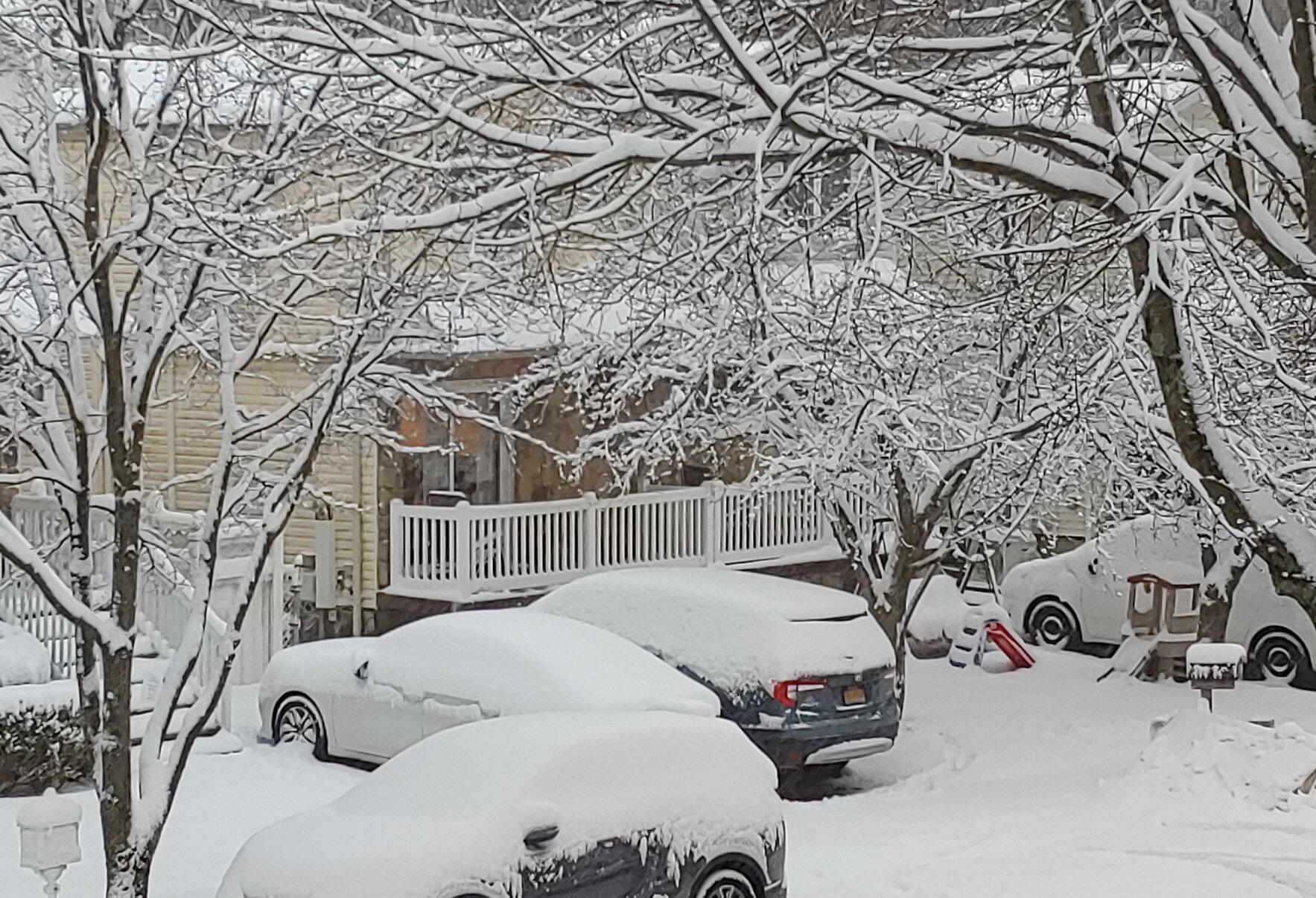
Heavy snow now and I'm just over an inch (starting snowing about an hour ago)
-
1 minute ago, bishbish777 said:
00Z RAP much better than previous run too
.thumb.png.1e7f4c1e624bf96a3d887bed0275e611.png)
-
1
-
-
2 minutes ago, JC-CT said:
No, this was more recent. March 2013 was amazing, but I give the models a pass on that one...a freakin fujiwara.
This is driving me crazy, I distinctly remember everyone arguing if double barrel lows could happen or it's convective feedback. In the end it was one strong consolidated low well west of what models initially had.
-
1 minute ago, JC-CT said:
nah, i bet Hoth and I are thinking of the same one, but it wasn't that one. that was a cutoff low issue.
Yeah, I deleted the post. I remember the scenario well but don't remember the year.
-
Lowest current observed surface pressure is near Boone NC at 1006 mb, it's in the mountains though so it's probably a bit higher.
-
8 minutes ago, WestBabylonWeather said:
Almost always start earlier and end earlier
I hope the clouds don't roll in till another few hours so we can radiate a bit with the low dew points we have. Not that temperatures are a concern, but the colder the better.
-
1
-
-
1 minute ago, MJO812 said:
What models ? They all show something except the nam.
Ukie, Icon, both NAMs, HRRR, etc.
I hope we both getsomething, just keep expectations low as there's a good chance we get nothing.
-
1
-
-
4 minutes ago, MJO812 said:
Or maybe the Nam is late to the table
I should be good for an inch or two but it will be tough seeing places to my south seeing alot of snow
You're far from guaranteed an inch. You might not even seeba flake if some models are right.
-
3 minutes ago, MJO812 said:
Cmc and Ukie are south for Monday . Tomorrow will be very interesting.
Canadian definitely came north from 12Z
-
1
-
-
Accumulating snow into DC now, pretty significant change from 12Z.
-
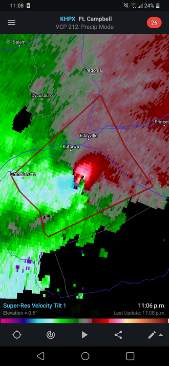
Strong couplet south of Edgerton KS, couplld probably use a tornado warning.
-
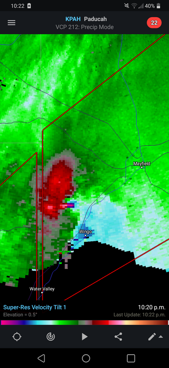
Appears to be up and running now (Radarscope)
-
BIG TDS east of Exira IA
-
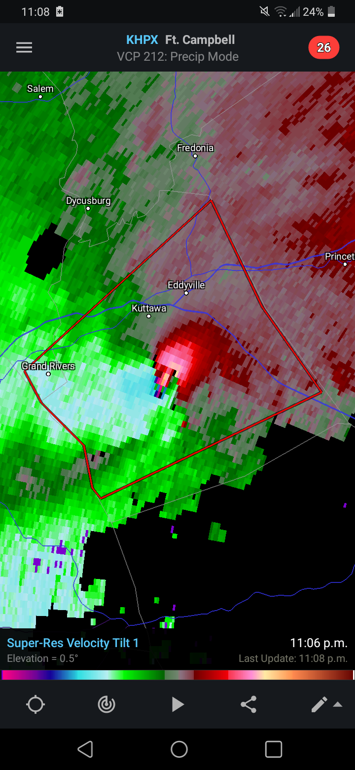
2 minutes ago, Witness Protection Program said:
May scoot between Earlington and Morton's Gap and miss most of the residences.
Looks like it, which is luckily as velocity scans are going nuts again. Still a lot of houses there, just not as bad.
-
-
1 minute ago, cheese007 said:
Any good local news sources for the storm as it heads towards Madisonville? It's moved out of the KFVS viewing area so they're dropping coverage
Last scan right as it passed over them looked mean
-
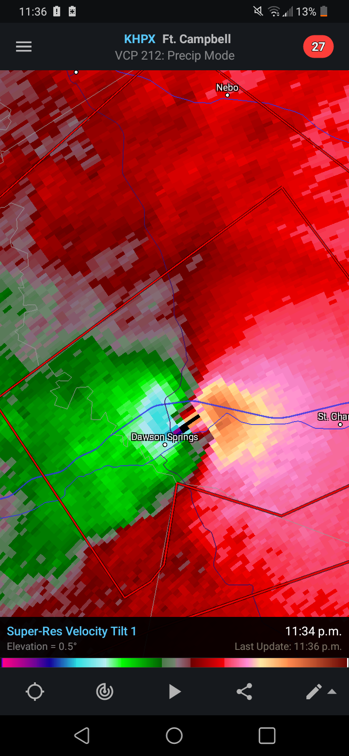
Dawson Springs in its crosshairs momentarily
-
1 minute ago, Moderately Unstable said:
Not sure if others have noticed but because Paducah is so close to Benton, Springfield MO is currently issuing the warnings for Paducah's CWA. (This occurs when the NWS staff need to take cover. There's a built in shelter in every NWS office).
https://twitter.com/JackSillin/status/1469520268154519553?s=19
-
Just an absolute monster
-
Speechless
.png.a04a8e62ae1667557c19e71111757ffb.png)

MLK 2022 Storm Potential
in Mid Atlantic
Posted
Look how far west it's closed off at 500 mb, if you extrapolate that it probably ends up really far west. Even compared to the GFS and Euro is significantly further west.