

mob1
-
Posts
2,194 -
Joined
-
Last visited
Content Type
Profiles
Blogs
Forums
American Weather
Media Demo
Store
Gallery
Posts posted by mob1
-
-
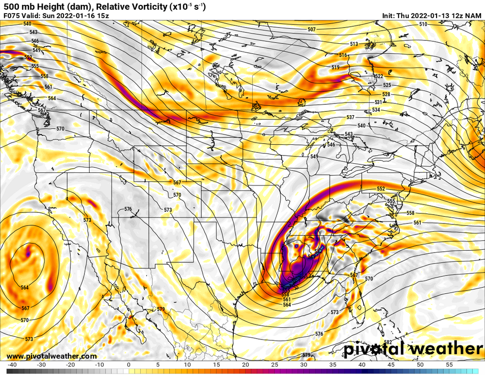
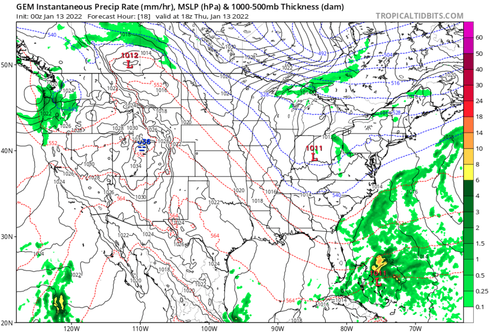
Southern vort is MUCH further southeast
-
 1
1
-
 1
1
-
-
At H5, it's closed over the western Carolinas vs northern GA in its last run.
-
4
-
-
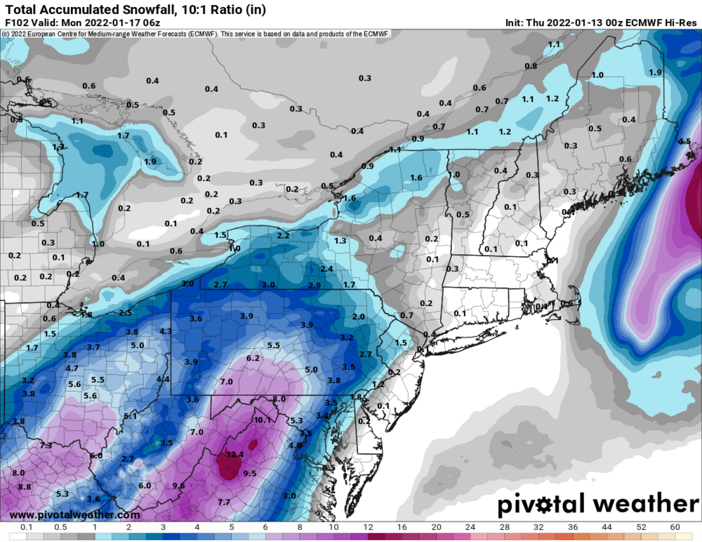
06Z Euro looks a bit better, has snow at hour 90 for SC and everything looks a touch east. It's hard to extrapolate from there as many models look good at that point and then take a sharp turn N or NW. We'll see what the EPS does.
-
Could be worse
-
-
Pretty ugly run, hopefully tomorrow brings better trends.
-
1
-
-
Just now, jayyy said:
GFS Ens Mean is awfully snowy for W NC into SW VA
There are many individual members that are near the benchmark. As a mean, it's almost comically different than the OP, it's unusual to such a large difference.
-
3 minutes ago, Random Chaos said:
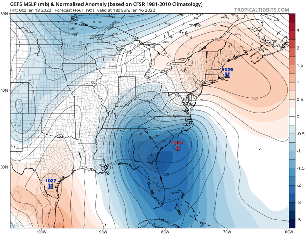
Looks to me the biggest problem with the models is consolidating the low pressure in a single location. The GFS is jumping back and forth between 2 of these lows, and that seems to be what is making the sudden west jog jyst before it hits us:
The irony is that models usually do the opposite when we want an offshore storm to move West, they chase the convection to the east and collapse the best dynamics there.
-
Canadian, moves even further NW from there

-
Because hope springs eternal
-
2
-
 1
1
-
-
2 minutes ago, nj2va said:
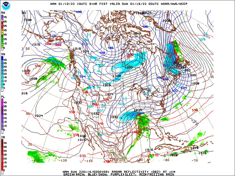
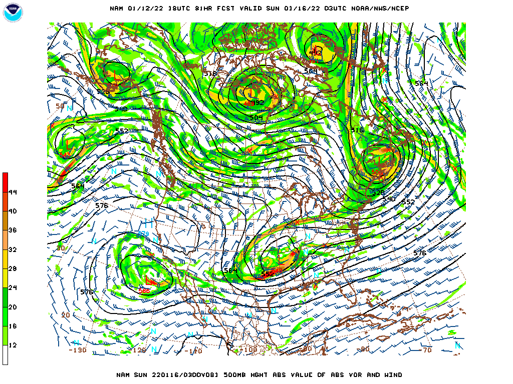
Hard to read the B&W maps but it looks like the CMC tracks the SLP similar(ish) to GFS.
Yep, ends up in central PA.
-
1
-
-
2 minutes ago, Ji said:
i went to the check the CMC on TT and its now running the model runs from 1/10/2022
It's running correctly now. There was some issue with it this morning.
-
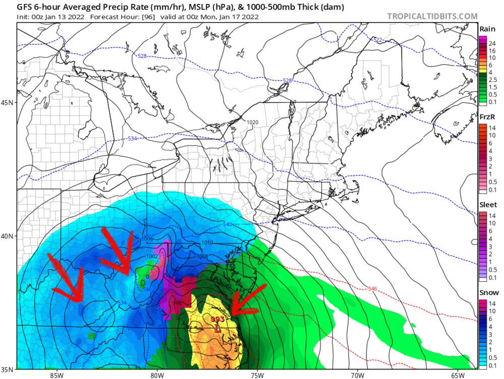
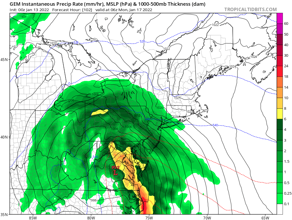
Man, the storm goes really far west on the GFS. Just refuses to budge. Still a nice front end thump.
-
-
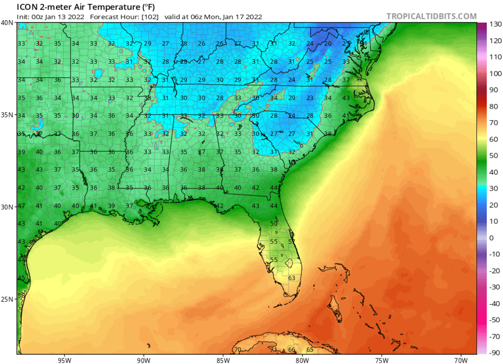
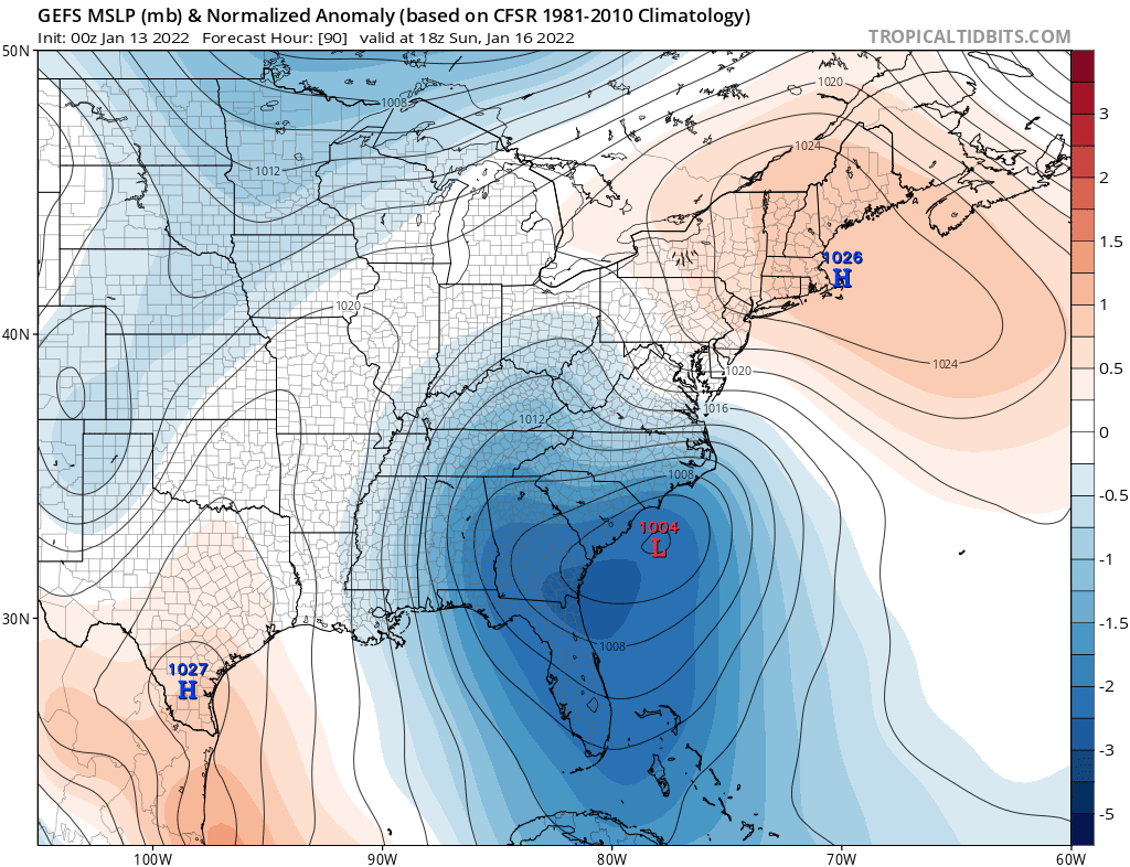
It's soooo much colder for DC
-
-
Just now, WinterWxLuvr said:
Tropical Tidbits picked a bad week to quit drinking.
It's out on StormVista and you'll like the end result, moved east by a fair bit.
-
1
-
-
2 minutes ago, WinterWxLuvr said:
At least so far he ICON looks a little better up in the Canadian border. Let’s see if that holds.
It ends up looking REALLY good for this area (especially just west of DC), definitely shifted east.
-
1
-
-
5 minutes ago, nj2va said:
No.

You're not comparing the same time frame. I'm talking about the NAM at the end of it's run vs the GFS and Euro at the same time (12Z Sunday). I wasn't being combative, I was replying to a specific post that showed that.
-
3 minutes ago, nj2va said:
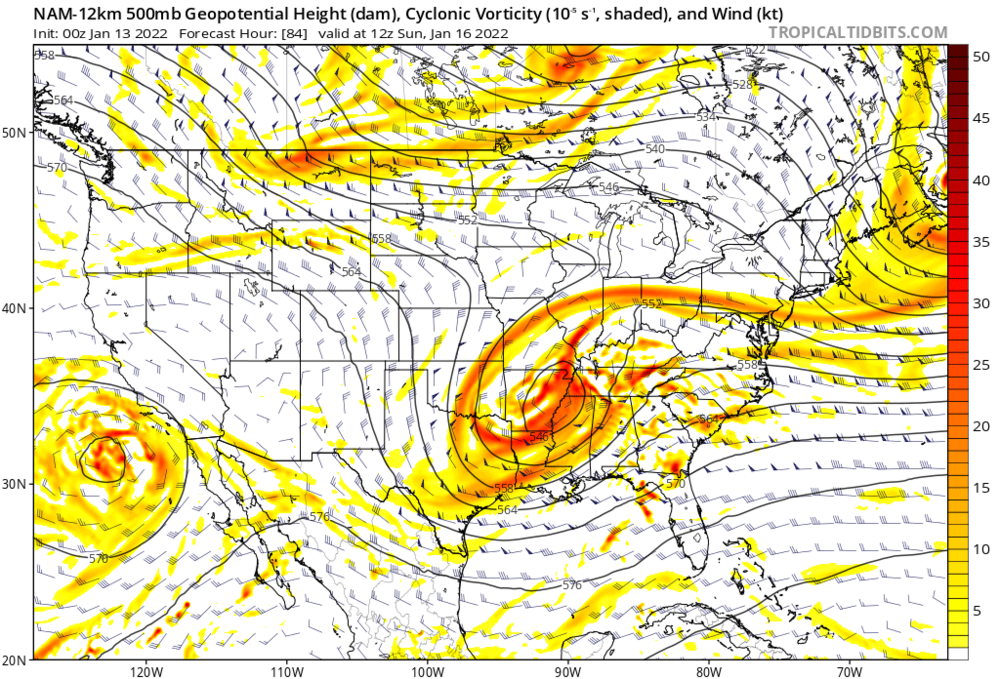
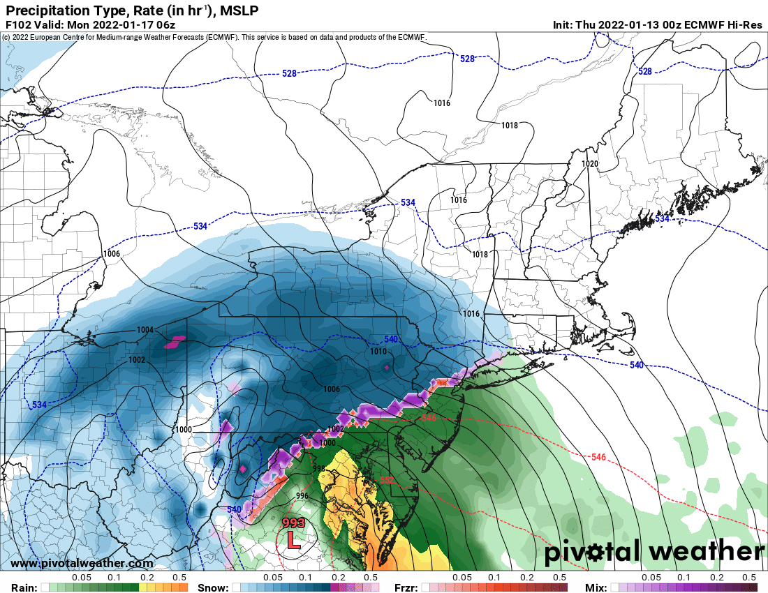
Not sure its worth analyzing the NAM at 500 at the end of the run but it closed off 500 east of Euro and GFS.
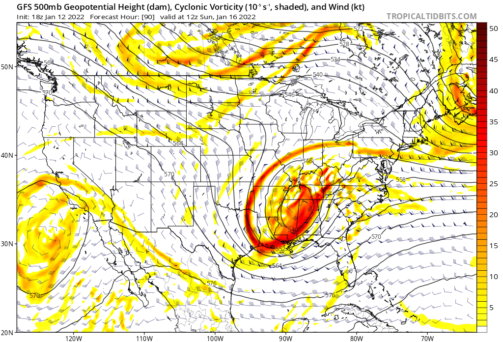
It isn't, but like you said it's the NAM at 84 hours. Hope you guys get clobbered, just saying what it shows. To perhaps level the playing field, it has the 250 mb jet further south and in a better position. It's closed off a full state west (though it's probably too agressive in that regard)

-
2 minutes ago, WinterWxLuvr said:
How’s it look for New York?
Im thinking heavy heavy rain.
The heaviest. Winds at least look exciting. Good luck guys.
-
1
-
-
11 minutes ago, StormchaserChuck! said:
0z NAM
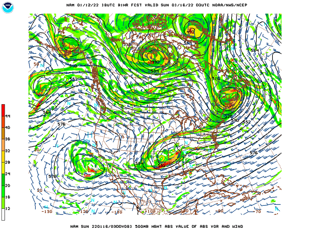
Look how far west it's closed off at 500 mb, if you extrapolate that it probably ends up really far west. Even compared to the GFS and Euro is significantly further west.
-
1
-
-
Just now, SnowenOutThere said:
maybe he meant Euro?
I think he meant with winds early next week, models have a rather significant wind event for coastal areas.
-
1
-
-
Just now, CoastalWx said:
They can fail in potent setups like this. I've found that to be true more often than not.
Probably because of their lower resolution, so they tend of be more broad and smooth out things.


MLK 2022 Storm Potential
in Mid Atlantic
Posted
A note of caution about the ICON, it shows anything with below freezing surface temperatures as snow (and vice versa) so it wouldn't show sleet or ice.