

Blizzard-on-GFS
-
Posts
697 -
Joined
-
Last visited
Content Type
Profiles
Blogs
Forums
American Weather
Media Demo
Store
Gallery
Posts posted by Blizzard-on-GFS
-
-
1 minute ago, Rjay said:
2 main camps on the EPS. 1 is a nyc subforum crusher. The other is a coastal scraper. Absolute wild at this lead time.
Yup clear as day the 2 camps. And the spread looks almost 50/50. It could really go either way.
-
 1
1
-
-
Just now, 40/70 Benchmark said:
Those will probably shrivel some going forward.
Hey hey, be nice, my house is over that jackpot lol
-
Explain to me how y’all aren’t happy with 20-30” of snow? EURO didn’t cave, it doubled down!
-
2
-
-
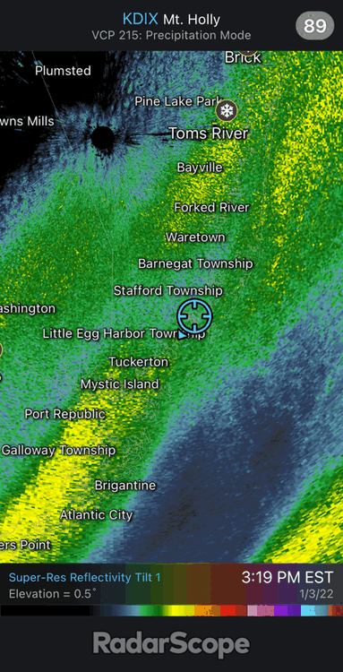
Nothing to Crazy in Manahawkin but it looks like that cell strengthened over LBI Ana d Barnegat Light, would not be surprised if it dropped a waterspout or wind damage in that area:

-
4
-
-
Waterspout signature headed my way in Manahawkin

-
Heavy snow, 31 degrees in Manahawkin. I think the coast jackpots again. Looks like mixing won’t be an issue as I feared
-
1
-
-
Just flipped from sleet to snow in Manahawkin/Beach Haven West. I was worried about mixing but we have a low dew point so I’m hoping it will be all snow now
-
GFS is widespread 4-6". And cold for the coast too.
-
3
-
-
5 minutes ago, dseagull said:
Nice. Just had the heaviest band move in, with 40 mph wind as we speak. Very thin on radar. I'm impressed. Busted wayyyy high on my thoughts.
-
1
-
-
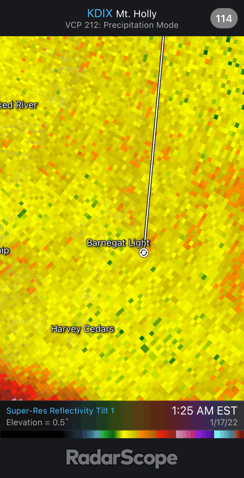
17 minutes ago, dseagull said:
I'm in Barnegat. (Waretown technically) I keep thinking this edge is gonna slide out, but the pivot is dumping on us. We may EEK out a legit 9.5-10 5 inches
You are clearly in Beach Haven West. I just got off the parkway from my hunting club. Nassssttyyy
Yup you guessed correctly! And yeah man this last band is some of the heaviest rates I’ve seen all day. We might eek out another 1-3”.
-
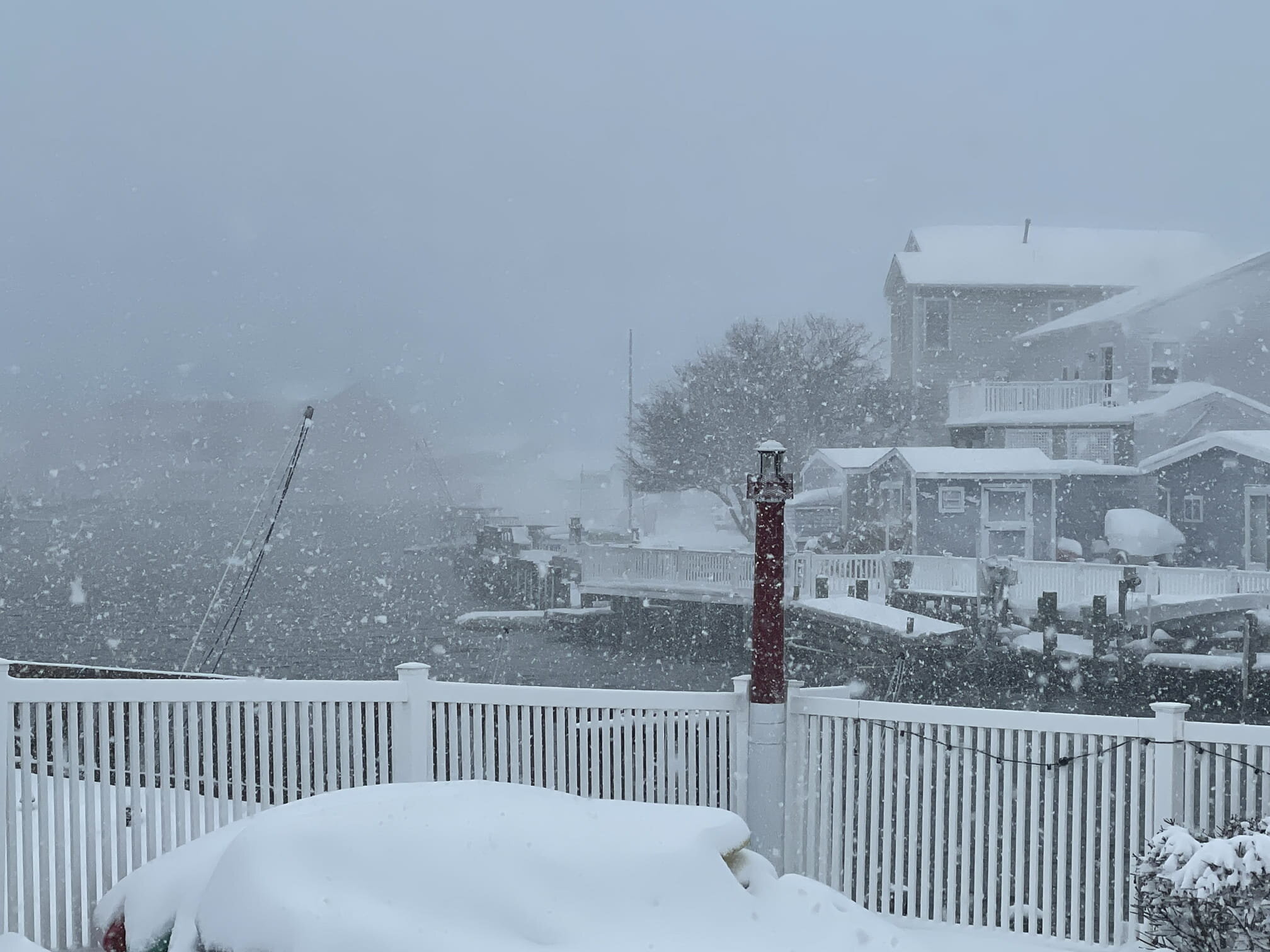
Dumping snow in Manahawkin, NJ! Been a great storm down here.

-
7
-
-
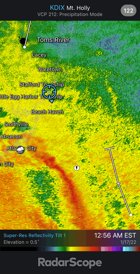
Man Cape May has been getting rocked all day. They have to end up over a foot of snow
-
2 minutes ago, dmillz25 said:
NAM is coming north from what I’m seeing
Agreed
-
Can someone please post the 18z Euro snow map for the NJ area please?
-
6 minutes ago, MJO812 said:
Euro south
Awful
Can you post the snow map?
-
1 minute ago, Ralph Wiggum said:
Thinking my parents in North Cape May might need a visit tonight and tomorrow

Do it! Join the coastal crew!!
-
5 minutes ago, Hurricane Agnes said:
Sorry had to weenie you. Haven't seen you in awhile.

Nothing like the threat of snow to lay to rest the threats to merge our poor little forum.
Currently 55 here with dp 51.
ETA - I know people here are afraid to make an event thread lest they jinx it but...
")
Lol im a daily lurker! I’ve been unloyal and dabbling my feet in the mid-Atlantic forum a lot lately haha. But yeah I’ll be here for obs! I think south Jersey gets rocked this time around. A lot of models yesterday were showing the precip dying as it moved up the coast but i’m starting to see some high-res models jackpotting the Jersey Shore. I know there’s usually some great forcing along the coast with these storms so I’m not surprised
-
I’m riding this one out at my parents shore house in Manahawkin. I really like my location for this. Most of the models show some really strong forcing along the cost for this one. I think I have a great shot at double digits. Its been like 4 years since I’ve seen over 10” so I’m overdue
-
 1
1
-
-
Really high winds and racing clouds picking up in Manahawkin, NJ. I am getting concerned as my area is still juiced as we didn't see much rain and clouds earlier and the upper level winds are racing...
-
1
-
-
5 minutes ago, hazwoper said:
Blizzard get on this one too. LOL
This appears to be real. Likely an F3 or even F4 went though this town based off the video footage I’ve seen
-
3
-
-
Just now, weathernut85 said:
Wait is this forreal? The other footage was incredible but, (to quote Twister), “mother of God…”
Old pic from Oklahoma
-
1
-
-
1 minute ago, hazwoper said:
Is this verifiable? Looks more like Kansas
FAKE I reverse image searched it. Its from OK
-
 1
1
-
-
14 minutes ago, Birds~69 said:
What is there really to talk about till it happens? Same goes w/T-storms. We all know there's a good chance.
Tornado watch has already been issued for Balt/MD areas and they'll probably extend it into NJ...
A Tornado Watch has been issued for Anne Arundel, Howard, Montgomery, Prince Georges, Carroll, Frederick, Cecil, Baltimore, Harford, Calvert, Charles and St. Marys counties and Baltimore City lasting through 7 p.m.
Dang someone is spicy today,
Same things we always talk about with weather… model output parameters, timing, forecasts etc.
Not sure why everyone is freaking out over 1-2” of rain when we could have a banner tornado outbreak today. I think from I-95 south east the rain is going to be a major fail today. NW of there is fair game for the heavy rain totals
-
1
-
-
How is no one talking about the tornado threat? Parameters are through the roof
-
1
-
1
-

January 28-30th Possible Nor'easter
in New York City Metro
Posted
46” over my house… I’ll never see a more beautiful model run in my life