
Sey-Mour Snow
-
Posts
6,995 -
Joined
-
Last visited
Content Type
Profiles
Blogs
Forums
American Weather
Media Demo
Store
Gallery
Everything posted by Sey-Mour Snow
-
Ya I hate winter rain and we didn’t have much of it this year, that was nice.
-
Definitely elevation aided wet roads down the hill , sheet of ice up here 30.1
-
I agree with a lot of this.. mostly the missed chances and the blizzard left me sour missing out on historic snow bc of the SE bump ..
-
Damn upper 70s in Canada
-
Looks like a 4-5 day window to get warm Sunday through Wednesday or Thursday.. 55-60 likely.. 65-75 if we can get a clear warm sector..
-
Please GOD, lets get 80 next week then a blizzard to close out March, then we will try the sustained warm weather for APRIL
-
EDIT Moosup CT Winter
-
DAMNNN.. I'm only a few miles SE and have .2"
-
Wow nice jealous pounding sleet still .. that’s the heavy snow zone
-
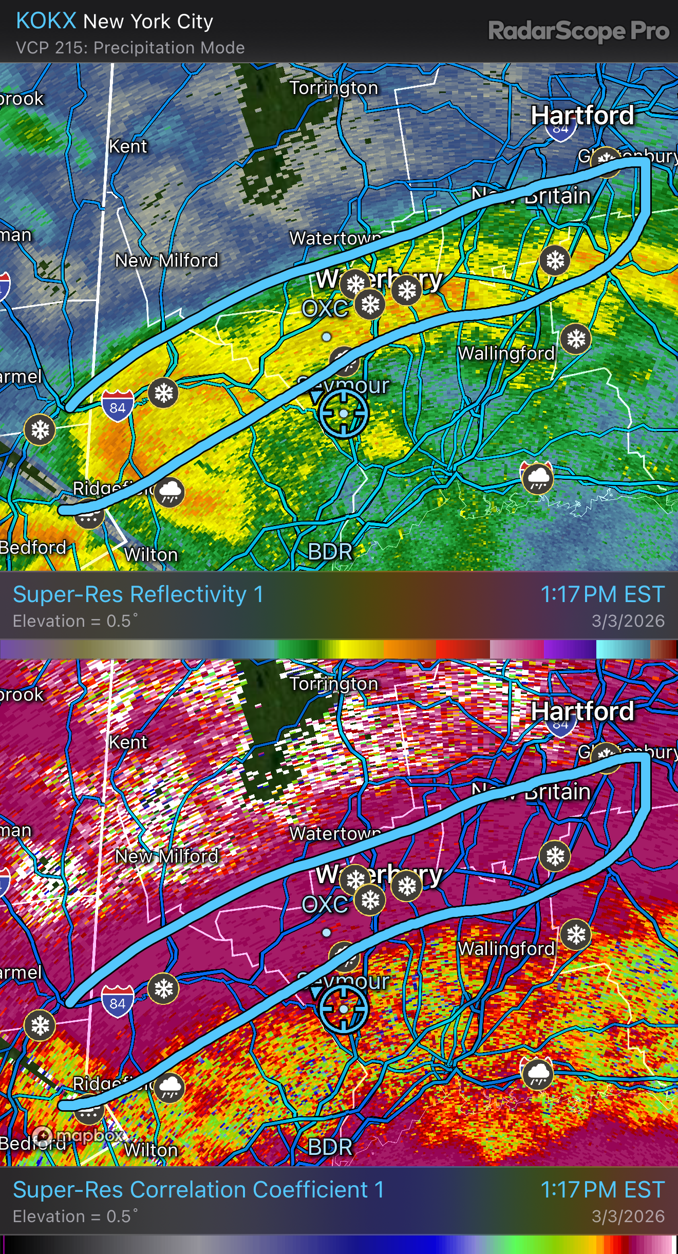
It's narrow southern 2/3rds of it is sleet
-
@Spanks45 @RUNNAWAYICEBERG what's this band doing for you? It's 100% pounding sleet here.. looks like heavy snow for you guys?
-
meh EURO is a joke of a model lately , don't care what it shows at hr 300 -340
-
They should hire @The 4 Seasons to make a HIRES one ..
-
ya it's about to pound here..
-
That average snowfall map seems suspect.. NE CT hills are well within the 25-50" while south of Boston on the coast is well within the 50-75" range.. that 25-50 " in western and NE CT has to be pushed south a good amount especially with this being 91-2020 which was an extremely snow period..
-
Middlesex County CT and the CT River Valley in Mass around Springfield local screw zones this winter..
-
Ended up being the right call here, sidewalks already slick for pickup with the radar lit up to our west with snow and sleet.. The sleet makes it worse as it doesn't melt as quickly as the snow does with the March sun
-
Sleet/snow mix now steady temp dropping slowly
-
Heavy stuff moving in soon with temp down to 30.5 elementary gets out in 15 min
-
I think it’s more about sidewalks and lots and Drieways a lot of slip risk with the kids when they get dismissed “IF” the cold holds.. still not sold as I’m up to 31 here
-
Very meh so far radar should fill in more after 12
-
More redevelops and moves in from Ohio and western PA this morning
-
Good snow growth
-
Steady light snow 29.5
-