Sey-Mour Snow
-
Posts
6,865 -
Joined
-
Last visited
Content Type
Profiles
Blogs
Forums
American Weather
Media Demo
Store
Gallery
Everything posted by Sey-Mour Snow
-
Ya im 26 already, I see the warmer guidance like EURO verifying for down here to the shore, colder valley's and northern CT should get a decent accretion though
-
I'm up 5 degrees since clouds rolled in.. HRRR is cold we will see if it's right.. mini icestorm.. I'm already 4 degrees warmer than it had for 7am
-
Not here .. we have a normally scheduled early dismissal and all the schools are on hills, should be fun between 12-1 when all schools in town dismiss today..
-
@The 4 Seasons
-
-
Ya any bit of salt in the piles vaporizes it with the sun out.
-
Crazy, pack is non existent along the shore out of the shade. Down to 3-6” here with grass showing up in spots.
-
North of Mass Pike
-
Negative .3 inches
-
Yup, told you it would stick to roads if it was steady enough, down to 29 here..
-
Snowing much harder than radar would suggest roads are terrible with this grainier snow..
-
Lol

-
Coming down good small flakes but heavy, all roads covered, it's like graupel so it's not melting on roads..
-
Stat padder but looks pretty cold this afternoon, doubt we melt the pack today, highs around freezing low dew points, gusty winds..
-
-
Hills FTW otherwise it's white rain
-
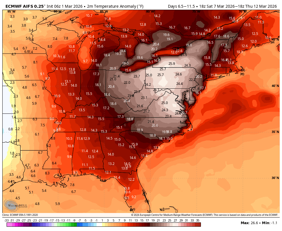
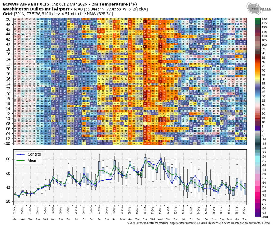
This is probably how the torch will verify, late spring to our west and southwest with 70s to 80. While we top out in the 50s and 60s outside chance one day breaks into the 70s for SNE but that will be hard to do.. Considering how nice 54 felt yesterday I'll take a week of 55-60.

-
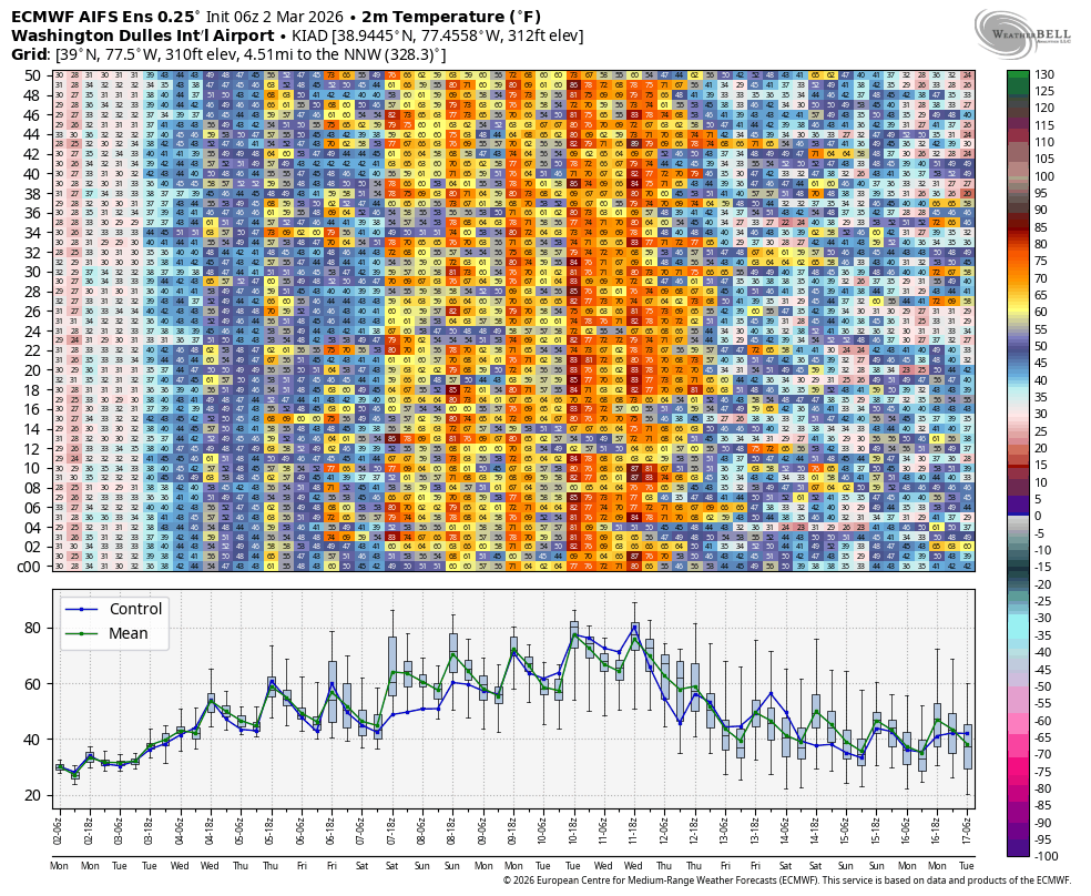
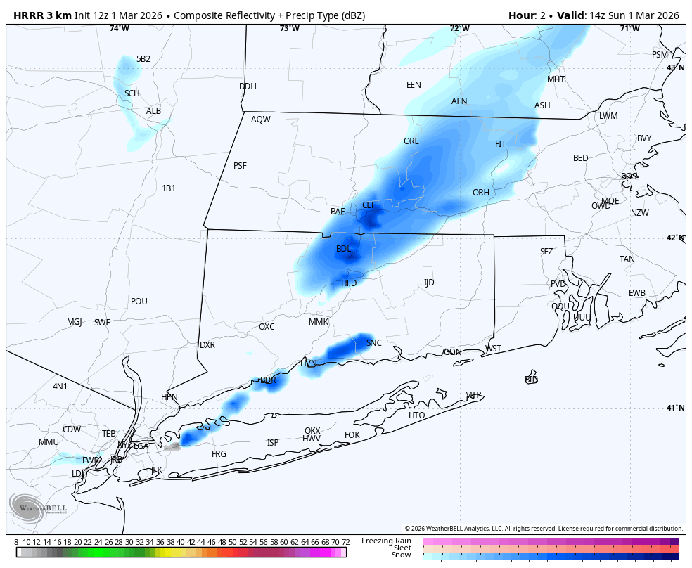
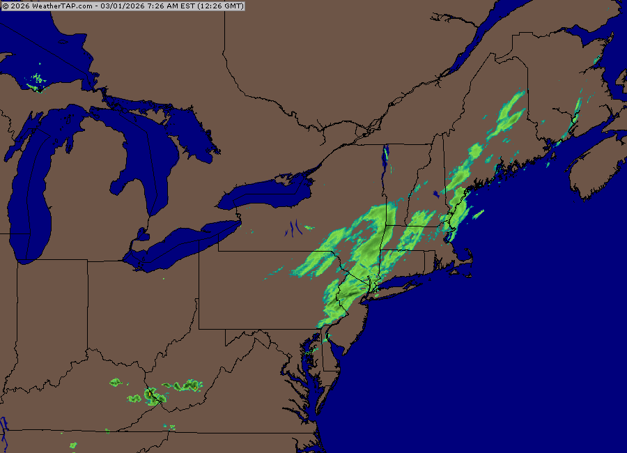
HRRR blows again for this one, officially has zero snow for all of western CT. However this is the current radar
-
glad we don't live there.. Excited for my 1.4" to get me to 64"
-
31 here
-
GFS bumped back up a touch and spreads the wealth to pike region
-
Ya I get it , sucks that it shredded to nothing for most last minute , the hope is for the few CT weenies to cash in one potentially one last one (Maybe Tuesday) before the torch..
-
ya it was .20" qpf yesterday for too big of an area, but timing wise it had the right idea, also things might be trying to tick back up qpf wise we shall see.. Euro was off with timing and has runs of .04 qpf too dry
-
It'll get cold quick overnight, if we get the same rates as Wednesday it'll stick to most roads. If only get modest rates then ya just side roads and colder surfaces, however I think this might come in as a quick 2-3 hour thump again..
-
Looks like GFS leading the way on this one, with qpf amounts and with timing.. NAM's run to run changes are laughable every 6 hours.. could be a slick morning in CT again just 2-3 hours later and on a Sunday