
Sey-Mour Snow
-
Posts
6,995 -
Joined
-
Last visited
Content Type
Profiles
Blogs
Forums
American Weather
Media Demo
Store
Gallery
Everything posted by Sey-Mour Snow
-

Thursday AM Jan 20 Anafront snow threat.
Sey-Mour Snow replied to Sey-Mour Snow's topic in New England
H triple R juicing back up ... -
Thursday AM Jan 20 Anafront snow threat.
Sey-Mour Snow replied to Sey-Mour Snow's topic in New England
Glad we don’t live there. -
Thursday AM Jan 20 Anafront snow threat.
Sey-Mour Snow replied to Sey-Mour Snow's topic in New England
Let’s see what 18z hrrr does , I’ve noticed the 0z 6z 12z 18z to be more in line with each other while in between runs waffle. -
Nice, yesterday really busted here cold wise was supposed to be lows in the teens and highs in the 20s. Ended up high 35, low 21. Today low 19 high 41 so far.
-
Lows in the single digits for SNE and barely below zero in CNE is not impressive for January.
-
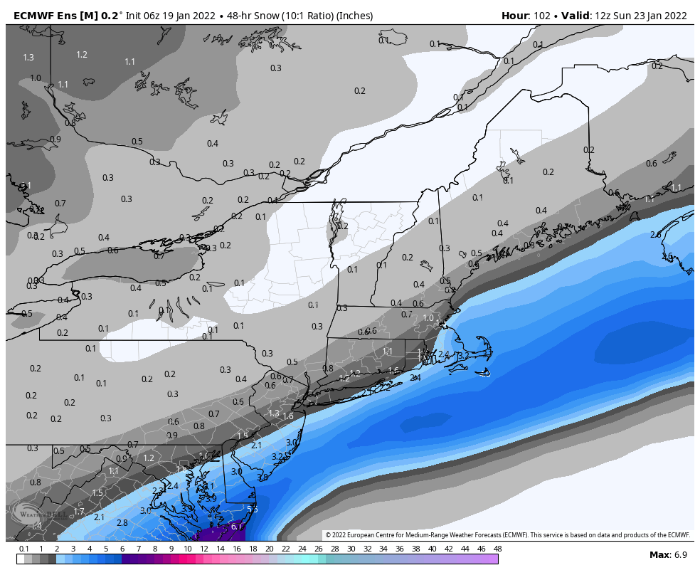
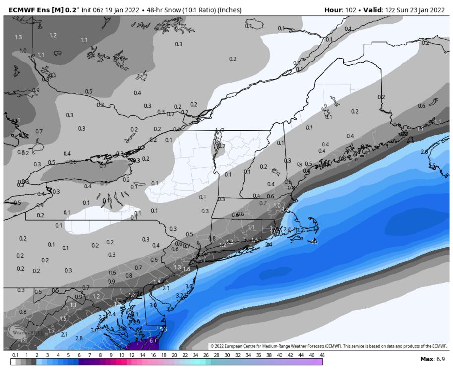
This is without the 1-3” tomorrow. So basically nothing Saturday on EPS besides islands and extreme south east mass and this is the snowiest solution for the weekend.
-
Thursday AM Jan 20 Anafront snow threat.
Sey-Mour Snow replied to Sey-Mour Snow's topic in New England
I think the problem is its mostly just central CT that is close to climo after we hopefuly get a few inches tomorrow we should be around 20" which is half climo with half the winter to go.. everyone else is way behind .. -
Thursday AM Jan 20 Anafront snow threat.
Sey-Mour Snow replied to Sey-Mour Snow's topic in New England
ya no goodski, the 3 run trend on the mesos besides hrrr is cut back 25% each run... -
Thursday AM Jan 20 Anafront snow threat.
Sey-Mour Snow replied to Sey-Mour Snow's topic in New England
still very possible but so is a coating to 1" -
Thursday AM Jan 20 Anafront snow threat.
Sey-Mour Snow replied to Sey-Mour Snow's topic in New England
It's definitely concerning 3km is like 3 hours of snow compared to the 8 hours we were looking at yesterday.. -
Thursday AM Jan 20 Anafront snow threat.
Sey-Mour Snow replied to Sey-Mour Snow's topic in New England
I'm definitely not throwing it out, maybe weight it 50% and the rest of the hi-res 50%. Sucks the nams were a widespread 4-7" yesterday.. they are pretty dry now.. 1-3" iso 4 for SE two thirds of CT may be the way to go here. -
Thursday AM Jan 20 Anafront snow threat.
Sey-Mour Snow replied to Sey-Mour Snow's topic in New England
NAM and 3km have definitely shifted well south with the goods, after the nice 12z and 18z runs, however it seems to spread the 1-2" accumulations farther north.. HRRR seems to be on amped island by itself.. -
Thursday AM Jan 20 Anafront snow threat.
Sey-Mour Snow replied to Sey-Mour Snow's topic in New England
CT and SE NE special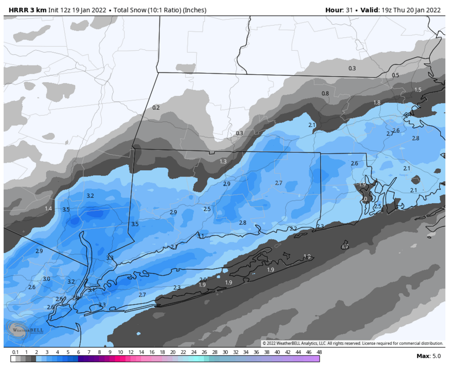
-
Thursday AM Jan 20 Anafront snow threat.
Sey-Mour Snow replied to Sey-Mour Snow's topic in New England
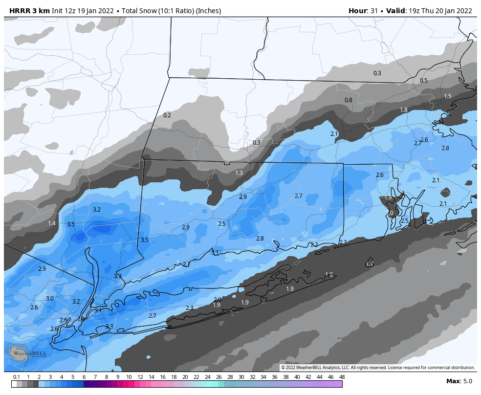
HRRR is in for a few inches as well.. -
Guidance converging on a 1-3 maybe 2-4" type deal Thursday AM for southern areas of SNE. Timing looks like 1-11am from west to east. However, surface temps look borderline to start, with temperatures 35-40 late Wednesday evening, this is likely to be a wet snow at first before temps really drop. Let's see how things trend today, 6z Euro finally getting on board for something light, while GFS and NAM are the most aggressive.
-
Monitoring a potential important TV to East Coastal storm: Jan 17
Sey-Mour Snow replied to Typhoon Tip's topic in New England
Will, what do you think of the 3km and HRRR being so cold, big difference down here in CT as well... -
Monitoring a potential important TV to East Coastal storm: Jan 17
Sey-Mour Snow replied to Typhoon Tip's topic in New England
NAM and 3KM cooler again especially 12km nam … -
Monitoring a potential important TV to East Coastal storm: Jan 17
Sey-Mour Snow replied to Typhoon Tip's topic in New England
HRRR still very cold for CT -
I actually enjoy your day 6 threads, keep them coming!
-
Monitoring a potential important TV to East Coastal storm: Jan 17
Sey-Mour Snow replied to Typhoon Tip's topic in New England
Euro snow depth algorithm says you keep 2-4" of pack.. It's forecasting 6" tomorrow night for you though, but it has you starting with just .1 today, I'm sure you have more than that glacierized since we have about 50% coverage up to an 2" here. -
Monitoring a potential important TV to East Coastal storm: Jan 17
Sey-Mour Snow replied to Typhoon Tip's topic in New England
Seems like 9z would be a good cutoff for frozen for southern CT maybe 10-12z by the time you get to NE corner? -
Monitoring a potential important TV to East Coastal storm: Jan 17
Sey-Mour Snow replied to Typhoon Tip's topic in New England
Ya, anything is better than all rain especially if we can mute the heavy rain to less than a quarter of an inch, and keep from torching.. -
Monitoring a potential important TV to East Coastal storm: Jan 17
Sey-Mour Snow replied to Typhoon Tip's topic in New England
GFS verbatim is mostly snow for Kevin, only .1 to .25" qpf as rain.. again thats just 12z gfs verbatim -
Monitoring a potential important TV to East Coastal storm: Jan 17
Sey-Mour Snow replied to Typhoon Tip's topic in New England
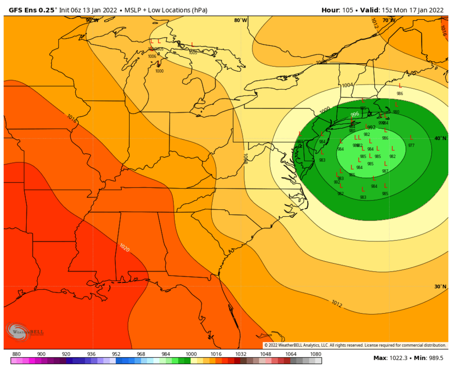
They don’t look too different .. lol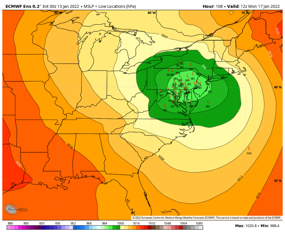
-
Monitoring a potential important TV to East Coastal storm: Jan 17
Sey-Mour Snow replied to Typhoon Tip's topic in New England
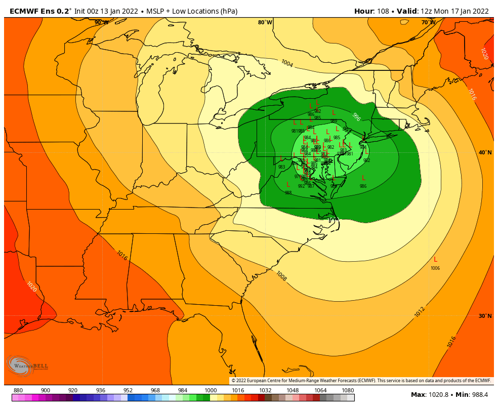
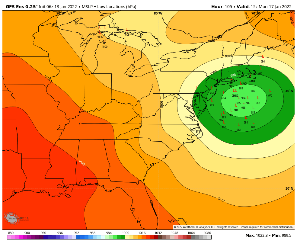
What’s up with GEFS being so far SE, interesting… we take