Sey-Mour Snow
-
Posts
5,907 -
Joined
-
Last visited
Content Type
Profiles
Blogs
Forums
American Weather
Media Demo
Store
Gallery
Everything posted by Sey-Mour Snow
-
If you toggle back and forth on the 12z run every single feature in the country moved west 25-50 miles… that is really weird…
-
Ha yes of course, I like the recent consistency and general agreement on ensembles for the long range.
-
Yes, I saw that, I think people as far east have you should have some hope for Friday..
-
Ok good to hear, not great with remembering past patterns.
-
Amazing look, keeps on getting better in the Pacific on all guidance.. One thing I noticed on today's EPS seems like the mean trough has pushed a bit far east on EPS to be perfect for storms to ride up the coast or is that just me?
-
EC close but a bit late , I love the gifs now lol
-


-
Not sure if this animation will work.. triple phaser?
-
I'm on weatherbell, but I'm sure pivotal or TT has it
-
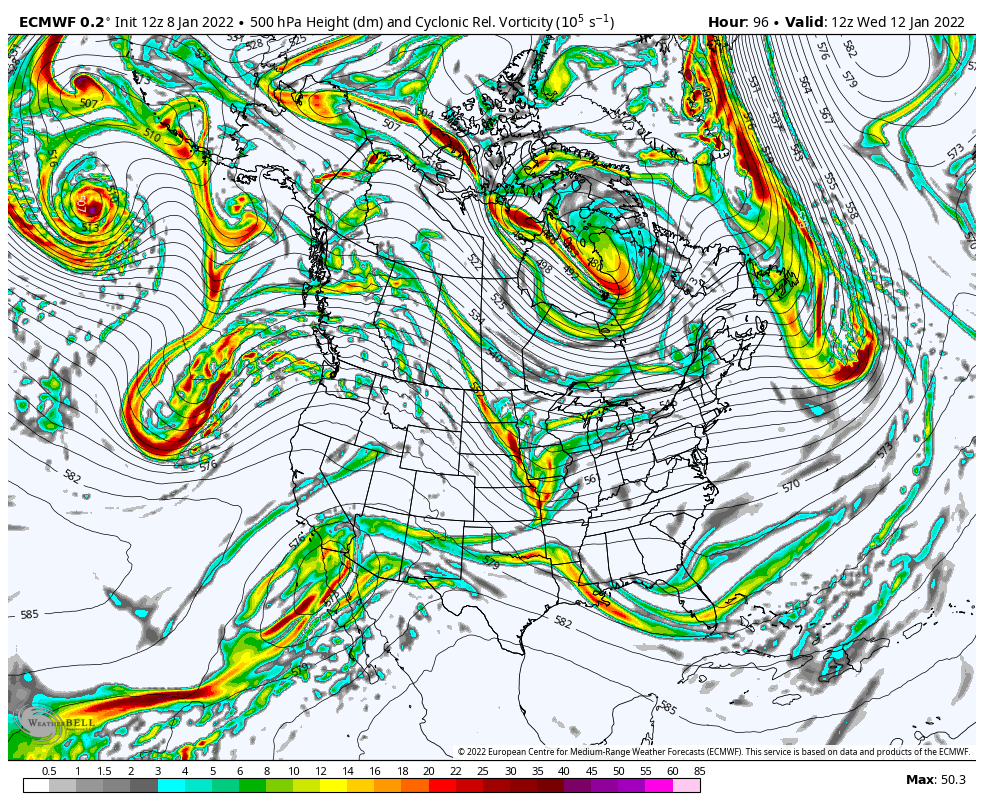
Do yourselves a favor and check out Euro Control run today, 3 monster blizzards, day 8, day 11, day 14.. One for everyone, some get all 3..
-
Clown range .. day 12.. we’d do ok, a few feet
-
@40/70 Benchmark would throw his computer out the window if that ever verified verbatim. LBSW
-
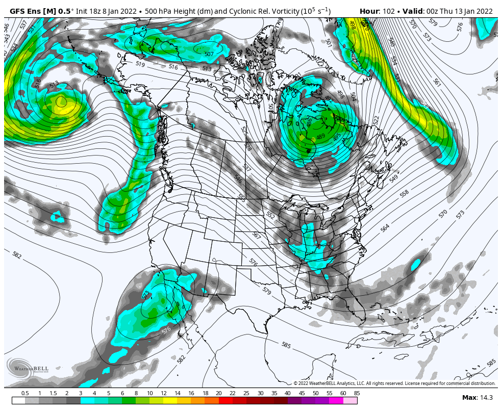
Long range GEFS look absolutely frigid with the trough moving into a favorable position.
-
jc-ct?
-
you had great snow growth, he didn't makes total sense..
-
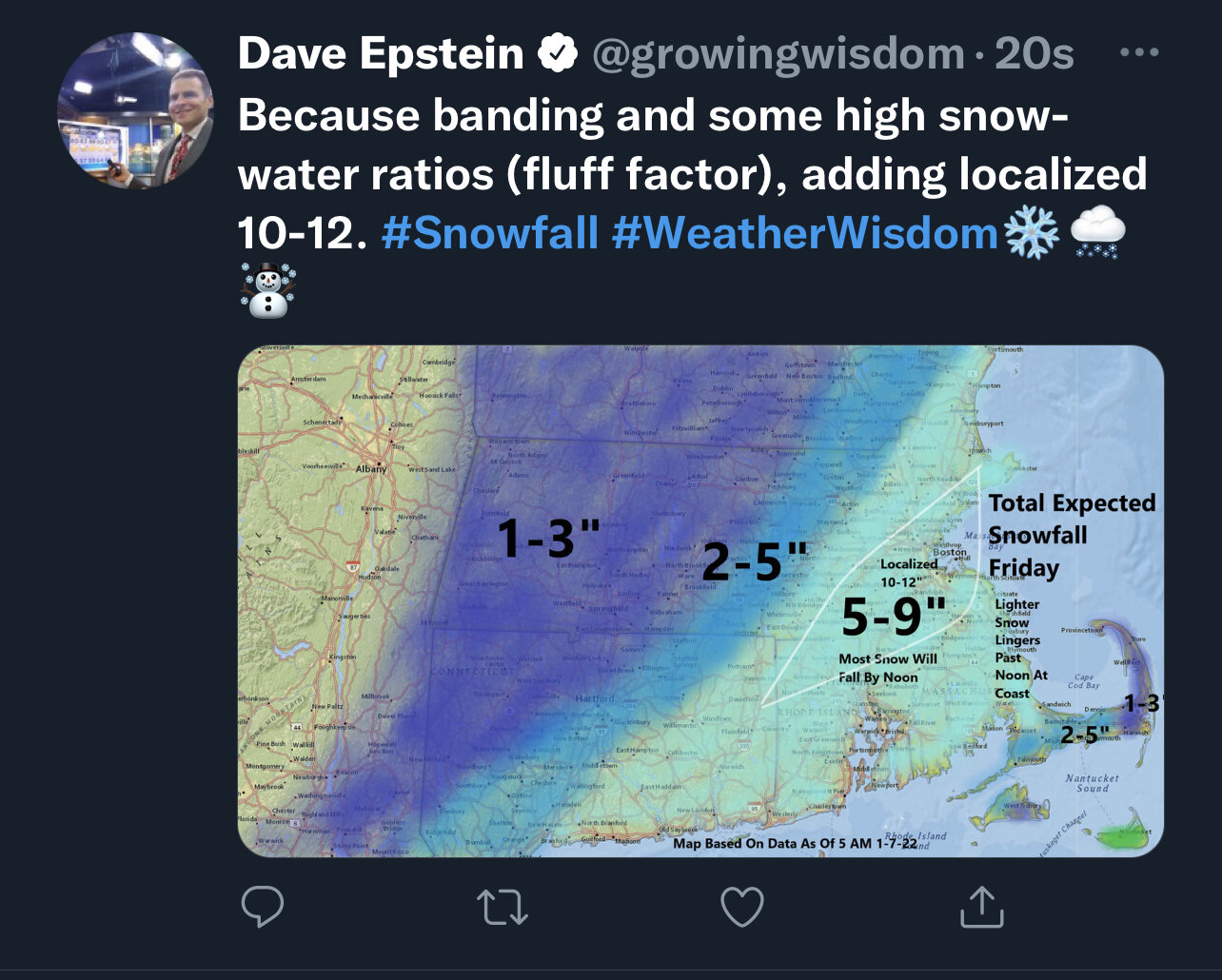
What are the reports in Boston area?? Looks like they’ve been in that band since 3:30am
-
Yes.
-
We figured 4-8” bc of the fronto but man was it close. Got lucky was on the right side of the band. Less than an inch in parts of Litchfield county.
-
Stein very confused. Posted at 7:10am…

-
8.7” should finish with 9”
-
30:1 ratios Weymouth
-
8.3" 1.6" rate
-
Widespread 8-12" amounts coming in SE of 84.. more widespread than I thought..
-
ya 12-15" very likely for east central CT.. wow..
-
7.2" down to around an inch an hour, another big band getting ready to move in, this should do it, hope to hit 10"