wxsniss
-
Posts
5,815 -
Joined
-
Last visited
Content Type
Profiles
Blogs
Forums
American Weather
Media Demo
Store
Gallery
Everything posted by wxsniss
-
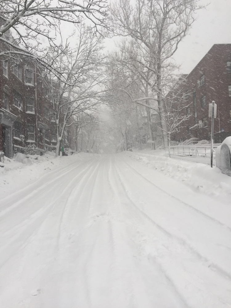
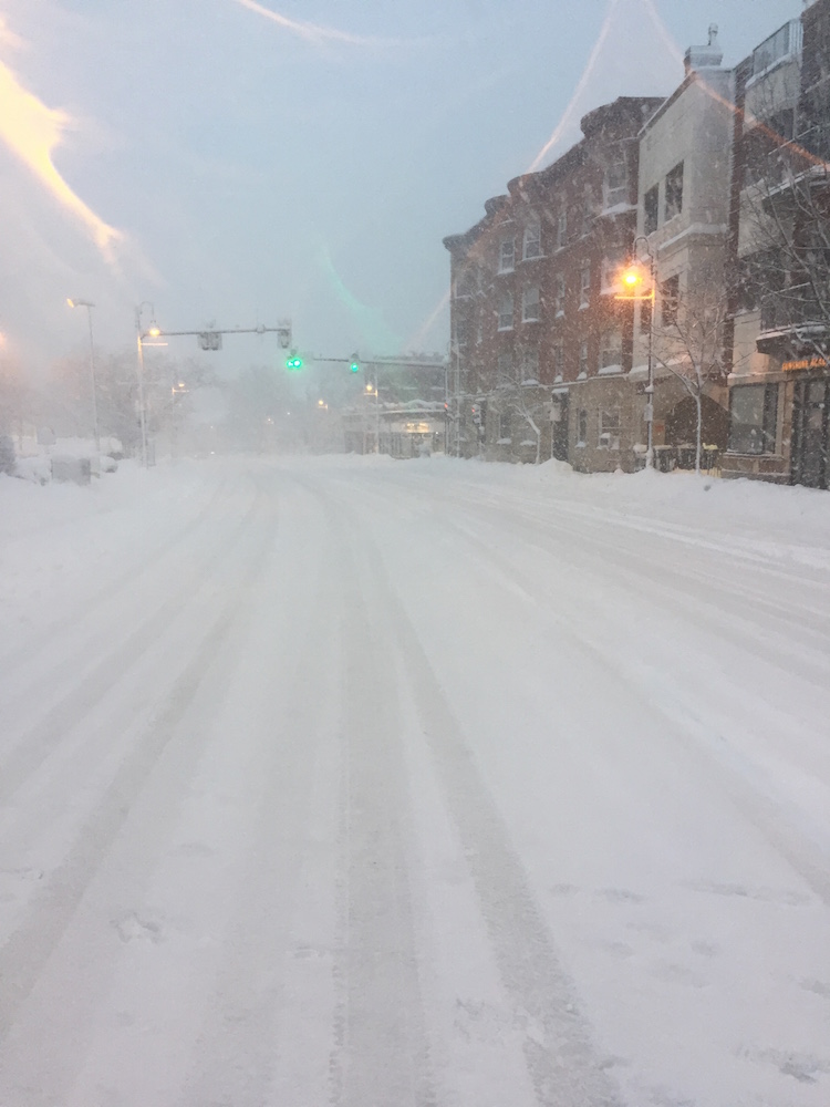
Ground truth is really delivering, wow... And look what Boston metro area and much of eastern SNE has to look forward to later tonight:
-
upstream returns looking really healthy for eastern MA 1-5 am should deliver some good stuff:
-
0z HREF looks great for most:
-
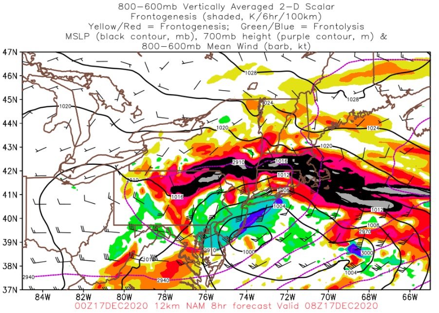
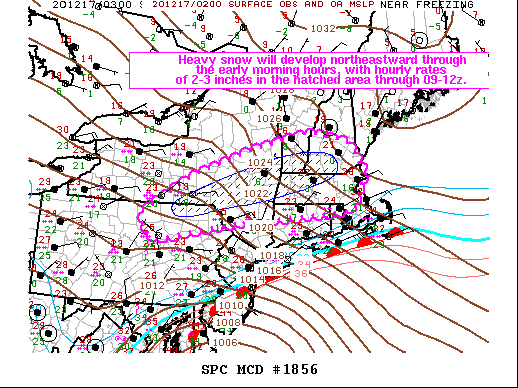
Mesoscale Discussion 1856 NWS Storm Prediction Center Norman OK 0912 PM CST Wed Dec 16 2020 Areas affected...Extreme northeastern PA...parts of southern/eastern NY...northern CT...western and northern MA...southern NH/VT Concerning...Heavy snow Valid 170312Z - 170915Z SUMMARY...The primary band of persistent heavy snow will orient from southern/east central NY across northwestern MA to southern VT/NH through the early morning hours, with 2-3 inch per hour rates expected through 09-12z. DISCUSSION...A 1002 mb surface cyclone along the MD coast will continue northeastward through early Thursday morning, just off the southern New England coast. Very strong low-midlevel warm advection has contributed to heavy snowfall the past several hours across parts of PA/NY into southern New England. A warm nose in the 850-700 mb layer (temperatures near or just above 0 C), and ocean influences near the coast have resulted in mixed precipitation spreading northward across NJ and Long Island, and this trend will continue into coastal areas of southern New England overnight. Additionally, the midlevel dry slot has reduced saturation in the dendritic growth zone (generally 600-500 mb layer) from south to north, which has reduced snowfall intensity and also contributed to mixed precipitation types. Northwest of the dry slot, the longer-duration heavy snow is expected, with some banding structures and embedded convection in association with weak static stability and focused frontogenesis in the midlevels. Here, ascent will be maximized in the dendritic growth zone for several hours and temperature profiles will remain well below 0 C, which will support snowfall rates of 2-3 inches per hour through about sunrise.
-
First flakes Brookline!
-
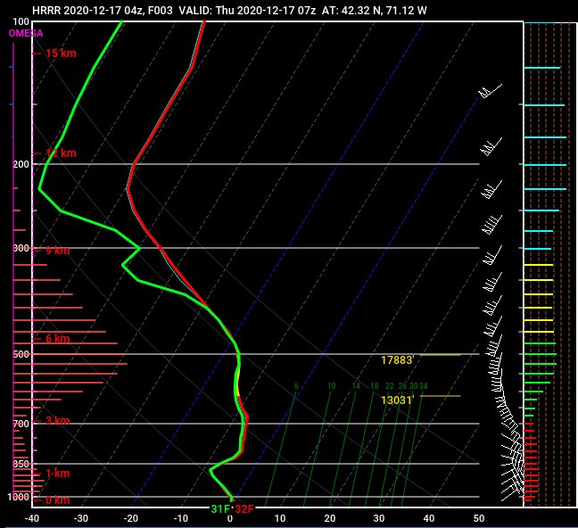
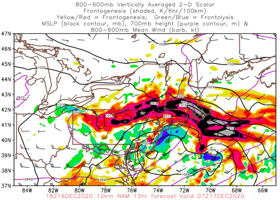
Yeah this will actually take a bit of strategy lol... For our area, I'm thinking best rates from WCB portion will be 1-5am... also will be fun to nowcast the CF flirting with the Boston metro for several hours, should see some enhancement north of that
-
2am-7am will be a blast for much of SNE...
-
Active mid December with multiple event potential
wxsniss replied to Typhoon Tip's topic in New England
Upstream obs... Philly area was getting 40-50+ dBZ, heavy snow WAA thump will rock tonight... might take some creative sleep strategies to be up for the best of it -
Active mid December with multiple event potential
wxsniss replied to Typhoon Tip's topic in New England
-
Active mid December with multiple event potential
wxsniss replied to Typhoon Tip's topic in New England
6z HRRR steady as she goes, slightly more robust than 0z HRRR... 6z NAM same Widespread 10-16" most of SNE, spots higher CF gets to just barely past Boston -
Active mid December with multiple event potential
wxsniss replied to Typhoon Tip's topic in New England
Better for much of SNE More uniform... maybe better warm conveyor belt into MA, less robbing from that convective blob, and as a result more uniform spread between the WAA and midlevel banding -
Active mid December with multiple event potential
wxsniss replied to Typhoon Tip's topic in New England
The issue we were talking about yesterday... that next-in-line shortwave digging more is interfering and de-amplifying our trough You can see it's less an issue on the 12z NAM -
Active mid December with multiple event potential
wxsniss replied to Typhoon Tip's topic in New England
Yep... while ptype and dryslot issues starting to creep into southeast MA Great banding signature to MA/NH border Ukie and NAM now more alike than Euro -
Active mid December with multiple event potential
wxsniss replied to Typhoon Tip's topic in New England
Yeah this is not done trending... 6z NAM looks even more amped and further NW than 0z -
Active mid December with multiple event potential
wxsniss replied to Typhoon Tip's topic in New England
Yeah you might guess the shortwave got shredded on approach if you just looked at the QPF maps, but it's definitely better than 12z -
Active mid December with multiple event potential
wxsniss replied to Typhoon Tip's topic in New England
This is a much better solution than 12z for SNE than the QPF maps would suggest -
Active mid December with multiple event potential
wxsniss replied to Typhoon Tip's topic in New England
H5 closed already at hr 54... this is a big jump NW -
Active mid December with multiple event potential
wxsniss replied to Typhoon Tip's topic in New England
Thru 48 already looking better Better looking shortwave Downstream ridging is better Better spacing from upstream shortwave This will be tucked more NW -
Active mid December with multiple event potential
wxsniss replied to Typhoon Tip's topic in New England
Thru 36h better digging trough and downstream ridging Watching the following energy over Saskatchewan... it's digging a little more than 18z, may not make any difference but we want that to remain flat and inconsequential... that's the piece that muffed a better SNE hit on today's12z Euro -
Active mid December with multiple event potential
wxsniss replied to Typhoon Tip's topic in New England
Huge hit well into NH and VT -
Active mid December with multiple event potential
wxsniss replied to Typhoon Tip's topic in New England
Crazy weekend at work but lurking... 0z NAM way further west and the H5 changes were apparent as early as 24 hours... significantly more amped than 18z NAM and Euro Whether this represents new sampling off Pacific vs. NAM in laughable range remains TBD... maybe only takehome point is further lack of support for GFS -
March 12/13/14 Blizzard/Winter Storm/WWA etc
wxsniss replied to Bostonseminole's topic in New England
I and probably eveyone was too exhausted to do a post-analysis... thought I'd toss up some tired and probably incomplete impressions. I went back through model runs in the 48 hour leadup and compared to the obs map above. Thought this was a clear NAM winner. Feel like it's had a good season. Very clear banding signatures that happened. Euro was good too. The old EE rule and ignoring all the other model noise would have given us the best handle of this particular storm. Most guidance wanted to jackpot southeast MA, but between mid-level processes generating bands further northwest and initial boundary layer issues southeast, jackpot ended up in the 495 corridor and extended further north than most expected. RGEM was spastic and more wrong than right. GFS was a national embarrassment, pretty much ignorable. Ok with SLP track, but qpf depictions and thermals were a joke. -
March 12/13/14 Blizzard/Winter Storm/WWA etc
wxsniss replied to Bostonseminole's topic in New England
Per usual, an anomaly compared to every surrounding site. I'd expect most sites in the immediate metro area (Chelsea, Revere, Hyde Park, South Boston) near 15" after that 5-7pm band. Some other nearby reports: Somerville 19.9 733 PM 3/13 Social Media Revere 15.0 632 PM 3/13 -
March 12/13/14 Blizzard/Winter Storm/WWA etc
wxsniss replied to Bostonseminole's topic in New England
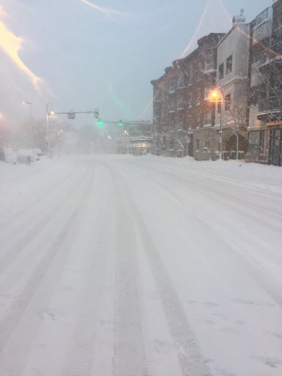
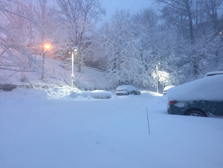
Just returned from a weenie walk around Coolidge Corner... AWT that band did not disappoint! Beautiful out there! Judging from rate of accumulation of freshly plowed pavement, that band reached rates 2" / hr. Amazingly fluffy snow, and notable lack of strong winds. I think we and Boston metro area end up 15-18" when all is said and done.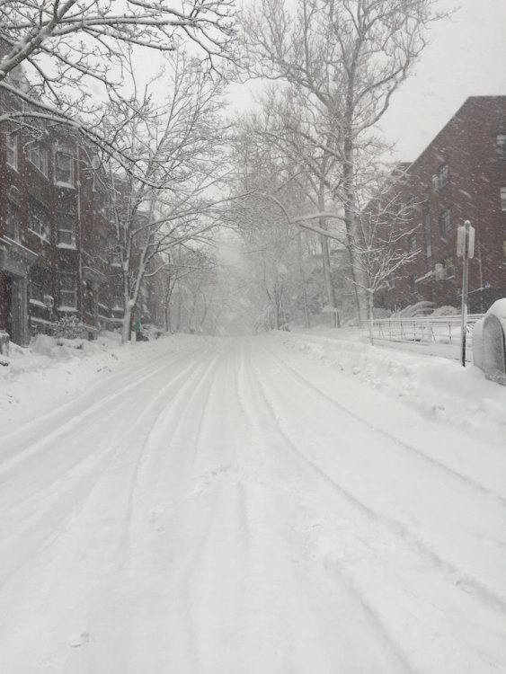
-
March 12/13/14 Blizzard/Winter Storm/WWA etc
wxsniss replied to Bostonseminole's topic in New England
Nice from Box... this is a healthy and slow band, 1-2" / hr incoming for Boston metro folks... this should get everyone into the 15-20" range: