-
Posts
2,388 -
Joined
-
Last visited
Content Type
Profiles
Blogs
Forums
American Weather
Media Demo
Store
Gallery
Everything posted by burrel2
-

Potential 1/28-1/30 2022 winter storm
burrel2 replied to Prismshine Productions's topic in Southeastern States
-
CMC and GFS ensemble mean all have a sustained +PNA in the long range.
-
Pattern looks awesome starting day 9/10. Nice western ridge, arctic front draped to our south, lots of energy swinging down in to the trough with room to amplify. Looks great!
-

Potential 1/28-1/30 2022 winter storm
burrel2 replied to Prismshine Productions's topic in Southeastern States
Even if this thing trends west... downsloping really a killer for those of us in the foothills of NC/SC/GA. Gonna need several more ticks west with the upper trough to overcome that. Need the trough to be further west so the surface low develops further south and west and we can get a more northeasterly surface fetch. Probably asking too much, but it is what it is. -

Potential 1/28-1/30 2022 winter storm
burrel2 replied to Prismshine Productions's topic in Southeastern States
I just got home and saw the 18z runs. Haven't read the thread, but i'll say this. If that sourthern vort gets completely sucked up and phased in to the trough then Eastern NC will measure in feet. It seems like something happened with these runs and that's now a distinct possibility. -
That’s all la la land but the point is after the 6-10 day warmup we could be in for another good set up. Definitely could look worse… and we are still not even to mid-February then… Mid-February has always been a great time for winter storms here historically.
-
Euro looks pretty good at 240hrs if you ask me. Nice ridge out west with some energy hanging back and the cold front sagging to our south. SER should keep it from being suppressed… maybe a good wedge set up down the line.
-

Potential 1/28-1/30 2022 winter storm
burrel2 replied to Prismshine Productions's topic in Southeastern States
I’ve got a friend that lives on the southeast coast of Delaware. He just sent me the control run… lol. It must be nice! -

2021-2022 Fall/Winter Mountains Thread
burrel2 replied to BlueRidgeFolklore's topic in Southeastern States
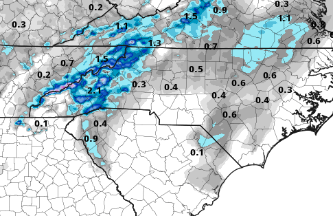
This storm looks like it's going to be an elite upslope/nw flow producer, regardless of track. Models seem pretty consistent with that. Edit: just saw I'm late to the draw with that. lol -
06z GEFS really escalated things quickly. Some super big dogs within the members
-
Gfs is really close to dragging a moderate strength gulf low across the coast in east to west fashion. We don’t need any phasing for that. In fact the phasing wit’s the northern branch sorta squashes those chances. If the 18z gfs had not been quite so diggy with the intital vort I believe it could have rolled it east and given a solid ENE tracking Miller A. You can see the gulf low develop but the northern branch squashes it just enough before it gets rolling our way.
-
Am I crazy or are the euro and gfs close to having a weak west to east moving gulf low type set up at 120hrs? If that digging shortwave can dig a little more and amplify/seperate/tilt a tad over Texas… seems like we could get gulf involvement. I know some of the gfs ensemble members showed this
-
I'm about ready to punt the late next week threat for mby. Eastern NC probably still has a small chance though. I think we have a chance after that coastal though... seems like all the modeling has some pacific energy dropping through on the heels of that big coastal. They are all handling it differently, but ensemble members are showing there's a path to a winter storm with that feature for us.
-
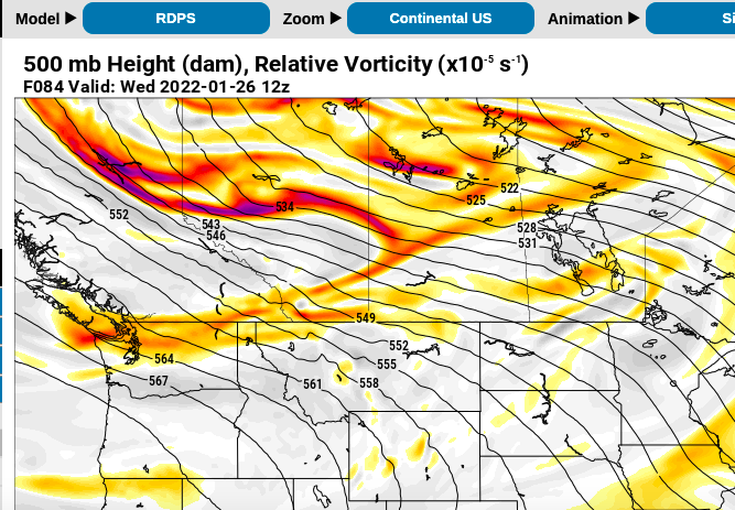
like the gfs... rgem is showing that piece of vorticity over the seattle area that winds up playing a key part in the GFS outcome... also the vorticity dropping down in the canada is way further west; another positive.
-
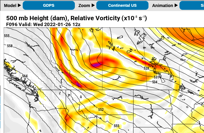
This is bit ridiculous to be analyzing, but the 84hr RGEM is a massive change from the 12z 96hr CMC in Southwest Canada in regards to our potential storm. 84hr rgem actually lines up well with the gfs now. As such, I'm going to predict the 00z CMC will be much more favorable for a winter storm when it comes out tonight.
-
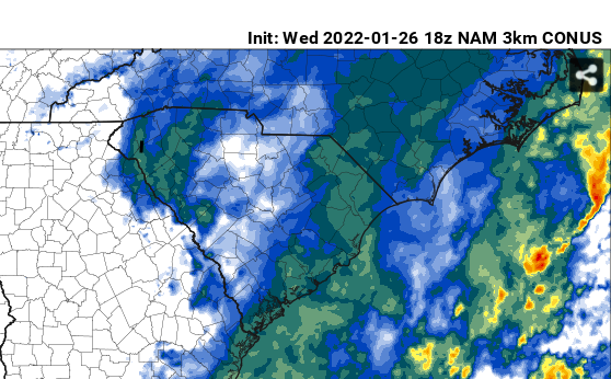
12z NAM is collapsing the boundary layer and dumping snow in North Alabama/GA with the shortwave that passes through Tuesday. Knew it would show that when we got in range. Only problem is most globals have trended away from any precip making it in to Northern AL/GA/SC. Sorta hard to believe how quickly they dampen out that wave though after it goes negative tilt back in Texas.
-
This actually looks pretty good. My biggest worry is the trough dropping down too late and too far to our east. All the models have been pretty consistent with the mega drop down and bombogenisis, it's just a lot of the early runs were doing it too late and too far east for us.
-
and there's not much ensemble support. This threat could definitely go poof with the next model cycle. It's a pretty anomalous set up in general. But all three global models having it is a great sign. We really need to keep the general look of a the wave dropping down hard enough to spark a gulf low for the next few cycles... if we do. then game on.
-
No i'm saying the threat may have some legs... as in there may be a winter storm impacting the southeast in some capacity.
-
CMC,Euro, and gfs are all giving you 18"+. I'm not sure i've ever seen a long range threat hit on all 3 global models like that. Has to be a great sign that this may have some legs. (CMC keying on a different wave, but does the same thing with it)
-
cold air out in front of this storm is pretty good, imo. Euro gets too warm b/c of the inland low track and pulling warm air off the ocean.
-
The 12z GFS and 12z Euro both have flakes starting to fly here at hr180.... that kind of agreement is incredible this far out. Almost inside 7 days with this threat too... if we can hold on to this look for a few more cycles... giddy up!
-
yea verbatim it's a little too amped and inland with the surface low to keep everyone snow. The good thing is I think the odds we miss this storm b/c it's too amped/warm is really, really low. So i'll take this run as a good sign. I'm much more worried the ridge out west won't pump high enough to cause this northern stream energy to dive bomb and amplify that hard.
-
Euro looks like it's going for glory at 144hr, imo.


