

jaxjagman
-
Posts
9,107 -
Joined
-
Last visited
About jaxjagman

Recent Profile Visitors

.thumb.jpg.049f4a7f726ada07e8cd30bd17e713cb.jpg)


-

2026-2027 Strong/Super El Nino
jaxjagman replied to Stormchaserchuck1's topic in Weather Forecasting and Discussion
-
2026-2027 Strong/Super El Nino
jaxjagman replied to Stormchaserchuck1's topic in Weather Forecasting and Discussion
Typically you see the Atmospheric River get going in a strong NINO on the west coast,so you dont see these SST'S out west.Like the NMME'S shows,Its the same into the GOM more or less downstream Out into the Yellow Sea and Sea of Japan has alot has to do with The Siberian blocking,so there's no guarantee even that that region will be warm or cold in a strong NINO. https://svs.gsfc.nasa.gov/4416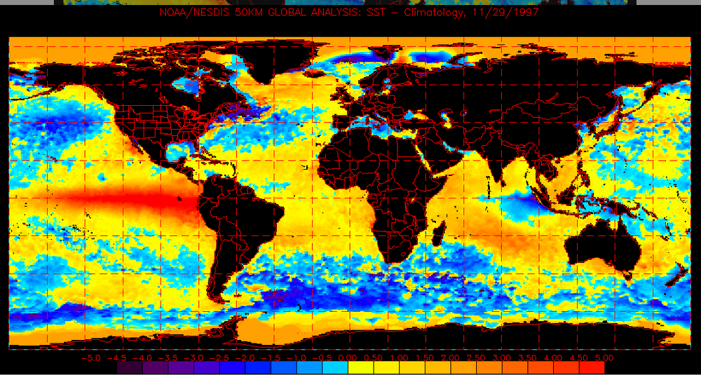
-
Did you go 55?I was watching my radar last night of the PDS,that had to be at least a EF3,i was kinda busy and couldnt watch the whole show but that was a nice couplet as it was headed towards Bube in that vicinity
-
2026-2027 Strong/Super El Nino
jaxjagman replied to Stormchaserchuck1's topic in Weather Forecasting and Discussion
Yes,im not sure even MV does maint on his sites anymore,but i still use it,so it could be wrong for sure -
2026-2027 Strong/Super El Nino
jaxjagman replied to Stormchaserchuck1's topic in Weather Forecasting and Discussion
This has been what the JMA has been showing and the folllowing year generally leads back into a NINA the following winter -
2026-2027 Strong/Super El Nino
jaxjagman replied to Stormchaserchuck1's topic in Weather Forecasting and Discussion
Seemingly or more likely we are headed towards a EQBO,i still think there would be little sample size what this winter will be,but more than likely as some of maps shown above,who knows maybe we will get suprised(ducking)..lol Edit:meant westerly WQBO -
2026-2027 Strong/Super El Nino
jaxjagman replied to Stormchaserchuck1's topic in Weather Forecasting and Discussion
i did some research a couple days ago how a strong Nino effects our area or region.In general Dec can have some strong tornadoes which surprised me because we dont see this in NINO into winter,in Jan along the Appalachian Mountains has flooding and a freak IP/SN happens in Feb Edit:Other wise its going to be AN with with temps -
2026-2027 Strong/Super El Nino
jaxjagman replied to Stormchaserchuck1's topic in Weather Forecasting and Discussion
I understand,i'd like to see it also myself..lol -
2026-2027 Strong/Super El Nino
jaxjagman replied to Stormchaserchuck1's topic in Weather Forecasting and Discussion
Thats kinda what i thought you was talking about,i dont know myself where to find that and even with the hype of a super NINA i would think the skill score of any model would be fairly low,if it even makes it to Super..JMO -
2026-2027 Strong/Super El Nino
jaxjagman replied to Stormchaserchuck1's topic in Weather Forecasting and Discussion
I think this goes out the furthest dont it?I know JMA goes through Dec,but i'm not sure this is what you are looking for https://iri.columbia.edu/our-expertise/climate/forecasts/enso/current/?enso_tab=enso-nmme -
Its been boring here,almost like 2022 where we only had 5 tornadoes the whole year,thats really surprising to me in 2022 it was mainly a moderate NINA the whole year
-
2026-2027 Strong/Super El Nino
jaxjagman replied to Stormchaserchuck1's topic in Weather Forecasting and Discussion
It seems like it could level off for a brief time,the MJO is forecast to stay into the IO for a brief time but this seems like its from the Rossby Wave train into the IO with a Kelvin Wave moving towards the Peruvian coast,you can see this as 1.2 is starting to rise now from downwelling Kelvin Wave.Another big WWB seems to be coming past mid month somewhere along the IDL -
All good,i guess work does come before play..lol..Good to see you back tho !! Its always good to read your post and Jeff during severe to read yalls thoughts.Looks like you have a shot middle of next week,lots of uncertainty in our parts. In the long range the MJO seems to be getting stuck into the IO by a Rossby Wave plus also you have a Kelvin in the east so the signal is getting destroyed.But if the -AAM can stayed coupled with the MJO,we could get rather active in the long range
-
You talk to Vortex any?I seen where they had a tornado recently around where he lives,he went AWOL on us
-
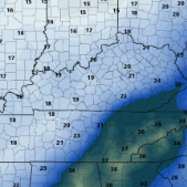
These models can be real shitty with severe,just like today.Nashville has been telling people for the last few days to not let your guard down today,which the models have been showing with basically wind dmg.We didnt get next to nothing,not even a drop of rain


