dendrite
-
Posts
73,202 -
Joined
Content Type
Profiles
Blogs
Forums
American Weather
Media Demo
Store
Gallery
Everything posted by dendrite
-
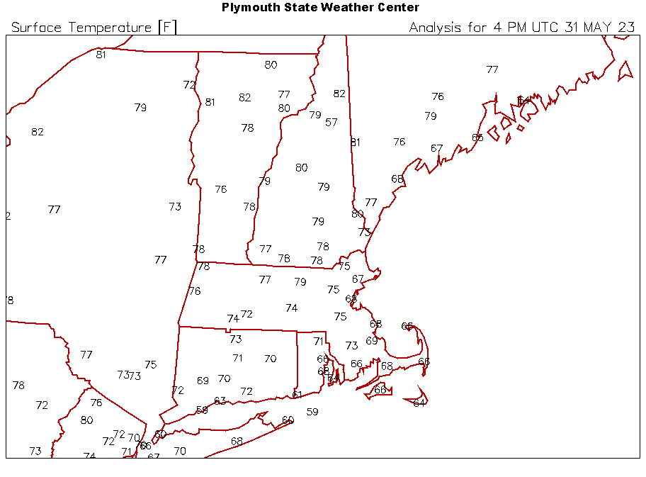
49° with occasional light showers. Not bad for noon a couple weeks from the solstice.
-

-
0.07” Terrible
-
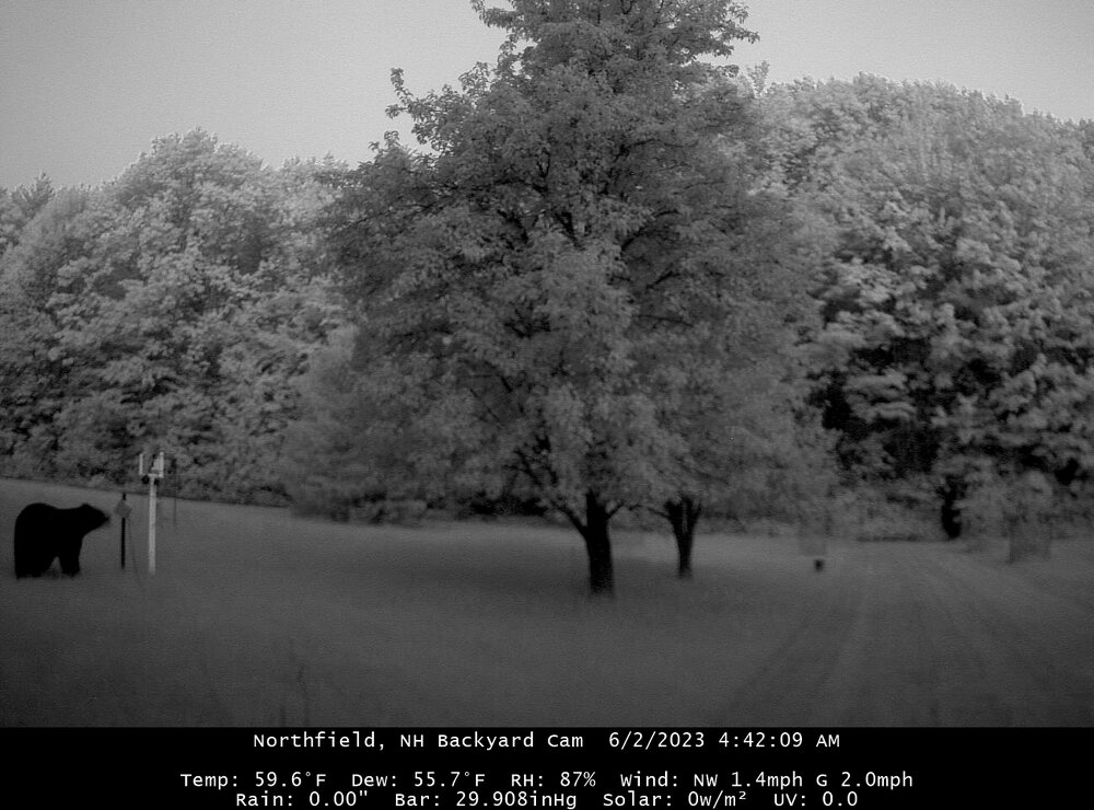
Why would bears do this? Cubs playing? They didn’t do anything to the trees…just tried trashing and crushing the fences.
-
Not boring.
-
Stein putting up a big fight here. Multiple 7-10s and the next line aiming right for here is dissipating. I need the rain.
-
It back.
-
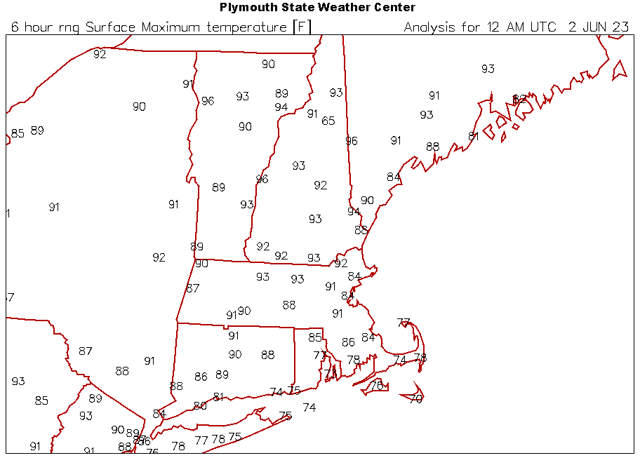
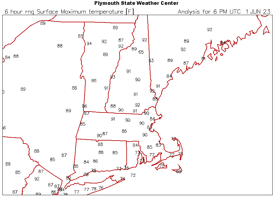
Highs today
-
I’ll go 96 only
-
LEB 95F BML 93F
-
Scorcher
-
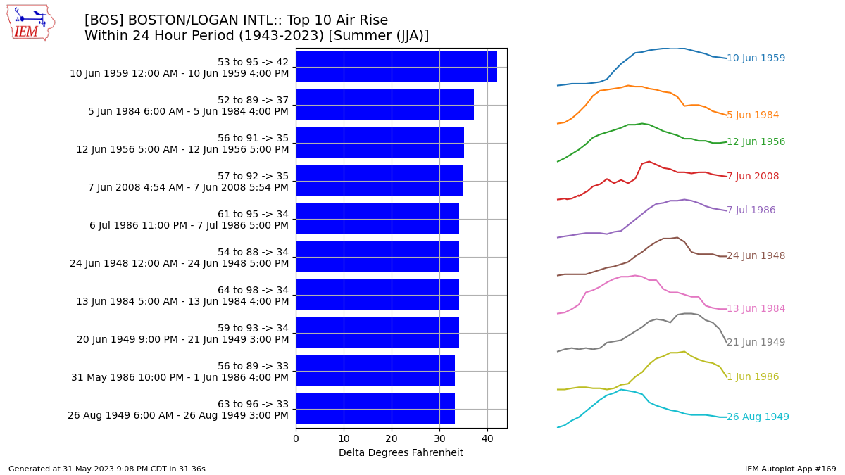
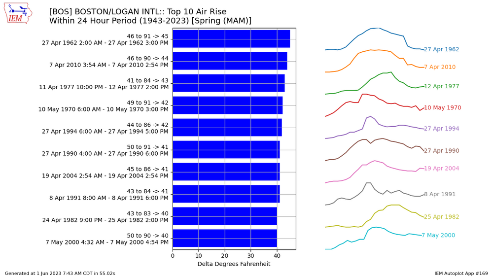
BML had a 75° rise in 24hrs one day in 95 or 96. I’d have to regenerate the image. I think it was -18 to 57. Rad cooling followed by warm sector later in the period.
-
lol...got hit by a big one this morning 5 minutes after I put the feeders out. Oh well.
-
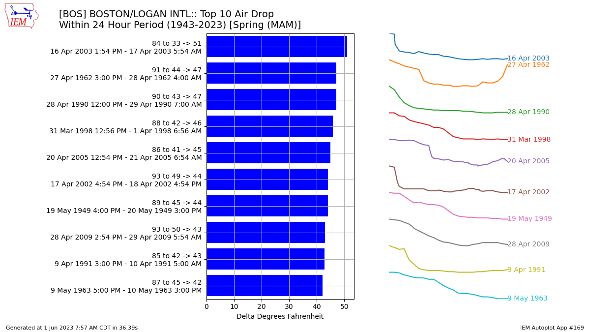
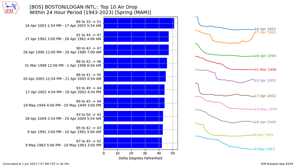
82F to 50F in 1 hr in the 2003 door. 40kt NE gust. BOS,2003-04-16 17:54,METAR KBOS 161754Z 30019G23KT 10SM FEW140 BKN200 BKN250 29/08 A2968 RMK AO2 SLP051 T02890083 10289 20183 55003 BOS,2003-04-16 18:54,METAR KBOS 161854Z 30011G20KT 10SM BKN095 OVC200 28/08 A2971 RMK AO2 PK WND 26027/1808 SLP059 T02780083 BOS,2003-04-16 19:04,KBOS 161904Z 03026G40KT 10SM BKN090 17/09 A2975 RMK AO2 PK WND 04040/1858 WSHFT 1845 PRESRR $ BOS,2003-04-16 19:54,METAR KBOS 161954Z 06023G28KT 10SM SCT095 BKN200 10/06 A2982 RMK AO2 PK WND 04040/1858 WSHFT 1845 SLP097 T01000061 $ BOS,2003-04-16 20:54,METAR KBOS 162054Z 07019KT 10SM SCT095 09/05 A2987 RMK AO2 PK WND 06029/1955 SLP115 T00890050 53064 $ BOS,2003-04-16 21:54,METAR KBOS 162154Z 08017KT 10SM FEW095 SCT250 08/04 A2991 RMK AO2 SLP129 T00830044 $ BOS,2003-04-16 22:54,METAR KBOS 162254Z 08012KT 10SM FEW110 SCT140 BKN300 BKN350 07/04 A2999 RMK AO2 SLP154 T00720044 $
-
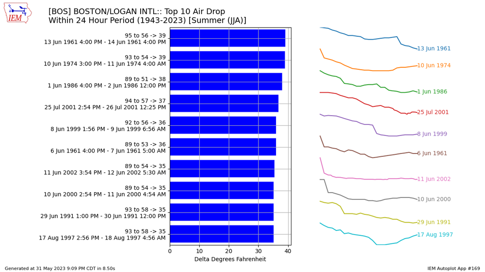
Those Apr 02 and 03 drops are pretty impressive. This is pretty gross. 91F to 59F in 1 hr. BOS,2002-04-17 21:54,METAR KBOS 172154Z 26012KT 10SM FEW070TCU SCT100 BKN250 BKN350 33/09 A2984 RMK AO2 SLP105 TCU DSNT NE MDT CU PRESENT T03280094 BOS,2002-04-17 22:32,KBOS 172232Z 02023G29KT 10SM FEW090 BKN110 BKN150 BKN250 19/10 A2989 RMK AO2 PK WND 02030/2228 WSHFT 2212 PRESRR $ BOS,2002-04-17 22:54,METAR KBOS 172254Z 03022G30KT 8SM FEW090 SCT110 BKN220 OVC300 15/10 A2994 RMK AO2 PK WND 04030/2254 WSHFT 2212 PRESRR SLP137 BINOVC MDT CU DSNT E T01500100 $ BOS,2002-04-17 23:54,METAR KBOS 172354Z 06006KT 9SM SCT110 BKN230 BKN300 13/09 A2997 RMK AO2 PK WND 03028/2256 SLP148 T01280094 10339 20128 53044 $
-
MAM
-
Well you did say summer so I wasn't too surprised. BOS record low for JJA is only 41F and that's 6/1. After 6/15 they don't have a record low below 46F. I don't think spring was that much more extreme either though.
-
-

May obs/discussion thread - Welcome to Severe Season!!
dendrite replied to weatherwiz's topic in New England
This would’ve been great during bike week. -
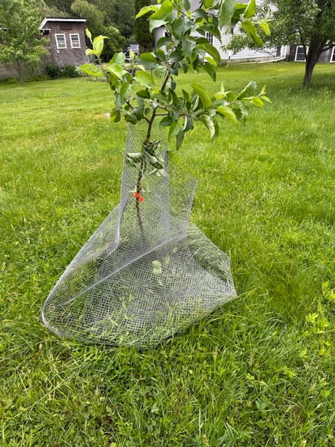
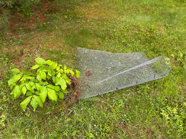
The 2023 Lawn, Garden, Landscape Party Discussion
dendrite replied to Damage In Tolland's topic in New England
I've never had a squirrel or chipmunk get around one of these baffles. -
May obs/discussion thread - Welcome to Severe Season!!
dendrite replied to weatherwiz's topic in New England
-
May obs/discussion thread - Welcome to Severe Season!!
dendrite replied to weatherwiz's topic in New England
BML leading the NH charge with 81F. NNE torchin'. -
May obs/discussion thread - Welcome to Severe Season!!
dendrite replied to weatherwiz's topic in New England
Only 46.5 here. lol Up to 63 -
Looks like cinnamon fern
-
May obs/discussion thread - Welcome to Severe Season!!
dendrite replied to weatherwiz's topic in New England
Let it in the truck and then fish bowl it.