dendrite
-
Posts
74,762 -
Joined
Content Type
Profiles
Blogs
Forums
American Weather
Media Demo
Store
Gallery
Everything posted by dendrite
-
20.0° SN Nearing an inch
-
The bodies were so close to being covered and then *poof*

-
It’s like summer convection robbing all of the moisture north of it.
-
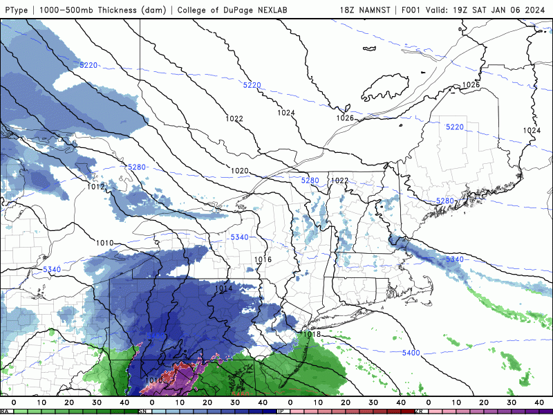
I’m not sure I’ve ever seen anything like this on a plot like this…lol
-
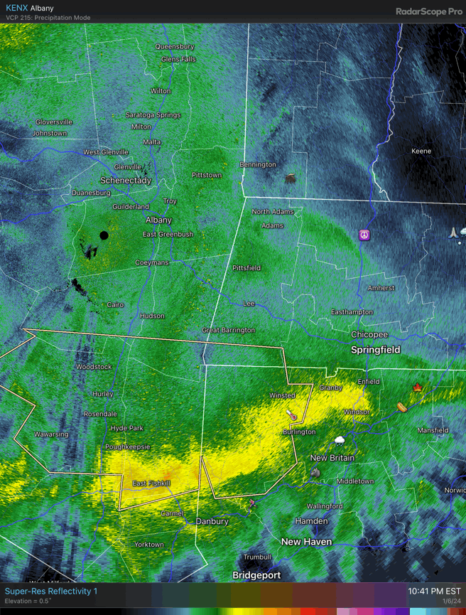
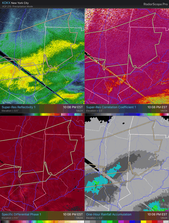
More likely with the ccb tomorrow if it really gets cranking. But like Ryan said, there’s some monster growth in SE NY moving into NW CT now. Usually when you get over 40dbz in snow there’s bright banding from the wet flakes, but cc is high with those bright reflectivities and kdp is high. The DGZ layer must be really deep with strong forcing there.
-

-
You’ll have pow for most of the WAA, but you’ll start getting pasty when you wake up around 4am. If a wire to wire paster is what you want then yeah, I agree with you it won’t be that.
-
Gangsta lean?
-
lol weenie. I said later. The event is just starting.
-
Enjoy the paste later.
-
 Hopefully we can get 10 posts at once from a strike like 2005.
 -
-
OES...it was well modeled
-
No one is dryslotting until a bit after midnight
-
28.6/23 -SN
-
Hopefully we can get Pope the jackpot.
-
Just blew the rats out of the snowblower. Euro looks good even if you lop a few inches off the kuchie.

-
All eastern mass all the time
-
Ratios. I think they may be HREF fans. It could pan out, but I think that would be my 10% upper end.
-
The first cutter’s the deepest
-
It has the max QPF axis cutting through me which would be ironic.
-
That 6z euro is nice up here with the midlevel goodies.
-
00z nam cumulative cobb ratios resulted in 14.0” for LWM, 11.8” for MHT, and 10.3” for CON. 6z GFS was 9.6”, 9.3”, 9.1” for the respective sites.