dendrite
-
Posts
73,506 -
Joined
Content Type
Profiles
Blogs
Forums
American Weather
Media Demo
Store
Gallery
Everything posted by dendrite
-
Will be some ginxy satellite porn
-
Nah…should be powder with some wind and drifting. Nothing crazy for wind though like coastal sections.
-
Well you’re right I think. Unless the track gets close to the Cape the upper slot should stay offshore. I’m still worried about some mid level dry air up here though.
-
It’s pretty much stacked early on….those “blizzard loops” happen in maturing storms when the sfc low starts getting “pulled” in by the upper low.
-
That would probably slide NE but yeah…the dry conveyor will start getting wrapped around the low.
-
None of them are. Just pick whichever one you like the most and roll with it.
-
I felt a little bad for Ray last night when he put out 18-30” or something for S NH and then immediately after the next 2 models took a decent shift SE
-
Literal shitstreaks on his maps
-
6.5”
-
It’s giving more weight to the correct ones
-
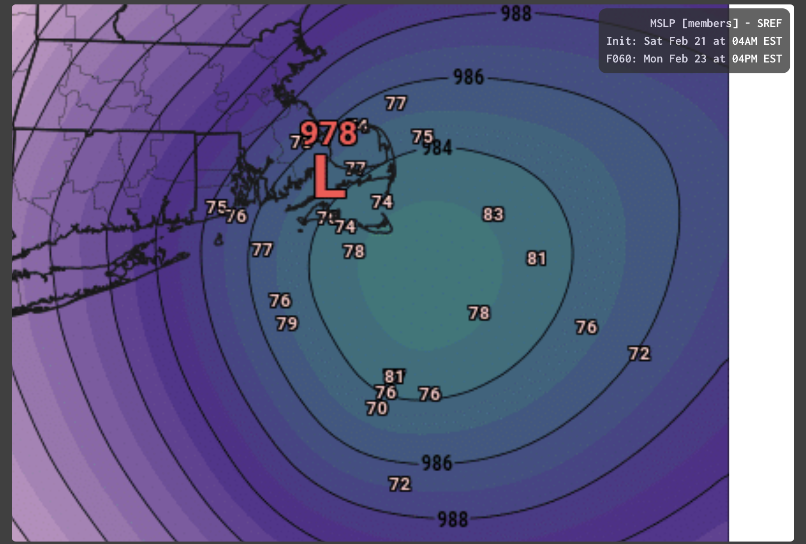
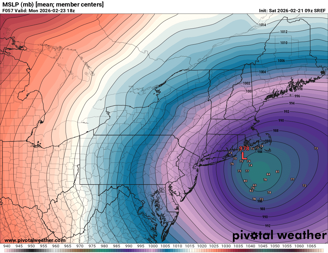
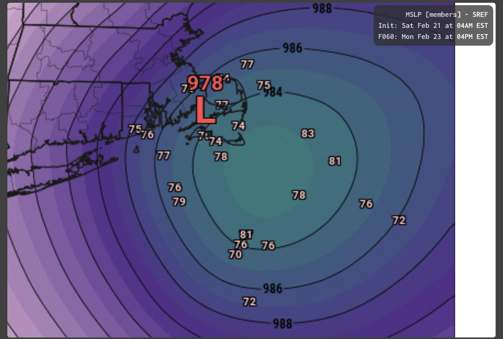
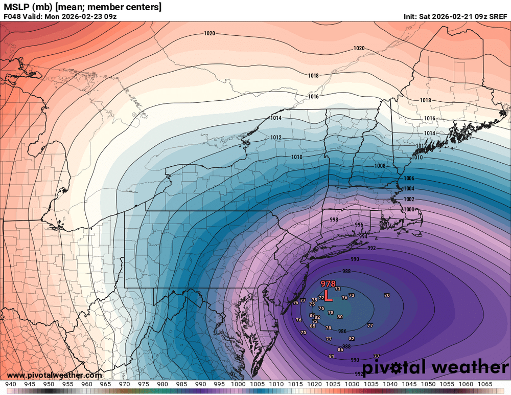
It’s seriously trying to landfall like 10-12 of those members

-
SREFs perform great in non-meteorological situations…otherwise leave them alone.
-
Lol tequila sunrise
-
Hopefully it’s a full rug pull up here so I don’t have to clear 3-5”

-
Did anyone post the 00z rufus?
-
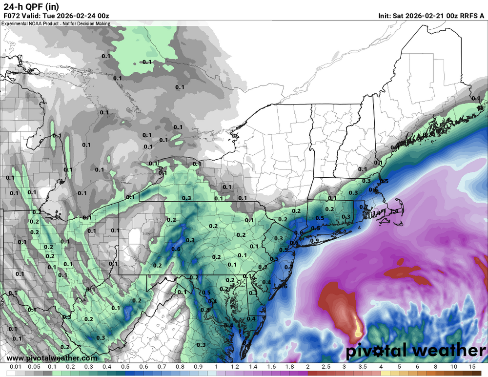
5.8”/0.50” 28.2° -SN
-
Weather willy…you don’t say…
-
Idiot
-
I really don’t want to delete more posts over stupid petty shit. Let’s have some fun and enjoy the tracking and snow.
-
Looks like Bryce’s 1-70” map
-
One over LI and one over the canal. lol
-
They call me thumpty IMG_8225.mov
-
Pounding right now despite radar looking meh
-
Ok ok ok let’s not go too far down this path. Back to weather.
-
Yeah thanks. What a first post though.