dendrite
-
Posts
73,517 -
Joined
Content Type
Profiles
Blogs
Forums
American Weather
Media Demo
Store
Gallery
Everything posted by dendrite
-
Great timing for the masshole kids following school vacay week.
-
Tip was starting to get a little ragey this morning with the S ticks. Has anyone checked on Christine?
-
A little L getting placed near strong convection early on isn’t a big deal. There probably is a mesolow associated with convection that technically has a lower mslp. The problem is if the model starts trying to feed the conveyors around it while it drifts OTS. The dynamics are still near the coast though while the real sfc low starts to develop and deepen.
-
Pretty good run for those on the northern edge and WOR
-
Reminds me of this old meme

-
Yeah some of the models are occluding this pretty quickly. Not sure what will be more correct. But it’s not often we have a 970ish long tracked seclusion going near the BM. Kinda fascinated to see how it plays out from the outside looking in.
-
@mahk_webstah
-
6z euro and rgem do it too. 3k keeps it going longer. Seems the strong WAA/fronto quickly shifts ENE along the H7 triple point on the gfs/rgem/ec
-
-
You can almost envision no snow on Tolland massif as it all blows down the hill and winds up in the Electric Blue parking lot.
-

"Don’t do it" 2026 Blizzard obs, updates and pictures.
dendrite replied to Ginx snewx's topic in New England
Proof that people will steal anything. I love the cutting board though…wish I shifted to that from a painted piece of wood sooner. -

-
"Don’t do it" 2026 Blizzard obs, updates and pictures.
dendrite replied to Ginx snewx's topic in New England
I use a large white cutting board now -
GYX shut me up pretty quick by issuing blizzard warnings for less than 12”
-
There’s some really low level echoes moving due west near PHL
-
"Don’t do it" 2026 Blizzard obs, updates and pictures.
dendrite replied to Ginx snewx's topic in New England
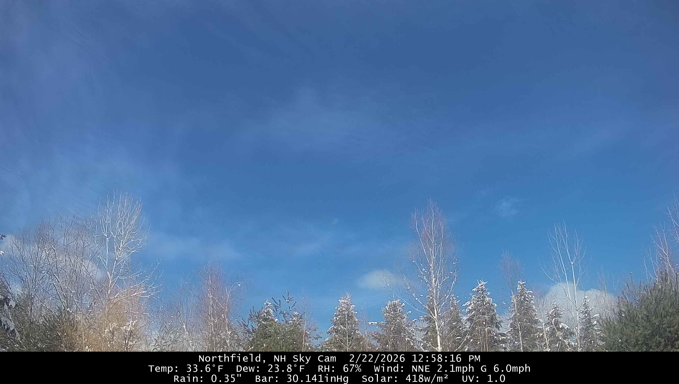
Beautiful sunny day 34°
-
I will ban everyone in SNE if you steal the end of week storm too.
-
Looks worse for NH. We’re pretty much toast.
-
Def tick SE but we’re talking like 0.1” less
-
Gotta be careful with total QPF comparisons now because some has already occurred further west
-
I’d have to dig into the warning archives but B warnings are few and far between here to begin with and I can’t recall GYX issuing one in an event under a foot.
-
We need to photoshop Scott, Brett, and Bryce into this.

-
Whatever the wheel lands on https://spinthewheel.app/uTL0HqhJgy
-
I can’t imagine any NWS office out here issuing a Blizz Warning for under a foot though. 90% of the public doesn’t know the definition of it no matter how many times you tell them.
-
Where’s my ground blizzard warning for D-1”?