

HoarfrostHubb
-
Posts
58,734 -
Joined
-
Last visited
Content Type
Profiles
Blogs
Forums
American Weather
Media Demo
Store
Gallery
Everything posted by HoarfrostHubb
-
Juicy
-
Nice. Snowing sideways!
-

11/26-11/27 Rain Ending as Snow Obs/Disco
HoarfrostHubb replied to 40/70 Benchmark's topic in New England
So appropriate for this forum though. Lol -
11/26-11/27 Rain Ending as Snow Obs/Disco
HoarfrostHubb replied to 40/70 Benchmark's topic in New England
I figured the Jack would be further East and north. Hardwick MA had 3.2”. -
11/26-11/27 Rain Ending as Snow Obs/Disco
HoarfrostHubb replied to 40/70 Benchmark's topic in New England
Wintry feel -
11/26-11/27 Rain Ending as Snow Obs/Disco
HoarfrostHubb replied to 40/70 Benchmark's topic in New England
2.5” here final. I expected an inch if lucky.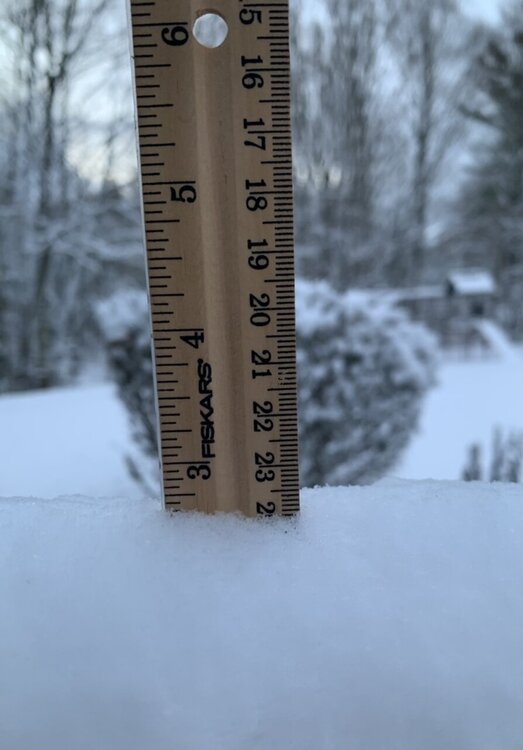
-
11/26-11/27 Rain Ending as Snow Obs/Disco
HoarfrostHubb replied to 40/70 Benchmark's topic in New England
The orange looks nice against the snow. -
11/26-11/27 Rain Ending as Snow Obs/Disco
HoarfrostHubb replied to 40/70 Benchmark's topic in New England
2.0” new here. Pretty stuff -
11/26-11/27 Rain Ending as Snow Obs/Disco
HoarfrostHubb replied to 40/70 Benchmark's topic in New England
Uncarved -
11/26-11/27 Rain Ending as Snow Obs/Disco
HoarfrostHubb replied to 40/70 Benchmark's topic in New England
Punkin Pummeler -
11/26-11/27 Rain Ending as Snow Obs/Disco
HoarfrostHubb replied to 40/70 Benchmark's topic in New England
When the frost is on the punkin’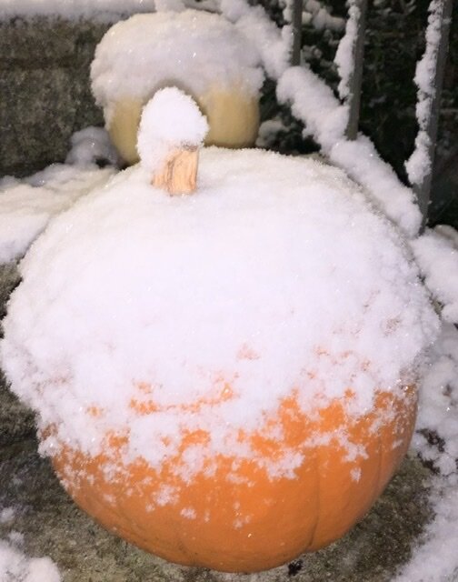
-
11/26-11/27 Rain Ending as Snow Obs/Disco
HoarfrostHubb replied to 40/70 Benchmark's topic in New England
Stone Cow Brewery in Barre on their IG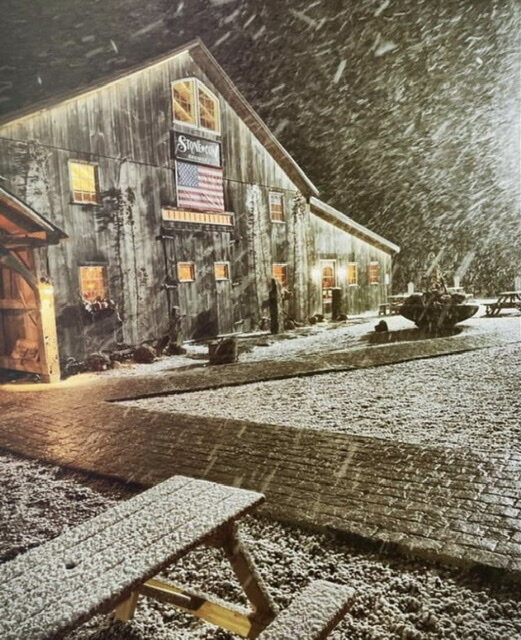
-
11/26-11/27 Rain Ending as Snow Obs/Disco
HoarfrostHubb replied to 40/70 Benchmark's topic in New England
Around a half inch on the grass. Driveway is just wet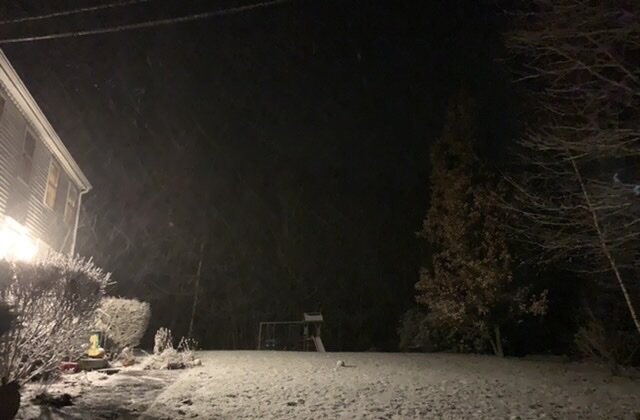
-
11/26-11/27 Rain Ending as Snow Obs/Disco
HoarfrostHubb replied to 40/70 Benchmark's topic in New England
Light snow here. Windy -
11/26-11/27 Rain Ending as Snow Obs/Disco
HoarfrostHubb replied to 40/70 Benchmark's topic in New England
39.5 here and light rain. -
11/26-11/27 Rain Ending as Snow Obs/Disco
HoarfrostHubb replied to 40/70 Benchmark's topic in New England
500 NAM The way it’s curling back makes me think Cape Anne into SNH back towards Ray look nice. -
11/26-11/27 Rain Ending as Snow Obs/Disco
HoarfrostHubb replied to 40/70 Benchmark's topic in New England
3k NAM. I had posted in the other thread -
Yep. Deleting and moving mine
-
There will be plenty of opportunities to make big calls this season that don’t come to fruition
-
Is that millimeters?
-
Of course extrapolating the NAM beyond 12 hours is risky…lol. At least there is something to watch besides my waistline today
-
Not the worst look at 500
-
That’s all I would expect as a ceiling anyway.
-
We are hoping for some white meat. Anything else is gravy. Mashed potatoes would be nice though
-
A few flakes Friday Maybe an inch or 2 in NH or Maine


