

mahk_webstah
-
Posts
10,345 -
Joined
-
Last visited
Content Type
Profiles
Blogs
Forums
American Weather
Media Demo
Store
Gallery
Posts posted by mahk_webstah
-
-
This was a good read and I think it should make our southern New Englanders who have suffered so much the last couple of years, very happy.
https://www.wpc.ncep.noaa.gov/discussions/hpcdiscussions.php?disc=qpfhsd
-
 1
1
-
 1
1
-
-
30 minutes ago, dendrite said:
Pretty wild trends the last 24hrs.
Put away your broom
-
 1
1
-
-
9 minutes ago, RUNNAWAYICEBERG said:
We needed a day like today to be confident. We know our climo here and how these trends inside 72hrs so today was clutch.
You’re back!
-
19 minutes ago, dendrite said:
You don’t want to windshield wipe it. They’re just watches…wait for another set of runs.
Well I know he knows what he’s doing. And I suppose somewhere up this way has a shot at a band with ratios. But it is an SNE special and we’ve been there before.
-
Strange that Elster kept Watches for SNH. He must be thinking good ratios.
-
14 minutes ago, AstronomyEnjoyer said:
Ah great, my hopes appear to be resting on the ICON and the 3k NAM. What a duo, haha. Gonna need me a freak deform band, zonked ratios, and some east flow to go.
Yeah we’re not gettin this one
-
 2
2
-
 1
1
-
-
That hoar gonna eat my goodies
-
1
-
-
12 minutes ago, dendrite said:
Nice run. I can push broom this amount.
Our mid level goodies getting eaten by someone else.
-
6 minutes ago, weathafella said:
Euro through 63 with the messenger shuffle. Much more confident for at least 8 for me now. Sorry Brian and Mark and Jeff et al.
I suspected this was coming. I’m glad you guys are going to get one to enjoy!
-
3 minutes ago, dendrite said:
Ukie with the Dan Patrick whiff up here
Gefs encouraging but euro will give us a sense of where this is headed. Although still time to trend and tick more.
-
12 minutes ago, NorEastermass128 said:
We’re only at a beep. Let’s honk at D4-D5. That’s when our best events show up (out of seemingly nowhere when potential is underlying)
Yes but the biggies generally show themselves a week out. Lets see where it stands tomorrow morning.
-
4 minutes ago, dryslot said:
Biggest run of your life?
for those of us who live in the moment… -
1 minute ago, NW_of_GYX said:
Starting to feel like a 3-6” forecast here
Same here with the caveat being where a band may set up for 6 to 10
-
1 minute ago, dendrite said:
Yeah it’s the NAM past 24hr so buyer beware with any run. But it was a bump north and it’s starting to feel out that H7 front up here like the globals. We’ll see how it shakes out…not worth overanalyzing the 48hr NAM.
Sometimes we do well in benchmark storms if the mid levels set up like that. I’m cautiously optimistic we can be in the northern band but it could mean that MHT is sucking exhaust
-
Just now, weatherwiz said:
That is moreso down across northern CT into southern MA. Precip is knocking on the NH border at that time
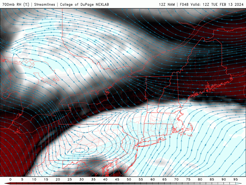
There is one on that pic posted right over the coop
-
1 minute ago, dendrite said:
Euro has 5-8” up here by 15z Tue and the NAM is dry.
What about the fronto band Wiz just posted on the nam?
-
1 hour ago, AstronomyEnjoyer said:
Now wait a minute, are you referring to me? I'm a guy, lol.
She cray
-
2
-
1
-
-
5 minutes ago, RUNNAWAYICEBERG said:
Yea. I expect it keep ticking north too. North of 84 is safe.
I kinda feel like you are getting this one. Give me a few problems at the start, but it doesn’t feel like a big north trend to me.
-
1 hour ago, Sey-Mour Snow said:
Wild loaded look for Presidents’ Day
I thought that was southern stream
-
7 minutes ago, Chrisrotary12 said:
When was our last northern stream nuke? Jan ‘05?
Is one coming?
-
For up here to get more than 6 inches I need to see more than just the euro and the Germans.
-
1 minute ago, CoastalWx said:
Euro smokes Berks into SW NH.
Early guess here is like 4-7 or so. Unless nam temps verify lol.
But yeah this will have one of those intense bands the lasts a few hours and smokes 3”+/hr at times. Probably more in the first half of the storm since the second half of it should start to pivot east.
That band is oriented and pointed towards this direction. We’ll have to see how that develops on future runs. Probably the east north east motion will cut it off west of here and move it east south east.
-
Did the euro trend in any direction?
-
5 minutes ago, dendrite said:
Still some split flow there with a weak ridge axis in western NAMER. Trough in the east. Ridging over Greenland. PV over Hudson Bay. It’s nothing epic, but we can snow with that.
Especially up here. We don’t want strong -nao, and we like -pna when there is a little help on the Atlantic side. That’s a good late winter pattern up here.
It was a Flop... February 2024 Disco. Thread
in New England
Posted
By about the end of next week, I think we are in Go big or go home territory