Interstate
-
Posts
5,731 -
Joined
-
Last visited
Content Type
Profiles
Blogs
Forums
American Weather
Media Demo
Store
Gallery
Everything posted by Interstate
-
Just like normal... it will be in Richmond before we know it
-
It looks like a foot kicking the snow away or getting ready to stomp on us.
-
IIRC... after the deep freeze... it really never got cold again.
-
Short Pump.
-
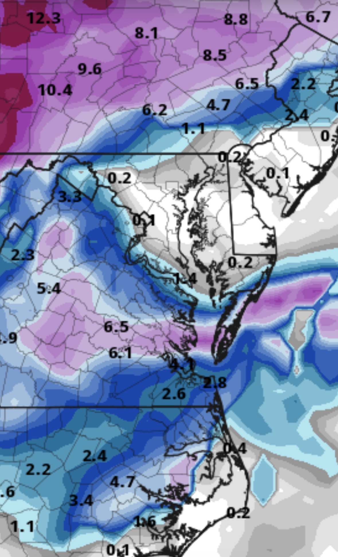
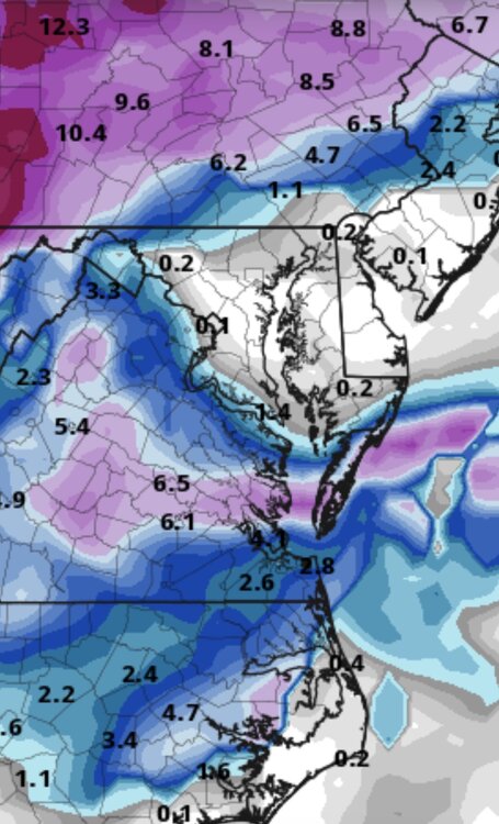
We are talking about possible light snow here on Friday and possible heavier event on Sunday... Keep up
-
I do not know if anyone knows... but the Beta version of Pivotal Weather now has the Euro 6z/18z for free.
-
Soon the GFS will shift it to Richmond
-
25.7/6.8 here in 21057. It is going to be a cold one tonight
-
He has 1K threes more then anyone else in NBA history.
-
Yep. This is better
-
I didn’t think it was still supposed to be snowing.
-

Frederick, Carroll, Baltimore, and Harford Counties Area Discussion
Interstate replied to Interstate's topic in Mid Atlantic
Yep. Never got over 27.2 for the day with .5 inches total today. -
Frederick, Carroll, Baltimore, and Harford Counties Area Discussion
Interstate replied to Interstate's topic in Mid Atlantic
It was a joke thread I made up last year when every storm missed us from the north, east, south and west. -
Frederick, Carroll, Baltimore, and Harford Counties Area Discussion
Interstate replied to Interstate's topic in Mid Atlantic
I saw this topic pop up and I thought who the $@&%^# start is thread. Lol -
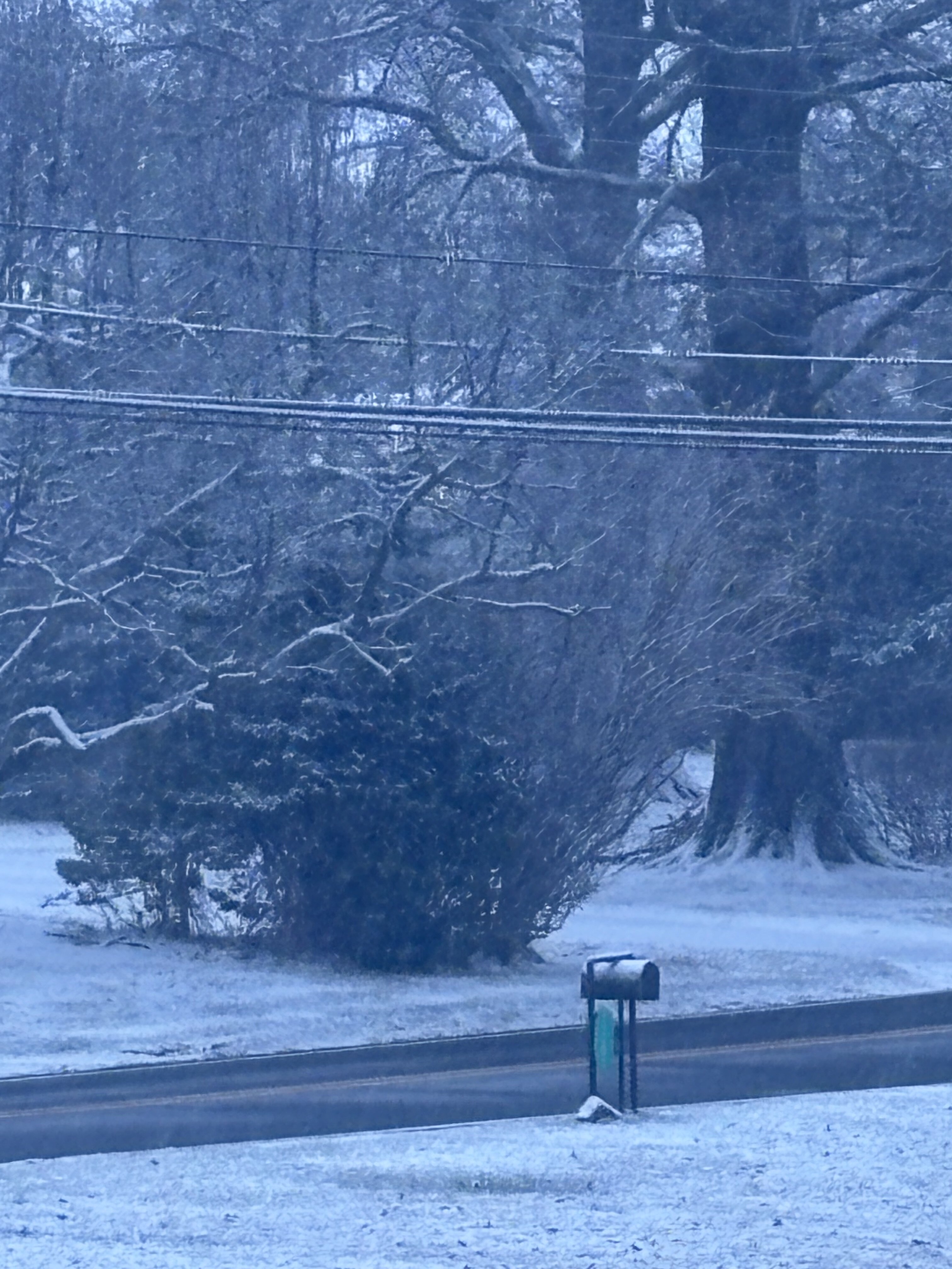
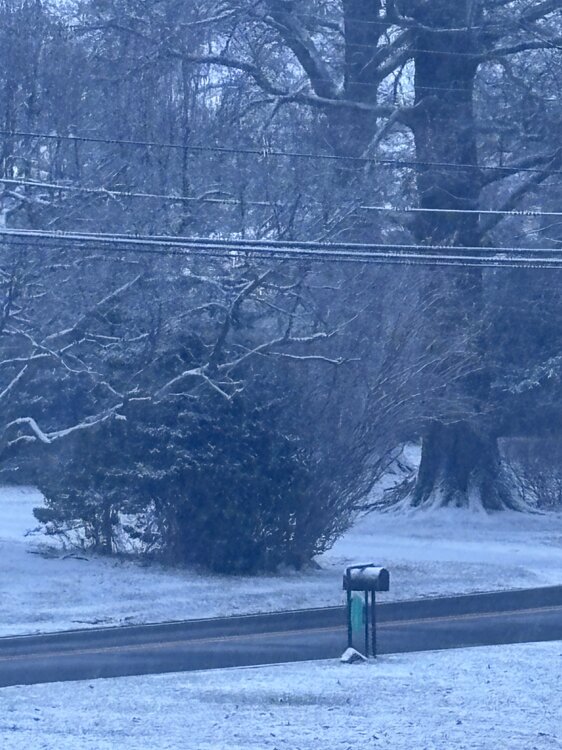
Still snowing here in 21057. Picked up a surprise dusting tonight
-
I have a coating now from that little thumb over Baltimore county.
-
Northern Counties Forcefield is up...
-
Oh you young kids. I never thought I would have to use... When I was your age...
-
Why would they delay. It was never supposed to get bad in Baltimore county. They are probably taking some backlash from Tuesday. Hell, even LWX dropped the WWA for southern Baltimore county. Like I say every year... If you as parents, and don't feel safe with sending your children to school. Don't send them. You can make the decision, someone doesn't need to make it for you.
-
What tweet was that?
-
29.5/17.3 here in 21057
-
We will this year.
-
I want Dec 8th 2013
-
Yeah... it means anyone north of DC get a thicker cloud deck tomorrow.
-
Reminds me of Jan 13th 2019... just not nearly as much.