

BrianW
-
Posts
2,008 -
Joined
-
Last visited
Content Type
Profiles
Blogs
Forums
American Weather
Media Demo
Store
Gallery
Posts posted by BrianW
-
-
13 hours ago, powderfreak said:
I also agree that it’s important to know the where and how, as it educates everyone to the danger or things to watch out for. It was lower down in a popular backcountry “bowl” called the Rock Garden. He fell into a hole or undermined area and became trapped and unable to free himself. Some of those traps are like 20+ feet down. Sounded like Rescuers had a sketchy time getting there, with a lot of undermined traps and punching through to air below the snowpack. It may look good and smooth, but with krummholz stunted trees and big boulders propping the fluffy snowpack up with a lot of air underneath, it’s like a whole zone of trap doors. My mind goes to all the thaws and warm weather, the rocks and trees absorb the heat and melt snow around them all winter. Then we get a big cycle of fluff and wind to cover it all up. You end up immobile or upside down, alone… I don’t know enough about it to know how much a partner would’ve helped, but the alarm would’ve sounded immediately instead of hours later.
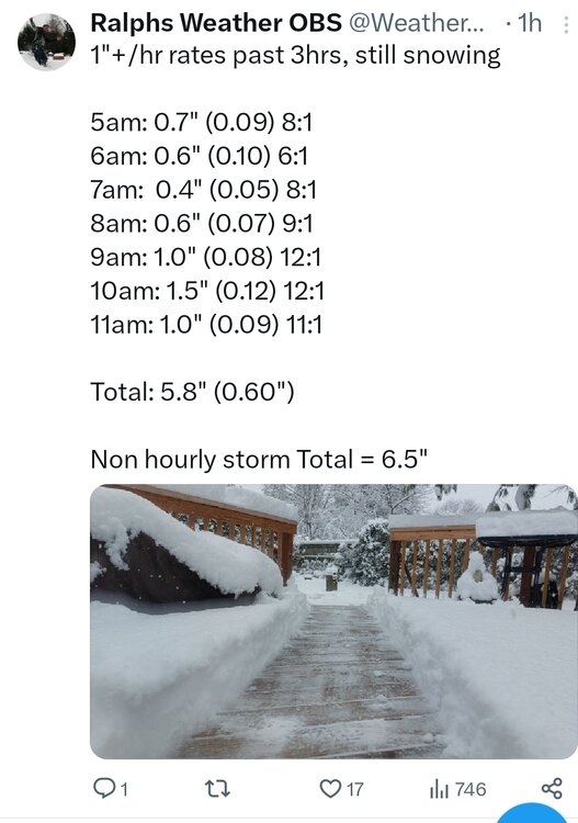
Thanks for the info. I found a YouTube video from the area. Seems like an insane area to ski by yourself. So the skier fell into something like at 35 seconds into the youtube video?
-
 2
2
-
-
2 hours ago, dendrite said:
MWN 147mph. Damn.
Nice 50 degree temp change there as well.
.thumb.png.452cbaaf4e7743f9457d209f7e9d3c5e.png)
-
1
-
-
7 minutes ago, powderfreak said:
I’m happy for the vacationers. Almost every holiday period for multiple years has included rain it seems like, ha.
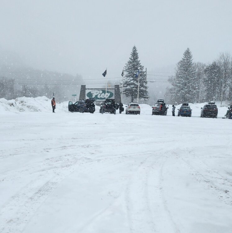
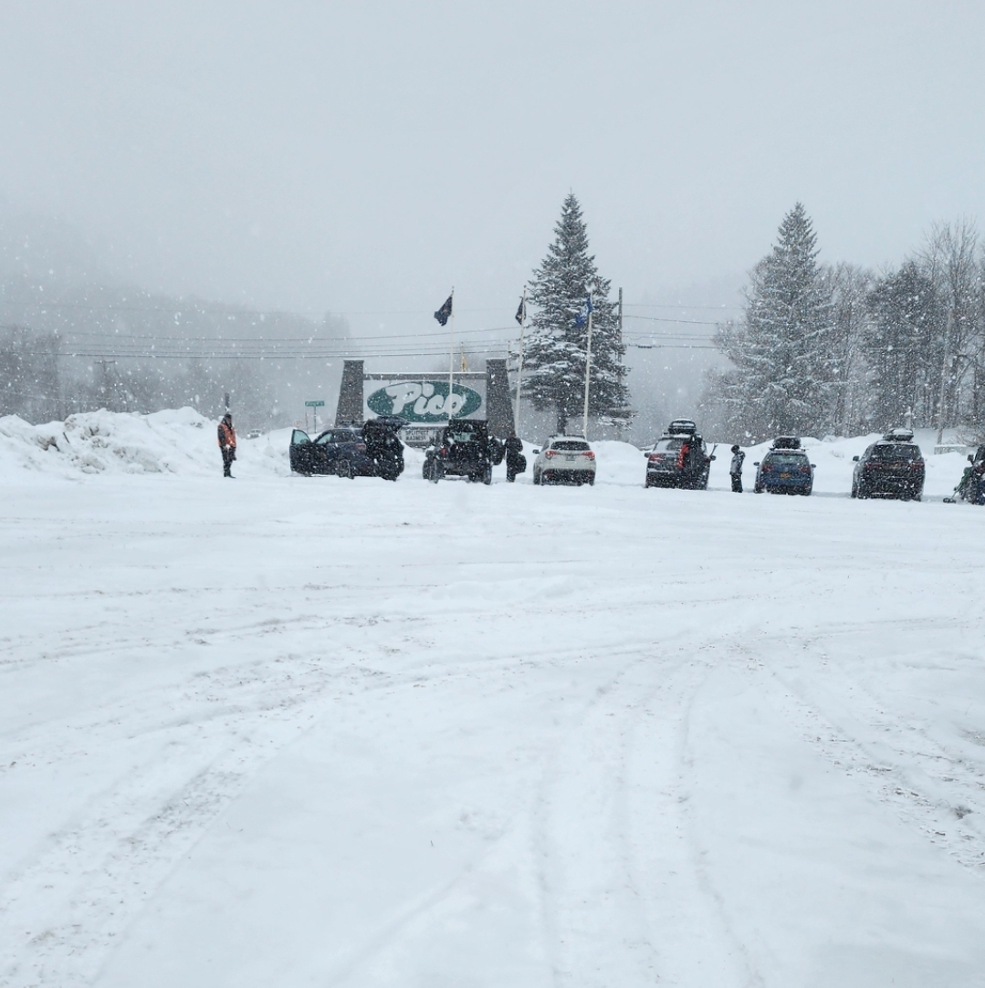
Been snowing all morning here at Pico with some awesome conditions.
-
4
-
-
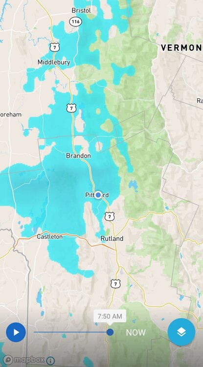
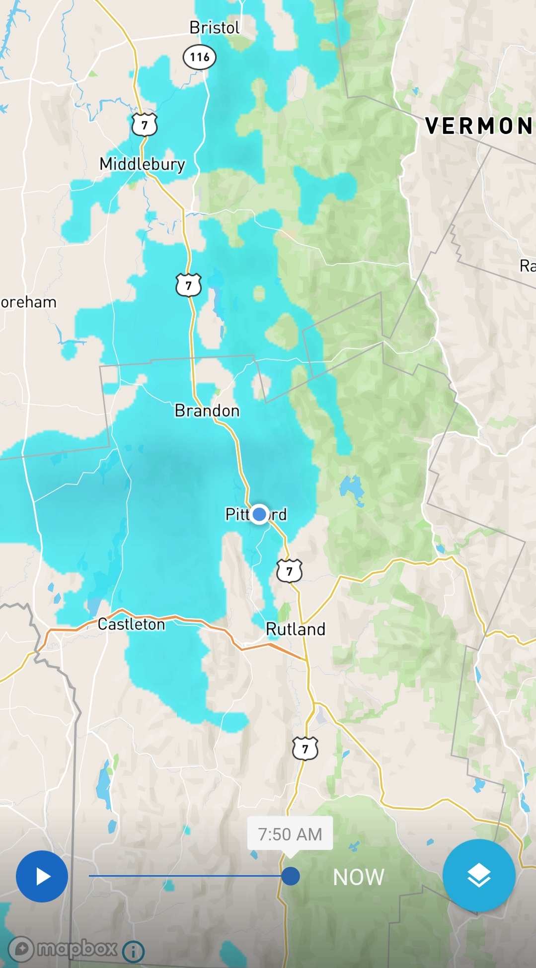
Up skiing in VT for the weekend and there's been a nice band over the Rutvegas area. About 3 inches here in Pittsford.
-
2
-
-
From WTNH.
Thomaston: 16″
East Farmington: 15.5″
West Hartford: 15.7″
Cheshire: 14″
Bristol: 14″
Newtown: 13.2″
Bethel: 13.2″
Southington: 13″
East Hartford: 13″
Wolcott: 13″
Vernon: 12.5″
Tolland: 12.5″
East Windsor: 12.5″
Waterbury: 12.5″
Ashford: 12″
Pomfret: 11.5″
Sherman: 11.5″
Manchester: 11.5″
Manchester: 11.5″
Coventry: 11.5″
Cromwell: 11.5″
Rocky Hill: 11.5″
Burlington: 11″
Warren: 11″
Litchfield: 11″
Woodbury: 11″
Newington: 10.5″
Hebron: 10.5″
Ellington: 10.5″
Berlin: 10.5″
Prospect: 10.5″
Hartford: 10.3″
Middlefield: 10″
Redding: 9.7″
New Canaan: 9.2″
Shelton: 9.1″
Simsbury: 9″
Northford: 9″
Bethany: 9″
Oxford: 9″
Naugatuck: 9″
Madison: 8.6″
Willimantic: 8.5″
Staffordville: 8.2″
Windsor: 8″
New Haven: 8″
Bridgeport: 7.6″
Chester: 7.5″
Weston: 7.4″
Andover: 7″
Greenwich: 6.5″
East Haven: 6.5″
Stamford: 6.2″
Norwalk: 6″
Milford: 6″
Guilford: 5.3″
Higganum: 3.8″https://www.wtnh.com/weather/winter-storm-how-much-snow-will-connecticut-get/
-
19 minutes ago, The 4 Seasons said:
Thanks for all the reports sent to me, i will have a CT map done today. The SNE & Tri-state maps will come tomorrow.
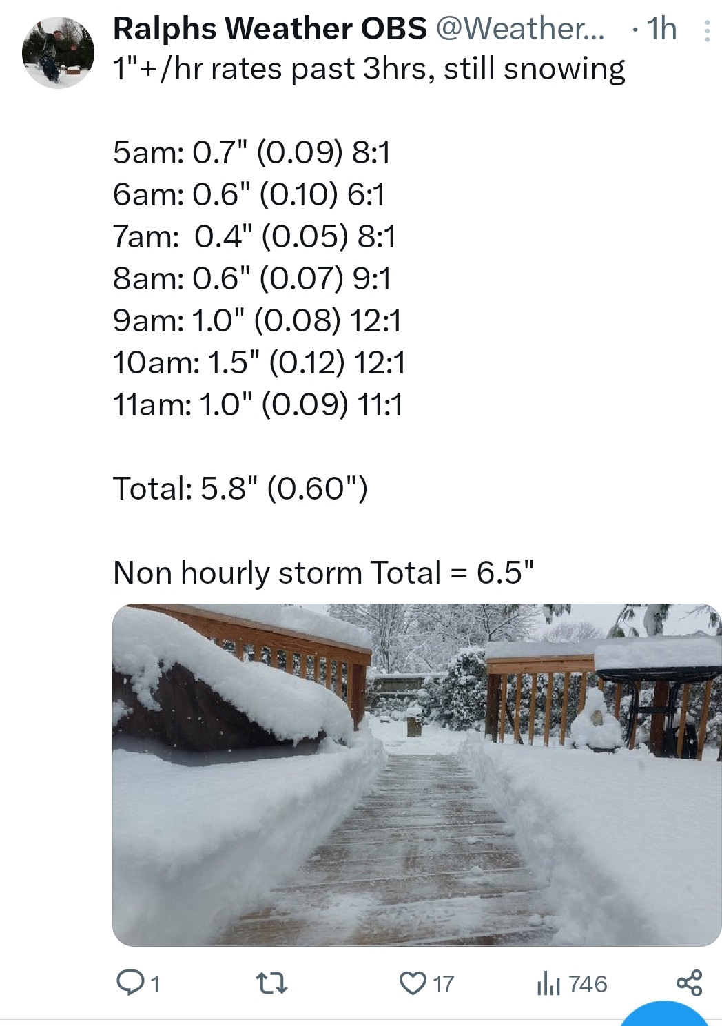
8.0" was the final here. No clearing just measured after accumulating snow had ended.
8.5 Branford.
-
 1
1
-
-
4 minutes ago, Sn0waddict said:
Curious about the amount of QPF Hartford got in correlation with their 15 inches.
Not Hartford but this guy is in Norwalk or somewhere in Fairfield County.
-
2
-
1
-
-
.NEAR TERM /UNTIL 6 PM THIS EVENING/...
*Winter Storm Warnings remain up across the entire forecast
area.*Adjusted snowfall totals across the board with storm totals around 8-10 inland and 6-9 inches near the coast. Locally higher amounts.
Impressive snow banding has been occurring with strong mid level frontogenesis this morning. We have been receiving reports in Orange County around 8 inches and seeing reports into CT 4-6" in
interior S CT. Have bumped totals back up in this corridor, but also note the heaviest banding should begin to sag southeastward this morning with rates dropping off inland in the next few
hours.Elsewhere, made some minor adjustments up with the overall totals remaining similar except indicating some enhanced totals
across Long Island as banding likely persists a few hours longer than places further N&W. A general 6-8 inches looks likely with locally higher amounts due to the banding.Snowfall rates of 1-2" per hour are expected through midday for
much of the area, but rates should be coming down inland in the
next few hours. -
6 minutes ago, Hoth said:
Didn't you just put up a 20 spot last month?
You out on Fishers? Looks exciting for the 3 shoreline people....
-
48 minutes ago, Torch Tiger said:
Gorgeous day with that hammering sun angle, poundtown!!
Yep. Great day for those with solar to tell Eversource and National Grid to fuck off with their outrageous rates.
-
2
-
2
-
-
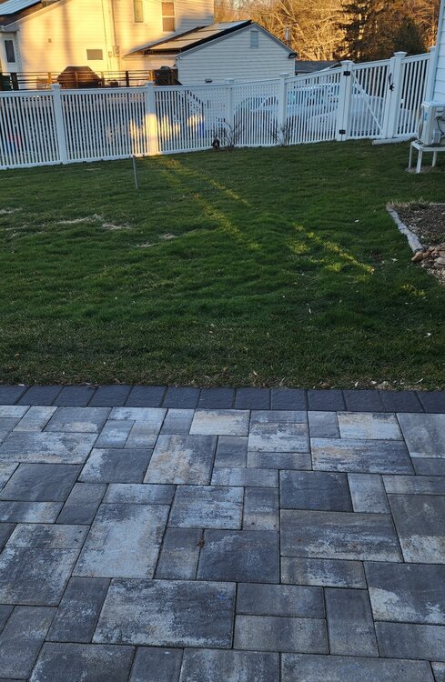
11 minutes ago, DavisStraight said:
You need some stone dust to fill in the pavers.
All the flooding rains washed it out...
-
7 minutes ago, Damage In Tolland said:
Summer temps disco in the Feb thread. Thats when you know it’s been a great winter!
About to drop some Lesco. What a winter for deep green lawns.
Wonder if that guy in RI is still mowing?
-
3
-
 1
1
-
-
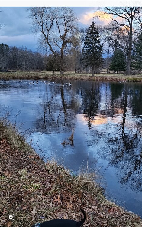
Many Canada Goose out there this morning....
-
1
-
-
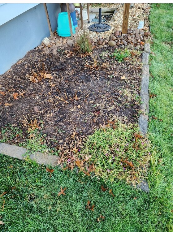
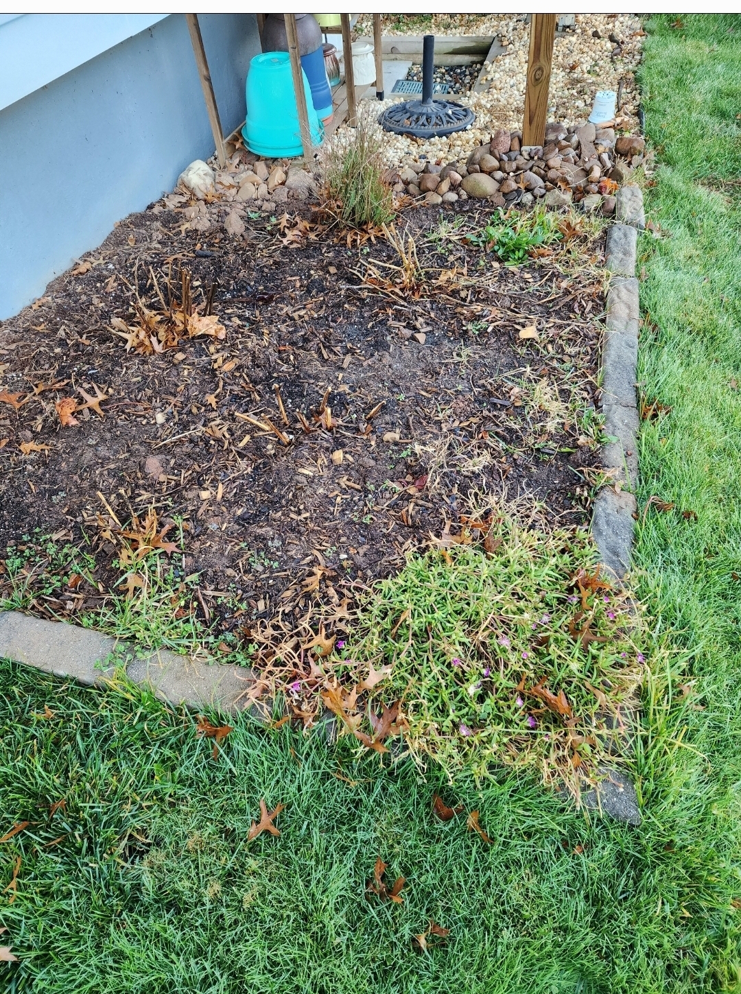
Some nice late December blooms from my Delosperma cooperi...
-
2
-
-
Looking forward for my first 20s of the season...
Lows are expected to be in the low-20s/upper teens for most. The NYC metro will be be drop into the upper-20s while far interior areas may see mid-teens. These temperatures are only a few degrees to 5 degrees below normal, but still some of the coldest we have seen thus far this season.
-
1
-
-
-
I think BDR,HVN and GON see 60+
Low level wind anomalies are 5-6SD
above normal which is maxed out relative to climatology for this time of year, and PWAT anomalies are 4-5SD above normal. This is a very strong signal for an anomalous wind and rain event-
1
-
-
28 minutes ago, Damage In Tolland said:
3.53” Might sneak out 4”.
Just SE of here in Willington is over 4
Hopefully we take some down this afternoon.
Gusts of 35 to 40 mph appear to be a good
bet for the mid to late morning as cold advection is maximized as the upper trough axis pivots through. -
2 minutes ago, dendrite said:
The wind threat fell apart quickly yesterday morning.
Yeah. Highest gust for CT was BDR at 31 and GON at 30.
-
2
-
1
-
-
-
5 minutes ago, Damage In Tolland said:
2500 outages in early stages in CT
What a night..
Strong to damaging wind gusts potential peaks over the next 6hrs across E LI/SE CT as the cold front slowly makes its way
across. Train of heavy rain with embedded thunderstorms will continue -
Upton thinks it might be a special night..
A very strong LLJ of 60-65 kt providing a classic warm tongue at 850 and 925 mb, along with a trough going negatively tilted is suggestive of an active night. This saturated deep layer column shown by all guidance and upstream soundings only increases confidence for a significant event
-
13 minutes ago, Torch Tiger said:
wow
BDR 1.32
-
1
-
1
-
-
38 minutes ago, Hoth said:
Effing pouring. This is a nightmare.
I'm about a 1/2 inch away from some major flooding...
.png.21c23525366fb0eff6cfa06a46e910a3.png)

.png.2d6aa5ab0e5b1e1394f4f5d5a30b3185.png)
March 2024 disco/obs
in New England
Posted
Daffodils were sprouting here on Feb 7th..