tamarack
-
Posts
16,290 -
Joined
-
Last visited
Content Type
Profiles
Blogs
Forums
American Weather
Media Demo
Store
Gallery
Everything posted by tamarack
-
That would make for the 3rd snowiest January here. Need only 4.6" to get there, but 10" to reach 2nd and 14 to pass 2015.
-
Highest I've seen in Maine is 20.5" at Parsonsfield, NW-most town in York County. Friends at the western part of Wells lost power for 30 hours; probably 6-8" plus ZR there.
-
This month will finish between 9 and 10° AN, about 2° above our 2nd mildest January in 2006, and snow is already 3"+ above average. Jan 2006 was 5" AN though that month had rain with almost every event and nothing bigger than 5.9" - that month's 11" max depth is the most pitiful mark for any winter here while we've got 24" at the stake with more to come (unless the forecast has a really radical change). December was 4"+ AN for snow and 5° AN - I can't recall having 2 significantly mild months with AN snow in both. NNE bonus. Makes up for January 2014, which was 3.5° BN with 120% precip that produced 27% of average snowfall. Its snow also ranked 129th of 130 Januarys at the Farmington co-op.
-
Super! Your area really got pounded during the day. We had 6.3" by 7 AM and I was pleased with another 3.8" to reach double digits and a 24" pack, but you must've had 9-10" after 7.
-
Trace at PQI thru 1 PM, nada CAR/FVE but at least they're cloudy - 2 hours ago they were partly sunny.
-
SSTs off the Maine coast at 45F today (50 at Georges Bank), and while I don't have the 100-year data, I'd guess the current temps are ~5° AN. Probably awful for the coast, maybe more snowy qpf farther inland?
-
Much better than today for the far north.
-
Back up to moderate at about 1 PM, now at 9" but the back edge may leave us below 10 - still an overperformer. Over 20k outages in southern Maine, chiefly York County, with perhaps the worst in Wells. Noon news showed a pic there with a large tree across a road, another with a tiny twig fatttened to at least 1/2" by ice. ZR+wet snow for the loss. Farther north, Versant listed 3 customers (Why me?) w/o power.
-
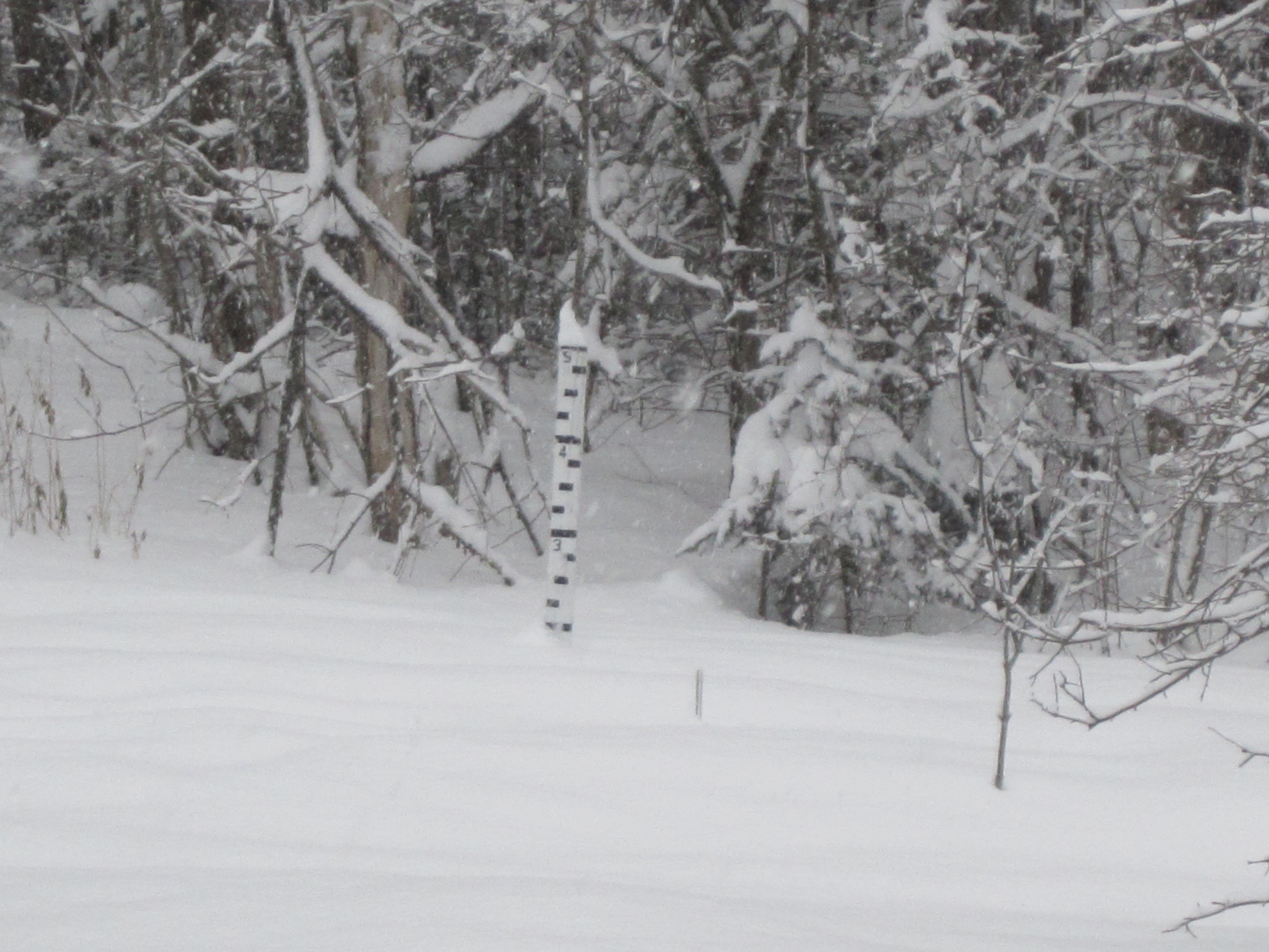
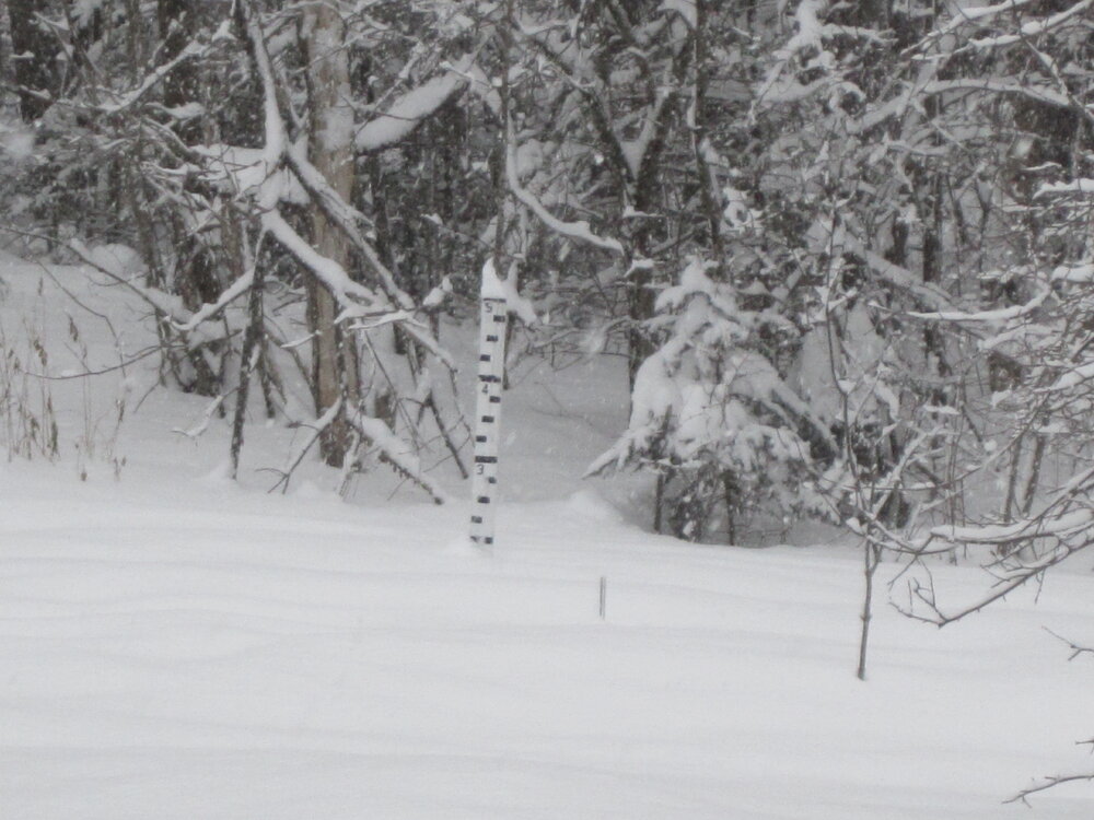
Note that the stake has acquired a slight lean thanks to the 12/23 deluge. Therefore, a pack touching the 2-foot bar is actually only 23.92"
-
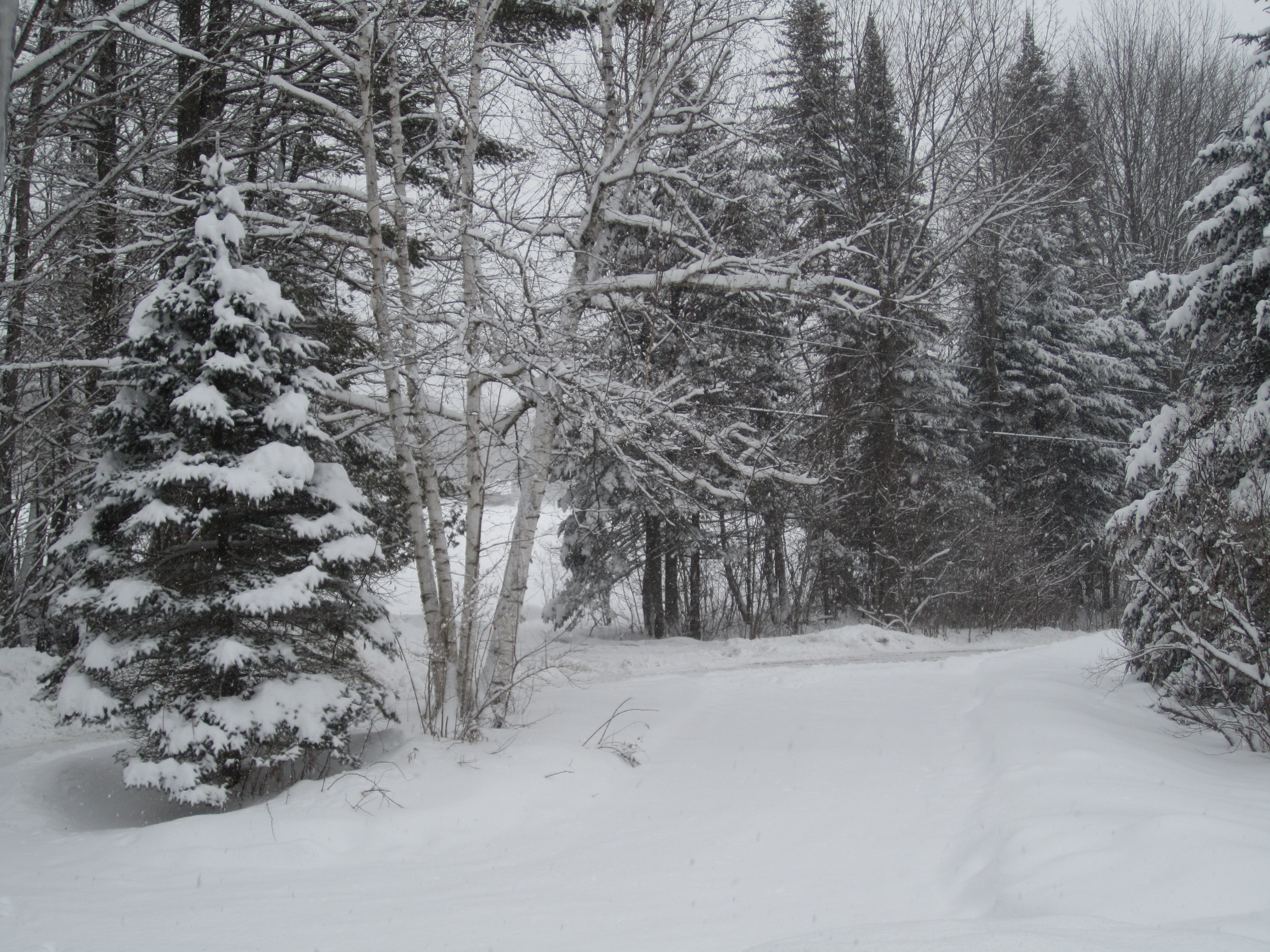
Advisory upped to warning overnight. Started about 8 PM with a bang - 1.3" by 9, then backed down to moderate, 5.0" more by 7 AM, another 2"+ since then. Near the 2-foot mark at the stake though the high (14:1) ratio means siggy settling.
-
Getting close to 2 feet.
-
6.3" of 14:1 pow by 7 AM, 2"+ since, currently lgt SN and mid 20s.
-
Hoping for a bit of real winter cold - maybe enough to kill off some hemlock wooly adelgids and moose ticks. Minus 3 (currently season's coldest) won't get it done.
-
6.6" with 0.55" LE, lots easier to snowblow than the 9:1 dump last month. 16" at the stake and deep blue sky with a few tiny clouds. Spectacular day
-
6.6" of 12:1 pow. The final 1.5" was especially fluffy. Brings us to an inch above YTD average.
-
Still wondering if we ever get deep winter cold. Least coldest winter temp here was -10 in 2005-06 and 19 of 24 winters has gotten down to at least -20. 2001-02 had its coldest max at 16, 2nd least cold is 12 in 2005-06. So far, our low here is -3 (may challenge that Sunday morning) and coldest max 20.
-
Still some tiny flakes in the air but accum is done, 6.5" with ratio of 12.5-to-1. 1st 5" was 11:1 but daytime feathers added 1.5" of 21:1 fluff. 17" at the stake. Edit: Good to see the Maine coast getting into the act. Also saw 6.6" at the Jetport, time of obs not shown.
-
We ma be almost done here, as the best echoes are now moving ESE rather than east.
-
What stands out to me is that every single day had AN max and AN min - only one low was <5° AN.
-
Started here a bit before midnight and had 5" of 11:1 pow by 7 AM, maybe 1.5" since with continuing light SN, safely in the 5-9 forecast. Trees are loaded thanks to little wind (increasing a bit now) but no danger to trees thanks to the good ratio.
-
We're in the 8-12 color, too, but P&C adds up to 5-9 and Farmington 90/50/10 percents are 5/8/11. Lots better than yesterday's estimates.
-
Here it's just over 10:1 for 98-99 thru 21-22. It was 10.5 going into 18-19 and that winter plus the next 2 have the lowest ratios of any of the 24. 20-21 was the nadir, at 6.5-to-1. The season's biggest storm, 9.5" on Feb 2, was all snow at mid-upper 20s with 1.35" LE for a 7.2:1 ratio. Lousy dendrites or something; places to the south (including NNJ and NYC) had better ratios.
-
Not for here, and the NAM map that PF posted shows the good stuff remaining to my south, leaving the Route 2 corridor with advisory snows, maybe 3-4". All snow is good snow, but that amount would be right on the threshold for snowblow/no snoblow. (Unless it's 6:1 paste, which would need to go.)
-
Very similar here, with some latitudinal advantage - total was 142.3", tops here since 98-99. Only dd's were 12.5" and 10.7", with 19 other events 3"-9.5".
-
This date in 2018, it might've been closer to 18". Had 7-8" on Flying Pond on 1/9, expect to see 9-10 if I get out there tomorrow - fish might be hungry with the falling bar.