winter_warlock
-
Posts
3,359 -
Joined
-
Last visited
Content Type
Profiles
Blogs
Forums
American Weather
Media Demo
Store
Gallery
Everything posted by winter_warlock
-

January 24-26: Miracle or Mirage JV/Banter Thread!
winter_warlock replied to SnowenOutThere's topic in Mid Atlantic
-
January 24-26: Miracle or Mirage OBS Thread!
winter_warlock replied to Jebman's topic in Mid Atlantic
I fixed it -
January 24-26: Miracle or Mirage OBS Thread!
winter_warlock replied to Jebman's topic in Mid Atlantic
I'm still sitting at 22 F.. looks like the original forecasted high of 30 here won't come to fruition -
January 24-26: Miracle or Mirage OBS Thread!
winter_warlock replied to Jebman's topic in Mid Atlantic
This storm reminds me of a storm. In 1994 that started as snow but then changed to sleet and I got like 5 inches of sleet on top of 6 inches of snow. Was wild!!!! -
January 24-26: Miracle or Mirage OBS Thread!
winter_warlock replied to Jebman's topic in Mid Atlantic
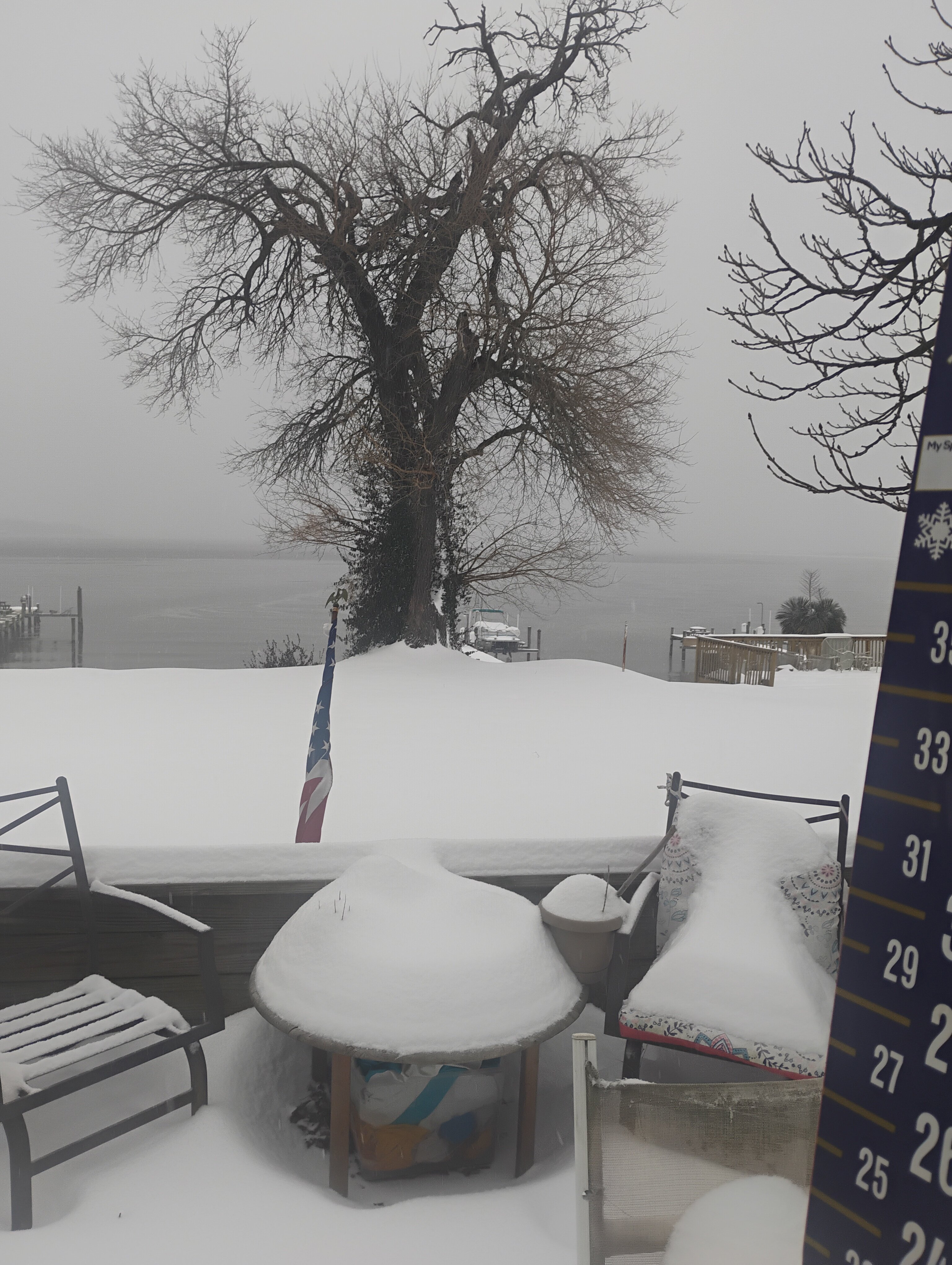
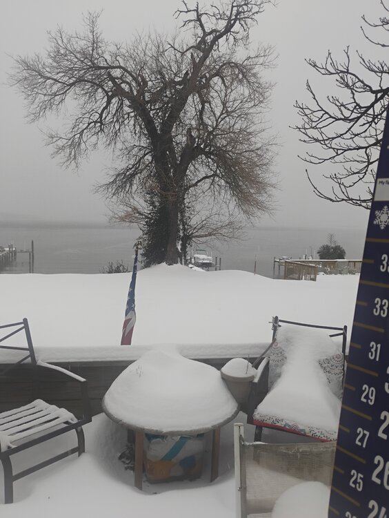
Sleet is so heavy, can't see across the water to rivera beach!! And the water isn't water, it's frozen all the way across!! 21F temp here in sparrows point MD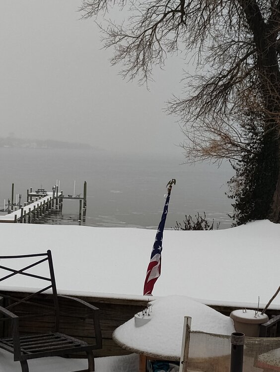
-
January 24-26: Miracle or Mirage OBS Thread!
winter_warlock replied to Jebman's topic in Mid Atlantic
I shoveled for the second time today just trying to keep up with it.. first time was 5 inches of snow.. this second time was 2 inches of snow and 2 inches of sleet. Seemed like it was a lot heavier and I could tell a lot more ice. Wore my ass out!! Lol -
January 24-26: Miracle or Mirage OBS Thread!
winter_warlock replied to Jebman's topic in Mid Atlantic
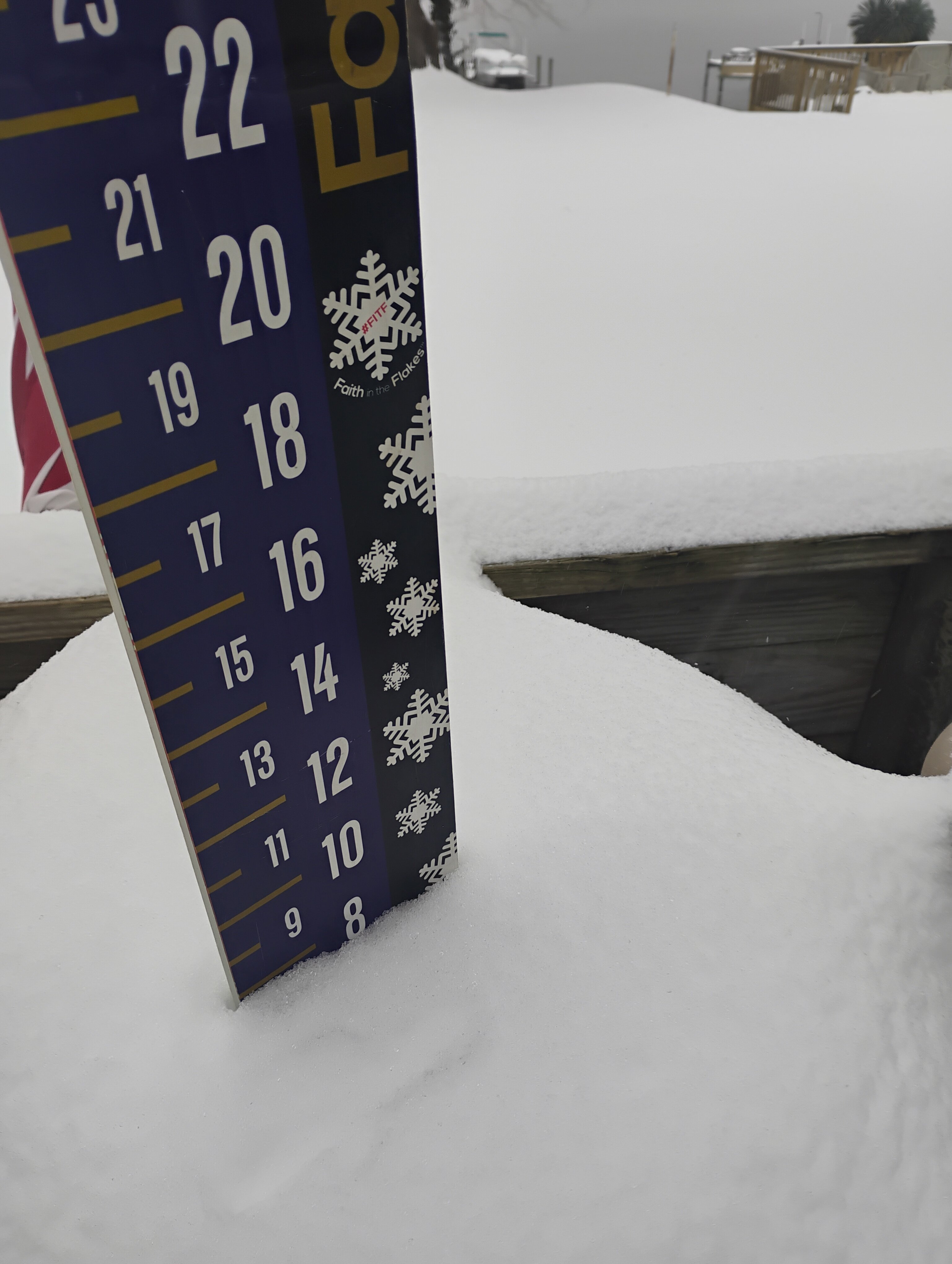
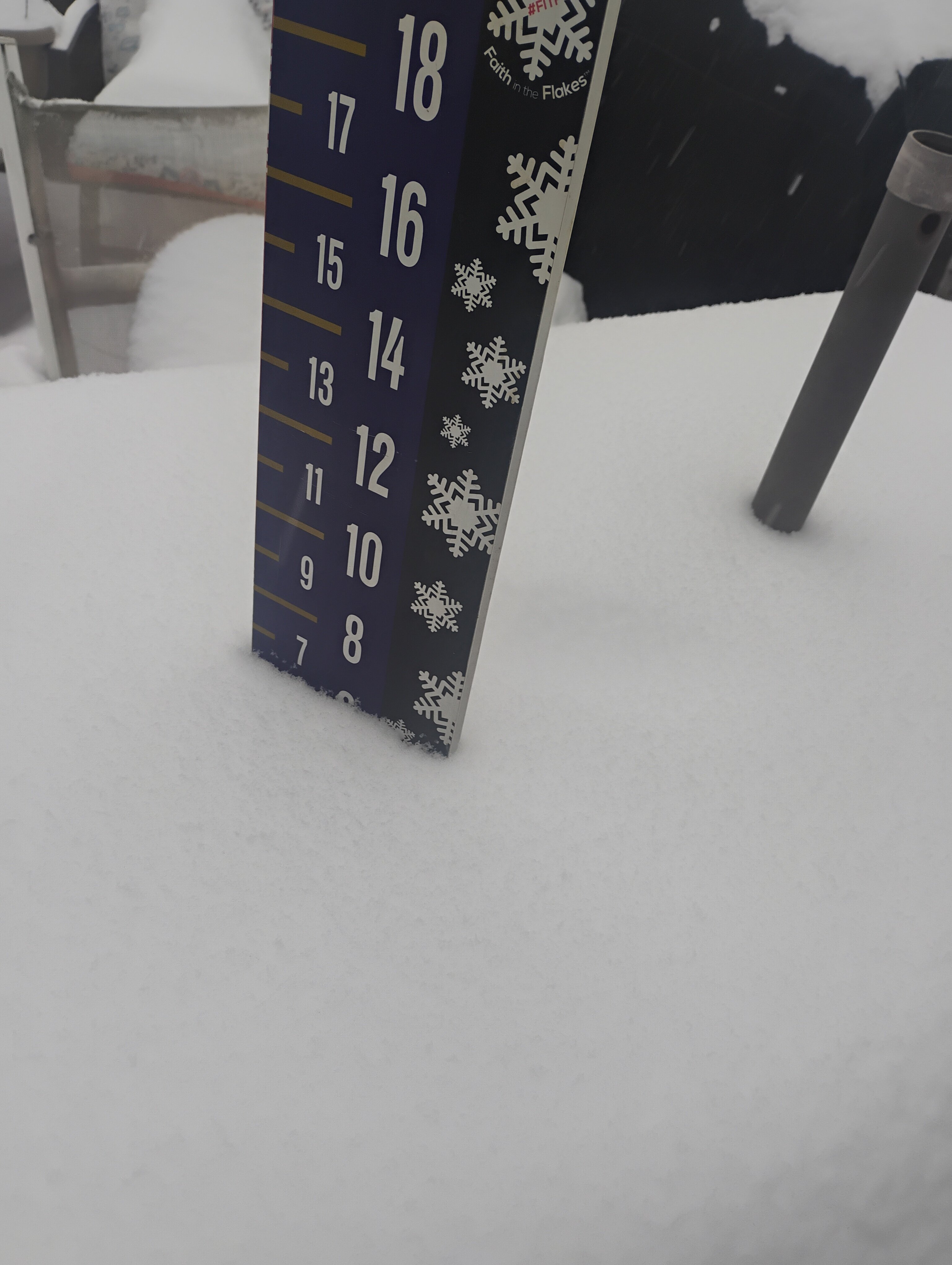
Up to 9.187 inches now in Sparrows point MD!!! Heavy sleet continues!! 20.2 F -
January 24-26: Miracle or Mirage OBS Thread!
winter_warlock replied to Jebman's topic in Mid Atlantic
I'm now up to 8.5 Inches Still getting heavy sleet here. Got .5 inches in last 2 hours.. not too bad considering is sleet 20.1 degreesF -
January 24-26: Miracle or Mirage JV/Banter Thread!
winter_warlock replied to SnowenOutThere's topic in Mid Atlantic
I've now hit 8 inches!! With heavy sleet. 17.3 F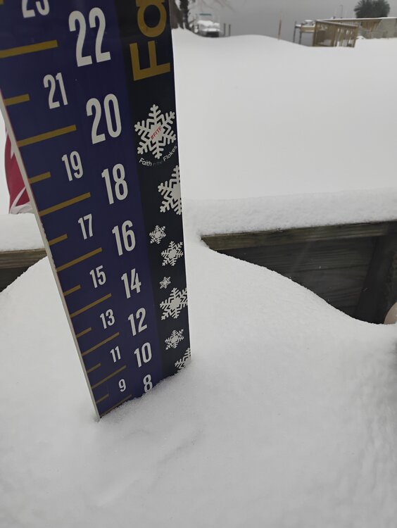
-
Like that trend
-
January 24-26: Miracle or Mirage OBS Thread!
winter_warlock replied to Jebman's topic in Mid Atlantic
Still holding steady at 15.5F. LWX has a high of 31 here I don't see that happeneing -
January 24-26: Miracle or Mirage OBS Thread!
winter_warlock replied to Jebman's topic in Mid Atlantic
Hopefully we will be able to cash in at least a few times!! -
January 24-26: Miracle or Mirage OBS Thread!
winter_warlock replied to Jebman's topic in Mid Atlantic
To be honest it's probably more sleet than snow here. But heavy. With a temp of only 15.5 here I'm thinking I'm not gonna see much in the way of ZR till maybe the very end -
January 24-26: Miracle or Mirage OBS Thread!
winter_warlock replied to Jebman's topic in Mid Atlantic
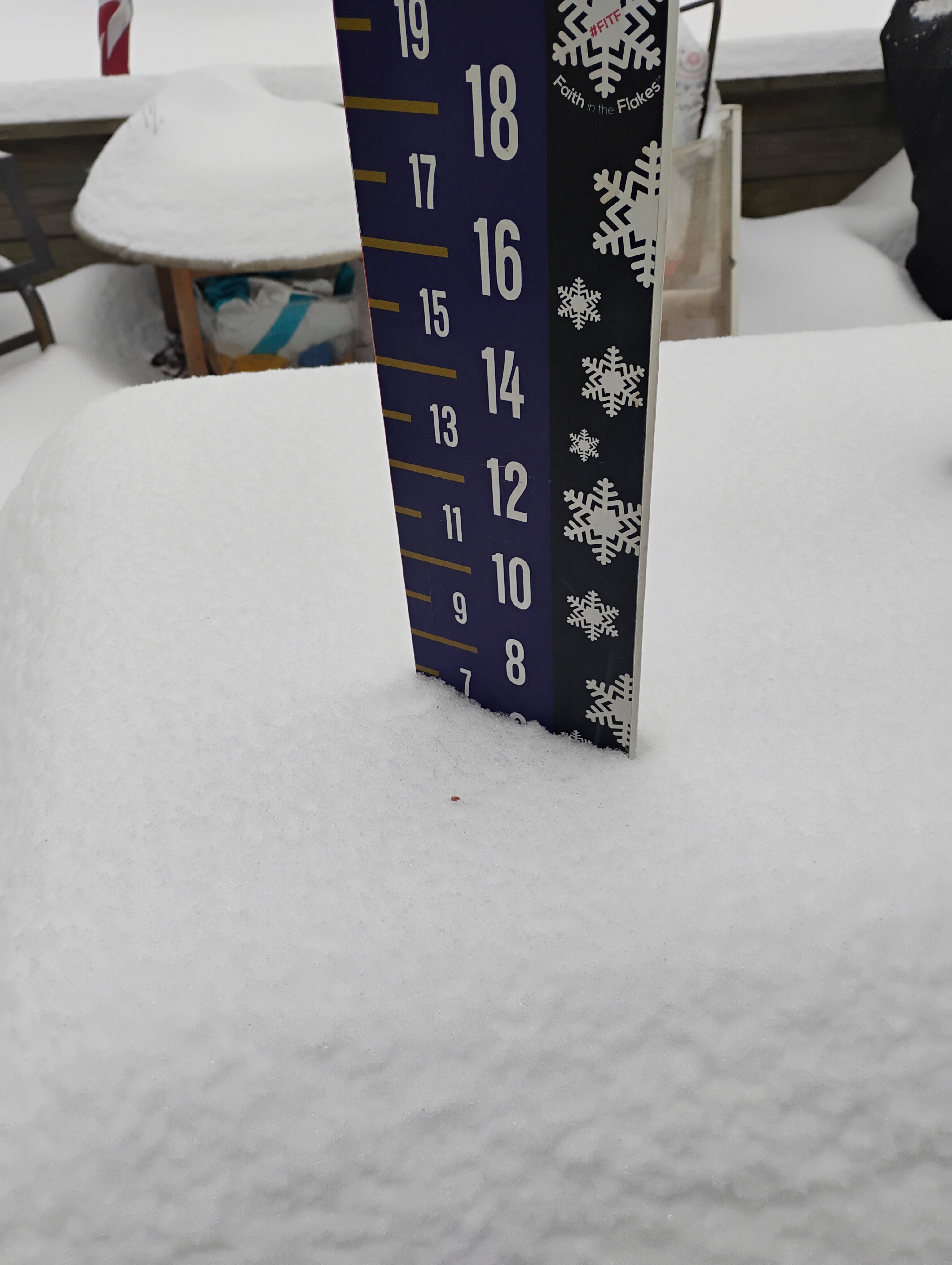
15.5 F Heavy sleet and snow mix Up to 7 inches here in sparrows point MD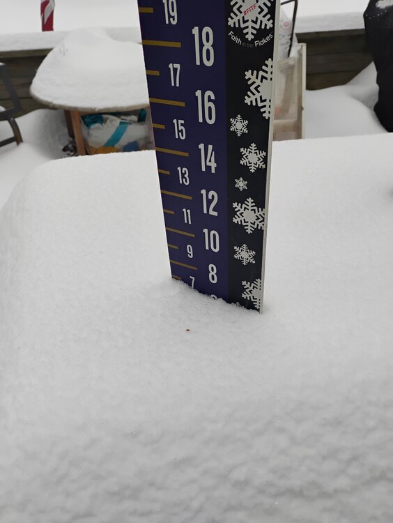
-
January 24-26: Miracle or Mirage JV/Banter Thread!
winter_warlock replied to SnowenOutThere's topic in Mid Atlantic
-
January 24-26: Miracle or Mirage JV/Banter Thread!
winter_warlock replied to SnowenOutThere's topic in Mid Atlantic
Heavy snow falling. 6.5 Inches here in sparrows point MD I got 1.5 inches in last hour!!!!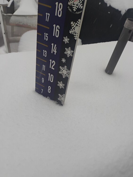
-
January 24-26: Miracle or Mirage OBS Thread!
winter_warlock replied to Jebman's topic in Mid Atlantic
15.1F temp has dropped. 5 inches moderate snow falling. In sparrows point MD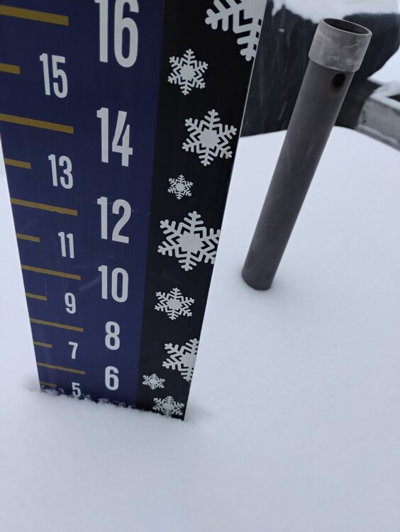
-
January 24-26: Miracle or Mirage OBS Thread!
winter_warlock replied to Jebman's topic in Mid Atlantic
We can only hope brother!!!! -
January 24-26: Miracle or Mirage OBS Thread!
winter_warlock replied to Jebman's topic in Mid Atlantic
Wow bro those last 3 pics looks like Christmas greeting cards!! Nice!!! -
January 24-26: Miracle or Mirage OBS Thread!
winter_warlock replied to Jebman's topic in Mid Atlantic
Light snow falling here in sparrows point MD 17.5 F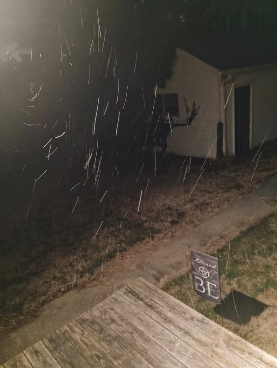
-
January 24-26: Miracle or Mirage OBS Thread!
winter_warlock replied to Jebman's topic in Mid Atlantic
The Spire? Or Cras? -
Well it's a week out so . The current storm looked a lot better a week ago. So hopefully the next storm improves in a week
-
January 24-26: Miracle or Mirage OBS Thread!
winter_warlock replied to Jebman's topic in Mid Atlantic
18.1F here in sparrows point MD 48%humidty 30.51 barometer! Dewpoint -3F So far just cloudy skies -
January 24-26: Miracle or Mirage OBS Thread!
winter_warlock replied to Jebman's topic in Mid Atlantic
That's what I was thinking. I'm curious to see what the upper air data shows for the 00z model suite!! -
January 24-26: Miracle or Mirage OBS Thread!
winter_warlock replied to Jebman's topic in Mid Atlantic
Hell yess