winter_warlock
-
Posts
3,363 -
Joined
-
Last visited
Content Type
Profiles
Blogs
Forums
American Weather
Media Demo
Store
Gallery
Everything posted by winter_warlock
-
Wow that's is definitely better !!
-
Georgia .. j/k
-
I'm older lol hell I was 43 when I left eastern and AccuWeather and came here in 2010.. I'm 58 now!!! Damn I grew old with u people
-
Agreed!! It's seams like most big storms trend nw
-
Ahhh ok I didn't think Americanwx came till later in 2010 when we all left eastern and AccuWeather later in 2010
-
This is off topic. But curious what's the most people we ever had in here at one time? I'm guessing the most would be when we were tracking the blizzard of 2016. Just curious lol
-
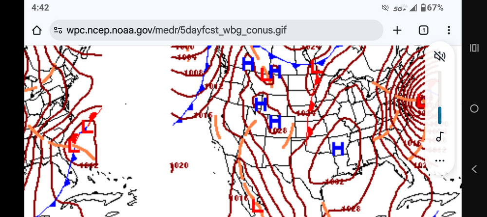
Wow definitely came nw!!!
-
Definitely came nw!!
-
Damnnn. .. but we got time!!
-
Close enough to keep us interested
-
Plzzz come north!!
-
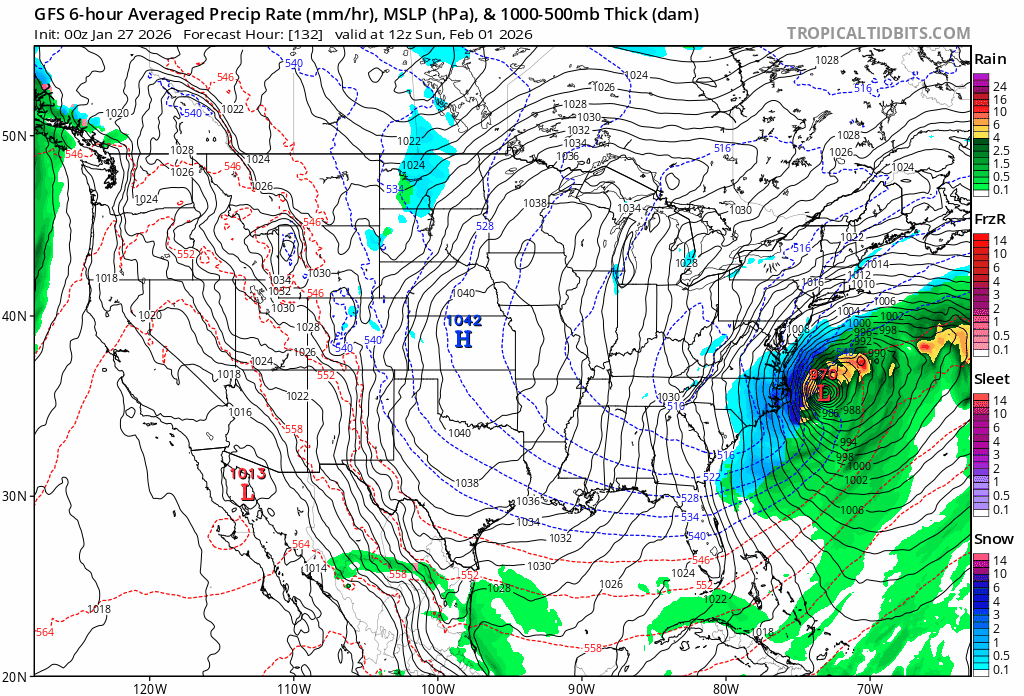
988mb!!!!
-
Slow mover would be nice!!
-
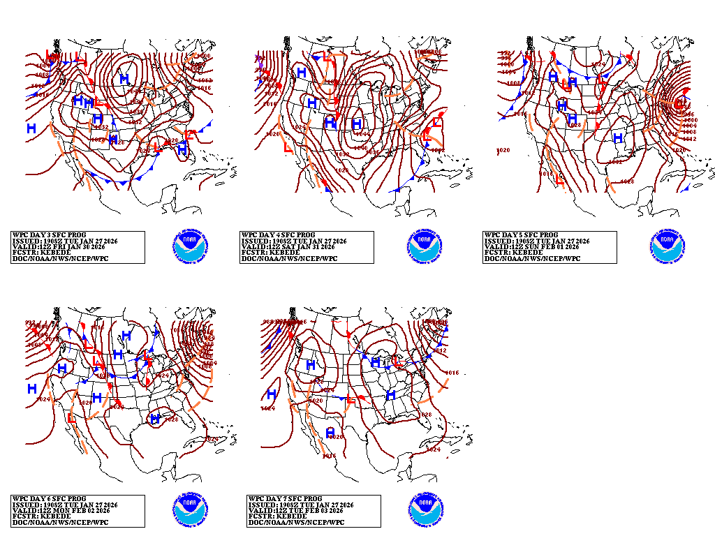
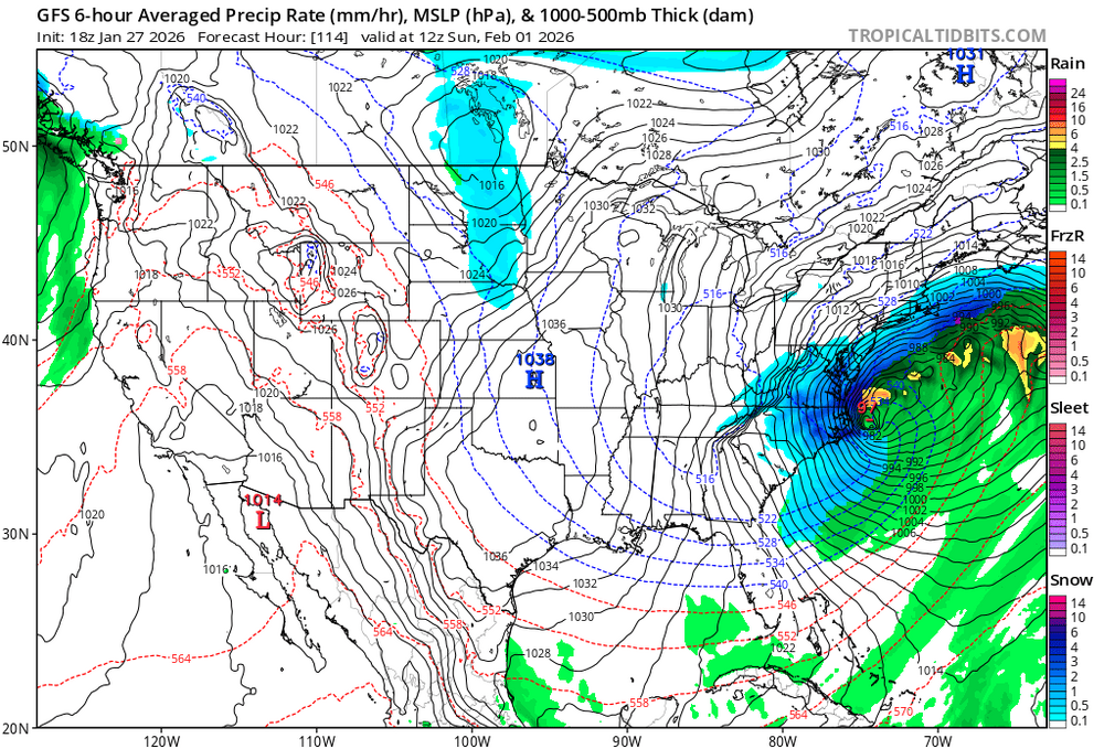
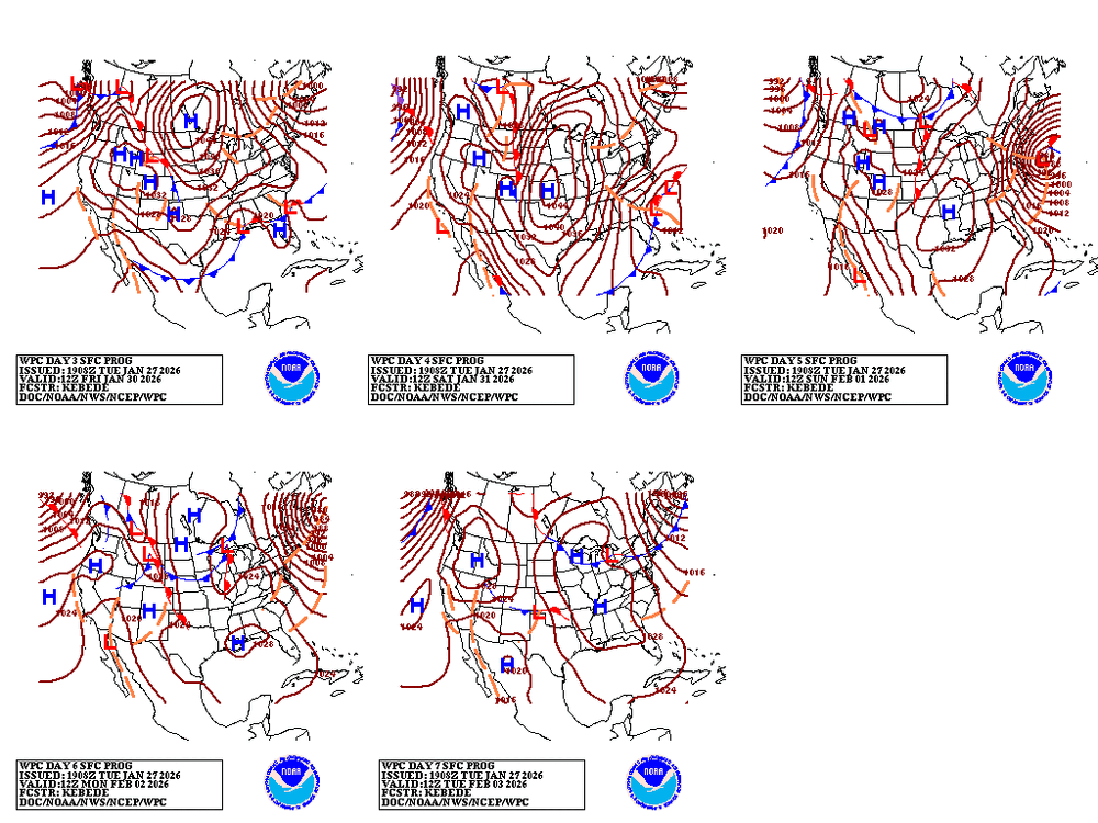
Interesting where the WPC has the storm. Kinda close to coast. They must be riding the GFS.. unless they see something we dont
-
Well it could be my way of not accepting reality too lol
-
Just remember folks.. the last storm ended up going west as time got closer. Went west enough to a point that we all got ice mixing in. I say give it time. Still over 100 hours away.. at least give it till were within 48 hours
-
Models are close enough to something big that we gotta keep checking them every 6 hours lol can't walk away
-
Alot closer and we're still over 100 hours away so we got time
-
If euro and Euro AI shows this. This board will crash lol
-
I'd rather have nothing instead of a cutter
-
How do u know they get worse?
-
Still a miss. Closer ..ohh so close.. won't take much
-
GFS Came nw

-
Winter of 2025-2026 total snowfall IMBY() Sparrows point MD) Dec 5-6th... .75 inches of snow Dec 13-14th. 2.125 inches Jan 1st ... .100 inches Jan 18th... .30inches Jan 24-25th. 10.3 inches Feb 22-23. 3.00 inches March 2nd. 1.00 inches ________________________________ Total snow..... 17. 575 inches
-
I only said that cause the poster said he didn't understand it lol