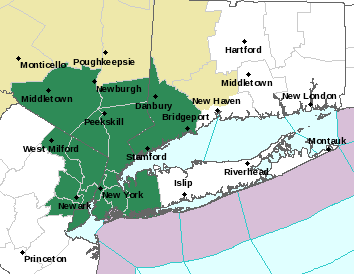
Flood Watch issued for parts of OKX:
Flood Watch
National Weather Service New York NY
312 PM EDT Fri Oct 6 2023
CTZ005-009-NJZ002-004-006-103>108-NYZ067>075-176>179-071000-
/O.NEW.KOKX.FA.A.0011.231007T0600Z-231008T0000Z/
/00000.0.ER.000000T0000Z.000000T0000Z.000000T0000Z.OO/
Northern Fairfield-Southern Fairfield-Western Passaic-Eastern
Passaic-Hudson-Western Bergen-Eastern Bergen-Western Essex-
Eastern Essex-Western Union-Eastern Union-Orange-Putnam-Rockland-
Northern Westchester-Southern Westchester-New York (Manhattan)-
Bronx-Richmond (Staten Island)-Kings (Brooklyn)-Northern Queens-
Northern Nassau-Southern Queens-Southern Nassau-
312 PM EDT Fri Oct 6 2023
...FLOOD WATCH IN EFFECT FROM 2 AM EDT SATURDAY THROUGH SATURDAY
EVENING...
* WHAT...Isolated to scattered instances of flash flooding caused by
excessive rainfall are possible, which could be locally
significant.
* WHERE...Portions of southern Connecticut, including the following
areas, Northern Fairfield and Southern Fairfield. Portions of
northeast New Jersey, including the following areas, Eastern
Bergen, Eastern Essex, Eastern Passaic, Eastern Union, Hudson,
Western Bergen, Western Essex, Western Passaic and Western Union.
Portions of southeast New York, including the following areas,
Bronx, Kings (Brooklyn), New York (Manhattan), Northern Nassau,
Northern Queens, Northern Westchester, Orange, Putnam, Richmond
(Staten Island), Rockland, Southern Nassau, Southern Queens and
Southern Westchester.
* WHEN...From 2 AM EDT Saturday through Saturday evening.
* IMPACTS...Excessive runoff may result in local to scattered areas
of flash flooding of poor drainage and urban areas. Flooding of
rivers, creeks, streams, and other low-lying and flood-prone
locations is also possible. Creeks and streams may rise out of
their banks.
* ADDITIONAL DETAILS...
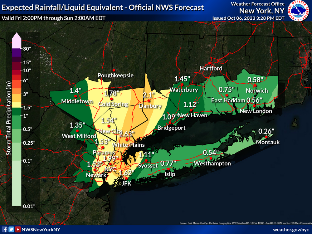
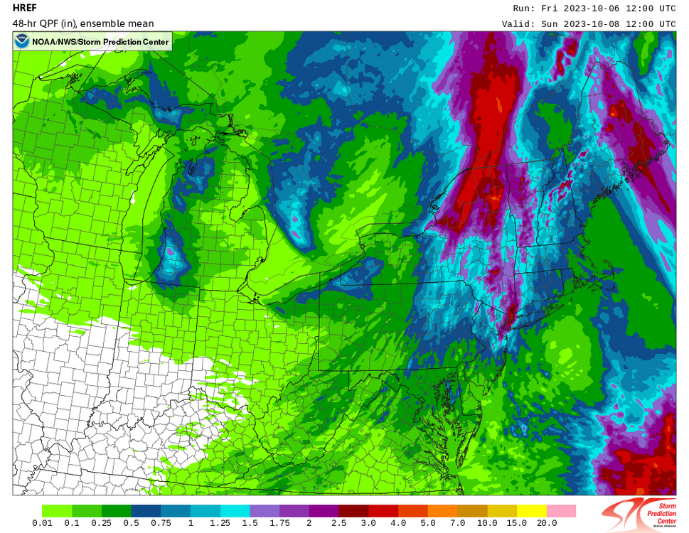
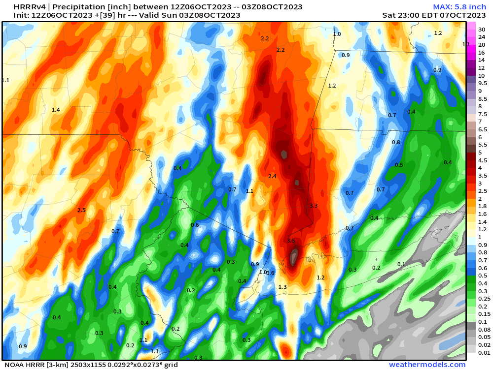
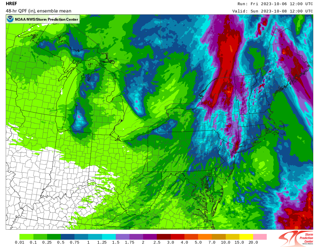
- Widespread 1.5 to 2.5 inches of rainfall, with locally 3 to 4
inches, are possible, especially where the axis of heavier
rain develops, and possibly remains for an hour or two.
Rainfall rates to 1 to 2 inches per hour are possible. If and
where the heaviest rainfall rates develop the flooding could
be locally significant, causing disruption to transportation,
flooding of basements, first floor residences and businesses,
and underground infrastructure, and pose an elevated threat
to life.
- http://www.weather.gov/safety/flood