

uofmiami
-
Posts
2,225 -
Joined
-
Last visited
Content Type
Profiles
Blogs
Forums
American Weather
Media Demo
Store
Gallery
Everything posted by uofmiami
-
-
30 at both my stations.
-
Already went through that this past weekend with the travel tournament kick off my son had. Made it to semi-finals before losing to the winner of the tournament but 4 games in two days with cold weather (40s) and rain was miserable. Sun will at least be out for your son's game.
-
Wind won’t help tomorrow once the sun goes down that’s for sure.
-
What temp did you turn thermostat down to?
-
23 degree drop in 1hr in Syosset. 77 to 54 currently. 48 just N of me in Oyster Bay on the water.
-
Winds went NE here in Syosset, currently 77
-
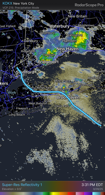
BDCF showing up nicely on radar
-
Leading edge of clouds with BDCF coming through Stillwell park currently.
-
Pushing 77 at my stations. 80 by 2pm, if not sooner.
-
Newark going to definitely hit 80. 79 at 12pm there. New York City Metropolitan Area Weather Roundup National Weather Service New York NY 1200 PM EDT SAT MAR 29 2025 CITY SKY/WX TMP DP RH WIND PRES REMARKS Central Park MOSUNNY 75 45 34 W9G20 29.96F LaGuardia Arpt PTSUNNY 75 45 34 SW13G24 29.93F Kennedy Intl PTSUNNY 71 49 45 SW18 29.96F Newark Liberty PTSUNNY 79 47 32 W16G41 29.94F Teterboro Arpt SUNNY 76 49 38 W18G33 29.93F Bronx Lehman C N/A 73 48 40 W8 N/A Queens College N/A 73 48 40 W14G26 N/A Breezy Point N/A N/A N/A N/A W10G16 N/A Brooklyn Coll N/A 73 46 38 W15 N/A Staten Island N/A 75 48 38 W16 N/A
-
71 in Syosset & Muttontown, made it into the 70s finally. Curious to see if 80 can be reached before BDCF arrival.
-
I have to check 12Z compared to 6Z I know NE Nassau was 3-4pm timeframe. Seems like 12Z may have sped that up by an hour.
-
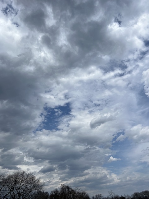
Clouds may be the bigger issue, though appears clearing is getting wider in scope, so temps should be able to rise under full sun.
-
Midnight temps will be the high for the day (Sunday) potentially, especially along the coast.
-
As long as it holds off until after 4pm I’m fine. I don’t want to be watching my kids sports and go from warmth to cold during their games.
-
Snowing in S Syosset/Plainview area based on Travel Baseball group chat.
-
Agreed, assuming we can hold off the wind.
-
Too early for stronger Bermuda High, Canadian will win out IMO. Probably around 55 for Central Park on Saturday.
-
.69 in Muttontown & .80 in Syosset
-
30 at my stations. I feel like everything is delayed by 2-3 weeks before we’ll be inundated with bugs, pollen, etc.
-
I’ll wait until inside 96hrs before getting hyped for warmth along coast here on LI. Hope the warmth doesn’t end up further W for Plains into Ohio Valley.
