GreyHat
-
Posts
388 -
Joined
-
Last visited
Content Type
Profiles
Blogs
Forums
American Weather
Media Demo
Store
Gallery
Everything posted by GreyHat
-
No one does, but this last storm showed big hits lots of snow for the area. Once data start getting injested things changed from big snows to a lot of sleet and freezing rain. What did the models for this storm? Something this far out big hits of snow and now moving to more ENE. Just my observation
-
Thursday will be the day just like the past storm. Data gets injested and things go from good to worse.
-
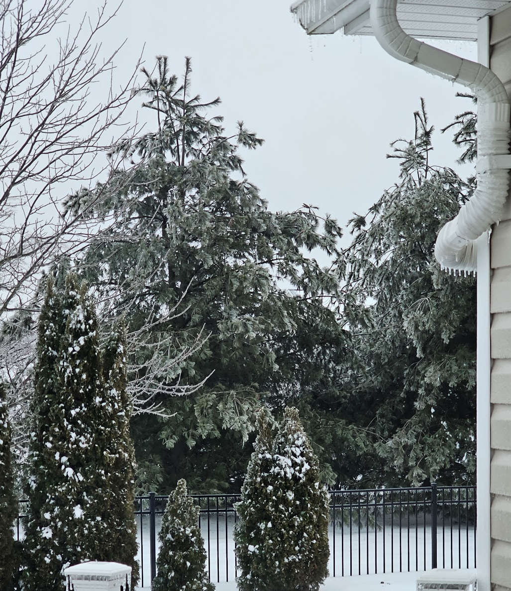
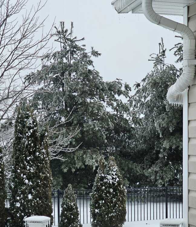
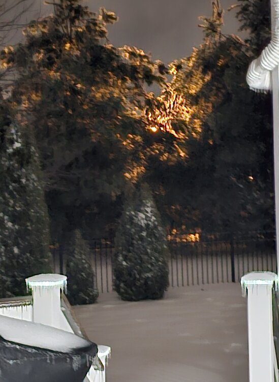
Yeah, notification went out from Delmarva Power that more outages may happen due to heavy ice on trees and limbs falling on wires. The back roads (peachtree rd) were 4" of ice and we saw limbs down from pine trees.
-
Good map, couldn't tell you what we got since that .42" of freezing rain on top of hours of sleet.
-
Personally I wouldn't be mad if it misses us. Just notified by Delmarva Power about more outages due to heavy ice on trees and strong winds as trees have come down.
-
Weaker Storm was modeled 977 and 1006.
-
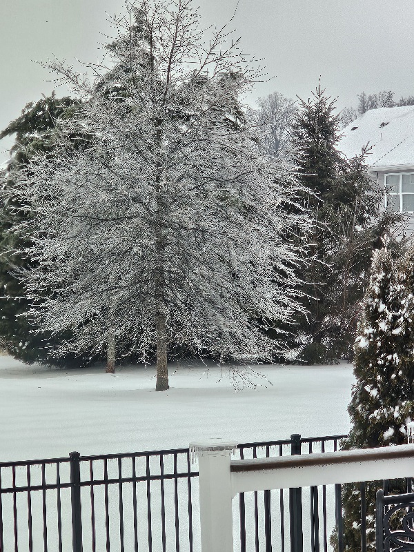
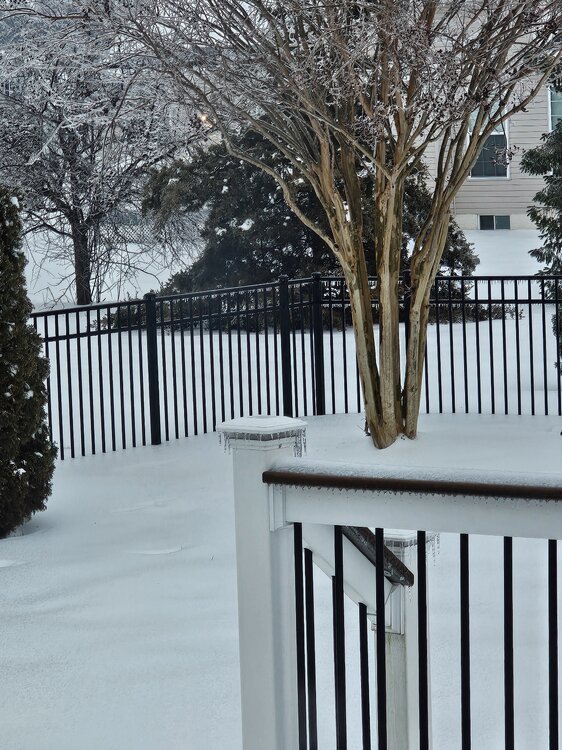
Went out and there are tree limbs down all over. You can walk on the top of the snow without going through. Governor of Maryland put out for people to stay off the roads.
-
Magnolia Delaware 23F Pressure 29.66 Winds 0, starting to blow and those trees may come down. Some big snow flurry flakes. Damage from the freezing rain.

-
It may as well have an eye like a hurricane.
-
Temp falling 23F Pressure rising 29.60 Final freezing rain total according to the weather system .42"
-
Magnolia Delaware 32F Passing .41" freezing rain
-
Magnolia Delaware 32F Freezing rain passing .36" Pressure dropping no winds
-
I have put it before and others aren't stating. Magnolia Delaware south of dover by 15 minutes.
-
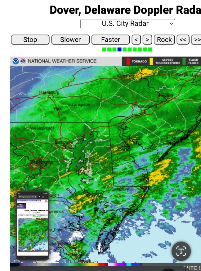
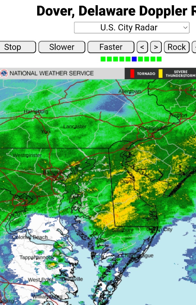
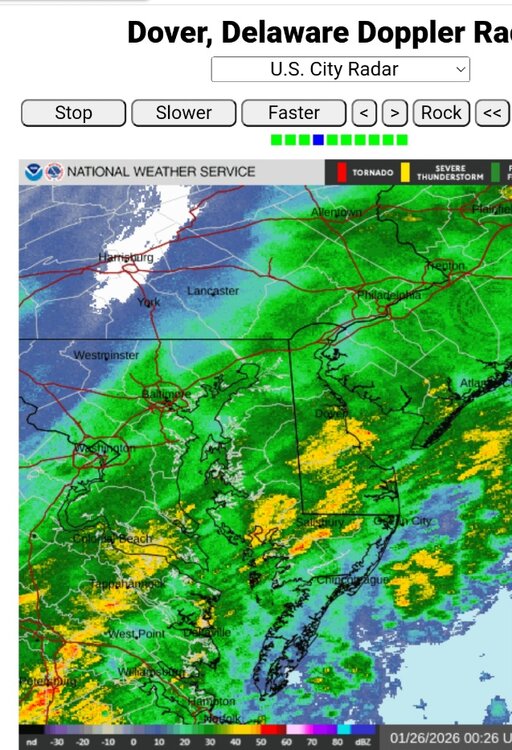
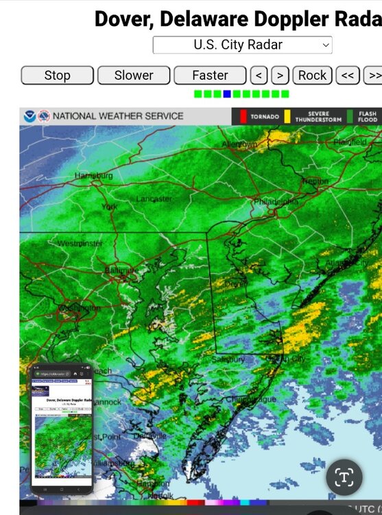
Heavy freezing rain continues to move through Delaware. This is not good. https://eldoradoweather.com/radar/dox/dox-dover-loop.php
-
32F Pressure continues to fall 29.51 Freezing rain passing .34" and still coming down.
-
Our power is flickering now. Dam that freezing rain. Good thing I have a hybrid F150 with a 7.2kw generator.
-
Nice but remember how this current storm looked before it hit. Keep calm but dam that would cause some serious problems.
-
32F Winds NW 0 Pressure 29.53 Freezing rain .30 and still come down moderately. Some tree limbs have come down. I hope this stop soon
-
Strong storms go NW. The HP 1033.
-
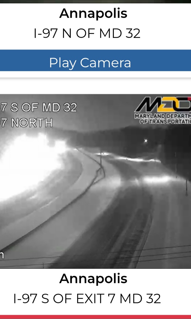
Going to take time before they get I97 clean

-
Heavy freezing rain heading to Delaware https://eldoradoweather.com/radar/dox/dox-dover-loop.php
-
32F Pressure still dropping 29.53 Winds NE 3 Freezing rain .17 and still coming down Looks pretty in the street lights but don't know how many trees or limbs will come down.
-
It should of been .11" rain and still coming down. They just plowed the development.
-
30F Pressure continues to drop with winds out of the NE Heavy yellow bands coming through Delaware. Just dropped. 11" rain in just a few minutes. https://eldoradoweather.com/radar/dox/dox-dover-loop.php

-
30F Pressure 29.58 Winds NW 3 Raining .10"