GreyHat
-
Posts
388 -
Joined
-
Last visited
Content Type
Profiles
Blogs
Forums
American Weather
Media Demo
Store
Gallery
Everything posted by GreyHat
-
 Yeah, but could cause severe flooding for people's basement and streams.
 -
The NAM shows a better trough but that Canada Lost likely will keep it south OTS. That's the problem with the current one and this one. Let's hope these Canadian lows don't keep ruining it for us.
-
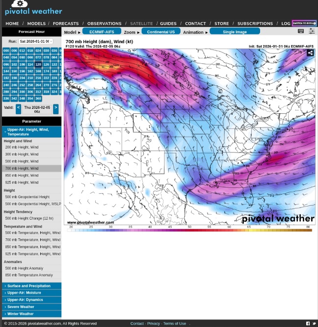
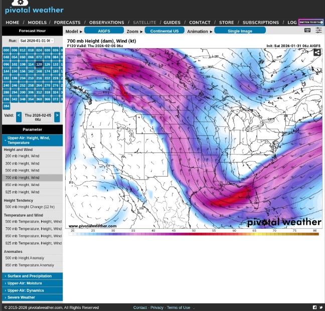
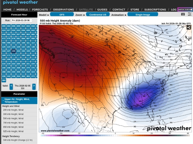
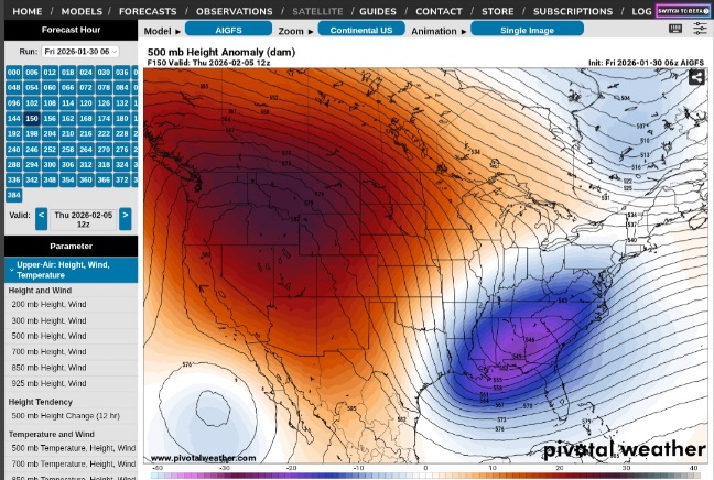
Looking at the 120 hr 500 level maps. The GFS has a positive or somewhat flat trough, whereas the ICON shows a neutral trough. EURO AIFS supports GFS with the positive trough. The GFS AI trough isn't as positive as the GFS and brings a little qpf to the MD area and south. This big system hitting our southern parts gets out of here.
-
If the long range GFS was to be correct, it also shows HP 1054 coming down from Canada. That of course would push that system in the gulf OTS.
-
Nws Baltimore put something out about it in their 5 a.m Hazardous outlook There is a Slight winter storm threat from late Tuesday night into Wednesday. If this threat materializes, there may be travel disruptions.
-
Maybe for the in land peeps, but not good for the coast. Especially with all that ice, the rain would have nowhere to go except people's basements. Got the whole weekend to see what happens.
-
I mentioned this before as the other day the GFS showed the system going south and OTS. Those runs showed the system coming down from Canada which maybe a reason. I say that because the GFS 18z run the other day didn't show the system coming down from Canada and so the system came west to east and we got snow. Now the GFS is showing that system again coming down from Canada.
-
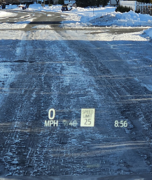
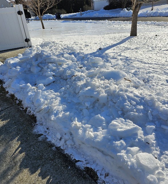
Yeah, I agree. We are still have icy roads in the development and the back roads to work from Delaware to the main road are still hazardous. That's mainly due to the sun not shining on them, so the material the road department puts down will take time. You can walk on the snow and quite funny watching the beagle try run down a rabbit as they slide across.
-
Minor event would be okay. We've had a couple minor events this winter overe here and this moderate one that gave us all this ice. I'll watch the models but with that positive trough and that system coming out of Canada may push it away from us. Again until the systems are sampled Sunday or Monday you can't rule anything out yet.
-
Not me, just what we see right now. The forecasters are saying, over here we should see a dusting. Off topic I was going deer hunting unrill I saw the winds and wind chills being forecasted.
-
It was never ours since the GFS has shown it from the beginning to be weak and OTS in both 6z & 12z yesterday. I wander if the system coming out of western Canada has anything to do with it.
-
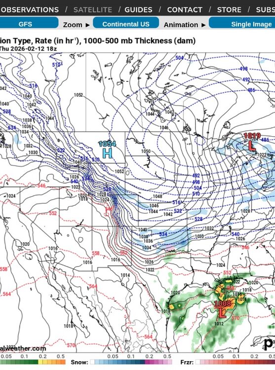
Of course both GFS and AIGFS 6z show positive tilt and weak low, plus the L coming out of Canada. The good thing is our area is in the mid 30s M - F before dipping back below 32F. That will help get the ice off the roads over in our area.
-
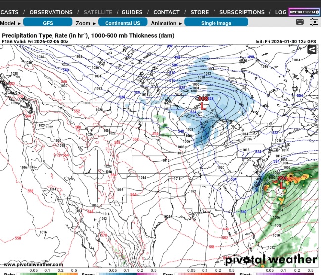
Maybe follow 6z & 12z GFS, does it show the system coming down out of Canada? What do you say the 6z and 12z GFS says OTS? The 18z shows L coming east with snow. The only thing I see different between the 3 is the L pressure coming out of Canada keeps the 6z & 12z south, 18z doesn't show it till later in the which allows the system not to go south and OTS. If that system comes out of Canada as depicted in the earlier runs wouldn't it stay south?
-
Unfortunately that seems to be what we're looking at cold and dry. At least next week being in the mid 30s will help melt this ice we have. MD2 in Arnold has had bobcats digging one of the lanes out around College Parkway. There are only 2 lanes.
-
It looked like the next couple systems get pushed OTS by the northern systems. Our area will be in the middle 30s Monday- Friday of next week before staying below freezing again. That's perfect our long range forecast.
-
The Jan 31 Potential: Stormtracker Failure or 'Tracker Trouncing
GreyHat replied to stormtracker's topic in Mid Atlantic
The 18z is also stronger, if that helps. -
The Jan 31 Potential: Stormtracker Failure or 'Tracker Trouncing
GreyHat replied to stormtracker's topic in Mid Atlantic
Off topic the Bay at the bay bridge. On my way to work this morning. Looking towards Baltimore and looking south. The shopping lanes are not frozen yet.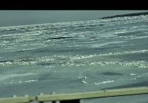
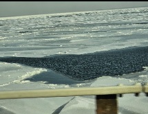

-
The Jan 31 Potential: Stormtracker Failure or 'Tracker Trouncing
GreyHat replied to stormtracker's topic in Mid Atlantic
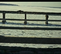
Off topic, how cold is it? This is the up in the inlet at Johnathan Landing Magnolia Delaware. No boats going out for awhile.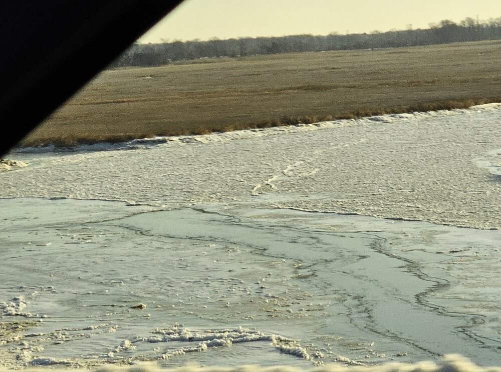
-
The Jan 31 Potential: Stormtracker Failure or 'Tracker Trouncing
GreyHat replied to stormtracker's topic in Mid Atlantic
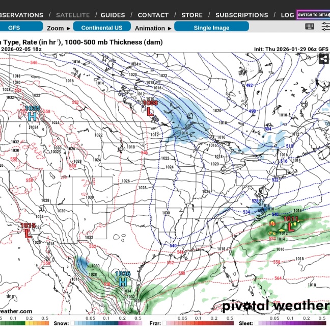
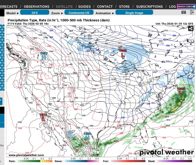
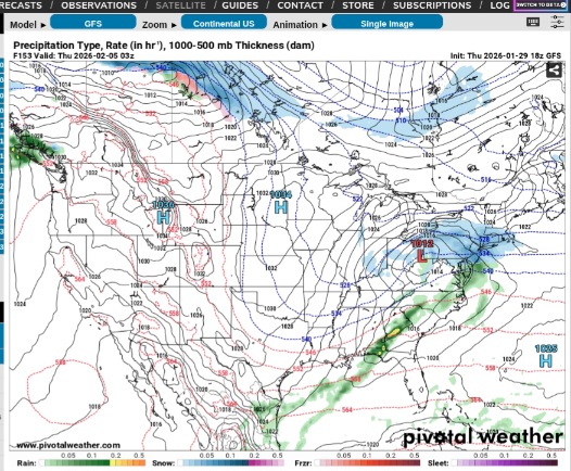
Anything is possible as it took a step in the right direction or at least the precip is more in land compared to 00z. I personally still think Thursday is the make or break like the last storm. -
The Jan 31 Potential: Stormtracker Failure or 'Tracker Trouncing
GreyHat replied to stormtracker's topic in Mid Atlantic
Here's 00z and 18z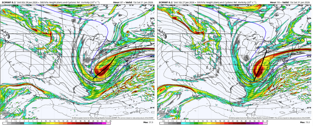
-
How about wxdisco board? Used to be free.
-
I suggested Thursday depending on sampling
-
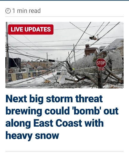
In the news
-
Thursday
-
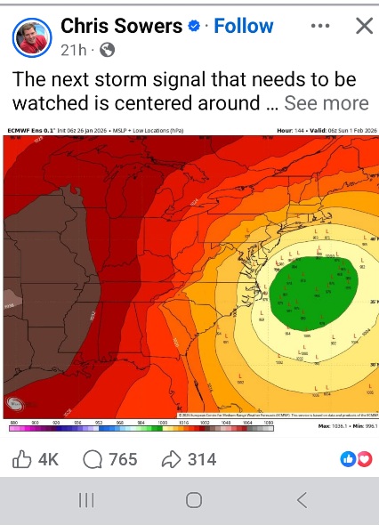
Actually someone did post the big hit on Facebook already.