pawatch
-
Posts
3,266 -
Joined
-
Last visited
Content Type
Profiles
Blogs
Forums
American Weather
Media Demo
Store
Gallery
Everything posted by pawatch
-
Frost Advisory up here tonight.
-
It looks like we got 0.53” here so far. “Still raining “ Wind appears to have been 13mph with 46 mph gust. Wind was pretty impressive!!
-
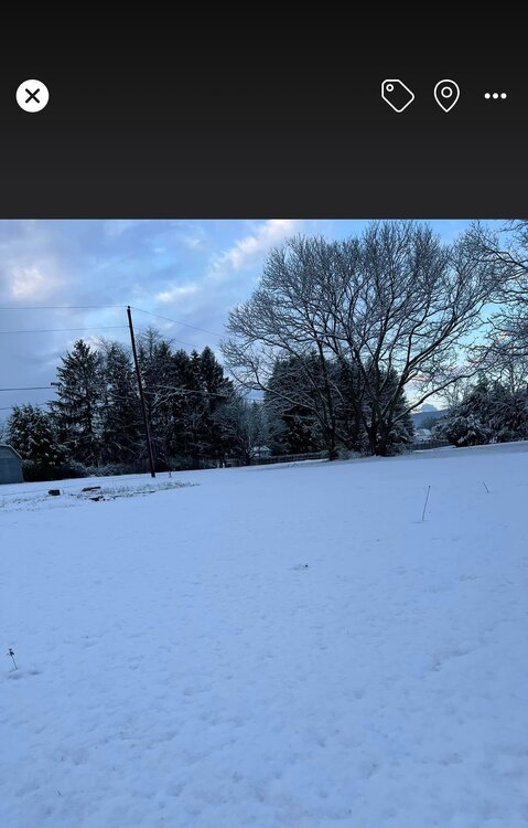
This show up on myFB memories from a year ago. Appears 2.5”
-
It’s crazy, I know I wouldn’t want to be anywhere near one.
-
I see you had a boat go over the dam down there last week. Those dams are drowning machines.
-
Fired my stove back up last night. After a couple weeks off. Toasty 70 degrees this morning in the house. 38 mph gust yesterday. Typical spring weather it seems. Just need some more rain.
-
0.16” of rain come through this morning. Done and heading north. 50 degrees
-
I’m going to get my feeders out. When do they start showing up?
-
High was 90 today. Another record. 84 degrees 1960 was the old record.
-
Meso this morning. Temps was all over. Set a record today 89 degrees old record was 85 degrees 2018. Had 90 at the house.
-
47 degrees here at 6:00 am. A lot of higher temps around looking at the meso.
-
28 degrees this morning. These cold starts is growing old.
-
South looking to get hit with moisture next week. Jet stream is giving us warm dry air.
-

The Ides of March end of Winter 2023
pawatch replied to paweather's topic in Upstate New York/Pennsylvania
Mowing season has officially begun. Mostly trimming a lot of high spots. High of 69 today. -
The Ides of March end of Winter 2023
pawatch replied to paweather's topic in Upstate New York/Pennsylvania
48 degrees when I went to bed last night at 10:00. Currently 42 degrees. Supposed to hit 72 today. Might have to mow the high spots today. Grass is really greening up. Enjoy this nice day!! -
The Ides of March end of Winter 2023
pawatch replied to paweather's topic in Upstate New York/Pennsylvania
Some 57 mph gusts, pretty impressive. Only 0.29” of rain here. Was hoping for more. Still a little windy this morning. -
The Ides of March end of Winter 2023
pawatch replied to paweather's topic in Upstate New York/Pennsylvania
That front come through last night it dropped the temperature about 20 degrees. With a 49 mph wind gust. Picking garbage this morning from a full trash can that got blowed over. 25 degrees this morning. -
The Ides of March end of Winter 2023
pawatch replied to paweather's topic in Upstate New York/Pennsylvania
Nooner 51 degrees partly cloudy and windy. -
The Ides of March end of Winter 2023
pawatch replied to paweather's topic in Upstate New York/Pennsylvania
On a good note I picked up almost a brand new snowblower dirt cheap. Next season needs to be a good one! Nooner 60 degrees, partly cloudy. -
The Ides of March end of Winter 2023
pawatch replied to paweather's topic in Upstate New York/Pennsylvania
Fishing is starting to pickup. The smallmouth are hungry, but the wind has been terrible. High gust yesterday was 44mph. -
The Ides of March end of Winter 2023
pawatch replied to paweather's topic in Upstate New York/Pennsylvania
41 degrees this morning. We only picked up 0.14” of rain yesterday which is less than they was forecasting. Here is where I have been spending my time. They have been biting.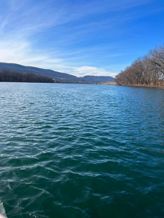
-
The Ides of March end of Winter 2023
pawatch replied to paweather's topic in Upstate New York/Pennsylvania
26 degrees this morning, with a high of 52 today. Lets see what the high ends up being. High yesterday was 39 degrees. With the wind it was just cold.
-
The Ides of March end of Winter 2023
pawatch replied to paweather's topic in Upstate New York/Pennsylvania
23 and windy again this morning, with a few stray snow flurries. Suppose to hit the 60’s on Tuesday. -
The Ides of March end of Winter 2023
pawatch replied to paweather's topic in Upstate New York/Pennsylvania
25 degrees this morning,suppose to hit 57 today. Sure glad to get rid of the winds -
The Ides of March end of Winter 2023
pawatch replied to paweather's topic in Upstate New York/Pennsylvania
Not really sure, some of them northern places don’t actually post snow information.