wthrmn654
-
Posts
3,953 -
Joined
-
Last visited
Content Type
Profiles
Blogs
Forums
American Weather
Media Demo
Store
Gallery
Everything posted by wthrmn654
-
so weird they must of had a malfunction but fixed it Cause on tidbits it said mission finished.
-
Looks like one of the AF low level recon flights ended very early they only took off did a small circle just offshore then returned to base. So as it stands we have no more recons at the moment
-
Yes
-
Sad state the Gulf observation buoys etc are in so many are offline possibly ahead of the storm or for other unknown reasons directly in the path of the storm to...

-
-
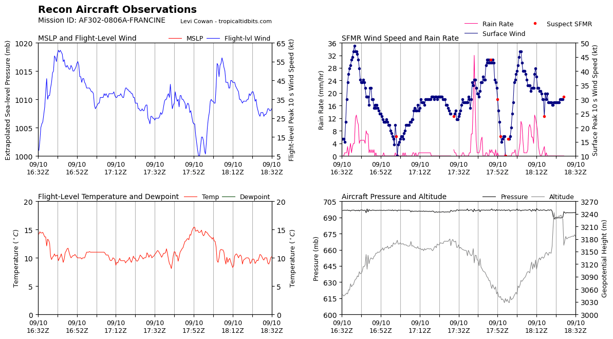
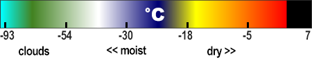
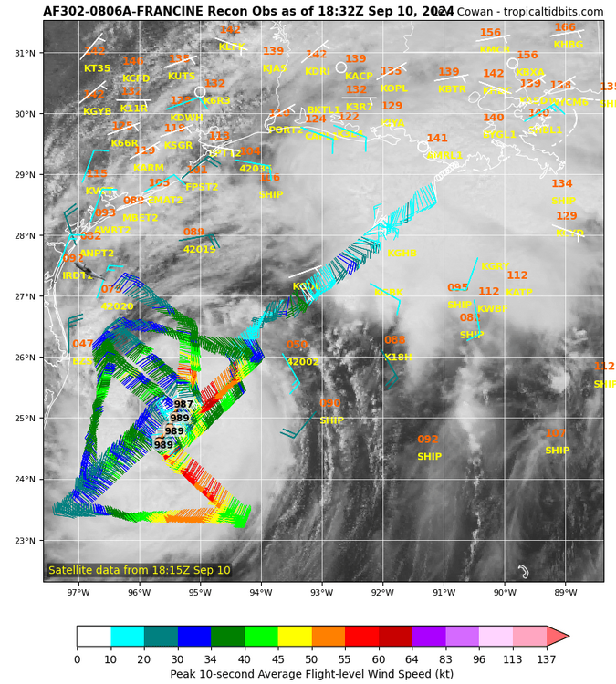
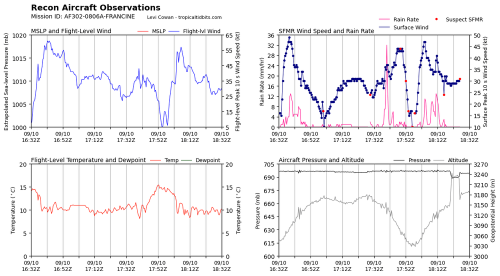
Reports from Air Force Reserve and NOAA Hurricane Hunter aircraft indicate that Francine has changed little in intensity during the last several hours. Flight-level winds from the aircraft and a northwest eyewall dropsonde suggest that the maximum sustained surface winds are near 80 kt, and the central pressure is near 976 mb. The aircraft have been reporting a large elliptical eye open to the south, which matches the depiction of the eye in WSR-88D Doppler radar data from Lake Charles. Satellite imagery does show that the cloud pattern is becoming elongated from northeast to southwest due to the increasing effects of southwesterly shear.
-
Sat Data has weakening flag now on, nhc also mentions shear is now starting to show its effects too. Nhc issued an extra update at 11 am (12 pm est) An oil platform north of the center recently reported sustained winds of 85 mph (137 km/h) and a gust of 101 mph (163 km/h) at an elevation of 98 ft (30 m).
-
-
Dam she picked up speed!
-
-
-
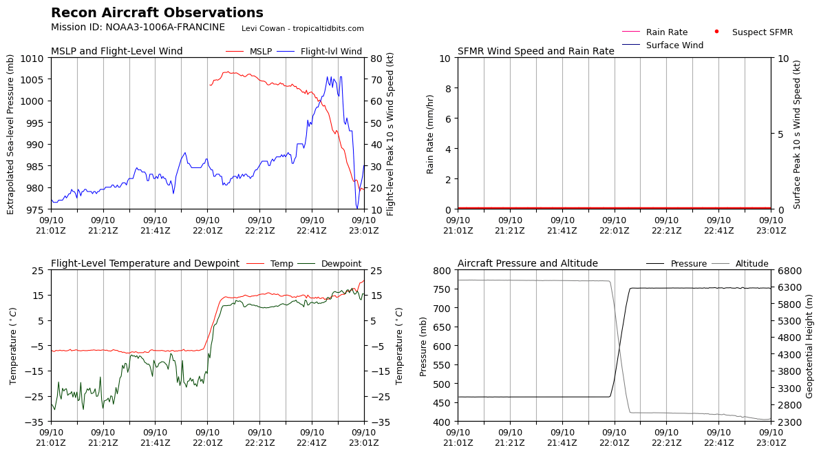
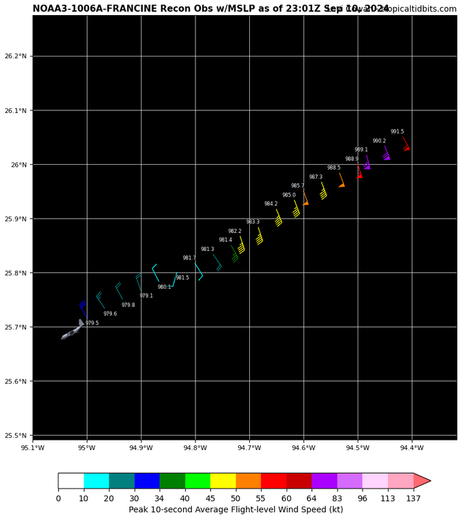
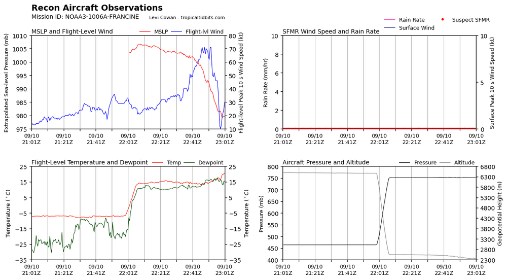
979 on recon?
-
-
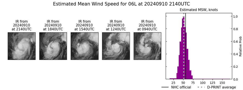
Impressive nearly 24 hours with little to no change in winds
-
Great thank you.
-
-
Is that another round a dry air getting wrapped into her on the left side? Such a tiny looking thing crazy!
-
-
Reminds me of Ernesto, pressure kept dropping but winds didn't follow for a while till just before getting near Bermuda.
-
@purduewx80 what are your thoughts and ideas with this storm? As a meteorologist, what do you see that you disagree with some thinking it won't be as strong? Legitimately asking.
-
Hurricane hunters saw 990, then 988 them the last 2 passes by 2 planes it raised back up to about 990
-
-
Upper divergence Lower convergence