wthrmn654
-
Posts
3,953 -
Joined
-
Last visited
Content Type
Profiles
Blogs
Forums
American Weather
Media Demo
Store
Gallery
Everything posted by wthrmn654
-
I'm not sure, sat loops have been al over the place and I think that's a bit of the dry air and attempt maybe? Hard to say.
-
-
Pressure matches the average mslp for a category 2 hurricane, which has winds of 96mph or higher, yet the winds are still not matching yet.. and are still sub par with only about 71-75 knots to the east of eye area.
-
-
968mb Could be rough looking but being better ish?
-
972.9mb recon pressure?
-
Big big looking slug of dry air getting wrapped in south west side now, I do believe. Closest to the center. Quite ragged looking, imo
-
EDIT: just checking the better sat map, deft more dry air about to get wrapped in from the west side
-
i mean i give this little guy credit, i think its trying to make an eye.. and it just about has absorbed the dry air from today but it would seem, depending what mode you select, that the left side might have another round of dry air starting to get wrapped into it again. seems there's 2 rotations in the clouds surrounding him.. inner spinning counterclockwise with the surrounding spinning clockwise.
-
pretty impressive, the microwave loop brought the winds up to 75knots and has not moved up or down for a several hours...
-
A lot of grey areas and to many unknowns Imo for the intensity forecasts to materialize as right now that dry air will not let go and has been super consistent... Hurricane Ernesto Discussion Number 17 NWS National Hurricane Center Miami FL AL052024 500 PM AST Thu Aug 15 2024 The inner core of Ernesto continues to be plagued by dry air intrusion. A NOAA Hurricane Hunter aircraft reported that Ernesto has yet to close off an eyewall. While the minimum central sea level pressure has fallen to an estimated 972 mb based on dropsonde data, the maximum flight-level winds are still at 86 kt, similar to the earlier mission. Therefore, the initial intensity is held at 75 kt for this advisory cycle. Warm waters and relatively low vertical wind shear should allow Ernesto to gradually intensify over the next 12 hours or so. Still, the mid-level atmospheric moisture is expected to be marginal and the system could continue to experience dry air intrusions. Global models suggest that while the vertical wind shear could begin to increase within a day, Ernesto may be positioned in a region relative to the departing trough where it could capitalize on enhanced outflow and continue to strength. By the weekend, atmospheric conditions should become less favorable and gradually weaken the hurricane. Still, Ernesto is expected to remain a powerful hurricane as it moves north of Bermuda. Little changes have been made to the latest NHC intensity forecast, which lies near the top of the model guidance envelope.
-
a little fun and games but historically speaking, ernesto has never materialized to much usually lol Ernesto 1982 – formed southwest of Bermuda and dissipated without threatening land. 1988 – formed east of Bermuda and did not cause any damage or casualties. 1994 – formed southwest of Cape Verde and dissipated without affecting land. 2000 – lasted for two days and did not threaten land. 2006 – a Category 1 hurricane which formed near the Windward Islands, made landfall in Haiti and Cuba, struck Florida and the Carolinas, and killed at least 11 people. 2012 – a Category 2 hurricane which made landfall in Mexico. 2018 – formed in the North Atlantic and dissipated without affecting land. 2024 – currently active.
-
-
unless I'm mistaken its northwest side just started interacting with the front? the clouds that were wrapping around all but vanished as soon as it touched it. that and looks like it just ran into some more decent dry air....
-
entire right side is winds of 64+knots
-
12z shear update
-
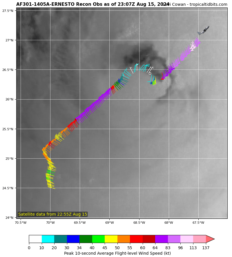
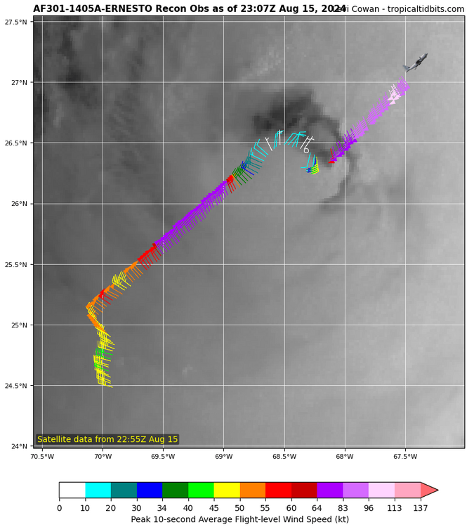
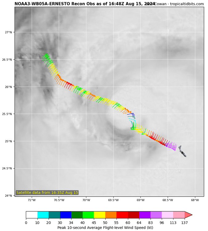
974mb first eye pass. so far aren't all that impressive but it came in from the northwest. Also where the dry air shows up closest to the center on radar, the winds are much lower versus earlier recon of the same sector. strongest winds however are still located farther out to the southeast same place as earlier recon.
-
poor spiraling storm! it slowed down 2 mph but still cruising along at a good clip.
-
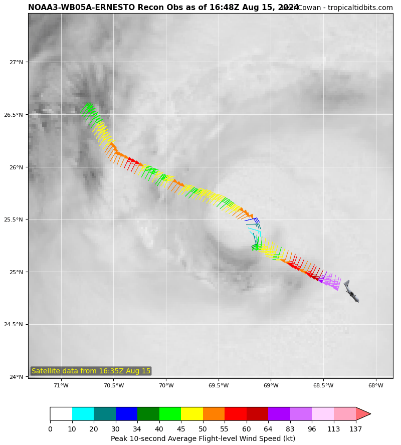
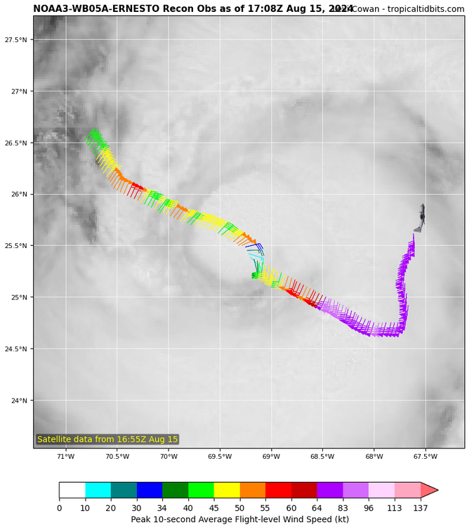
currently 2 noaa planes are doing hard core recon, ones been in the storm for a little bit doing star pattern upper air recon 2nd plane is just reaching the storm will be doing lower air recon.
-
if Ernesto is to really get cranking before Bermuda, it still has some time, but that window is closing. Model guidance is still suggesting that some continued gradual strengthening is possible in the next day or so. The deep-layer vertical wind shear is forecast to be weak to moderate, and Ernesto should be over warm waters for the next few days. However, the broad nature of the current circulation, coupled with some dry air ingestion, will likely slow the intensification rate. Ernesto is now forecast to peak at 95 kt in 24 h, which is near the top of the model guidance envelope. Beyond a day, the shear is expected to increase and induce gradually weakening, though the warm waters and positive interaction with the upper-level trough will likely allow Ernesto remain a powerful hurricane as it moves north of Bermuda.
-
boy Ernesto is struggling nonstop it looks like the dry air has been able to go nearly all the way around the storm itself. with no end in sight, visually speaking in terms of satellite views...
-
-
It does not look very pretty on satellite
-
5 am update While the shear near Ernesto remains low, a large dry slot continues to wrap near the core, preventing anything other than slow intensification so far. Most of the guidance gradually intensifies the system during the next day or so as the very warm waters and light-to-moderate shear outweigh the effects of the dry air. Little change was made to the intensity forecast,
-