.jpg.b9a795a9fe89b3aa2ead015665ae36fe.jpg)
nvck
-
Posts
445 -
Joined
-
Last visited
Content Type
Profiles
Blogs
Forums
American Weather
Media Demo
Store
Gallery
Everything posted by nvck
-
.thumb.jpg.ad3a2e31d30aff035044689b311a0540.jpg)
4/1-4/2 severe threat (southern portion of subforum)
nvck replied to largetornado's topic in Lakes/Ohio Valley
Tornado likely about to touchdown soon in S IN, near Crothersville. pretty concerning velocity couplet -
4/1-4/2 severe threat (southern portion of subforum)
nvck replied to largetornado's topic in Lakes/Ohio Valley
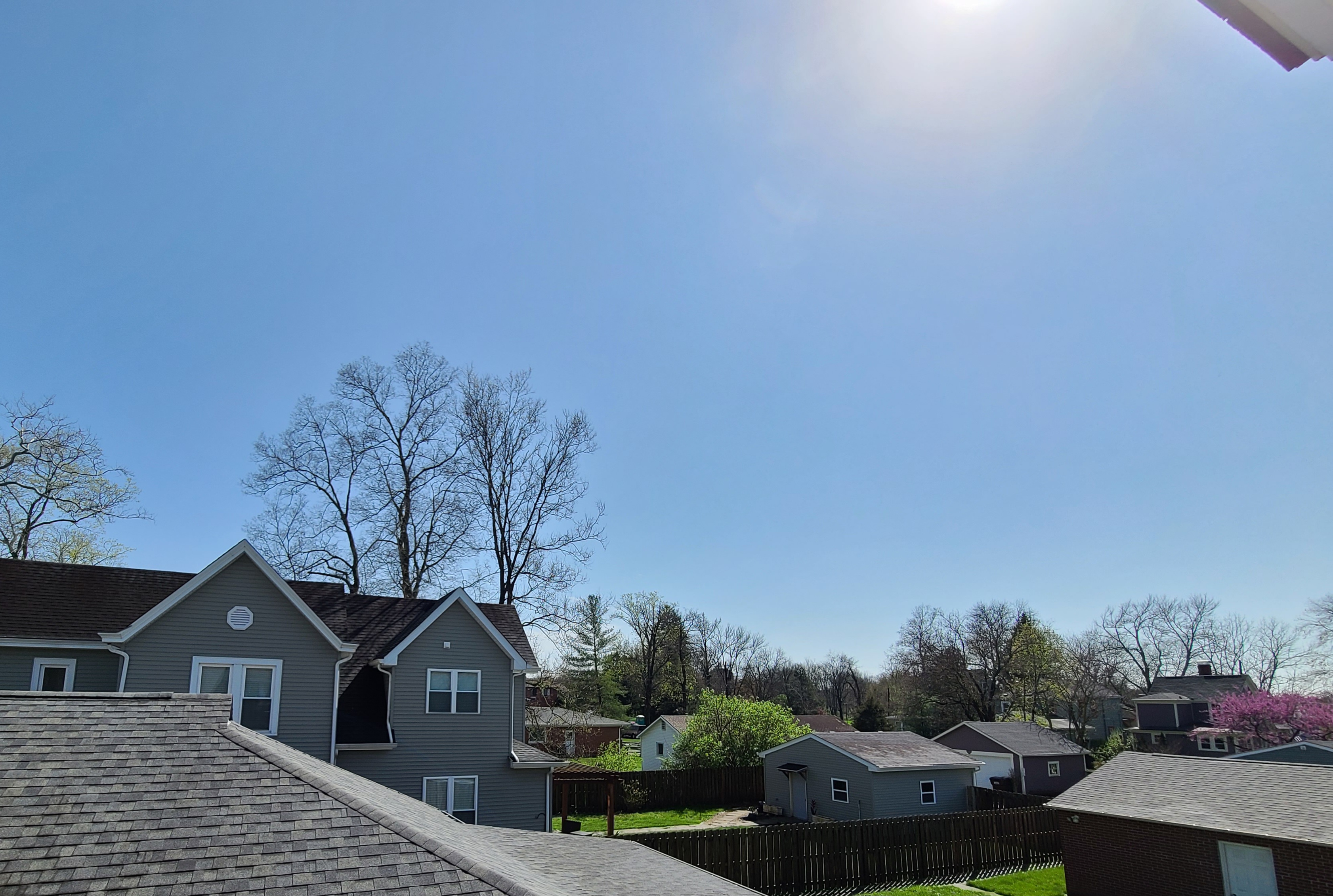
after some fairly intense rain and a bit of thunder, the skies are fairly clear again in the Cincinnati area. 70 with a 65° dew point. photo attached is looking SSW
-
4/1-4/2 severe threat (southern portion of subforum)
nvck replied to largetornado's topic in Lakes/Ohio Valley
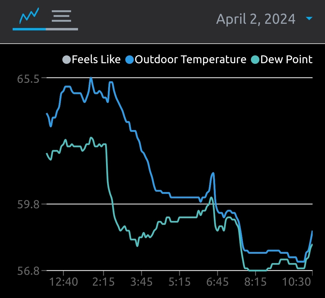
recovery beginning here in SW ohio, with dews and temps starting to rise back up. solar radiation is also picking up, per the weather station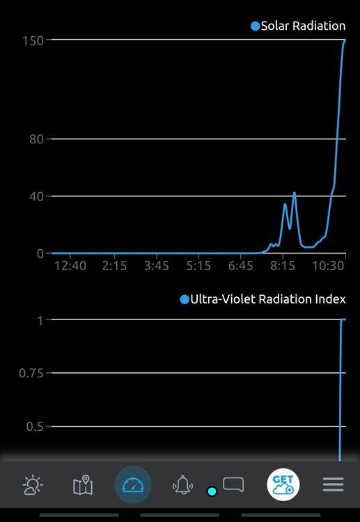

-
4/1-4/2 severe threat (southern portion of subforum)
nvck replied to largetornado's topic in Lakes/Ohio Valley
looks like clearing is beginning in the area around indy, rain is moving out of the Cincinnati area now, with some weak sunshine trying to get through the clouds -
4/1-4/2 severe threat (southern portion of subforum)
nvck replied to largetornado's topic in Lakes/Ohio Valley
Not really impacting this area, but a hail-driven MDT was added for what I believe is the first MDT of the year? Also, a large area of 10# tornado, with the 5% coming maybe a bit more east than the previous outlook
-
4/1-4/2 severe threat (southern portion of subforum)
nvck replied to largetornado's topic in Lakes/Ohio Valley
12z HRRR for E IN and W OH ... one of the most impressive runs in quite some time -
4/1-4/2 severe threat (southern portion of subforum)
nvck replied to largetornado's topic in Lakes/Ohio Valley
SPC goes with a d2 enhanced, which makes sense, although I almost expected a 10# risk rather than just a 10. most surprising thing for me is the placement, a lot of models have been showing this a lot further north than the area that the SPC has the enhanced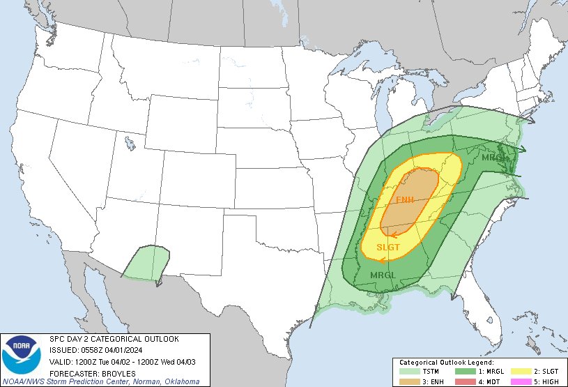
-
2024 Short/Medium Range Severe Weather Discussion
nvck replied to Chicago Storm's topic in Lakes/Ohio Valley
30% added to the D4 outlook for Monday, with most of the Southern area of the sub under a 15%. Does this mean that tomorrow's D3 outlook will more likely be slight/enhanced, or marginal/slight? -
that lil blob in the corner of se IN and sw OH is my only hope for this one
-
kind of a similar situation to this last storm, models slowly start pulling nw until we are fully in the rain area
-
needs to come back se to avoid a repeat of today's cold rain hell
-
So far about 1.3 inches of rain today, is up to 50 now. Pressure is 980mb, lowest I've seen since installing the weather station about six months ago.
-
feel that. hoping this weekend brings some excitement
-
Hoping we don't just get a bunch of wind and rain here, but it's increasingly looking that way :/ , at least we should have an inch or 2 tomorrow as a winter teaser
-
not as cold there now, but there's an insane 1064mb high parked over western Russia rn.
-
(edited) photo from the weekend here in Cincinnati, Sunday finally snapped a like 5 day long gray streak
-
max heat index imby today was 120, 83.2 dew point, 94.5 air temp
-
2023 Short/Medium Range Severe Weather Discussion
nvck replied to Chicago Storm's topic in Lakes/Ohio Valley
Insane winds here on the west side of lansing, no hail but 15 or so minutes of 60+mph winds. power faded in and out at the hotel, and a tree came down right where I was parked before i moved it... crazy stuff. link to the photo on Twitter... too big to embed -
2023 Short/Medium Range Severe Weather Discussion
nvck replied to Chicago Storm's topic in Lakes/Ohio Valley
driving into s Michigan from Fort Wayne, very sunny and car says 93... feels disgusting out -
95/72/106 here... same HX as Monday, but doesn't feel as humid. tomorrow looking like a good chance to break 100 and maybe 110hx ?
-
93/76/105 here... air is very still and we've been hovering around 100-105 feels like for about an hour. I think we're going to blow past ILN's projected max heat index of 101.
-
2023 Short/Medium Range Severe Weather Discussion
nvck replied to Chicago Storm's topic in Lakes/Ohio Valley
interesting d3&5 outlooks for the ohio (especially cincinnati) area
-
92/78/105 here... sweating sweating sweating
-
92 here, with a 76 degree dewpoint heat index went up to 105
-
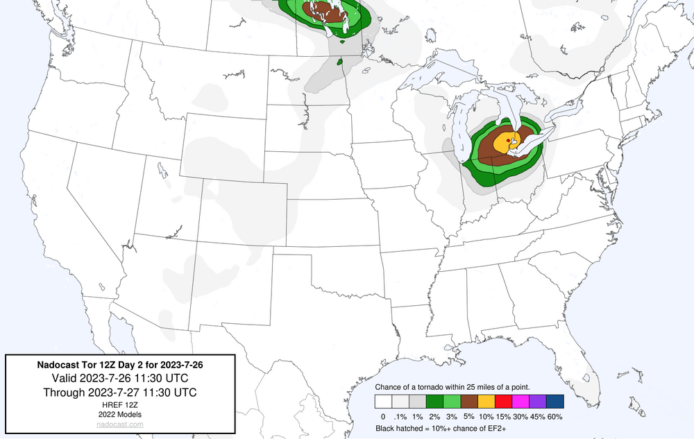
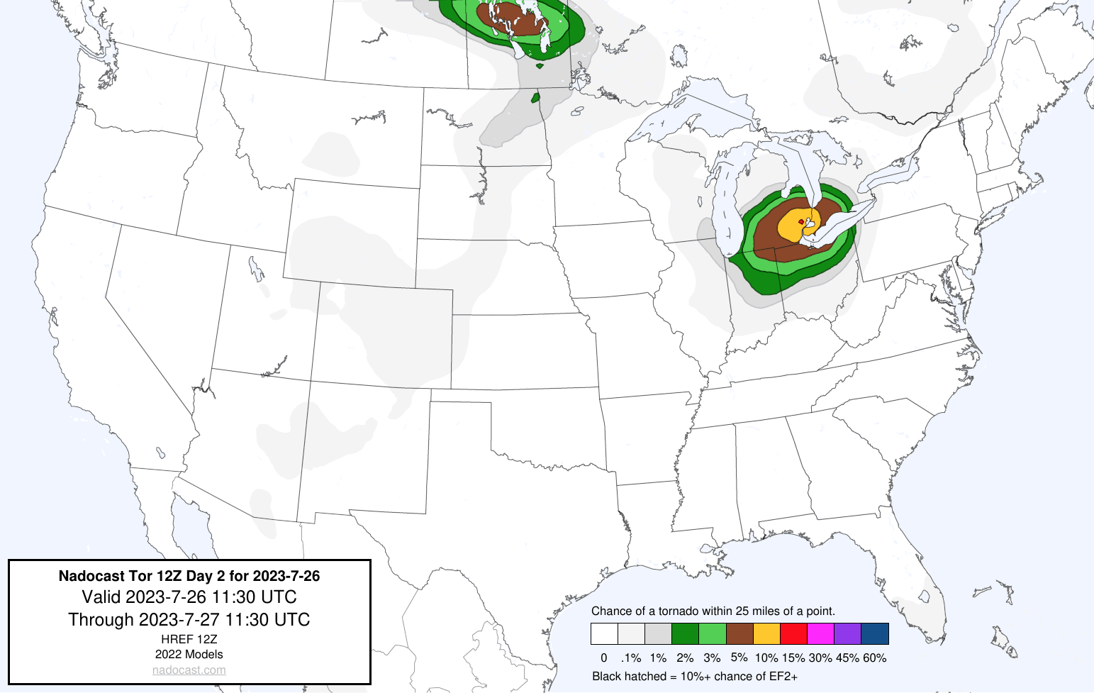
nadocast day2 is very bullish on the tornado potential in se michigan/Detroit area tomorrow... highly doubt that this verifies but will be interesting to see