Hurricane Agnes
-
Posts
9,263 -
Joined
Content Type
Profiles
Blogs
Forums
American Weather
Media Demo
Store
Gallery
Everything posted by Hurricane Agnes
-
E PA/NJ/DE Spring 2023 OBS Thread
Hurricane Agnes replied to Hurricane Agnes's topic in Philadelphia Region
New Warnings, including a TOR in Delaware, are up plus summary - -
E PA/NJ/DE Spring 2023 OBS Thread
Hurricane Agnes replied to Hurricane Agnes's topic in Philadelphia Region
STSs issued. The line looks solid.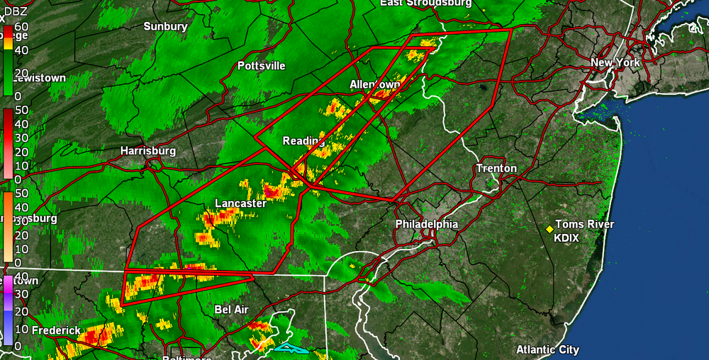
-
E PA/NJ/DE Spring 2023 OBS Thread
Hurricane Agnes replied to Hurricane Agnes's topic in Philadelphia Region
Showtime. Norman just issuing - Currently sunny and 69 here with DP 57. -
E PA/NJ/DE Spring 2023 OBS Thread
Hurricane Agnes replied to Hurricane Agnes's topic in Philadelphia Region
SWDY1 threw us into a (rare) "Enhanced Risk" - Temp here is up to 68 with dp 56. -
E PA/NJ/DE Spring 2023 OBS Thread
Hurricane Agnes replied to Hurricane Agnes's topic in Philadelphia Region
And the sun is now out here as the back edge moves east. Round 1 was 0.38" and with a dp in the upper 50s (57 at post time) and an expectation for the temp to shoot up (currently 62), I can imagine things might destabilize later today. -
E PA/NJ/DE Spring 2023 OBS Thread
Hurricane Agnes replied to Hurricane Agnes's topic in Philadelphia Region
Definite contrast of days - yesterday's low of 32 eventually transformed to a high of 62 but this morning my low was 58, and am currently at my high of 62 for the day so far. Didn't get any rain yesterday or overnight from the multiple but fizzled bands, but this morning, some finally reached the ground. At onset, something convective nearby even set off my lightning detector (around 7 - 7:30ish am). Currently have 0.37" in the bucket with some mist/light rain and dp that has soared to 62. -
E PA/NJ/DE Spring 2023 OBS Thread
Hurricane Agnes replied to Hurricane Agnes's topic in Philadelphia Region
After a low of 31 yesterday, I made it up to 48 as a high. Looks like the temps will be shooting up the next couple days but then the wind and rain will be incoming too, with some possible t-storms. Currently 35 with dp 29. -
E PA/NJ/DE Spring 2023 OBS Thread
Hurricane Agnes replied to Hurricane Agnes's topic in Philadelphia Region
I can proudly say that I run my non-Delaware River-derived Schuylkill (River) Punch through a Pur water filter! I did actually make it to 61 for a high yesterday and rebounded quickly from ideal radiational cooling with some puffs of a breeze, to go from a 38 low earlier this morning, to my current 45 with dp 27. Will be on the lookout for more incoming rain later today. -
E PA/NJ/DE Spring 2023 OBS Thread
Hurricane Agnes replied to Hurricane Agnes's topic in Philadelphia Region
Must have been this guy driving around - Sun was welcome today after a few days of rain/overcast and with some low stratus/fog wringing out another 0.01" of rain this morning plus 0.24" yesterday, I ended up with 0.94" total over the past 4 days. Low was 44 this morning and am currently at my high for the day so far of a sunny 60 with dp 32. -
E PA/NJ/DE Spring 2023 OBS Thread
Hurricane Agnes replied to Hurricane Agnes's topic in Philadelphia Region
My high for the day actually came about a half hour after midnight and hit a non-diurnal low of 44 before 10 am. Picked up 0.47" of rain yesterday and 0.22" today so far for a 0.69" 2-day total. Currently overcast and 48 with dp of 35. -
E PA/NJ/DE Spring 2023 OBS Thread
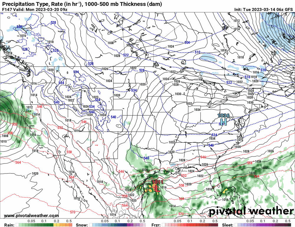
Hurricane Agnes replied to Hurricane Agnes's topic in Philadelphia Region
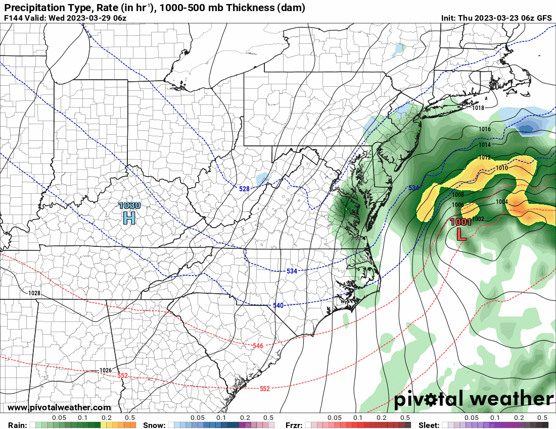
It's like a love note. 6z ditches the idea and blows it through faster (1st image is the same time as yours and the 2nd is 12 hours earlier with an almost disorganized rainstorm). As an obs, have had scattered showers this morning with a brief interlude of sun before it clouded up again. Had a low of 47 and am currently overcast and 50 with 0.09" of rain so far.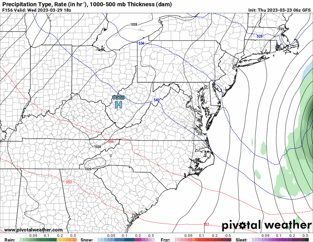

-
E PA/NJ/DE Spring 2023 OBS Thread
Hurricane Agnes replied to Hurricane Agnes's topic in Philadelphia Region
After a low of 30 this morning, so far have hit a high of 61 today and definitely a pleasant day although there was still some chill in the air, probably because of the couple antecedent days of cold. It's currently 50 with dp 25 (and humidifiers going full blast). -
E PA/NJ/DE Spring 2023 OBS Thread
Hurricane Agnes replied to Hurricane Agnes's topic in Philadelphia Region
I actually bottomed out a degree lower this morning than yesterday morning with a low of 25. But in this case, it was due to radiational cooling when the winds went calm overnight vs yesterday when there was apparently all kinds of CAA going on with the winds whipping most of the night. It's currently mostly sunny and 36 with dp 19. -
E PA/NJ/DE Spring 2023 OBS Thread
Hurricane Agnes replied to Hurricane Agnes's topic in Philadelphia Region
My 41 high for today came at midnight, so definitely winter doing its last hurrah.. Currently 34 with dp 14. -
E PA/NJ/DE Spring 2023 OBS Thread
Hurricane Agnes replied to Hurricane Agnes's topic in Philadelphia Region
Well made it up to 54 yesterday after a low of 40 and 0.02" of rain but after the front came through overnight, it's a whole different story this morning. The bottom fell out and I am currently partly sunny and finally ticked up to 27 from a low of 26 with dp 7 (where it had gone as low as 5). One of my late-blooming lilacs ("Miss Kim") had sprouted some leaves all up and down the branches and am hoping that those leaves survive despite the temp being under the "hard freeze" temp of 28. That lilac is 25 years old so it has seen it all, but still. -
E PA/NJ/DE Spring 2023 OBS Thread
Hurricane Agnes replied to Hurricane Agnes's topic in Philadelphia Region
Well the overcast hung on all morning and the sun struggled mightily but has now finally come out, with the cloud deck clearing. Bottomed out at 34 and am currently at 51 with a dp that has finally trudged back into the 20s at 23, after going as low as 5 sometime just after midnight, and slowly recovering the rest of the morning. -
E PA/NJ/DE Spring 2023 OBS Thread
Hurricane Agnes replied to Hurricane Agnes's topic in Philadelphia Region
It's like what I always would hear midwesterners talk about - the endless "cloudy gray winters". -
E PA/NJ/DE Spring 2023 OBS Thread
Hurricane Agnes replied to Hurricane Agnes's topic in Philadelphia Region
I went to the Flower Show this past Saturday and never saw it here in Philly! Today is the first time it is fully out since last week! -
E PA/NJ/DE Spring 2023 OBS Thread
Hurricane Agnes replied to Hurricane Agnes's topic in Philadelphia Region
My high yesterday ended up being 39 after most of the precip ended after 2:30 pm (with nothing really measurable than maybe the 0.1" brief dusting). The low was 33 this morning and it's currently not much warmer at 35 with dp 22. The frontal passage definitely hit on the dps. The winds have been fierce as well. When I had to step out front yesterday to grab a delivery that had just been dropped off, I had to struggle with the door just to get out there. -
E PA/NJ/DE Spring 2023 OBS Thread
Hurricane Agnes replied to Hurricane Agnes's topic in Philadelphia Region
I have continued with the pixie dust and pity flakes the past hour or so and whatever managed to briefly "dust" the car is long gone. Meanwhile the sun keeps trying to shine through the cloud deck and the temp is up to 37 with dp 28. -
E PA/NJ/DE Spring 2023 OBS Thread
Hurricane Agnes replied to Hurricane Agnes's topic in Philadelphia Region
Getting some almost pancake-sized flakes at near a SN rate and the persistence has chilled the normally-colder surfaces, so there is some stickage on light-colored cars and on the grass, but it's struggling. Currently 33 with dp 31. -
E PA/NJ/DE Spring 2023 OBS Thread
Hurricane Agnes replied to Hurricane Agnes's topic in Philadelphia Region
Have pixie dust flakes here with nothing sticking yet but it has taken the temp down a bit. Currently 34 with dp 31. -
E PA/NJ/DE Spring 2023 OBS Thread
Hurricane Agnes replied to Hurricane Agnes's topic in Philadelphia Region
Yeah and unless there is some arctic outbreak that oozes down that week, the ssts certainly won't help (except maybe helping it bomb out).
-
E PA/NJ/DE Spring 2023 OBS Thread
Hurricane Agnes replied to Hurricane Agnes's topic in Philadelphia Region
And the flakes have moved in. SN- and also breezy. -
E PA/NJ/DE Spring 2023 OBS Thread
Hurricane Agnes replied to Hurricane Agnes's topic in Philadelphia Region
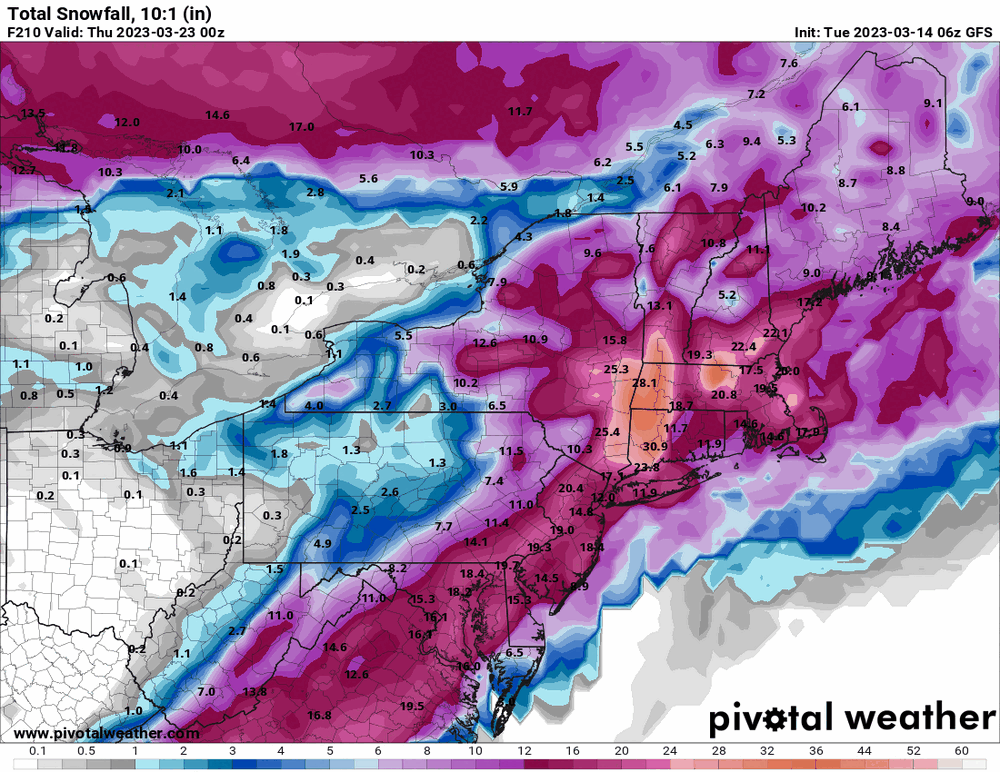
You mean the next GFS "10-day snowzapalooza"?